- Maryland Route 80
-
Maryland Route 80
Fingerboard Road 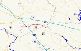
Route information Maintained by MDSHA Length: 14.79 mi[1] (23.80 km) Major junctions West end:  MD 85 near Buckeystown
 MD 355 at Urbana
East end:  MD 27 at Claggetsville
Highway system Maryland highway system
Interstate • US • State • Minor • Former • Turnpikes←  MD 79
MD 79I-81  →
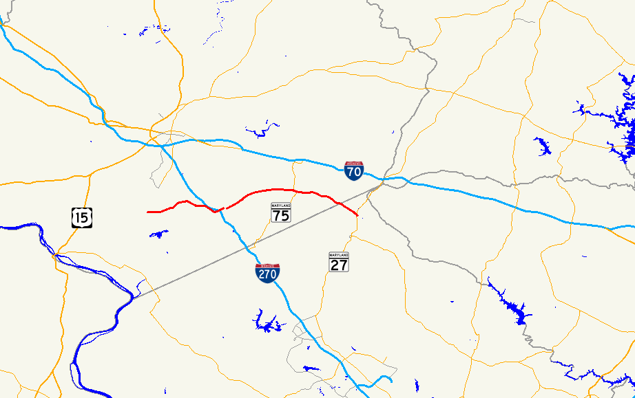
→Maryland Route 80 is a state highway in the southern part of Frederick County in the U.S. state of Maryland. Towards its eastern terminus at MD 27, the highway briefly enters Montgomery County as well.
Contents
Counties traversed
Route description
From its western terminus at MD 85, Maryland Route 80 begins as a two-lane undivided highway with hard shoulders, as a road featuring long straights and gentle curves, carrying Fingerboard Road. Route 80 continues in this fashion until crossing the Monocacy River, at which point it loses its shoulders and becomes markedly more curvy as it passes through Hope Hill. Approaching Urbana, MD 80 begins to parallel Interstate 270, turning at Thurston Road to feature a folded cloverleaf interchange with the Interstate.
After this, MD 80 spreads to become a dual-carriageway route and features a roundabout with MD 355. Both I-270 and MD 355 serve as major highways for the Frederick and Montgomery County area. Massive development in the Urbana region, first started in 1999, stressed the existing infrastructure of the area. To accommodate this, a traffic circle was added to the highway in between the junctions with Interstate 270 and MD 355. To the east of the current intersection with MD 355, state highway workers have started construction on a new intersection planned with MD 355 along a realignment of said route onto an extension of Worthington Boulevard. This new intersection will replace the old one (the existing section of MD 355 is to be signed as Maryland Route 355 Business) following a rerouting of MD 355 through Urbana. To accommodate the heavier traffic flow from the rapidly expanding Urbana area, MD 80 has been widened through the town, and several traffic lights have been installed.
After leaving Urbana, however, MD 80 returns to being a rural two-lane undivided highway for the remainder of its path, quickly returning to the open countryside for a long stretch. The route features only two more traffic lights (at MD 75 and Lynn Burke Road). Once entering Fountain Mills, residential development begins to face the road, and follows it all the way down to Hanford Estates before it enters Montgomery County. From there, the road's name changes to Kemptown Road, and it continues through more homes before ending at MD 27.
History
The Fingerboard Road designation of Route 80 has a colorful history to it. Today, there are multiple theories that attempt to explain the name. One explanation deals with an old sign that used to exist on the side of the road with a finger pointing to a local area. Other explanations say that it was named for a farmer who lost his finger picking up milk at a milk stand. [2]
For years, at the intersection with Lynn Burke Road, Route 80 simply had a flashing yellow light while Lynn Burke Road had a flashing red light. This intersection was often seen as one of the most dangerous ones in the county due to a hill providing limited visibility of the traffic heading westbound on Route 80. In the 1990s, a traffic light was installed and has served to greatly reduce the number of accidents at the intersection.
Junction list
County Location Mile[1] Road Notes Frederick Buckeystown 0.00 MD 85 (Buckeystown Pike)Western terminus Urbana 4.98  I-270 (Dwight D. Eisenhower Highway)
Interchange 5.75 MD 355 (Urbana Pike)East end of MD 355 concurrency Fountain Mills 10.16  MD 75 north (Green Valley Road)
West end of MD 75 concurrency 10.29 MD 75 south (Green Valley Road)East end of MD 75 concurrency Montgomery Claggettsville 14.79 MD 27 south (Ridge Road)Eastern terminus References
- ^ a b Maryland State Highway Administration (2008). "Highway Location Reference: Howard County" (PDF). http://apps.roads.maryland.gov/KeepingCurrent/performTrafficStudies/dataAndStats/hwyLocationRef/2008_hlr_all/co13.pdf. Retrieved 2010-04-21.
- ^ "Urbana road names have long history (purchase required)". Pamela Rigaux for The Frederick News-Post. 2006-08-20. https://www.fredericknewspost.com/sections/archives/confirm.htm?StoryID=60265. Retrieved 2007-03-21.
External links
Roads in Montgomery County, Maryland Maryland State Highways 
U.S. Routes Interstate Highways Roads by name Cabin John Parkway · Clara Barton Parkway · Cherry Hill Road · Connecticut Avenue · Georgia Avenue · Montrose Road · New Hampshire Avenue · Randolph Road · Sligo Creek Parkway · Wisconsin Avenue · 16th StreetCategories:- State highways in Maryland
- Roads in Frederick County, Maryland
- Roads in Montgomery County, Maryland


Wikimedia Foundation. 2010.