- Maryland Route 107
-
Maryland Route 107
Whites Ferry Road 
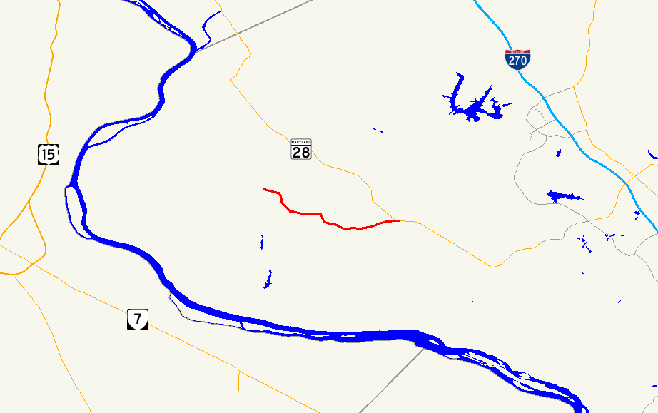
Route information Maintained by MDSHA Length: 4.79 mi[1] (7.71 km) Major junctions West end:  MD 109 in Poolesville
East end:  MD 28 at Dawsonville
Highway system Maryland highway system
Interstate • US • State • Minor • Former • Turnpikes←  MD 106
MD 108  →
→Maryland Route 107 (MD 107) is a 4.79-mile (7.71 km) east–west state highway in the U.S. state of Maryland. It goes from MD 109 in Poolesville, Maryland to MD 28 in Dawsonville. The entire route is in Montgomery County.
Route description
Maryland Route 107 begins at the intersection with MD 109 in Poolesville near the historic Medley District and John Poole House. Initially, it is named Fisher Road, carrying between two and three lanes of traffic southeast through an older residential section of Poolesville. Between Hersperger Road and Partnership Road, the road takes a sharp turn southward and becomes exclusively a two-lane road. The road, now named becomes Whites Ferry Road, crosses more rural and forested areas. As it enters Dawsonville, another cluster of homes fronts the road, and the route ends at an acute intersection with MD 28.[1][2]
Junction list
The entire route is in Montgomery County.
Location Mile
[1]Roads intersected Notes Poolesville 0.00 MD 109 north (Elgin Road)Western terminus Dawsonville 4.79 MD 28 (Darnestown Road)Eastern terminus References
- ^ a b c Maryland State Highway Administration (2008). "Highway Location Reference: Montgomery County" (PDF). http://apps.roads.maryland.gov/KeepingCurrent/performTrafficStudies/dataAndStats/hwyLocationRef/2008_hlr_all/co15.pdf. Retrieved 2010-04-21.
- ^ Google, Inc. Google Maps – overview of Maryland Route 107 (Map). Cartography by Google, Inc. http://maps.google.com/maps?f=d&source=s_d&saddr=maryland+109+and+maryland+107&daddr=maryland+28+and+maryland+107&hl=en&geocode=FUxSVQId3LZi-ymNr5hMJCW2iTG8c_LknC5OpQ%3BFfYNVQIdkdVj-ylVBLhl1y-2iTFqzb5DF-6SEA&mra=ls&sll=39.312815,-77.101155&sspn=0.121392,0.338173&ie=UTF8&t=h&z=14. Retrieved 2010-09-30.
Roads in Montgomery County, Maryland Maryland State Highways 
U.S. Routes Interstate Highways Roads by name Cabin John Parkway · Clara Barton Parkway · Cherry Hill Road · Connecticut Avenue · Georgia Avenue · Montrose Road · New Hampshire Avenue · Randolph Road · Sligo Creek Parkway · Wisconsin Avenue · 16th StreetCategories:- State highways in Maryland
- Roads in Montgomery County, Maryland


Wikimedia Foundation. 2010.