- Maryland Route 390
-
Maryland Route 390
16th Street 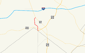
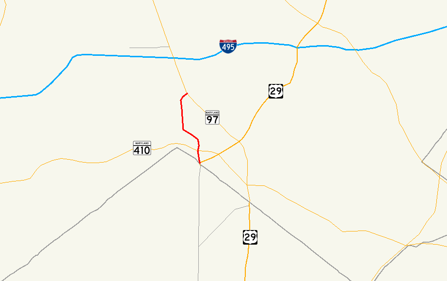
Maryland Route 390 highlighted in redRoute information Maintained by MDSHA Length: 1.09 mi[1] (1.75 km) Major junctions South end: 16th Street in Silver Spring  MD 410 in Silver Spring
North end:  MD 97 in Silver Spring
Highway system Maryland highway system
Interstate • US • State • Minor • Former • Turnpikes←  MD 388
MD 392  →
→Maryland Route 390 (MD 390) is a state highway in the U.S. state of Maryland. The state highway runs 1.09 mi (1.75 km) from the boundary with Washington, D.C. north to MD 97 in Silver Spring. MD 390 is a continuation of 16th Street into Maryland and serves as a major commuter route.
Contents
Route description
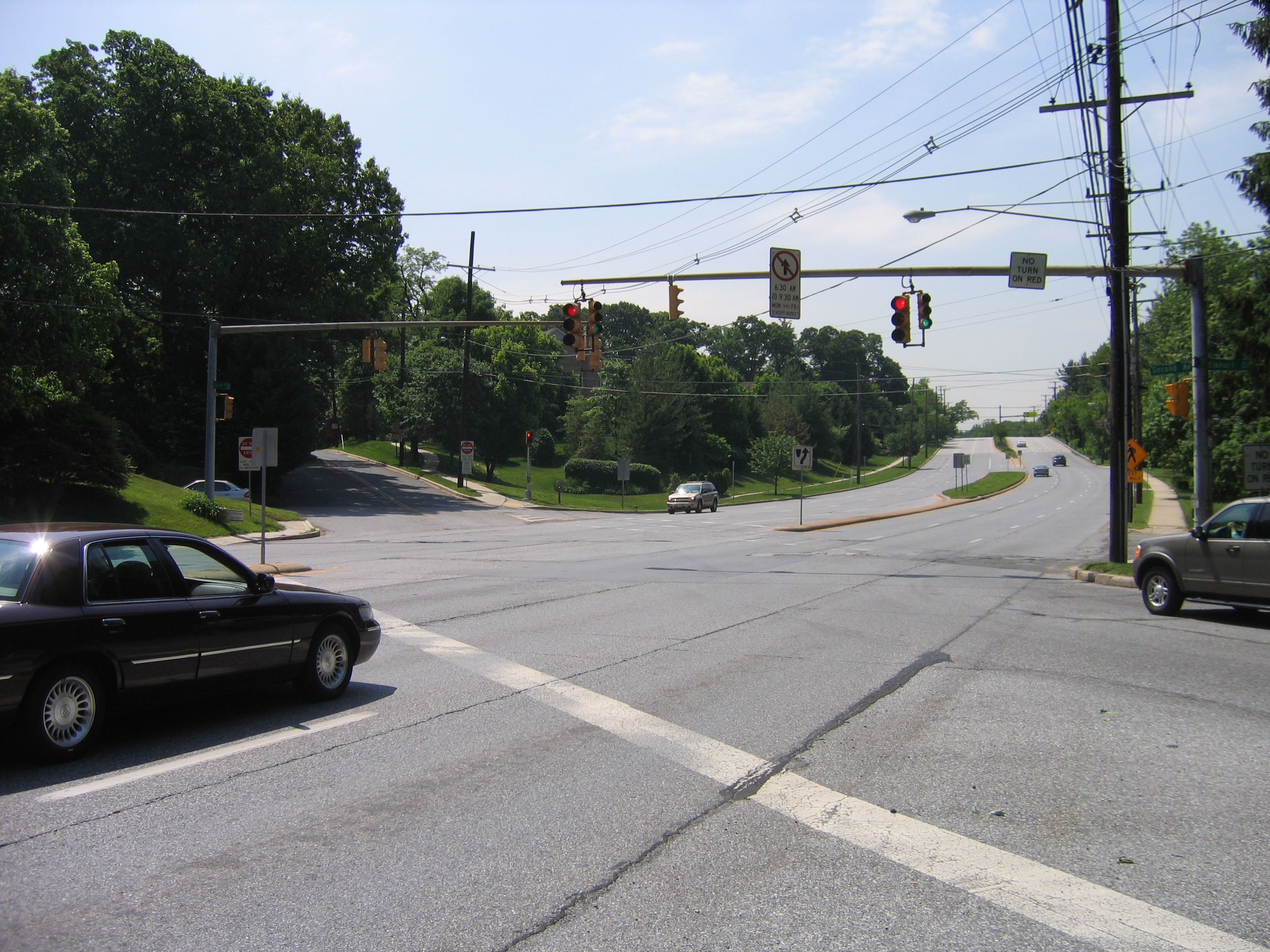
 MD 390 at Second Avenue in Silver Spring
MD 390 begins at Blair Portal, a traffic circle at the boundary between the District of Columbia and Silver Spring, Maryland.[1][2] 16th Street Northwest heads south toward the White House, Eastern Avenue heads southeast along the border, North Portal Drive heads southwest toward Rock Creek Park, and MD 384 (Colesville Road) heads northeast toward downtown Silver Spring, where Colesville Road continues as part of U.S. Route 29 (US 29).[2] MD 390 heads north from Blair Portal as a six-lane divided highway between several apartment complexes.[1][2] After intersecting MD 410 (East–West Highway) and Spring Street, which heads northeast into downtown Silver Spring, the state highway curves to the northwest and passing a shopping center on the northbound side. MD 390 curves north again and crosses over CSX's Metropolitan Subdivision and MARC's Brunswick Line. North of the railroad tracks, the state highway passes through a residential area, cutting across the street grid at an angle, including an oblique intersection with Second Street. After passing Grace Church Road, the two directions of MD 390 split to terminate at separate intersections with MD 97 (Georgia Avenue) in the Montgomery Hills neighborhood of Silver Spring. There is no access between northbound MD 97 and southbound MD 390.[2]
Junction list
The entire route is in Silver Spring in Montgomery County.
Mile
[1]Destinations Notes 0.00 16th Street south / Eastern Avenue south / North Portal Drive west – Washington Blair Portal; southern terminus; District of Columbia boundary 0.02 
 MD 384 east (Colesville Road) to US 29 – Columbia
0.16 MD 410 (East–West Highway) – Bethesda, Takoma Park0.85 Second Avenue Former MD 515 1.09  MD 97 (Georgia Avenue) to I-495 (Capital Beltway) – Wheaton
Northern terminus References
- ^ a b c d "Highway Location Reference: Montgomery County" (PDF). Maryland State Highway Administration. 2008. http://apps.roads.maryland.gov/KeepingCurrent/performTrafficStudies/dataAndStats/hwyLocationRef/2008_hlr_all/co15.pdf. Retrieved 2010-05-18.
- ^ a b c d Google, Inc. Google Maps – Maryland Route 390 (Map). Cartography by Google, Inc. http://maps.google.com/maps?f=d&source=s_d&saddr=16th+St+NW&daddr=16th+St&hl=en&geocode=FaT4UgIddIVo-w%3BFcYvUwIdmnpo-w&mra=ls&sll=39.005679,-77.039266&sspn=0.00762,0.01929&ie=UTF8&t=h&z=15. Retrieved 2010-05-18.
External links
Roads in Montgomery County, Maryland Maryland State Highways 
U.S. Routes Interstate Highways Roads by name Cabin John Parkway · Clara Barton Parkway · Cherry Hill Road · Connecticut Avenue · Georgia Avenue · Montrose Road · New Hampshire Avenue · Randolph Road · Sligo Creek Parkway · Wisconsin Avenue · 16th StreetCategories:- State highways in Maryland
- Roads in Montgomery County, Maryland


Wikimedia Foundation. 2010.