- Montgomery County, Maryland
-
Montgomery County, Maryland 
Flag
Seal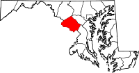
Location in the state of Maryland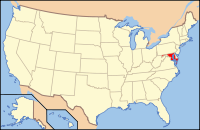
Maryland's location in the U.S.Founded 1776 Seat Rockville Largest city Rockville Area
- Total
- Land
- Water
507 sq mi (1,313 km²)
496 sq mi (1,285 km²)
12 sq mi (31 km²), 2.3%Population
- (2010)
- Density
971,777
1,959.2/sq mi (756.2/km²)Time zone Eastern : -5/-4 Website http://www.montgomerycountymd.gov Montgomery County is a county in the U.S. state of Maryland, situated just to the north of Washington, D.C., and southwest of the city of Baltimore. It is one of the most affluent counties in the United States,[1] and has the highest percentage (29.2%) of residents over 25 years of age who hold post-graduate degrees.[2] The county seat and largest municipality is Rockville.[3] As of 2010 the population was 971,777.[4] Most of the county's residents live in unincorporated locales, the most populous of which are Silver Spring, Germantown and Bethesda, though the incorporated cities of Rockville and Gaithersburg are also large population centers. It is a part of both the Washington Metropolitan Area and the Baltimore-Washington Metropolitan Area.
In 2008, Montgomery County was the second richest county in terms of per capita income in the state of Maryland and 13th richest in the United States, with a median household income of $92,213.[5][6]
Contents
Economy
Montgomery County is an important business and research center. It is the epicenter for biotechnology in the Mid-Atlantic region. Montgomery County is the third largest biotechnology cluster in the USA, holding the principal cluster and companies of large corporate size in the state. Biomedical research is carried out by institutions including Johns Hopkins University's Montgomery County Campus (JHU MCC), Howard Hughes Medical Institute and the University of Maryland. Federal government agencies engaged in related work include the Food and Drug Administration (FDA), the National Institutes of Health (NIH), and the Walter Reed Army Institute of Research.
Many large firms are based in the county, including Discovery Communications, Coventry Health Care, Lockheed Martin, Marriott International, Host Hotels & Resorts, Travel Channel, Ritz-Carlton, Robert Louis Johnson Companies (RLJ Cos), Choice Hotels, MedImmune, TV One, BAE Systems Inc, Hughes Network Systems and GEICO.
Other U.S. federal government agencies based in the county include the National Oceanic and Atmospheric Administration (NOAA), Nuclear Regulatory Commission (NRC), U.S. Department of Energy (DOE),the National Institute of Standards and Technology (NIST), the National Naval Medical Center (NNMC), U.S. Consumer Product Safety Commission (CPSC) and the National Geospatial-Intelligence Agency (NGA).
Downtown Bethesda and Silver Spring are the largest urban business hubs in the county; combined, they rival many major city cores.
Top employers
According to the County's 2009 Comprehensive Annual Financial Report,[7] the top employers by number of employees in the county are:
# Employer # of Employees 1 United States Department of Health and Human Services 39,979 2 Montgomery County Public Schools 20,953 3 United States Department of Defense 14,709 4 United States Department of Commerce 8,749 5 Montgomery County 8,525 6 Lockheed Martin 7,000 7 Adventist HealthCare 6,911 8 Marriott International 3,957 9 Giant 3,816 10 Holy Cross Hospital 3,200 History
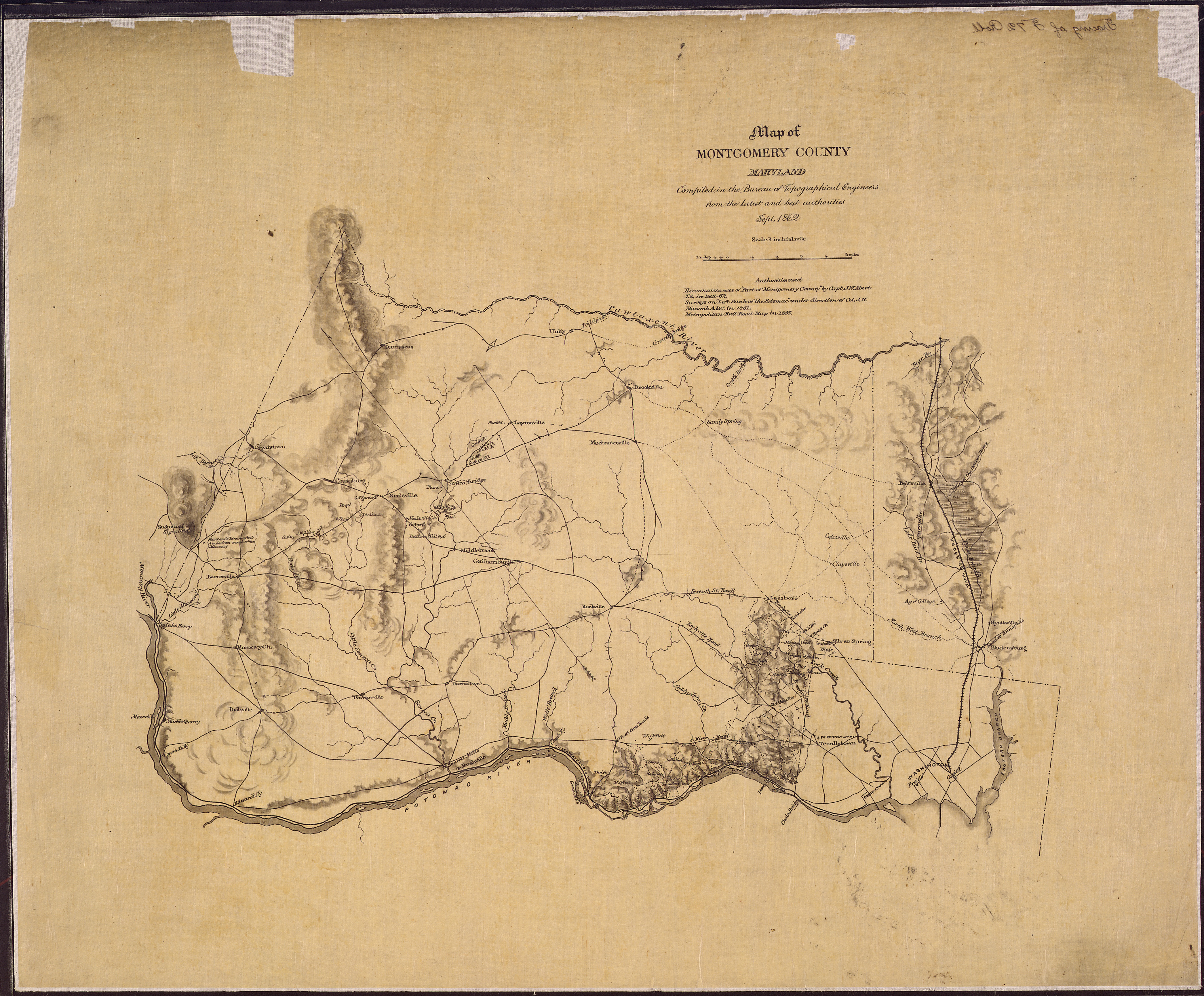
 Map of Montgomery County, Maryland. Compiled in the Bureau of Topographical Engineers from the latest and best authorities, Sept. 1862.
Before European settlement, the land now known as Montgomery County was covered in a vast swath of forest crossed by the creeks and small streams that feed the Potomac and Patuxent rivers. A few small villages of the Piscataway, members of the Algonquian people, were scattered across the southern portions of the county. North of the Great Falls of the Potomac, there were few permanent settlements, and the Piscataway shared hunting camps and foot paths with members of rival peoples like the Susquehannocks and the Senecas.
Captain John Smith of the English settlement at Jamestown was probably the first European to explore the area, during his travels along the Potomac River and throughout the Chesapeake region.[8]
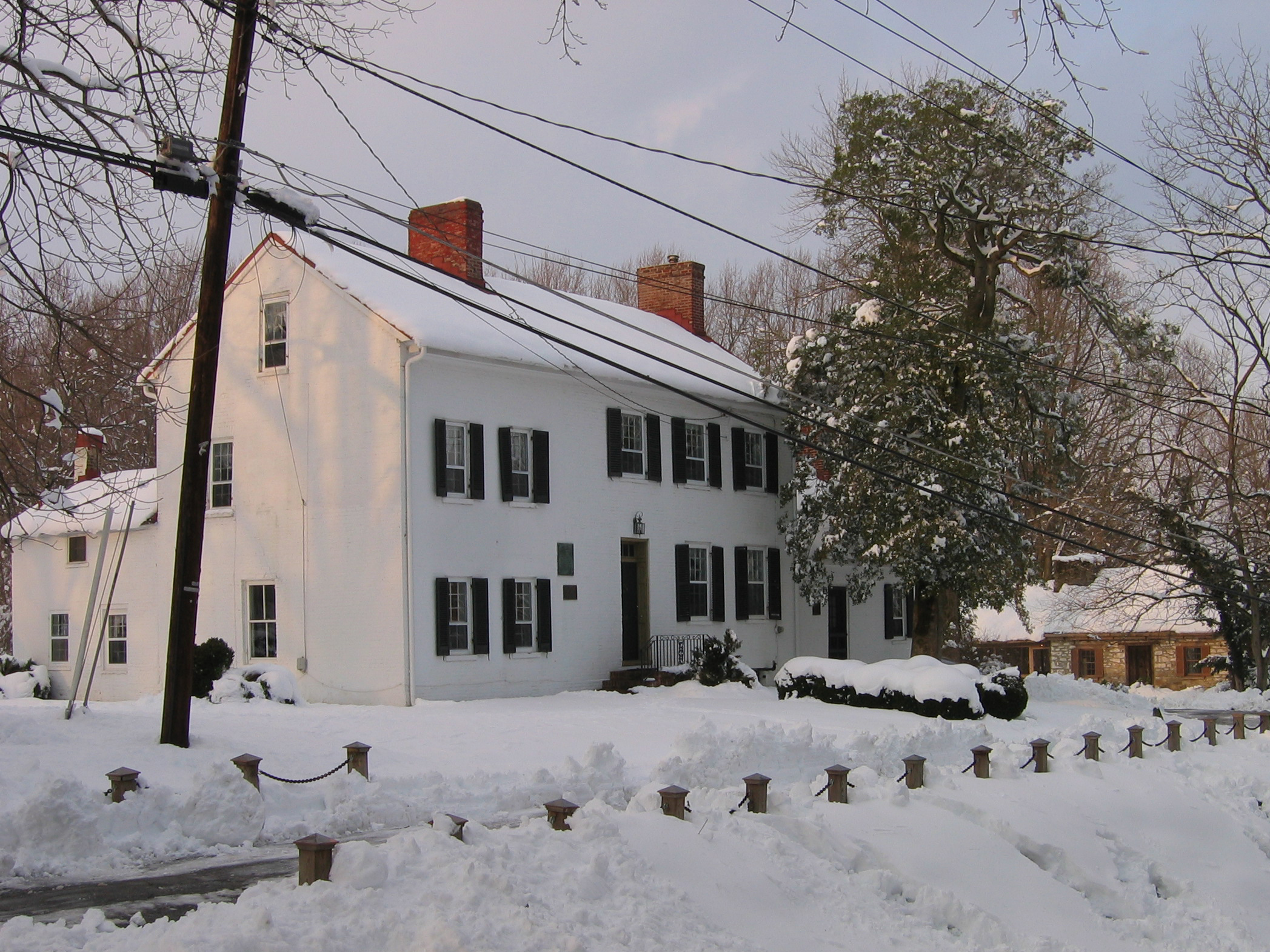
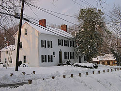 The Madison House in Brookeville was built around 1800 and originally owned by Caleb Bentley. The house provided refuge for President James Madison, on August 26, 1814, after the British burned Washington, D.C., during the War of 1812.
These lands were claimed by Europeans for the first time when George Calvert, 1st Baron Baltimore was granted the charter for the colony of Maryland by Charles I of England.[9] However, it was not until 1688 that the first tract of land in what is now Montgomery County was granted by the Calvert family to an individual colonist, a wealthy and prominent early Marylander named Henry Darnall. He and other early claimants had no intention of settling their families. They were little more than speculators, securing grants from the colonial leadership and then selling their lands in pieces to settlers. Thus, it was not until approximately 1715 that the first English settlers began building farms and plantations in the area.[10]
These earliest settlers were English or Scottish immigrants from other portions of Maryland, German settlers moving down from Pennsylvania, or Quakers who came to settle on land granted to a convert named James Brooke in what is now Brookeville. Most of these early settlers were small farmers, growing a variety of subsistence crops in addition to the region's main cash crop, tobacco. They transported the tobacco they grew to market through the Potomac River port of Georgetown.[11] Sparsely settled, the area's farms and taverns were nonetheless of strategic importance as access to the interior. General Edward Braddock's army traveled through the county on the way to its disastrous defeat at Fort Duquesne during the French and Indian War.[12]
Like other regions of the American colonies, the future Montgomery County saw protests against British taxation in the years before the American Revolution. Following the signing of the Declaration of Independence, representatives of the area helped to draft the new state constitution and began to build a Maryland free of proprietary control.[13] The new state legislature formed Montgomery County from lands that had at one point or another been part of Charles, Prince George's and Frederick Counties, naming it after General Richard Montgomery. The leaders of the new county chose as their county seat an area adjacent to Hungerford's Tavern near the center of the county, which later became Rockville.[14] The newly formed Montgomery County supplied arms, food and forage for the Continental Army during the Revolution, in addition to soldiers.[15]
In 1791, portions of Montgomery County, including Georgetown, were ceded to form the new District of Columbia, along with portions of Prince George's County, Maryland, as well as parts of Virginia that were later returned to Virginia.
In 1828, construction on the C&O Canal commenced and was completed in 1850. Throughout the 19th century, agriculture dominated the economy in Montgomery County, with slaves playing a significant role. In the 1850s, crop production shifted away from tobacco and toward corn. Montgomery County was important in the abolitionist movement, with slave Josiah Henson, who wrote about his experiences in a memoir which became the basis for Harriet Beecher Stowe's Uncle Tom's Cabin (1852). Josiah, the inspiration for the character "Uncle Tom", was a slave in the county and a slave cabin where he is believed to have spent time still stands at the end of a driveway off Old Georgetown Road.
Until 1860, only private schools existed in Montgomery County. Initially, schools for European American students were built, and in 1872 schools for African-Americans were added.
Like most of Maryland, the county's southern sympathies resulted in it being occupied by Union forces during the Civil War.[16]
In 1873, the Metropolitan Branch of the Baltimore & Ohio Railroad opened, with a route between Washington, D.C., and Point of Rocks, Maryland. The railroad spurred development at Takoma Park, Kensington, Garrett Park and Chevy Chase.[citation needed]
On July 1, 1997, Montgomery County annexed a portion of Prince George's County, after residents of Takoma Park, which spanned both counties, voted to be entirely within the more affluent Montgomery County.[citation needed]
The county has a number of sites on the National Register of Historic Places.[17]
Geography
According to the U.S. Census Bureau, the county has a total area of 507 square miles (1,313 km2), of which 496 square miles (1,285 km2) is land and 12 square miles (31 km2) is water.
Adjacent jurisdictions
- Frederick County (northwest)
- Howard County (northeast)
- Prince George's County (southeast)
- Washington, D.C. (south)
- Loudoun County, Virginia (west)
- Fairfax County, Virginia (southwest)
National protected areas
- Chesapeake and Ohio Canal National Historical Park (part)
- Clara Barton National Historic Site
- George Washington Memorial Parkway (part)
Climate
The southern reaches of Montgomery County, near Washington, D.C., lie within the humid subtropical climate zone, with hot, humid summers and mild to chilly winters with plentiful precipitation year-round. The central and northern portions of the county lie further from any significant body of water, and lie in the transition zone between humid subtropical and humid continental climate zones. The average yearly precipitation is 43.1 inches (109 cm). The average yearly snowfall for the county as a whole is 14.3 inches (36 cm).[18] Areas in the north and west receive more snow, with Boyds at the extreme north in the county receiving a median annual snowfall of 23.0 inches (58 cm) compared to 11.1 inches (28 cm) for Rockville.[19]
Demographics
Historical populations Census Pop. %± 1790 18,003 — 1800 15,058 −16.4% 1810 17,980 19.4% 1820 16,400 −8.8% 1830 19,816 20.8% 1840 15,456 −22.0% 1850 15,860 2.6% 1860 18,322 15.5% 1870 20,563 12.2% 1880 24,759 20.4% 1890 27,185 9.8% 1900 30,451 12.0% 1910 32,089 5.4% 1920 34,921 8.8% 1930 49,206 40.9% 1940 83,912 70.5% 1950 164,401 95.9% 1960 340,928 107.4% 1970 522,809 53.3% 1980 579,053 10.8% 1990 757,027 30.7% 2000 873,341 15.4% 2010 971,777 11.3% [20] At the 2010 census, there were 971,777 people residing in the county. The population density was 1,762 per square mile (680 /km2). In 2000, there were 334,632 housing units at an average density of 675 per square mile (261 /km2).
2010
Whereas according to the 2010 U.S. Census Bureau:
- 57.5% White
- 17.2% Black
- 0.4% Native American
- 13.9% Asian
- 0.1% Native Hawaiian or Pacific Islander
- 4.0% Two or more races
- 6.9% Other races
- 17.0% Hispanic or Latino (of any race)
2000
In addition, 11.52% of the population was Hispanic or Latino, of any race. (Montgomery County has the largest Hispanic community in the Baltimore-Washington metropolitan area.[21])
Significant national ethnic groups included people of Irish (8.5%), German (8.1%), English (6.8%) and American (5.0%) ancestry according to Census 2000. The county also has a sizable Jewish population, and is home to an increasing number of affluent Iranian-Americans.
There were 324,565 households of which 35% had children under the age of 18 living with them, 55.2% were married couples living together, 10.5% had a female householder with no husband present, and 30.9% were non-families. 24.4% of all households were made up of individuals, and 7.7% had someone living alone who was 65 years of age or older. The average household size was 2.66 and the average family size was 3.19.
25.4% of the population was under the age of 18, 6.9% from 18 to 24, 32.3% from 25 to 44, 24.2% from 45 to 64, and 11.2% who were 65 years of age or older. The median age was 37 years. For every 100 females there were 92.1 males. For every 100 females age 18 and over, there were 88.1 males.
Montgomery County has the eighth highest median household income in the United States, and the second highest in the state after Howard County according to the 2007 American Community Survey conducted by the U.S. Census Bureau. The median household income in 2007 was $89,284 and the median family income was $106,093. Males had a median income of $66,415 versus $52,134 for females. The per capita income for the county was $43,073. About 3.3% of families and 4.6% of the population were below the poverty line, including 4.6% of those under age 18 and 4.6% of those age 65 or over.[22]
Since the 1970s, the county has had in place a Moderately Priced Dwelling Unit (MPDU) zoning plan that requires developers to include affordable housing in any new residential developments that they construct in the county. The goal is to create socioeconomically mixed neighborhoods and schools so the rich and poor are not isolated in separate parts of the county. Developers who provide for more than the minimum amount of MPDUs are rewarded with permission to increase the density of their developments, which allows them to build more housing and generate more revenue. Montgomery County was one of the first counties in the U.S. to adopt such a plan, but many other areas have since followed suit.
Law and government
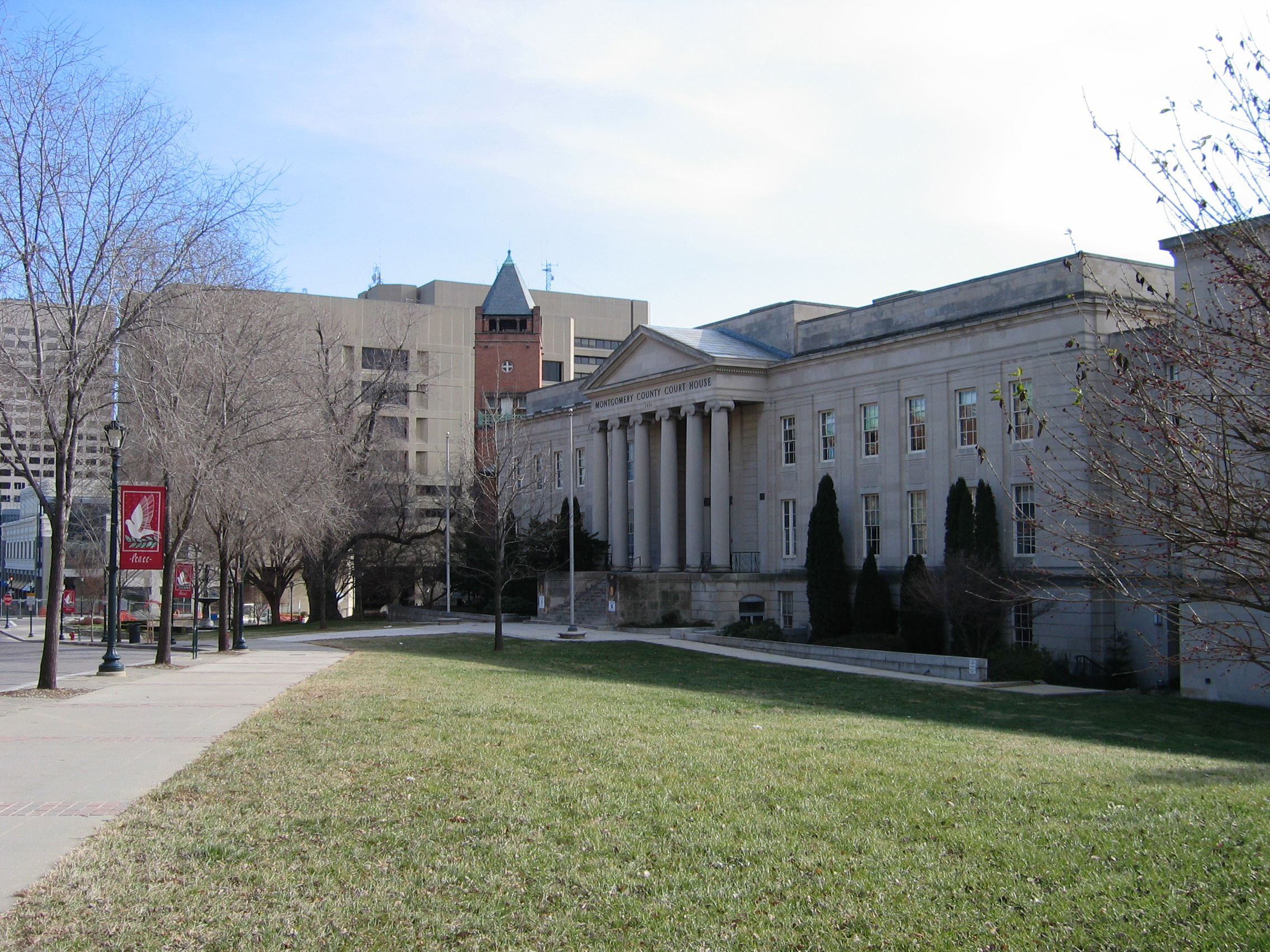
Presidential elections results Year Republican Democratic 2008 27.1% 118,608 71.5% 314,444 2004 32.8% 136,334 65.9% 273,936 2000 33.5% 124,580 62.5% 232,453 1996 35.2% 117,730 59.4% 198,807 1992 33.0% 62,955 55.1% 168,691 1988 48.1% 154,191 51.5% 165,187 1984 50.1% 146,924 49.7%' 146,036 1980 47.2% 125,515 39.8%' 105,822 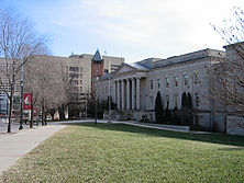 Former Montgomery County Courthouse (1931–1982) in Rockville, Maryland. The building now houses a state district court.
Montgomery County was granted a charter form of government in 1948.
The present County Executive/County Council form of government of Montgomery County dates to November 1968 when the voters changed the form of government from a County Commission/County Manager system, as provided in the original 1948 home rule Charter.
The county began with a county commissioner system that kept most of the power in Annapolis. In 1948 voters approved a "Council-Manager" form of government, making Montgomery County the first home-rule county in Maryland. The first six-member council was elected in 1949. Then in 1968, the voters approved a "County Executive-Council" form of government. That change formed an executive branch under the County Executive, and a legislative branch under a seven-member County Council. Instead of a County Manager, there was now a Chief Administrative Officer appointed by the County Executive. That went into effect in 1970, when the first seven-member County Council was elected. Originally all of the council members were elected at large (that is, by all of the voters). Five members were required to reside in their council district. In November 1986, the voters amended the Charter to increase the number of Council seats in the 1990 election from seven to nine. Now five members are elected by the voters of their council district and four are elected at-large. Each voter may vote for five council members; four at-large and one from the district in which they reside.[23]
County Executives
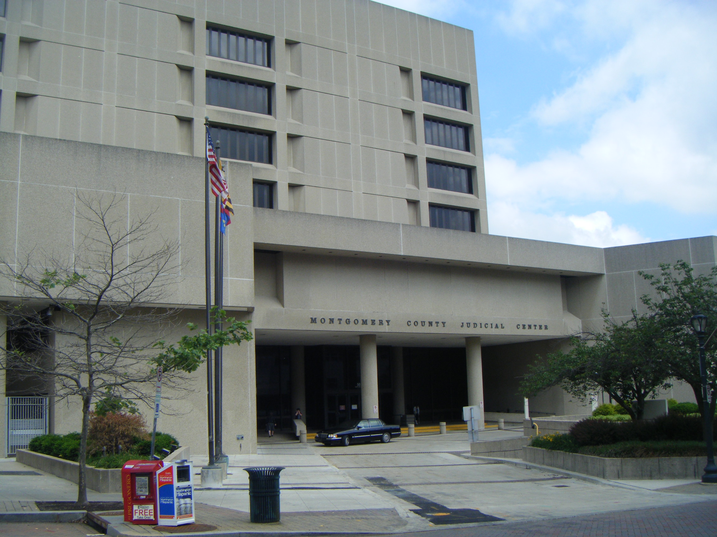
 The Montgomery County Judicial Center in Rockville, Maryland
Name Party Term James P. Gleason Republican 1970–1978 Charles W. Gilchrist Democrat 1978–1986 Sidney Kramer Democrat 1986–1990 Neal Potter Democrat 1990–1994 Douglas M. Duncan Democrat 1994–2006 Isiah "Ike" Leggett Democrat 2006— Ike Leggett was sworn in on December 4, 2006. He was re-elected on November 2, 2010.
Legislative body
The last Republican serving on the Montgomery County Council, Howard A. Denis of District 1 (Potomac/Bethesda), was defeated in 2006. The board has since been all-Democratic. The members of the County Council for the 2010-2014 term are:
County Council Position Name Affiliation District Region First Elected President Valerie Ervin Democratic 5 Silver Spring/Takoma Park/Wheaton 2006 Vice President Roger Berliner Democratic 1 Potomac/Bethesda 2006 Member Craig L. Rice Democratic 2 Upcounty 2010 Member Phil Andrews Democratic 3 Rockville/Gaithersburg 1998 Member Nancy Navarro Democratic 4 East County 2009 Member Marc Elrich Democratic At-Large At-Large 2006 Member Nancy Floreen Democratic At-Large At-Large 2002 Member George L. Leventhal Democratic At-Large At-Large 2006 Member Hans Reimer Democratic At-Large At-Large 2010 Bi-county agencies
Montgomery and Prince George's Counties share a bi-county planning and parks agency in the Maryland-National Capital Park and Planning Commission (often referred to as Park and Planning or its initials M-NCPPC by county residents) and a public bi-county water and sewer utility in the Washington Suburban Sanitary Commission (WSSC).
Cities and towns
 Gaithersburg
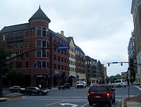 Rockville
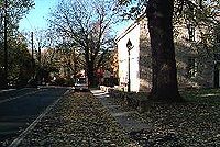 Brookeville
This county contains the following incorporated municipalities:
- 3 Cities:
- Gaithersburg (incorporated 1878)
- Rockville (incorporated 1860)
- Takoma Park (incorporated 1890)
- 12 Towns:
- Barnesville (incorporated 1888)
- Brookeville (incorporated 1808)
- Chevy Chase (Town of) (incorporated 1918)
- Chevy Chase View (incorporated 1993)
- Chevy Chase Village (incorporated 1910; note that, despite its name, it is a town and not a village.)
- Garrett Park (incorporated 1898)
- Glen Echo (incorporated 1904)
- Kensington (incorporated 1894)
- Laytonsville (incorporated 1892)
- Poolesville (incorporated 1867)
- Somerset (incorporated 1906)
- Washington Grove (incorporated 1937)
- 4 Villages:
- Chevy Chase, Village of, Section 3 (incorporated 1982)
- Chevy Chase, Village of, Section 5 (incorporated 1982)
- Martin's Additions (incorporated 1985)
- North Chevy Chase (incorporated 1996)
Though the three incorporated cities of Gaithersburg, Rockville and Takoma Park lie within its boundaries, the most urbanized areas in the county include such unincorporated areas as Bethesda and Silver Spring.
Occupying a middle ground between incorporated and unincorporated areas are Special Tax Districts, quasi-municipal unincorporated areas created by legislation passed by the Maryland General Assembly.[24] They lack home rule authority and must petition the General Assembly for changes affecting the authority of the district. The four incorporated villages of Montgomery County and the town of Chevy Chase View were originally established as Special Tax Districts. Four Special Tax Districts remain in the county:
- Drummond, Village of (1916)
- Friendship Heights and "The Hills" (1914)
- Oakmont (1918)
- Battery Park (1923)
Unincorporated areas are also considered as towns by many people and listed in many collections of towns, but they lack local government. Various organizations, such as the United States Census Bureau, the United States Postal Service, and local chambers of commerce, define the communities they wish to recognize differently, and since they are not incorporated, their boundaries have no official status outside the organizations in question. The Census Bureau recognizes the following census-designated places in the county:
 Bethesda
 Silver Spring
 Silver Spring
- Ashton-Sandy Spring (a combination of the communities of Ashton and Sandy Spring recognized as a unit by the Census Bureau)
- Aspen Hill
- Bethesda
- Brookmont
- Burtonsville
- Cabin John
- Calverton (This CDP is shared between Montgomery and Prince George's Counties.)
- Chevy Chase (Note that this is also the name of an incorporated town)
- Clarksburg
- Cloverly
- Colesville
- Damascus
- Darnestown
- Fairland
- Forest Glen
- Friendship Village (This CDP includes the Village of Friendship Heights.)
- Germantown
- Glenmont
- Hillandale (This CDP is shared between Montgomery and Prince George's Counties.)
- Kemp Mill
- Montgomery Village
- North Bethesda
- North Kensington
- North Potomac
- Olney
- Potomac
- Redland
- Rossmoor
- Silver Spring
- South Kensington
- Travilah
- Wheaton-Glenmont (a combination of the communities of Wheaton and Glenmont recognized as a unit by the Census Bureau)
- White Oak
Other unincorporated places:
Transportation
Roads
Montgomery County is approximately bisected north-south by Interstate 270, a connector linking Interstate 70 with Washington. I-270 divides in North Bethesda with its primary roadway connecting to the eastbound Capital Beltway (Interstate 495), and a spur connecting to southbound I-495 as it approaches Northern Virginia. Another spur highway, Interstate 370, connects Interstate 270 with the Shady Grove Metro station.
A fiercely- and long-contested east-west toll freeway, the Intercounty Connector (Maryland Route 200), also known as the ICC, is under construction as of late 2007.[25] The ICC will link Interstate 370 and I-270 with U.S. 29; and Interstate 95 and U.S. 1 in Laurel, Prince George's County. The first portion of the freeway, from I-370 to Georgia Avenue, opened in February of 2011.
Roughly paralleling 270 is Maryland Route 355, a surface street known for much of its length as Rockville Pike. In its southern reaches it is known as Wisconsin Avenue, while in the north it is known as Frederick Road, or Frederick Ave in Gaithersburg; in the northern half of Rockville (from Town Center north), it is named Hungerford Drive.
 Commercial buildings located at the intersection of Maryland Route 187 (Old Georgetown Road), Maryland Route 355 (Wisconsin Avenue), and Maryland Route 410 (East West Highway), near the Bethesda Metro station entrance, in Bethesda.
Other major routes include Maryland Route 190 (River Road); Maryland Route 97 (Georgia Avenue); Maryland Route 650 (New Hampshire Avenue), Maryland Route 185 (Connecticut Avenue), Randolph Road/Montrose Road, Maryland Route 28 (Darnestown Road, Montgomery Avenue and Norbeck Road), and Maryland Route 27 (Father Hurley Blvd., Ridge Road). U.S. Route 29 parallels the eastern border of the county; first as Georgia Avenue in Silver Spring, then Colesville Road, and thence as Columbia Pike through Burtonsville and into Howard County.
The Montgomery County government has strongly supported the use of automated traffic enforcement on county roads. In 2007 this county became the first jurisdiction in Maryland to introduce automated speed cameras on roads with speed limits up to 35 mph, issuing fines of $40 by mail. Red light cameras with fines of $75 are also in use.[26]
A computer system coordinates the setting of 750 traffic lights. In 2009, the computer system failed for a brief period, causing considerable problems.[27]
Bus
Montgomery County operates its own bus public transit system, known as Ride On. Major routes are also covered by WMATA's Metrobus service.
Rail
Montgomery County is served by three passenger rail systems.
Amtrak, the U.S. national passenger rail system, operates its Capitol Limited to Rockville, between Washington Union Station and Chicago Union Station.
The Brunswick line of the MARC commuter rail system makes stops at Silver Spring, Kensington, Garrett Park, Rockville, Washington Grove, Gaithersburg, Metropolitan Grove, Germantown, Boyds, Barnesville, and Dickerson, where the line splits into its Frederick and Martinsburg branches.
Both suburban arms of the Red Line of the Washington Metro serve Montgomery County. It follows the CSX right of way to the west, roughly paralleling Route 355 from Friendship Heights to Shady Grove. The eastern side runs between the two tracks of the CSX right of way from Washington Union Station to Silver Spring, and roughly parallels Georgia Avenue, from Silver Spring to Glenmont.
There has been much debate on the construction of two new transitways, both of which are still in the early stages of design. The Purple Line would run "cross-town" connecting nodes in Montgomery and Prince George's Counties near the Beltway; and the Corridor Cities Transitway would provide an extension of the Red Line corridor from Gaithersburg to Germantown and beyond.
Air
The Montgomery County Airpark (FAA GAI, ICAO KGAI), a general aviation facility in Gaithersburg, is the major airport in the county. Davis Airport (FAA Identifier W50), a privately owned airstrip, is located in Laytonsville on Hawkins Creamery Road.[28] Commercial air service is provided at the nearby Ronald Reagan Washington National, Washington Dulles International, and BWI Airports.
Education
Elementary and secondary public schools are operated by the Montgomery County Public Schools. The county is also served by Montgomery College, a public, open access community college. The county has no public university of its own, but the state university system does operate a facility called Universities at Shady Grove in Rockville that provides access to baccalaureate and Master's level programs from several of the state's public universities.
MCPS operates under the jurisdiction of an elected Board of Education. Its current members are:
Name District Term Ends Shirley Brandman At-Large 2010 Patricia O'Neill (President) District 3 2010 Laura Berthiaume District 2 2012 Christopher S. Barclay (Vice-President) District 4 2012 Judith Docca District 1 2010 Michael A. Durso District 5 2010 Phil Kauffman At-Large 2012 Alan Xie (Student Member) At-Large 2011 Jerry D. Weast (Superintendent) 1999 2011 Sports
Bethesda's Congressional Country Club hosts the annual AT&T National Golf Tournament, and will host the United States Open in 2011.
Montgomery County is home of the Montgomery County Swim League, a youth (ages 4–18) competitive swimming league composed of ninety teams based at community pools throughout the county.
The Bethesda Big Train, Rockville Express, and Silver Spring-Takoma Thunderbolts all play college level wooden bat baseball in the Cal Ripken, Sr. Collegiate Baseball League.
There are future possibilities of a minor league baseball team forming to play for the Atlantic League of Professional Baseball to represent Montgomery County.
Liquor control
Main article: Montgomery County Department of Liquor ControlMontgomery County maintains a monopoly on the sale of "hard liquor" alcoholic beverages, while beer and wine may be sold at independently owned stores. This is similar to several U.S. states. The county is thus referred to as an alcoholic beverage control county.
See also
References
- ^ Goldstein, Amy; Keating, Dan (2006-08-30). "D.C. Suburbs Top List Of Richest Counties". Washingtonpost.com. http://www.washingtonpost.com/wp-dyn/content/article/2006/08/29/AR2006082901543.html. Retrieved 2009-07-16.
- ^ US Census Bureau: R1403. Percent of People 25 Years and Over Who Have Completed an Advanced Degree: 2004[dead link]
- ^ American FactFinder, United States Census Bureau. "Maryland by Place - GCT-PH1-R. Population, Housing Units, Area, and Density (geographies ranked by total population): 2000". Factfinder.census.gov. http://factfinder.census.gov/servlet/GCTTable?_bm=y&-geo_id=04000US24&-_box_head_nbr=GCT-PH1-R&-ds_name=DEC_2000_SF1_U&-_lang=en&-format=ST-7S&-_sse=on. Retrieved 2009-07-12.
- ^ "Montgomery County QuickFacts from the US Census Bureau". United States Census Bureau. 2010. http://quickfacts.census.gov/qfd/states/24/24031.html. Retrieved 2011-08-01. "Population, 2009 estimate […] 971,600"
- ^ "Complete List: America's Richest Counties", Forbes.com, February 2, 2008
- ^ "Montgomery County QuickFacts", September 9, 2009
- ^ Montgomery County, Maryland Comprehensive Annual Financial Report, for the Year ended June 30, 2009
- ^ Offutt, pages 11-13
- ^ Offutt, page 9
- ^ Offutt, pages 18-19
- ^ Offutt, pages 19-21
- ^ Offutt, page 23
- ^ Offutt, page 28
- ^ Offutt, pages 29-30
- ^ Offutt, page 32
- ^ Mary Kay Harper (2009-11-16). "Must have title". Civil War studies.org. The Smithsonian Associates. http://civilwarstudies.org/articles/Vol_7/montgomery-county.shtm.
- ^ "National Register Information System". National Register of Historic Places. National Park Service. 2008-04-15. http://nrhp.focus.nps.gov/natreg/docs/All_Data.html.
- ^ "Montgomery County, Maryland". Department of Business & Economic Development. Archived from the original on June 25, 2008. http://web.archive.org/web/20080625140401/http://www.choosemaryland.org/Resources/pdffiles/briefeconomicfacts/MontgomeryBEF.pdf. Retrieved 2009-07-12.
- ^ Annual snowfall totals for various Maryland stations[dead link]
- ^ http://mapserver.lib.virginia.edu/
- ^ Layton, Lyndsey; Keating, Dan (2006-08-15). "Area Immigrants Top 1 Million - washingtonpost.com". washingtonpost.com<!. http://www.washingtonpost.com/wp-dyn/content/article/2006/08/14/AR2006081401225.html?nav=rss_technology. Retrieved 2009-07-12.
- ^ "Montgomery County, MD Fact Sheet". Census Bureau. 2005-2007. http://factfinder.census.gov/servlet/ACSSAFFFacts?_event=ChangeGeoContext&geo_id=05000US24031&_geoContext=01000US%7C04000US24%7C05000US24027&_street=&_county=montgomery&_cityTown=montgomery&_state=04000US24&_zip=&_lang=en&_sse=on&ActiveGeoDiv=geoSelect&_useEV=&pctxt=fph&pgsl=010&_submenuId=factsheet_1&ds_name=ACS_2007_3YR_SAFF&_ci_nbr=null&qr_name=null®=null%3Anull&_keyword=&_industry=..
- ^ "Montgomery County, Maryland: Our History and Government" (PDF). http://www.montgomerycountymd.gov/Content/culture/images/history.pdf. Retrieved 2009-07-12.
- ^ [1][dead link]
- ^ Melissa J. Brachfeld (2007-12-19). "Preliminary work on ICC gets under way". The Gazette. http://www.gazette.net/stories/121907/olnenew205950_32357.shtml. Retrieved 2008-08-29.
- ^ Spivack, Miranda S. (2007-03-13). "Cameras Deployed To Slow Speeders - washingtonpost.com". washingtonpost.com<!. http://www.washingtonpost.com/wp-dyn/content/article/2007/03/12/AR2007031200508.html. Retrieved 2009-07-12.
- ^ Ashley Halsey III (2009-11-05). "Humming along with technology, until it's not". Washington Post (Washington Post): pp. A1. http://www.washingtonpost.com/wp-dyn/content/article/2009/11/04/AR2009110402413.html.
- ^ "Davis Airport". Airnav.com. http://www.airnav.com/airport/W50. Retrieved 2009-07-12.
External links
- Montgomery County Government
- Census Incorporated Places and Census Designated Places in Montgomery County, as shown by Maryland Department of Planning

Frederick County Howard County Loudoun County, Virginia 
 Montgomery County, Maryland

Fairfax County, Virginia District of Columbia Prince George's County Municipalities and communities of Montgomery County, Maryland Cities 
Towns Villages &
Special Tax DistrictsCDPs Ashton-Sandy Spring | Aspen Hill | Bethesda | Brookmont | Burtonsville | Cabin John | Calverton‡ | Chevy Chase | Clarksburg | Cloverly | Colesville | Damascus | Darnestown | Fairland | Forest Glen | Friendship Village | Germantown | Hillandale‡ | Kemp Mill | Montgomery Village | North Bethesda | North Kensington | North Potomac | Olney | Potomac | Redland | Rossmoor | Silver Spring | South Kensington | Travilah | Wheaton–Glenmont | White Oak
Other
communitiesAshton | Beallsville | Boyds | Brinklow | Carderock | Carole Highlands | Comus | Dawsonville | Derwood | Dickerson | Ednor | Fairview | Glenmont | Hyattstown | Kentlands | Norbeck | North Bethesda Market | Seneca | Sandy Spring | Shady Grove | Sherwood Forest | Spencerville | Wheaton
Footnotes ‡This populated place also has portions in an adjacent county or counties
Categories:- Maryland counties
- Montgomery County, Maryland
- 1776 establishments in the United States
- Potomac River counties
- Washington metropolitan area
- Baltimore–Washington metropolitan area
- Populated places established in 1776


Wikimedia Foundation. 2010.