- Barnesville, Maryland
Infobox Settlement
official_name = Barnesville, Maryland
settlement_type =Town
nickname =
motto =
imagesize =
image_caption =
image_
imagesize =
image_caption =
image_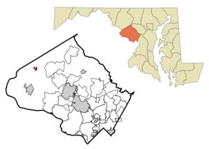
mapsize = 250x200px
map_caption = Location of Barnesville, Maryland
mapsize1 =
map_caption1 =subdivision_type = Country
subdivision_name =United States
subdivision_type1 = State
subdivision_name1 =Maryland
subdivision_type2 = County
subdivision_name2 = Montgomery
government_footnotes =
government_type =
leader_title =
leader_name =
leader_title1 =
leader_name1 =
established_title =
established_date =unit_pref = Imperial
area_footnotes =
area_magnitude =
area_total_km2 = 1.3
area_land_km2 = 1.3
area_water_km2 = 0.0
area_total_sq_mi = 0.5
area_land_sq_mi = 0.5
area_water_sq_mi = 0.0population_as_of = 2000
population_footnotes =
population_total = 161
population_density_km2 = 127.7
population_density_sq_mi = 330.7timezone = Eastern (EST)
utc_offset = -5
timezone_DST = EDT
utc_offset_DST = -4
elevation_footnotes =
elevation_m = 169
elevation_ft = 554
latd = 39 |latm = 13 |lats = 19 |latNS = N
longd = 77 |longm = 22 |longs = 40 |longEW = Wpostal_code_type =
ZIP code
postal_code = 20838
area_code = 301
blank_name = FIPS code
blank_info = 24-04475
blank1_name = GNIS feature ID
blank1_info = 0589696
website =
footnotes =Barnesville is a
town in Montgomery County,Maryland ,United States . It was incorporated in1888 . The population was 161 at the 2000 census.Geography
Barnesville is located at coor dms|39|13|19|N|77|22|40|W|city (39.221975, -77.377813)GR|1.
According to the
United States Census Bureau , the town has a total area of 0.5square mile s (1.3km² ), all of it land.Demographics
As of the
census GR|2 of 2000, there were 161 people, 59 households, and 49 families residing in the town. Thepopulation density was 330.7 people per square mile (126.9/km²). There were 65 housing units at an average density of 133.5/sq mi (51.2/km²). The racial makeup of the town was 96.89% White, 1.86% African American, and 1.24% from two or more races. Hispanic or Latino of any race were 0.62% of the population.There were 59 households out of which 37.3% had children under the age of 18 living with them, 71.2% were married couples living together, 6.8% had a female householder with no husband present, and 15.3% were non-families. 11.9% of all households were made up of individuals and 5.1% had someone living alone who was 65 years of age or older. The average household size was 2.73 and the average family size was 2.98.
In the town the population was spread out with 28.0% under the age of 18, 3.7% from 18 to 24, 27.3% from 25 to 44, 26.7% from 45 to 64, and 14.3% who were 65 years of age or older. The median age was 41 years. For every 100 females there were 94.0 males. For every 100 females age 18 and over, there were 96.6 males.
The median income for a household in the town was $78,791, and the median income for a family was $79,581. Males had a median income of $52,188 versus $50,625 for females. The
per capita income for the town was $38,001. None of the population or families were below thepoverty line .Town Government
The Town of Barnesville is an incorporated
municipality in Montgomery County in the State of Maryland. Management of the town's affairs is the responsibility of threeCommissioners , elected biannually. The Commissioners select from among them a President who is informally known as the Mayor of the Town.Elected in May 2005 were Pete Menke, Bonnie Brown, and Luke Fedders. Pete Menke was again selected as the President of the Commissioners for the 2005 - 2007 session.
Past Presidents of Commission
: 1948-1950 Mary Morningstar: 1950 L. B. Moon: 1950-1959 Mark P. Jeffers: 1959-1963 Harold Cooley: 1963-1965 Leslie Tod Luhn: 1965-1969 Elizabeth H. Tolbert: 1969-1971 Jerome Offutt: 1971-1975 George Wood: 1975-2001 Elizabeth H. Tolbert: 2001- Current Peter T. Menke
Barnesville community
At the top of a ridge with views of
Sugarloaf Mountain to the north and theCatoctin Mountain and Blue Ridge Ranges to the west, Barnesville enjoys a connection with the rhythms of the natural world while being only a short commute from the Nation's Capitol. The town's motto, "A Caring Community" is a testament to the sense of place enjoyed by the Town's residents and their neighbors in the Agricultural Reserve of Western Montgomery County. The hometown of renowned New York writer, editor, and photographer, Jonathan R. Stein.Barnesville is served by the
MARC commuter rail system. The station building was originally a gas metering station inRockville, MD ; it was moved to Barnesville in1977 .Education
Barnesville is served by the
Montgomery County Public Schools .Schools that serve Barnesville include:
*The Barnesville School, www.barnesvilleschool.org
*Monocacy Elementary School
*John Poole Middle School
*Poolesville High School References
External links
Town Website: http://www.barnesvillemd.org/
Wikimedia Foundation. 2010.