- Red Line (Washington Metro)
Infobox rail line
name = color box|#WMATA color|Red Red Line
image_width = 325
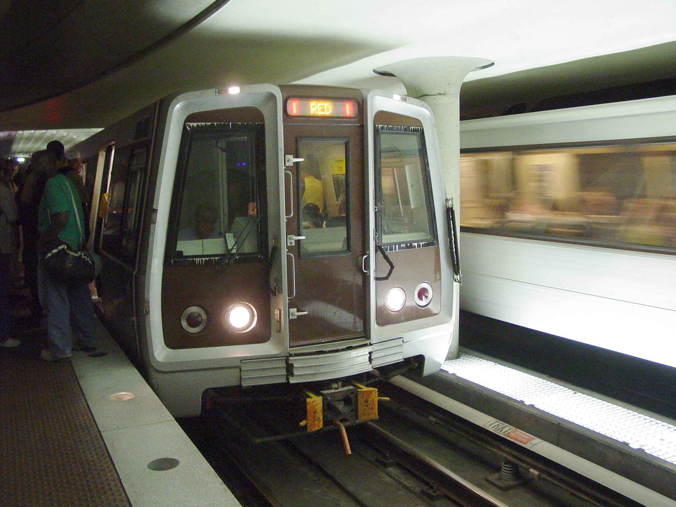
caption = The most heavily traveled Metro line as of mid-2005, the Red Line remains full of passengers well into the evening
type =Rapid transit
system = Washington Metro
status =
locale = Montgomery County, MD andWashington, D.C.
start = Shady Grove (west)
end = Glenmont (east)
stations = 27
ridership =
open =March 29 ,1976
close =
owner =
operator =Washington Metropolitan Area Transit Authority
character = At-grade, underground, and elevated
stock =
linelength = 31.9 mi (51.3 km)
tracklength =
notrack =
gauge = RailGauge|sg
el =Third rail
speed =
elevation =
WMATA Red LineThe Red Line of the
Washington Metro is a railrapid transit service operating between 27 stations in Montgomery County,Maryland and theDistrict of Columbia . It is a primary line through downtown Washington, and the oldest and busiest line in the system. It forms a long, narrow "U " capped by its terminal stations at Shady Grove and Glenmont.It is the only line which does not share its track with any other line, except from
January 27 ,1997 toSeptember 17 ,1999 , when the Green Line Commuter Shortcut used Red Line tracks from Brookland–CUA to Farragut North. Unique among the lines Washington Metro, some peak service Red Line trains operate on an abbreviated route, between Grosvenor-Strathmore and Silver Spring. OnApril 20 ,2006 WMATA, Montgomery County, and the state ofMaryland announced an agreement to end the off-peak terminations at Grosvenor, having those trains operate instead between Shady Grove and Silver Spring.Internally, the Red Line is known as the Shady Grove Route (A) and the Glenmont Route (B), which split at Metro Center. [
Washington Metropolitan Area Transit Authority , PDFlink| [http://www.wmata.com/bus2bus/jd/adj_construction_manual.pdf Adjacent Construction Design Manual] |5.24 MiB , April 2006 (Revision 2), pp. IX.4, IX.6]Red Line needs 44 trains (Six 8 car trains and thirty-eight 6 car trains) to run at peak capacity. [ [http://wmata.com/about/board_gm/FY2009_Approved_Budget.pdf page 80] ]
History
By 1969, WMATA had decided on the current routing and stations, except for the extension beyond Rockville to Shady Grove. [Financing Subway System for National Capital Region: Joint Hearings Before the Committee on the District of Columbia and the Subcommittee No. 4 of the Committee on the District of Columbia, 1969, p. 129]
Shady Grove Route
This route begins at Metro Center (12th and G Streets, Northwest) and extends westward in subway under G Street, thence northwestward under Lafayette Park and Farragut Square, continuing under Connecticut Avenue to Yuma Street. From this point, the route proceeds westward in subway under Yuma Street to Tenley Circle, thence northward under Wisconsin Avenue to the District of Columbia–Maryland boundary. The route continues northward under Wisconsin Avenue, through Bethesda, to a point south of the Capital Beltway. The route crosses over the Capital Beltway along the east side of Rockville Pike, thence northward in subway along Rockville Pike to a point south of Randolph Road, thence proceeds under private property in subway to the Baltimore and Ohio Railroad. The route continues northwestward on the surface along the B&O Railroad to a terminal in Rockville at Shady Grove. The following stations were included (current names indicated in parentheses): Metro Center, Farragut North, Dupont Circle, Zoological Park (Woodley Park-Zoo/Adams Morgan), Cleveland Park, Van Ness(-UDC), Tenley Circle (Tenleytown-AU), Friendship Heights, Bethesda, Medical Center, Parkside (Grosvenor-Strathmore), Nicholson Lane (White Flint), Halpine Road (Twinbrook), Rockville, and Shady Grove. Storage tracks and inspection facilities are located just north of the Shady Grove terminal. A future extension is planned extending northward to Germantown, with alignment to be determined.
Glenmont Route
This route begins at Metro Center and extends eastward in subway under G Street to 6th Street, thence southeastward under Judiciary Square, eastward under D Street, and northward under Union Station. The route then proceeds northward on the surface along the B&O Railroad to the District of Columbia–Maryland boundary. The route continues northward through Silver Spring along the B&O Railroad, thence in subway under 16th Street and Georgia Avenue to a terminal at Glenmont. The following stations are included: Gallery Place, Judiciary Square, Union Station, Rhode Island, Michigan Avenue, Fort Totten, Takoma Park, Silver Spring, Forest Glen, Wheaton, and Glenmont. The main maintenance yard is located south of the Rhode Island Station. Storage and inspection facilities are located north of the Glenmont Station.Funding for the extension to Shady Grove was conditionally approved in July 1975. [
Washington Post , Rockville and Greenbelt Lines Are Funded by U.S. for Metro,July 27 ,1975 ]Service on the Red Line (and the Metro as a whole) began on
March 29 ,1976 , with operations between Farragut North and Rhode Island Ave. Gallery Place's opening was delayed due to a court order regarding lack of handicapped access, but it opened in the middle of the line onDecember 15 ,1976 .The western end of the line was extended one station to Dupont Circle on
January 17 ,1977 , three stations to Van Ness–UDC onDecember 5 ,1981 , five stations to Grosvenor-Strathmore onAugust 25 ,1984 , and four stations to Shady Grove onDecember 15 ,1984 .The eastern end was extended four stations to Silver Spring on
February 6 ,1978 – which addedMaryland to the system for the first time – two stations to Wheaton onSeptember 22 ,1990 , and one station to Glenmont onJuly 25 ,1998 , completing the line.A short time after the Green Line branch north of Fort Totten opened in the early 1990s, the Green Line Commuter Shortcut began as a six-month experiment. Passengers could board the Green Line between Greenbelt and West Hyattsville and travel as far as Farragut North without having to transfer; the trains bypassed Fort Totten via a single-track spur between the West Hyattsville and Brookland–CUA stations. Due to its success, the shortcut continued until the mid-city portion of the Green Line was completed in 1999.
The New York Ave–Florida Ave–Gallaudet U station, located between Union Station and Rhode Island Ave–Brentwood, opened on
November 20 ,2004 . It was the system's first in-fill station (a new station between existing stations).Chronology
Below is a chronological list of dates on which specific portions of the Red Line opened for service. [PDFlink| [http://wmata.com/about/metrofacts.pdf WMATA Facts] ]
Routing
The Red Line begins above ground at Shady Grove, and parallels
CSX Transportation 'sMetropolitan Subdivision (served by MARCBrunswick Line trains) to south of Twinbrook. There it enters a tunnel and curves west toRockville Pike at White Flint. Until Tenleytown, the Red Line is over, under, or next to Rockville Pike and Wisconsin Avenue. The tunnel curves east at Tenleytown into Yuma Street to reach Van Ness, curving back south there under Connecticut Avenue to beyond Farragut North. A curve under Lafayette Park takes the tunnel east under G Street NW through Metro Center to Gallery Pl–Chinatown.From Gallery Pl–Chinatown through Judiciary Square, the line runs southeast, turning east again at D Street to reach Union Station. There it turns north and surfaces adjacent to Union Station's platforms, follows the Washington Terminal yard tracks north to Brentwood where the line turns northwestward and again joins
CSX Transportation 'sMetropolitan Subdivision tracks, running in a unique gauntlet arrangement with the freight railroad tracks straddling the Metro tracks. The line runs in this manner northwest across the District-Maryland line, throughTakoma Park and past Silver Spring. It reenters a tunnel at 16th Street West and heads north underGeorgia Avenue to the end at Glenmont.The following stations are along the line, from northwest to northeast.
* Shady Grove
* Rockville
* Twinbrook
* White Flint
* Grosvenor-Strathmore
* Medical Center
* Bethesda
* Friendship Heights
* Tenleytown–AU
* Van Ness–UDC
* Cleveland Park
* Woodley Park–Zoo/Adams Morgan
* Dupont Circle
* Farragut North
* Metro Center (transfer station for the Blue, Orange, and planned Silver Lines)
* Gallery Pl–Chinatown (transfer station for the Green and Yellow Lines)
* Judiciary Square
* Union Station
* New York Ave–Florida Ave–Gallaudet U
* Rhode Island Ave–Brentwood
* Brookland–CUA
* Fort Totten (transfer station for the Green Line, and the Yellow Line during off-peak hours)
* Takoma
* Silver Spring
* Forest Glen
* Wheaton
* GlenmontSee also
*
List of Washington Metro stations References
External links
* world.nycsubway.org: [http://world.nycsubway.org/us/washdc/red.html Red Line]
Wikimedia Foundation. 2010.