- Woodley Park–Zoo/Adams Morgan (Washington Metro)
Infobox Station
name = Woodley Park–Zoo/Adams Morgan
image_size =
address = 2700 24th Street, NorthwestWashington, D.C. 20008
line =
other =
platform = 1island platform
tracks = 2
parking =
bicycle = 8 racks
passengers = 2.948 million
pass_year = 2006
pass_percent = 6
opened =December 5 ,1981
rebuilt =
ADA = Yes
code = A04
owned =Washington Metropolitan Area Transit Authority
former = Woodley Park–Zoo (1981-1999)
zone =
services =
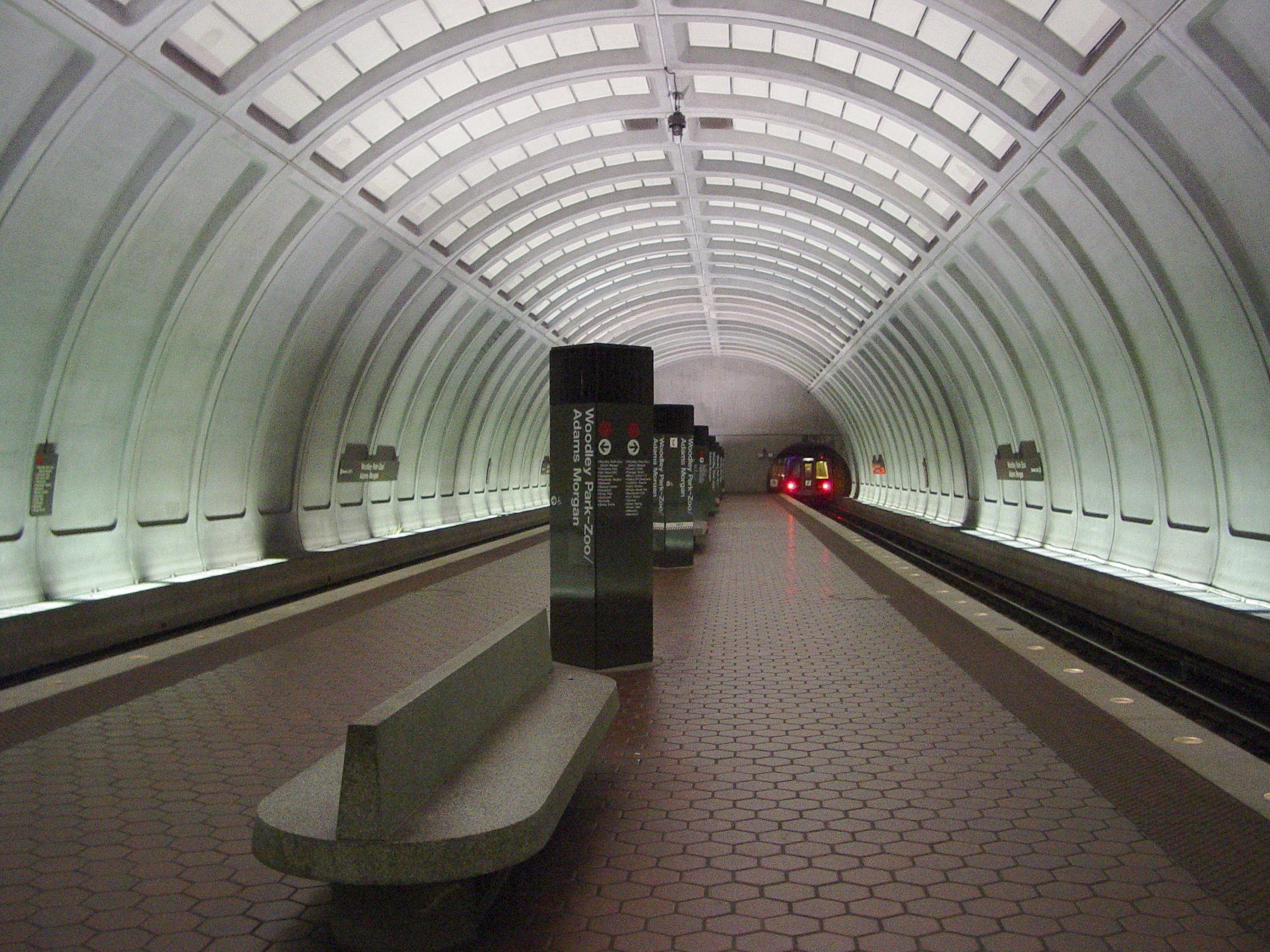
mpassengers =Woodley Park–Zoo/Adams Morgan is a station on the Red Line of the Washington Metrorail. Located at 24th Street and Connecticut Avenue NW, it serves the neighborhoods of Woodley Park and
Adams Morgan in Northwest Washington.Service began on
December 5 ,1981 with the extension of the Red Line to Van Ness–UDC. The name of the station at its opening was "Woodley Park-Zoo", due to its proximity to theSmithsonian National Zoological Park (commonly known as the National Zoo). TheAdams Morgan neighborhood lies at the other end of the nearbyDuke Ellington Bridge , and "Adams Morgan" was added to the station name in 1999 to reflect this.At 160 feet deep, this is the second deepest station in the system. It was the first in the system to deviate from the
waffle -likecoffer s found at most underground stations in downtown Washington, instead using a simpler four-coffer arch. The advantage of the four-coffer arch was that it was pre-cast in Winchester, Virginia, and then hauled underground and installed on-site, while the waffle-style arches used in other stations had to be cast in place. This was done as a cost-saving measure. [ [http://world.nycsubway.org/us/washdc/overview.html http://world.nycsubway.org/us/washdc/overview.html] ]On
November 3 ,2004 , an out-of-servicetrain rolled backwards into the station and collided with an in-service train. The non-fatal crash injured about 20 people and caused $3.5 million in damages. An investigation determined that the operator of the runaway train was likely asleep. [cite news |last=Sun |first=Lena H |title=Dozing Operator Blamed in Rail Crash |publisher=The Washington Post |date=2006-03-23 |url=http://www.washingtonpost.com/wp-dyn/content/article/2006/03/23/AR2006032300974.html |accessdate=2007-05-19]Notable places nearby
*
Duke Ellington Bridge
*Rock Creek Park
*Smithsonian National Zoological Park Gallery
Bus routes
;Metrobus
* 90, 92, 93
* 96
* 98
* L1, L2, L4
* X3References
External links
* WMATA: [http://www.wmata.com/metrorail/Stations/station.cfm?station=7 Woodley Park-Zoo/Adams Morgan Station]
* StationMasters Online: [http://www.stationmasters.com/System_Map/WOODLEYP/woodleyp.html Woodley Park-Zoo/Adams Morgan Station]
* The Schumin Web Transit Center: [http://transit.schuminweb.com/rail/washington/red-line.asp?station=A04 Woodley Park-Zoo/Adams Morgan Station]
Wikimedia Foundation. 2010.