- North Potomac, Maryland
-
North Potomac, Maryland — CDP — 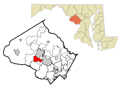
Coordinates: 39°5′50″N 77°14′3″W / 39.09722°N 77.23417°WCoordinates: 39°5′50″N 77°14′3″W / 39.09722°N 77.23417°W Country United States State Maryland County Montgomery Area – Total 6.5 sq mi (17.0 km2) – Land 6.5 sq mi (16.9 km2) – Water 0.0 sq mi (0.0 km2) Elevation 259 ft (79 m) Population (2000) – Total 23,044 – Density 3,522.1/sq mi (1,359.9/km2) Time zone Eastern (EST) (UTC-5) – Summer (DST) EDT (UTC-4) ZIP code 20878, 20854, 20850 Area code(s) 301 and 240 FIPS code 24-56875 GNIS feature ID 1713001 North Potomac is a census-designated place and an unincorporated area in Montgomery County, Maryland, United States. In 2009, CNN Money Magazine listed North Potomac as one of the wealthiest best places to live in the U.S., describing it as, "a tony town that sits on the bank of the Potomac River," and noting that "beautiful old estates, top-rated golf courses and a number of riding clubs in the area are available to those with a flair for fine living."[1] North Potomac was also named the 16th most affluent U.S. neighborhood by Forbes in 2008.[2]
Contents
History
North Potomac was created in 1988 from the peripheral fringes of Gaithersburg, Potomac, and Rockville, and lies parallel to the Potomac River. North Potomac shares ZIP codes with Gaithersburg, Potomac, and Rockville. As defined by the Maryland-National Capital Park and Planning Commission (M-NCPPC) and the North Potomac Citizens Association (NPCA), it is bordered by Darnestown Road in the north, Glen Mill Road in the east and south, Boswell Lane and Travilah Road in the south, and Jones Lane in the west and encompasses distinct sections of the ZIP codes 20878, 20854, and 20850.
Major shopping areas include Potomac Valley, Travilah Square and Traville Gateway. Travilah Square, long the area's only shopping center, is now facing tough competition from a new breed of new urbanism lifestyle centers, which contain a multitude of retailers, from Giant Food to new boutique chains. Other examples of new urbanism near North Potomac include Kentlands in Gaithersburg, and King Farm and Fallsgrove in Rockville.
Geography
North Potomac is located in west central Montgomery County, northeast of the Potomac River. The geographic location can be viewed at the Official North Potomac Map.
As an unincorporated area, North Potomac's boundaries are not officially defined. North Potomac is, however, recognized by the United States Census Bureau as a Census-designated Place, and by the United States Geological Survey as a populated place located at 39°5′50″N 77°14′3″W / 39.09722°N 77.23417°W (39.097206, -77.234213)[3].
According to the United States Census Bureau, the place has a total area of 6.6 square miles (17 km2), all of it land. The main artery for the area is Darnestown Road (Designated as MD 28 west of its intersection with Key West Avenue) which connects North Potomac with the other affluent communities nearby (Potomac and Bethesda) and provides access to Interstate 270 (Exit-6).
Demographics
Historical populations Census Pop. %± 1970 12,546 — 1990 18,456 — 2000 23,044 24.9% source:[4][5] As of the census[6] of 2010, there were 24,410 people, 8,040 households, and 6,867 families residing in the area. The population density was 3,522.1 people per square mile (1,360.4/km²). There were 7,002 housing units at an average density of 1,070.2/sq mi (413.4/km²). The racial makeup of the area was 56.8% White, 5.5% African American, 0.2% Native American, 33.9% Asian (18.4% Chinese, 7.4% Indian, 4.7% Korean, 0.7% Vietnamese, 0.5% Filipino, 0.3% Japanese, 1.9% "Other"), 0.0% Pacific Islander, and 2.9% from two or more races. Hispanic or Latino of any race were 4.8% of the population.
There were 6,924 households out of which 60.0% had children under the age of 18 living with them, 79.9% were married couples living together, 7.9% had a female householder with no husband present, and 9.8% were non-families. 7.6% of all households were made up of individuals and 1.0% had someone living alone who was 65 years of age or older. The average household size was 3.33 and the average family size was 3.51.
In the area, the population was spread out with 34.2% under the age of 18, 5.7% from 18 to 24, 29.2% from 25 to 44, 27.2% from 45 to 64, and 3.7% who were 65 years of age or older. The median age was 36 years. For every 100 females there were 97.8 males. For every 100 females age 18 and over, there were 93.7 males.
According to a 2007 estimate,[7] the median income for a household in the area was $156,275, and the median income for a family was $164,522. Males had a median income of $91,216 versus $79,634 for females. The per capita income for the area was $57,573. About 0.9% of families and 1.1% of the population were below the poverty line, including 1.6% of those under age 18 and 2.4% of those age 65 or over.
According to the U.S. Census conducted in 2000, 14.5% of North Potomac's residents identified themselves as being of Chinese ancestry, which was the highest in any place besides California and Hawaii.[8]
Neighborhoods
The major neighborhoods in North Potomac include Potomac Grove, Amberlea Farm, Potomac Farm, Willows of Potomac, Potomac Glen (also known as Piney Glen Village), Stonebridge, Stoneview, Washingtonian Woods, Dufief Mill Estates, DuFief, Flints Grove, Mills Farm, Hunting Woods/Potomac Point, Lakewood Estates, Stoney creek Estates, Potomac Chase Estates, Potomac Crossing, Potomac Edge, Potomac Mill Farm, Potomac Oaks, Potomac Preserve, Potomac Ridge, Potomac Haven Estates, Potomac Valley (Owens Glen), Quail Run, Quince Haven, Quince Orchard Knolls, Travilah Meadows, Travilah Grove, Traville, Tobytown, and Westleigh.
Schools
Local schools include Stone Mill Elementary School, Travilah Elementary School, DuFief Elementary School and Wayside Elementary School. Stone Mill feeds into Cabin John Middle School. Travilah and DuFief feed into Robert Frost Middle School. Wayside feeds into Herbert Hoover Middle School. Also, there is Jones Lane Elementary School which feeds into Ridgeview Middle School in Gaithersburg, Maryland. Cabin John and Robert Frost middle schools feed into Thomas S. Wootton High School in nearby Rockville, Maryland, Herbert Hoover feeds into Churchill High School in nearby Potomac, Maryland, and Jones Lane feeds into Quince Orchard High School.
References
- ^ "6-Figure Towns". CNN. July 21, 2009. http://money.cnn.com/galleries/2009/moneymag/0907/gallery.bplive_6_figure_towns.moneymag/3.html.
- ^ Sherman, Lauren. "In Depth: Twenty Most Affluent U.S. Neighborhoods". Forbes. http://www.forbes.com/2008/12/08/america-affluent-neighborhoods-forbeslife-cx_ls_1209realestate_slide_6.html.
- ^ "US Gazetteer files: 2010, 2000, and 1990". United States Census Bureau. 2011-02-12. http://www.census.gov/geo/www/gazetteer/gazette.html. Retrieved 2011-04-23.
- ^ "CENSUS OF POPULATION AND HOUSING (1790-2000)". United States Census Bureau. http://www.census.gov/prod/www/abs/decennial/index.html. Retrieved 2010-07-17.
- ^ Census area not enumerated separately in 1980.
- ^ "American FactFinder". United States Census Bureau. http://factfinder.census.gov. Retrieved 2008-01-31.
- ^ "North Bethesda CDP, Maryland, 2005-2009 American Community Survey 5-Year Estimates". United States Census Bureau. http://factfinder.census.gov/servlet/ACSSAFFFacts?_event=Search&geo_id=16000US2456337&_geoContext=01000US%7C04000US24%7C16000US2456337&_street=&_county=north+potomac&_cityTown=north+potomac&_state=04000US24&_zip=&_lang=en&_sse=on&ActiveGeoDiv=geoSelect&_useEV=&pctxt=fph&pgsl=160&_submenuId=factsheet_1&ds_name=ACS_2007_3YR_SAFF&_ci_nbr=null&qr_name=null®=null%3Anull&_keyword=&_industry=.
- ^ Chinese Communities, Epodunk. Accessed January 22, 2009.
Municipalities and communities of Montgomery County, Maryland Cities 
Towns Villages &
Special Tax DistrictsCDPs Ashton-Sandy Spring | Aspen Hill | Bethesda | Brookmont | Burtonsville | Cabin John | Calverton‡ | Chevy Chase | Clarksburg | Cloverly | Colesville | Damascus | Darnestown | Fairland | Forest Glen | Friendship Village | Germantown | Hillandale‡ | Kemp Mill | Montgomery Village | North Bethesda | North Kensington | North Potomac | Olney | Potomac | Redland | Rossmoor | Silver Spring | South Kensington | Travilah | Wheaton–Glenmont | White Oak
Other
communitiesAshton | Beallsville | Boyds | Brinklow | Carderock | Carole Highlands | Comus | Dawsonville | Derwood | Dickerson | Ednor | Fairview | Glenmont | Hyattstown | Kentlands | Norbeck | North Bethesda Market | Seneca | Sandy Spring | Shady Grove | Sherwood Forest | Spencerville | Wheaton
Footnotes ‡This populated place also has portions in an adjacent county or counties
Categories:- Unincorporated communities in Maryland
- Populated places in Montgomery County, Maryland
- Census-designated places in Maryland


Wikimedia Foundation. 2010.