- South Kensington, Maryland
Infobox Settlement
official_name = South Kensington, Maryland
settlement_type = CDP
nickname =
motto =
imagesize =
image_caption =
image_
imagesize =
image_caption =
image_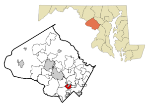
mapsize =
map_caption =
mapsize1 =
map_caption1 =subdivision_type = Country
subdivision_name =United States
subdivision_type1 = State
subdivision_name1 =Maryland
subdivision_type2 = County
subdivision_name2 = Montgomery
government_footnotes =
government_type =
leader_title =
leader_name =
leader_title1 =
leader_name1 =
established_title =
established_date =unit_pref = Imperial
area_footnotes =area_magnitude =
area_total_km2 = 5.5
area_land_km2 = 5.5
area_water_km2 = 0.0
area_total_sq_mi = 2.1
area_land_sq_mi = 2.1
area_water_sq_mi = 0.0population_as_of = 2000
population_footnotes =
population_total = 7887
population_density_km2 = 1428.3
population_density_sq_mi = 3699.2timezone = Eastern (EST)
utc_offset = -5
timezone_DST = EDT
utc_offset_DST = -4
elevation_footnotes =
elevation_m = 87
elevation_ft = 285
latd = 39 |latm = 1 |lats = 4 |latNS = N
longd = 77 |longm = 4 |longs = 36 |longEW = Wpostal_code_type =
postal_code =
area_code =
blank_name = FIPS code
blank_info = 24-73600
blank1_name = GNIS feature ID
blank1_info = 1867302
website =
footnotes =South Kensington is a
census-designated place and an unincorporated area in Montgomery County,Maryland ,United States .Geography
As an unincorporated area, South Kensington's boundaries are not officially defined. South Kensington is, however, recognized by the
United States Census Bureau as aCensus-designated Place , and by theUnited States Geological Survey as a populated place located at coor dms|39|1|4|N|77|4|36|W|city (39.017683, -77.076605)GR|1.According to the
United States Census Bureau , the place has a total area of 2.1square mile s (5.5km² ), all of it land.Demographics
As of the
census GR|2 of 2000, there were 7,887 people, 3,061 households, and 2,170 families residing in the area. Thepopulation density was 3,699.2 people per square mile (1,429.7/km²). There were 3,120 housing units at an average density of 1,463.4/sq mi (565.6/km²). The racial makeup of the area was 92.08% White, 2.42% African American, 0.15% Native American, 2.83% Asian, 0.05% Pacific Islander, 0.95% from other races, and 1.52% from two or more races. Hispanic or Latino of any race were 4.88% of the population.There were 3,061 households out of which 33.2% had children under the age of 18 living with them, 61.9% were married couples living together, 6.9% had a female householder with no husband present, and 29.1% were non-families. 23.0% of all households were made up of individuals and 11.2% had someone living alone who was 65 years of age or older. The average household size was 2.52 and the average family size was 2.99.
In the area, the population was spread out with 24.1% under the age of 18, 3.0% from 18 to 24, 28.7% from 25 to 44, 26.4% from 45 to 64, and 17.7% who were 65 years of age or older. The median age was 42 years. For every 100 females there were 89.1 males. For every 100 females age 18 and over, there were 84.2 males.
The median income for a household in the area was $102,048, and the median income for a family was $111,753. Males had a median income of $73,558 versus $52,260 for females. The
per capita income for the area was $44,755. About 1.4% of families and 1.5% of the population were below thepoverty line , including 1.0% of those under age 18 and 2.4% of those age 65 or over.Population History of South Kensington CDP from the
U.S. Census Bureau *1970...10,289
*1980....9,344
*1990....8,777
*2000....7,887Source: [http://www.census.gov U.S. Census Bureau]
References
External links
Wikimedia Foundation. 2010.