- North Kensington, Maryland
-
North Kensington, Maryland — CDP — Location of North Kensington, Maryland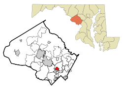
Coordinates: 39°2′27″N 77°4′17″W / 39.04083°N 77.07139°WCoordinates: 39°2′27″N 77°4′17″W / 39.04083°N 77.07139°W Country United States State Maryland County Montgomery Area – Total 1.5 sq mi (4.0 km2) – Land 1.5 sq mi (4.0 km2) – Water 0.0 sq mi (0.0 km2) Elevation 318 ft (97 m) Population (2000) – Total 8,940 – Density 5,799.5/sq mi (2,239.2/km2) Time zone Eastern (EST) (UTC-5) – Summer (DST) EDT (UTC-4) FIPS code 24-56712 GNIS feature ID 0590893 North Kensington is a census-designated place and an unincorporated area in Montgomery County, Maryland, United States.
Geography
As an unincorporated area, North Kensington's boundaries are not officially defined. North Kensington is, however, recognized by the United States Census Bureau as a Census-designated Place, and by the United States Geological Survey as a populated place located at 39°2′27″N 77°4′17″W / 39.04083°N 77.07139°W (39.040709, -77.071296)[1].
According to the United States Census Bureau, the place has a total area of 1.5 square miles (3.9 km2), all of it land.
Demographics
Historical populations Census Pop. %± 1980 9,039 — 1990 8,607 −4.8% 2000 8,940 3.9% source: [2] As of the census[3] of 2000, there were 8,940 people, 3,527 households, and 2,197 families residing in the area. The population density was 5,799.5 people per square mile (2,241.4/km²). There were 3,631 housing units at an average density of 2,355.5/sq mi (910.3/km²). The racial makeup of the area was 67.00% White, 13.31% African American, 0.39% Native American, 8.66% Asian, 0.07% Pacific Islander, 6.33% from other races, and 4.24% from two or more races. Hispanic or Latino of any race were 15.08% of the population.
There were 3,527 households out of which 25.8% had children under the age of 18 living with them, 47.8% were married couples living together, 11.0% had a female householder with no husband present, and 37.7% were non-families. 29.8% of all households were made up of individuals and 10.9% had someone living alone who was 65 years of age or older. The average household size was 2.47 and the average family size was 3.07.
In the area, the population was spread out with 21.0% under the age of 18, 6.3% from 18 to 24, 32.5% from 25 to 44, 23.7% from 45 to 64, and 16.6% who were 65 years of age or older. The median age was 39 years. For every 100 females there were 90.5 males. For every 100 females age 18 and over, there were 85.4 males.
The median income for a household in the area was $65,144, and the median income for a family was $75,554. Males had a median income of $46,631 versus $40,609 for females. The per capita income for the area was $28,816. About 3.7% of families and 6.3% of the population were below the poverty line, including 8.4% of those under age 18 and 8.1% of those age 65 or over.
References
- ^ "US Gazetteer files: 2010, 2000, and 1990". United States Census Bureau. 2011-02-12. http://www.census.gov/geo/www/gazetteer/gazette.html. Retrieved 2011-04-23.
- ^ "CENSUS OF POPULATION AND HOUSING (1790-2000)". U.S. Census Bureau. http://www.census.gov/prod/www/abs/decennial/index.html. Retrieved 2010-07-17.
- ^ "American FactFinder". United States Census Bureau. http://factfinder.census.gov. Retrieved 2008-01-31.
Municipalities and communities of Montgomery County, Maryland Cities 
Towns Villages &
Special Tax DistrictsCDPs Ashton-Sandy Spring | Aspen Hill | Bethesda | Brookmont | Burtonsville | Cabin John | Calverton‡ | Chevy Chase | Clarksburg | Cloverly | Colesville | Damascus | Darnestown | Fairland | Forest Glen | Friendship Village | Germantown | Hillandale‡ | Kemp Mill | Montgomery Village | North Bethesda | North Kensington | North Potomac | Olney | Potomac | Redland | Rossmoor | Silver Spring | South Kensington | Travilah | Wheaton–Glenmont | White Oak
Other
communitiesAshton | Beallsville | Boyds | Brinklow | Carderock | Carole Highlands | Comus | Dawsonville | Derwood | Dickerson | Ednor | Fairview | Glenmont | Hyattstown | Kentlands | Norbeck | North Bethesda Market | Seneca | Sandy Spring | Shady Grove | Sherwood Forest | Spencerville | Wheaton
Footnotes ‡This populated place also has portions in an adjacent county or counties
Categories:- Unincorporated communities in Maryland
- Populated places in Montgomery County, Maryland
- Census-designated places in Maryland


Wikimedia Foundation. 2010.