- Cloverly, Maryland
-
Cloverly, Maryland — CDP — Location of Cloverly, Maryland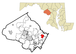
Coordinates: 39°6′11″N 76°58′35″W / 39.10306°N 76.97639°WCoordinates: 39°6′11″N 76°58′35″W / 39.10306°N 76.97639°W Country United States State Maryland County Montgomery Area – Total 3.9 sq mi (10.1 km2) – Land 3.9 sq mi (10.1 km2) – Water 0.0 sq mi (0.0 km2) Elevation 522 ft (159 m) Population (2000) – Total 7,835 – Density 2,004.7/sq mi (774.0/km2) Time zone Eastern (EST) (UTC-5) – Summer (DST) EDT (UTC-4) ZIP code 20905 Area code(s) 301, 240 FIPS code 24-18150 GNIS feature ID 0583819 Cloverly is a census-designated place and an unincorporated town in Montgomery County, Maryland, United States.
Geography
As an unincorporated area, Cloverly's boundaries are not officially defined. Many residents consider themselves to live in a neighborhood of Silver Spring, Maryland, the central area of which lies to the south. Cloverly is, however, recognized by the United States Census Bureau as a Census-designated Place, and by the United States Geological Survey as a populated place located at 39°6′11″N 76°58′35″W / 39.10306°N 76.97639°W (39.102958, -76.976275)[1].
According to the United States Census Bureau, the place has a total area of 3.9 square miles (10 km2), all of it land.
The commercial center of Cloverly lies at the intersection of New Hampshire Avenue (MD Route 650) and Briggs Chaney Road.
Demographics
As of the census[2] of 2000, there were 7,835 people, 2,492 households, and 2,113 families residing in the area. The population density was 2,004.7 people per square mile (773.7/km²). There were 2,540 housing units at an average density of 649.9/sq mi (250.8/km²). The racial makeup of the area was 61.52% White, 19.13% African American, 0.40% Native American, 14.05% Asian, 1.98% from other races, and 2.92% from two or more races. Hispanic or Latino of any race were 5.13% of the population.
There were 2,492 households out of which 43.7% had children under the age of 18 living with them, 71.4% were married couples living together, 9.8% had a female householder with no husband present, and 15.2% were non-families. 12.0% of all households were made up of individuals and 3.6% had someone living alone who was 65 years of age or older. The average household size was 3.14 and the average family size was 3.41.
In the area, the population was spread out with 29.0% under the age of 18, 7.4% from 18 to 24, 25.5% from 25 to 44, 29.2% from 45 to 64, and 8.9% who were 65 years of age or older. The median age was 39 years. For every 100 females there were 98.0 males. For every 100 females age 18 and over, there were 93.3 males.
The median income for a household in the area was $82,544, and the median income for a family was $88,370. Males had a median income of $51,377 versus $40,972 for females. The per capita income for the area was $31,123. About 2.5% of families and 3.4% of the population were below the poverty line, including 3.6% of those under age 18 and none of those age 65 or over.
References
- ^ "US Gazetteer files: 2010, 2000, and 1990". United States Census Bureau. 2011-02-12. http://www.census.gov/geo/www/gazetteer/gazette.html. Retrieved 2011-04-23.
- ^ "American FactFinder". United States Census Bureau. http://factfinder.census.gov. Retrieved 2008-01-31.
Municipalities and communities of Montgomery County, Maryland Cities 
Towns Villages &
Special Tax DistrictsCDPs Ashton-Sandy Spring | Aspen Hill | Bethesda | Brookmont | Burtonsville | Cabin John | Calverton‡ | Chevy Chase | Clarksburg | Cloverly | Colesville | Damascus | Darnestown | Fairland | Forest Glen | Friendship Village | Germantown | Hillandale‡ | Kemp Mill | Montgomery Village | North Bethesda | North Kensington | North Potomac | Olney | Potomac | Redland | Rossmoor | Silver Spring | South Kensington | Travilah | Wheaton–Glenmont | White Oak
Other
communitiesAshton | Beallsville | Boyds | Brinklow | Carderock | Carole Highlands | Comus | Dawsonville | Derwood | Dickerson | Ednor | Fairview | Glenmont | Hyattstown | Kentlands | Norbeck | North Bethesda Market | Seneca | Sandy Spring | Shady Grove | Sherwood Forest | Spencerville | Wheaton
Footnotes ‡This populated place also has portions in an adjacent county or counties
Categories:- Unincorporated communities in Maryland
- Populated places in Montgomery County, Maryland
- Census-designated places in Maryland


Wikimedia Foundation. 2010.