- Darnestown, Maryland
-
Darnestown, Maryland — CDP — Location of Darnestown, Maryland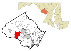
Coordinates: 39°6′5″N 77°16′52″W / 39.10139°N 77.28111°WCoordinates: 39°6′5″N 77°16′52″W / 39.10139°N 77.28111°W Country United States State Maryland County Montgomery Area – Total 17.7 sq mi (45.8 km2) – Land 16.6 sq mi (42.9 km2) – Water 1.1 sq mi (2.9 km2) Elevation 410 ft (125 m) Population (2000) – Total 6,378 – Density 384.6/sq mi (148.5/km2) Time zone Eastern (EST) (UTC-5) – Summer (DST) EDT (UTC-4) ZIP codes 20874, 20878 Area code(s) 301/240 FIPS code 24-21825 GNIS feature ID 0590068 Darnestown is a census-designated place and an unincorporated area in Montgomery County, Maryland, United States.
Contents
Geography
As an unincorporated area, Darnestown's boundaries are not officially defined. Darnestown is, however, recognized by the United States Census Bureau as a Census-designated Place, and by the United States Geological Survey as a populated place located at 39°6′5″N 77°16′52″W / 39.10139°N 77.28111°W (39.101429, -77.281236)[1].
According to the United States Census Bureau, the place has a total area of 17.7 square miles (46 km2), of which, 16.6 square miles (43 km2) of it is land and 1.1 square miles (2.8 km2) of it (6.27%) is water.
Demographics
As of the census[2] of 2000, there were 6,378 people, 2,038 households, and 1,830 families residing in the area. The population density was 384.6 people per square mile (148.5/km²). There were 2,064 housing units at an average density of 124.5/sq mi (48.1/km²). The racial makeup of the area was 85.06% White, 3.95% African American, 0.25% Native American, 7.92% Asian, 0.03% Pacific Islander, 0.58% from other races, and 2.21% from two or more races. Hispanic or Latino of any race were 3.23% of the population.
There were 2,038 households out of which 47.9% had children under the age of 18 living with them, 83.3% were married couples living together, 4.1% had a female householder with no husband present, and 10.2% were non-families. 7.5% of all households were made up of individuals and 2.3% had someone living alone who was 65 years of age or older. The average household size was 3.13 and the average family size was 3.29.
In the area, the population was spread out with 30.7% under the age of 18, 4.5% from 18 to 24, 25.5% from 25 to 44, 31.8% from 45 to 64, and 7.5% who were 65 years of age or older. The median age was 40 years. For every 100 females there were 98.8 males. For every 100 females age 18 and over, there were 96.0 males.
The median income for a household in the area was $173,326, and the median income for a family was $190,608. Males had a median income of $120,476 versus $89,958 for females. The per capita income for the area was $85,466. About 1.5% of families and 2.2% of the population were below the poverty line, including 1.0% of those under age 18 and 5.2% of those age 65 or over.
History
Named for William Darnes, the community was built on 2,000 acres (810 ha) of land inherited by his wife from her father Charles Gassway's 'Mount Pleasant' land grant. Originally, the town was referred to as Mount Pleasant, but the name shifted in popular parlance to Darnes and eventually Darnestown. The community was located halfway between Montgomery Court House (modern-day Rockville and the mouth of the Monocacy River, and originally consisted of a tavern, a pair of blacksmiths, a wheelwright, a single store, and a log building which served as both a school and the home of several churches. The community's greatest economic boom was during the Civil War, when providing for the needs of the armies camped around Washington, DC provided new income. Following the war, however, Darnestown slowly deflated and eventually ceased being a commercial center, with only a few of the original buildings left standing. The area has since been absorbed by suburban development.[3]
Shopping
Darnestown has two grocery stores. Safeway and Harris Teeter. Both Safeway and Harris Teeter are open 7 days a week til Midnight. For beer and wine, one has to visit the 6-12 on the corner of Seneca Rd and Rte 28. 6-12 is open daily until 10pm.
References
- ^ "US Gazetteer files: 2010, 2000, and 1990". United States Census Bureau. 2011-02-12. http://www.census.gov/geo/www/gazetteer/gazette.html. Retrieved 2011-04-23.
- ^ "American FactFinder". United States Census Bureau. http://factfinder.census.gov. Retrieved 2008-01-31.
- ^ Offutt, William; Sween, Jane (1999). Montgomery County: Centuries of Change. American Historical Press. pp. 165–166.
External links
- Darnestown Online features information about history, government, and links to nearby businesses and organizations.
Municipalities and communities of Montgomery County, Maryland Cities 
Towns Villages &
Special Tax DistrictsCDPs Ashton-Sandy Spring | Aspen Hill | Bethesda | Brookmont | Burtonsville | Cabin John | Calverton‡ | Chevy Chase | Clarksburg | Cloverly | Colesville | Damascus | Darnestown | Fairland | Forest Glen | Friendship Village | Germantown | Hillandale‡ | Kemp Mill | Montgomery Village | North Bethesda | North Kensington | North Potomac | Olney | Potomac | Redland | Rossmoor | Silver Spring | South Kensington | Travilah | Wheaton–Glenmont | White Oak
Other
communitiesAshton | Beallsville | Boyds | Brinklow | Carderock | Carole Highlands | Comus | Dawsonville | Derwood | Dickerson | Ednor | Fairview | Glenmont | Hyattstown | Kentlands | Norbeck | North Bethesda Market | Seneca | Sandy Spring | Shady Grove | Sherwood Forest | Spencerville | Wheaton
Footnotes ‡This populated place also has portions in an adjacent county or counties
Mary of Nazareth Class of 2012!
Categories:- Census-designated places in Maryland
- Populated places in Montgomery County, Maryland
- Unincorporated communities in Maryland
- Populated places on the Potomac River


Wikimedia Foundation. 2010.