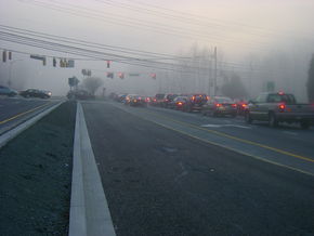
- Maryland Route 124
-
Maryland Route 124 
Route information Maintained by MDSHA Length: 17.03 mi[1] (27.41 km) Major junctions South end:  MD 28 near Darnestown
 MD 355
North end:  MD 108 in Damascus
Highway system Maryland highway system
Interstate • US • State • Minor • Former • Turnpikes←  MD 121
MD 125  →
→Maryland Route 124 is a mixed suburban and semi-rural road that runs through several suburbs and exurbs to the north of Washington, DC in Montgomery County, Maryland. It changes names several times over its 17-mile (27 km) length, beginning as Quince Orchard Road near Darnestown and terminating as Woodfield Road in Damascus. It is located in Montgomery County.
Route description
Maryland Route 124 starts as a four-lane divided road at MD 28 near Darnestown, and continues north through business and residential areas in Gaithersburg, where the road narrows to a single carriageway with a shared left-turn lane. The road dualizes shortly before its interchange with I-270, where its name changes to Montgomery Village Avenue, and it continues north in this fashion through more densely developed retail areas until it reaches Midcounty Highway, just beyond the Lakeforest Mall-area shopping complexes. Here, MD 124 turns to the east on this road, while the roadway itself continues north towards Montgomery Village.[1][2]
MD 124 and Midcounty Highway travel east through slightly wooded areas before it turns north onto Woodfield Road, a two-lane road which begins as a four-lane divided road until just after the intersection. This section of road passes through mainly light industrial areas in and just outside Gaithersburg. After dropping to two lanes and passing through Goshen and Woodfield, travelling north through residential areas and woodland, it intersects with MD 108 in the center of Damascus.[1][2]
Points of interest along Route 124 include Quince Orchard High School, the U.S. National Institute for Standards and Technology (NIST), Lakeforest Mall and several strip malls in its immediate vicinity, and the Montgomery County Airpark. Much of the northern section (north of Washington Grove) is semi-rural in nature, though new developments have been increasing in number since 2000. Several large companies have major facilities in the area near the intersection of Route 124 and Route 355, including IBM, Lockheed-Martin, and RAXCO.[1][2]
Junction list
The entire route is in Montgomery County.
Location Mile
[1]Roads intersected Notes Darnestown 0.00  MD 28 (Darnestown Road)
Southern terminus Gaithersburg 1.19  MD 119 (Great Seneca Highway)
2.73  MD 117 (West Diamond Avenue) – Dawsonville
3.22  I-270 (Eisenhower Memorial Highway) – Frederick, Washington
I-270 exit 11 3.59  MD 355 (Frederick Road)
Washington Grove 6.95  MD 115 east (Muncaster Mill Road)
Damascus 17.03  MD 108 (Main Street)
Northern terminus References
- ^ a b c d e Maryland State Highway Administration (2008). "Highway Location Reference: Montgomery County" (PDF). http://apps.roads.maryland.gov/KeepingCurrent/performTrafficStudies/dataAndStats/hwyLocationRef/2008_hlr_all/co15.pdf. Retrieved 2010-04-21.
- ^ a b c Google, Inc. Google Maps – overview of Maryland Route 124 (Map). Cartography by Google, Inc. http://maps.google.com/maps?f=d&source=s_d&saddr=Maryland+28+%26+Maryland+124,+Darnestown,+Montgomery,+Maryland+20878&daddr=39.1585324,-77.1952673+to:maryland+124+and+maryland+108&geocode=FW7kVAIdkjdl-ynF_hGJiC22iTHOKTAKUycqQg%3BFQSDVQId_Rdm-ylNFP3I0iy2iTHmL64qQ29beA%3BFXl7VwIdz_5l-ymhiH3HTtXJiTHc-UUsQwtZ5Q&hl=en&mra=ls&sll=39.202994,-77.23114&sspn=0.22933,0.676346&ie=UTF8&t=h&z=11&via=13. Retrieved 2010-04-27.
Roads in Montgomery County, Maryland Maryland State Highways 
U.S. Routes Interstate Highways Roads by name Cabin John Parkway · Clara Barton Parkway · Cherry Hill Road · Connecticut Avenue · Georgia Avenue · Montrose Road · New Hampshire Avenue · Randolph Road · Sligo Creek Parkway · Wisconsin Avenue · 16th StreetCategories:- State highways in Maryland
- Roads in Montgomery County, Maryland
Wikimedia Foundation. 2010.


