- Interstate 370
Infobox road
route=370
state=MD
type=I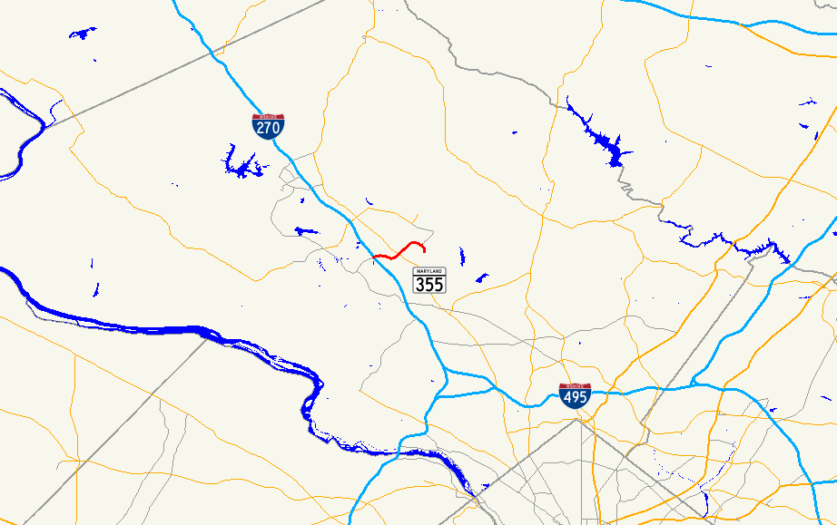
length_mi=3.13
length_round=2
length_ref= [ [http://www.fhwa.dot.gov/reports/routefinder/table2.htm Route Log - Auxiliary Routes of the Eisenhower National System Of Interstate and Defense Highways - Table 2] ]
year_established=1990s
direction_a=West
terminus_a=Sam Eig Highway & Washingtonian Boulevard in Gaithersburg
junction=Jct|state=MD|I|270 in Gaithersburg
Jct|state=MD|MD|355 near Rockville
direction_b=East
terminus_b=Shady Grove Metro Station
previous_type=MD
previous_route=368
next_type=MD
next_route=370Interstate 370 (abbreviated I-370) is a 3.13-mile
Interstate highway spur route off Interstate 270 in Gaithersburg,Maryland to apark and ride lot at the Shady Grove station on the Red Line of theWashington Metro . Despite the number x70, I-370 does not connect to I-70 itself.Route description
The route is a four-lane freeway that begins at the eastern terminus of the
Sam Eig Highway , at its intersection with Washingtonian Blvd. The route continues east and intersects I-270 almost immediately. Beyond I-270 the road continues east and interchanges withMaryland Route 355 before curving sharply south to the station.The I-370 designation officially ends outside the station environs, but the physical roadway runs in a full loop through the station parking lot. I-370 officially opened in August 1989; between its completion and official opening, commuters used the highway as an overflow parking lot.
Future
As of 2008,
Maryland Route 200 , also known as the Intercounty Connector, is currently under construction. When completed, it will run from I-370 east to Interstate 95 and U.S. Route 1 in Laurel.Exit list
Related routes
*
Maryland Route 200 References
Wikimedia Foundation. 2010.