- Interstate 270 (Ohio)
-
Interstate 270
Route information Maintained by ODOT Length: 54.97 mi[1] (88.47 km) History: Late 1950s–present; completed in 1975 Major junctions Beltway around Columbus, Ohio  I-71 north
 I-70 west
 US 23
US 23
 SR 161
 SR 315
I-71 south
 I-670 I-70 east
Highway system Auxiliary route of the Interstate Highway System
Main • Auxiliary • BusinessOhio highways
Interstates • U.S. Routes • State Routes←  SR 269
I-271  →
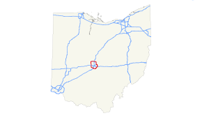
→Interstate 270 (abbreviated I-270) is the beltway loop freeway in the Columbus metropolitan area, commonly known locally as "The Outerbelt," or the "Jack Nicklaus Freeway." The "western" (and "eastern") terminus of I-270, at least in terms of the zero-milepost, is at the junction with I-71 east of Grove City, Ohio. I-270, along with I-670, provides access to Port Columbus International Airport. The entire length of I-270 is 54.97 miles (88.47 km).
Contents
History
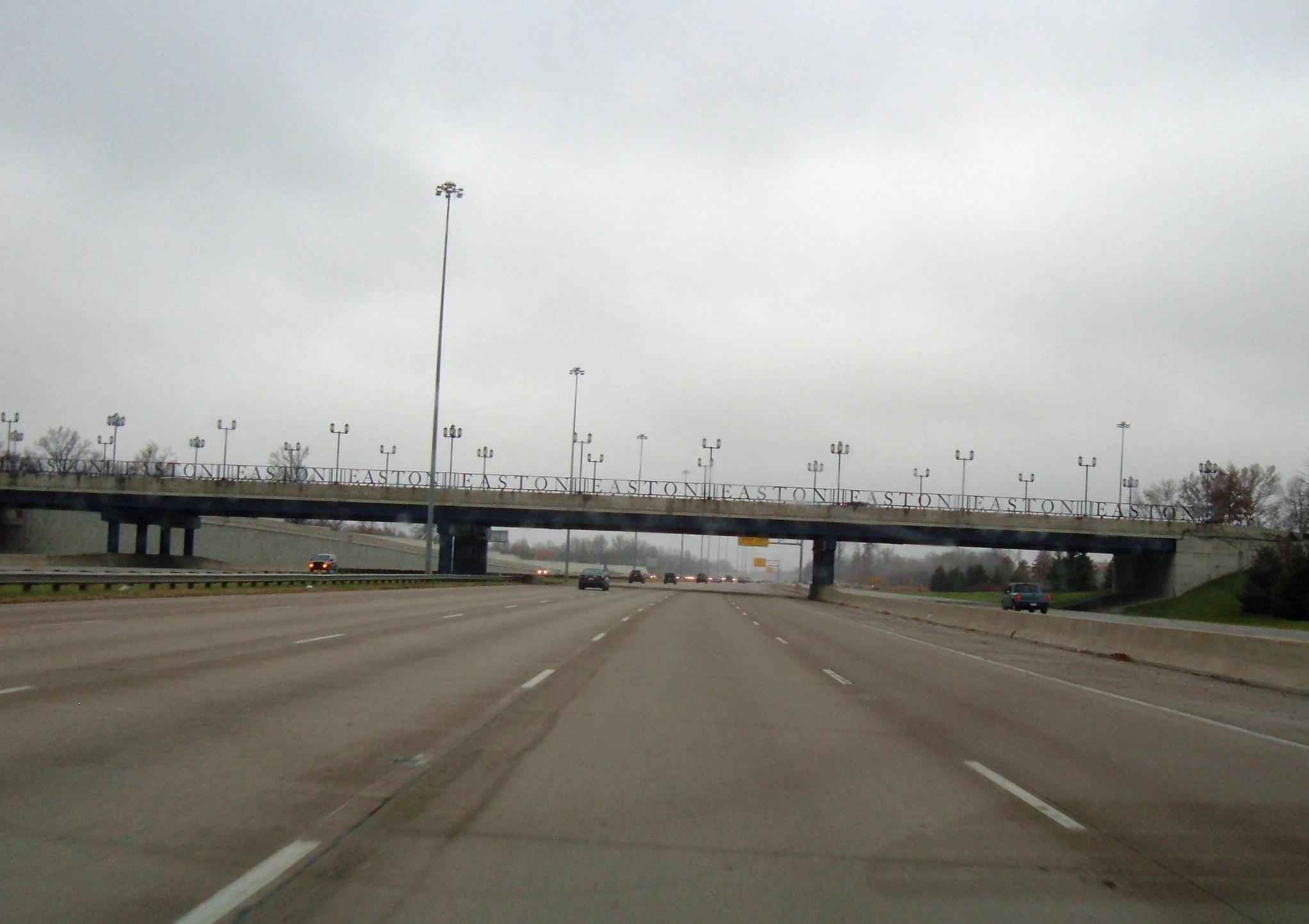
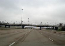 I-270 at exit 33
Planning
Planning for an outerbelt around Columbus began in the late 1950s. By the early 1960s detailed planning for the route had begun, and several controversies arose. The first involved the location of the northern segment, which was originally planned to pass south of Worthington, passing through the Ohio Deaf School and just north of the then ten year old Graceland Shopping Center. Through vigorous lobbying throughout 1961, and with the help of Ohio Governor Michael DiSalle, residents were able to get the outerbelt relocated to pass north of Worthington.[2]
Another contentious issue involved the routing of the eastern portion of the outerbelt between Port Columbus International Airport and the city of Gahanna. While the airport wanted the outerbelt pushed out towards Gahanna so as to leave land for future runway expansion, the residents of Gahanna wanted it pushed back towards Columbus. The final compromise led to an interesting kink in I-270 as it jogs around the airport.[3]
Construction
Construction of the outerbelt began in 1962, and work was begun on various disconnected sections. The first portion to be completed connected US Route 23 (US 23) with I-71 south of Columbus.[4] The portion between US 23 and I-71 on the north side opened in August 1967.[5]
The section between I-70 on the West Side and I-71 on the south side opened in August 1970.[6] In late 1970, sections opened on the east side between US 33 and I-70, and between Stare Route 3 (SR 3) in Westerville and SR 161 on the east side. It was now possible to bypass Columbus using I-270 by going around the south side of the city.[7]
In June 1971, the section between Morse Road and SR 161 on the east side opened. In October 1971, another section on the east side between I-70 and East Main Street opened. It would take four more years to complete the northeast portion of the outerbelt.[8]
The last section of I-270, on the east side, between Hamilton Road and East Broad Street, was opened on August 20, 1975.[9] The total cost of the 10-year construction project was $175 million, compared to the original 1961 estimate of $104 million.
Accidents and Incidents
- In December 1965, during the construction of the northern section of I-270 across the N&W and NYC railroad tracks between US 23 and I-71, the New York Central's Ohio State Limited was wrecked after it hit a piece of earthmoving machinery, resulting in the operator's death and the injury of several passengers and crew. The train was dumped into the cornfield resulting in a major operation to clean it up.[10]
- On November 4, 1968, David R. Booth, age 29, became the first person to die on I-270 when he hit another car while merging onto US 23 from I-270.[11]
- In February, 1974, three trucks traveling on I-270 on the south side near US 33 were struck by gunfire during a violent Teamsters Strike.[12]
- Ohio highway sniper attacks: The highway was again the subject of national media attention in 2003 when 24 sniper shootings were reported along the southern portion of the Interstate and other neighboring highways. Sixty-two-year-old Gail Knisley was shot to death on November 25, 2003, making her the only fatality associated with the string of shootings. Charles A. McCoy, Jr., who had been diagnosed with paranoid schizophrenia in 1996, was accused of the shootings and stood trial in 2005. The first trial with death penalty charges resulted in a hung jury on May 9, 2005, most likely due to McCoy's severe mental illness. Rather than face a retrial, McCoy accepted a plea arrangement where he avoided the death sentence. He was sentenced to 28 years in prison on August 9, 2005.
Expansion and noise barriers
In 1978, the first noise barriers were constructed on the portion of I-270 passing near Gahanna. Noise barriers have been slowly added around the length of the 55-mile (89 km) long belt as development has crowded up to the noisy road.[13]
Massive development followed the construction of I-270, especially around the north and northwest sides. The northern suburbs of Westerville, Worthington and Dublin, and Hilliard to the west benefited the most. As in other sizeable cities across America, the effect of this outerbelt driven development was to hasten the decline of the Columbus core. The south portion of I-270 was much slower to develop due to the location of sewage treatment and landfill facilities, as well as quarries and the flood prone Scioto River. Grove City began to develop in the 1990s with the addition of office/warehouse space, and the conversion of Rickenbacker Air Force Base to a civilian air freight facility.
Exit list
The entire route is in Franklin County.
Location Mile[1] Exit Destinations Notes Grove City 0.00
54.9755 I-71 – Columbus, CincinnatiSigned as exits 55A (north) and 55B (south) Urbancrest 2.13 2 
 US 62 / SR 3 – Grove City
Columbus 4.97 5 Georgesville Road Westbound changes to northbound; southbound changes to eastbound 6.91–
7.047  US 40 (Broad Street)
Signed as exits 7A (west) and 7B (east) southbound 8.69–
8.718 I-70 – Columbus, DaytonSome signage says Indianapolis instead of Dayton; signed as exits 8A (east) and 8B (west) 10.50 10 Roberts Road Hilliard 12.63–
12.6413 Fishinger Road – Upper Arlington
Cemetery Road – Hilliard, Franklin County FairgroundsSigned as exits 13A (Fishinger Road) and 13B (Cemetery Road) northbound 13.8 14 Davidson Road Proposed Columbus 15.63 15 Tuttle Crossing Blvd The Mall at Tuttle Crossing Dublin 17.29–
17.3117  US 33 / SR 161 – Dublin, Muirfield, Marysville, Plain City
Signed as exits 17A (east, north) and 17B (west, south); northbound changes to eastbound and westbound changes to southbound Columbus 19.82 20 Sawmill Road – Columbus Zoo, Zoombezi Bay, Muirfield (WB) First SPUI in Ohio Worthington 22.78 22 SR 315Severe weaving issues; interchanges will be braided in project beginning 2009; signed as exits 22A (south) and 22B (north) 23.78 23 US 23 – Worthington, Delaware, ToledoSigned as exits 23A (south) and 23B (north) Columbus 25.83 26 I-71 – Columbus, ClevelandSigned as exits 26A (south) and 26B (north) eastbound 27.38 28  SR 710 west (Cleveland Avenue)
Eastern terminus of SR 710,(Also a Westerville exit); signed as exits 28A (south) and 28B (north/west) Westerville 28.71 29 SR 3 – WestervilleEastbound changes to southbound and northbound changes to westbound; SR 3 known as State Street north of I-270 and Westerville Road south of I-270 Columbus 30.53 30 SR 161 – Worthington, New AlbanySigned as exits 30A (south) and 30B (north); shares C-D roads with exit 33 32.27 32 Morse Road No connection to exits 30 or 33 32.92 33 Easton Way – Easton Shares C-D roads with exit 30 Gahanna 35.16–
35.5135 I-670 west / US 62 west – Airport
US 62 east – Gahanna
Johnstown RoadSigned as exits 35A (I-670/US 62 west), 35B (US 62 east) and 35C (Johnstown Road) southbound; Johnstown Road exit is northbound exit only 37.36 37  SR 317 (Hamilton Road)
Columbus 39.53 39  SR 16 (Broad Street) / Taylor Station Road – Whitehall, Newark
Signed as exits 39A (west) and 39B (east); Taylor Station Road northbound exit only via Old Morrison Road and Westbourne Avenue 41.32 41 US 40 (Main St) – Whitehall, ReynoldsburgSigned as exits 41A (west) and 41B (east); shares C-D roads with exit 43 42.82 43 I-70 – Columbus, Bexley, Zanesville, WheelingSigned as exits 43A (west) and 43B (east); shares C-D roads with exit 41 46.13 46 US 33 – Bexley, LancasterSigned as exits 46A (west) and 46B (east) Obetz 48.98 49 Alum Creek Drive – Obetz, Rickenbacker Int'l Airport Southbound becomes westbound and eastbound becomes northbound Columbus 52.72 52 US 23 – Columbus, CirclevilleSigned as exits 52A (north) and 52B (south)) westbound 1.000 mi = 1.609 km; 1.000 km = 0.621 mi References
- ^ a b District 6 staff (January 2006). "ODOT Straight Line Diagram, Franklin IR 270" (PDF). Ohio Department of Transportation. pp. 1–11. http://www.odotonline.org/techservapps/SLD/pdf_files/FRAIR0270R.pdf. Retrieved August 24, 2011.
- ^ "Meeting Decries 'Near' Outerbelt". Columbus Dispatch: p. 1A. February 9, 1961.
- ^ "Ohio Dept of Highways Completes Work on a Proposed New Alignment through Gahanna for the Outerbelt Expressway which Would Permit Future Expansion for Port Columbus". Columbus Dispatch: p. 1B. March 30, 1967.
- ^ "Ohio Highway Department Reports on the Status of 6 Columbus Expressway Projects: Outerbelt, Ft Hayes Interchange, East Freeway, Parsons and Fulton Expressways". Columbus Dispatch: p. 14A. June 16, 1963.
- ^ "The Outerbelt Expressway (I-270) Between the North Freeway and N High St Is Opened at Ceremonies Led by the Worthington Chamber of Commerce". Columbus Dispatch: p. 1B. August 15, 1967.
- ^ "8.5 Mile Stretch of Outerbelt, I-270, Between I-70 West and South Freeway, Will Open 8/17". Columbus Dispatch: p. 1B. August 13, 1970.
- ^ "A Missing Link in the Cols Outerbelt Opens to Traffic Nov 20, Allowing East–West Traffic to Pass Cols; the 3.2 Mile Link Between Rt 33 and I-70 Beats a Thanksgiving Deadline". Columbus Dispatch: p. 1A. November 19, 1970.
- ^ "The Opening of E Main St (Rt&nsp;40) over the Outerbelt Is Scheduled for 6/21, and Work on E Main St–NOE–Bixby Rd Intersection May Also Be Completed by that Date". Columbus Dispatch: p. 19A. June 13, 1971.
- ^ "Outerbelt Finish Set for Aug. 20". Columbus Dispatch: p. 1C. July 9, 1975.
- ^ "Dana B. Bolin, 49, of Athens, Ohio, Is Killed and about 30 People Are Injured in the Crash of New York Central's Ohio State Limited Passenger Train in Worthington". Columbus Dispatch: p. 1A. December 19, 1965.
- ^ "David R. Booth, 29, 1066 Corwin Ave, Dies when his Car Collides with Another just North of I-270 Exit onto Rt 23, South of Columbus". Columbus Dispatch: p. 1B. November 4, 1968.
- ^ "Three Trucks Traveling in Convoy on the Columbus Outerbelt near US 33 Are Struck by Gunfire as Violence Continues in the Strike by Independent Truckers". Columbus Dispatch. 1A.
- ^ "Noise from the Outerbelt Are Erected in Gahanna; City Threatened To Sue Ohio Dept of Transportation if Barriers Were Not Erected". Columbus Dispatch: p. 10B. June 1, 1978.
Auxiliary routes of Interstate 70  Categories:
- Interstate 70
- Three-digit Interstate Highways
- Interstate Highways in Ohio
- Orbital roads in the United States
- Transportation in Columbus, Ohio


Wikimedia Foundation. 2010.