- Ohio State Route 710
-
State Route 710
Route information Maintained by ODOT Length: 4.06 mi[3] (6.53 km) Existed: 1969[1][2] – present Major junctions West end:  SR 161 in Columbus
East end:  I-270 in Columbus
Location Counties: Franklin Highway system Ohio highways
Interstates • U.S. Routes • State Routes←  SR 709
SR 711  →
→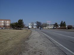 Along SR 710 near the intersection with SR 161.
State Route 710 (SR 710, OH 710) is a 4.06-mile (6.53 km) long state highway in the central portion of the U.S. state of Ohio. Existing entirely within the northern portion of the city of Columbus, SR 710 has its western terminus at a signalized intersection with SR 161, less than 0.25-mile (0.40 km) west of Exit 117 off of Interstate 71 (I-71). The eastern terminus of the highway is at a seven-ramp partial cloverleaf (parclo) interchange with I-270 at its Exit 27.
SR 710 was established in the late 1960s. Although signed as an east–west route, the overall path of this route is that of an irregularly-shaped inverted "U", with its westernmost and easternmost portions following north–south roadways.
Contents
Route description
The entire length of SR 710 is situated within the northern portion of Franklin County, and entirely within the city limits of Columbus. SR 710 is not included as a part of the National Highway System (NHS). The NHS is a network of highways identified as being most important for the economy, mobility and defense of the nation.[4]
History
The SR 710 designation was applied in 1969. Since its inception, it has utilized the same alignment between SR 161 and I-270 in the northern portion of Columbus.[1][2]
Major intersections
The entire route is in Columbus, Franklin County.
Mile[3] Destinations Notes 0.00 SR 161Western terminus at signalized intersection 4.06 I-270Eastern terminus at Exit 27 off of I-270, a seven-ramp parclo interchange with loop ramps in all but the northwestern quadrant 1.000 mi = 1.609 km; 1.000 km = 0.621 mi References
- ^ a b Ohio Department of Highways (1967) (MrSID). Official Ohio Highway Map (Map). Cartography by ODOH. http://www.dot.state.oh.us/Divisions/TransSysDev/Innovation/prod_services/Documents/StateMaps/otm1967a.sid. Retrieved 2011-05-29.
- ^ a b Ohio Department of Highways (1969) (MrSID). Official Ohio Highway Map (Map). Cartography by ODOH. http://www.dot.state.oh.us/Divisions/TransSysDev/Innovation/prod_services/Documents/StateMaps/otm1969a.sid. Retrieved 2011-05-29.
- ^ a b Ohio Department of Transportation. "Technical Services Straight Line Diagrams: SR 710, Franklin County". http://www.odotonline.org/techservapps/SLD/pdf_files/frasr0710r.pdf. Retrieved 2009-01-29.
- ^ Federal Highway Administration (December 2003) (PDF). National Highway System: Ohio (Map). http://www.fhwa.dot.gov/planning/nhs/maps/oh/oh_Ohio.pdf. Retrieved 2011-05-29.
External links
Categories:- State highways in Ohio
- Transportation in Columbus, Ohio


Wikimedia Foundation. 2010.