- Dublin, Ohio
-
City of Dublin — City — 
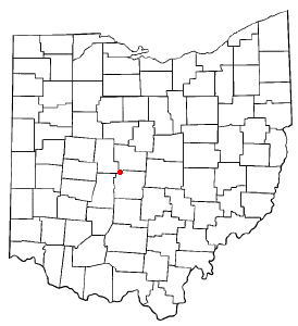
SealMotto: Where Yesterday Meets Tomorrow Location of Dublin within Ohio.
Coordinates: 40°6′33″N 83°8′25″W / 40.10917°N 83.14028°WCoordinates: 40°6′33″N 83°8′25″W / 40.10917°N 83.14028°W Country United States State Ohio Counties Franklin, Delaware, Union City status 1987 Government – Mayor Tim Lecklider Area – City 21.1 sq mi (54.8 km2) – Land 21.1 sq mi (54.7 km2) – Water 0.04 sq mi (0.1 km2) 0.04% Elevation 830 ft (253 m) Population (2010) – City 41,751 – Density 1,978.7/sq mi (761.9/km2) – Metro 1,773,120 Time zone Eastern (UTC-5) – Summer (DST) Eastern (UTC-4) ZIP codes 43016-43017 Area code(s) 614 FIPS code 39-22694[1] GNIS feature ID 1056264[2] Website City of Dublin, Ohio Dublin is a city in Franklin, Delaware, and Union counties in the U.S. state of Ohio. The population was 41,751 at the 2010 census. Dublin is a suburb of Columbus, Ohio. Approximately 57,000 people live within the Dublin school district.[citation needed]
Each year in late May or early June, the city hosts the Memorial Tournament, a stop on golf's PGA Tour. Consequently, a large number of golf aficionados choose to make Dublin their home.[citation needed] There are also several other golf courses in Dublin. The Riviera Golf Club is home to the American-Italian Golf Association. Tartan Fields Golf Club, which hosted the LPGA's Wendy's Championship for Children from 2002 through 2006, is also in Dublin. Dublin also has a public golf course financed by the city, as well as the Nicklaus-designed Country Club at Muirfield.
Other annual events include the 4th of July music event, a St. Patrick's Day parade, and the Dublin Irish Festival, which is one of America's largest Irish festivals.
Contents
History
Although its earliest settlements date back to 1802, the village that came to be known as Dublin didn't begin to take shape until the arrival of the Sells family of Huntingdon, Pennsylvania. Brothers Peter and Benjamin Sells purchased 400 acres (1.6 km²) of land on the west banks of the Scioto River as a gift for their brother John. In 1808, John Sells brought his family to the region, and by 1810 he had begun to survey lots for the new village with his partner, an Irish gentleman named John Shields. According to historians, Shields is responsible for naming the town after his birthplace:
"If I have the honor conferred upon me to name your village, with the brightness of the morn, and the beaming of the sun on the hills and dales surrounding this beautiful valley, it would give me great pleasure to name your new town after my birthplace, Dublin, Ireland."[3]
In 1970, Dublin was still a small town with only 681 residents. However, the construction of Interstate 270 facilitated a population boom, spearheaded by the acquisition of major corporate headquarters such as Ashland Inc and Wendy's International. In addition, the growth of the Muirfield Village Golf Club and its residential subdivision attracted a large number of affluent citizens to the rapidly growing suburb. Dublin was officially declared a city in 1987, after reaching a population of 5,000 residents.
As part of this boom Dublin significantly expanded its area, annexing parts of both Washington Township and Perry Township.
Geography
Dublin is located at 40°6′33″N 83°8′25″W / 40.10917°N 83.14028°W (40.109262, -83.140247).[4]
According to the United States Census Bureau, the city has a total area of 21.1 square miles (54.8 km²), of which, 21.1 square miles (54.7 km²) of it is land and 0.04 square miles (0.1 km²) of it (0.09%) is water.
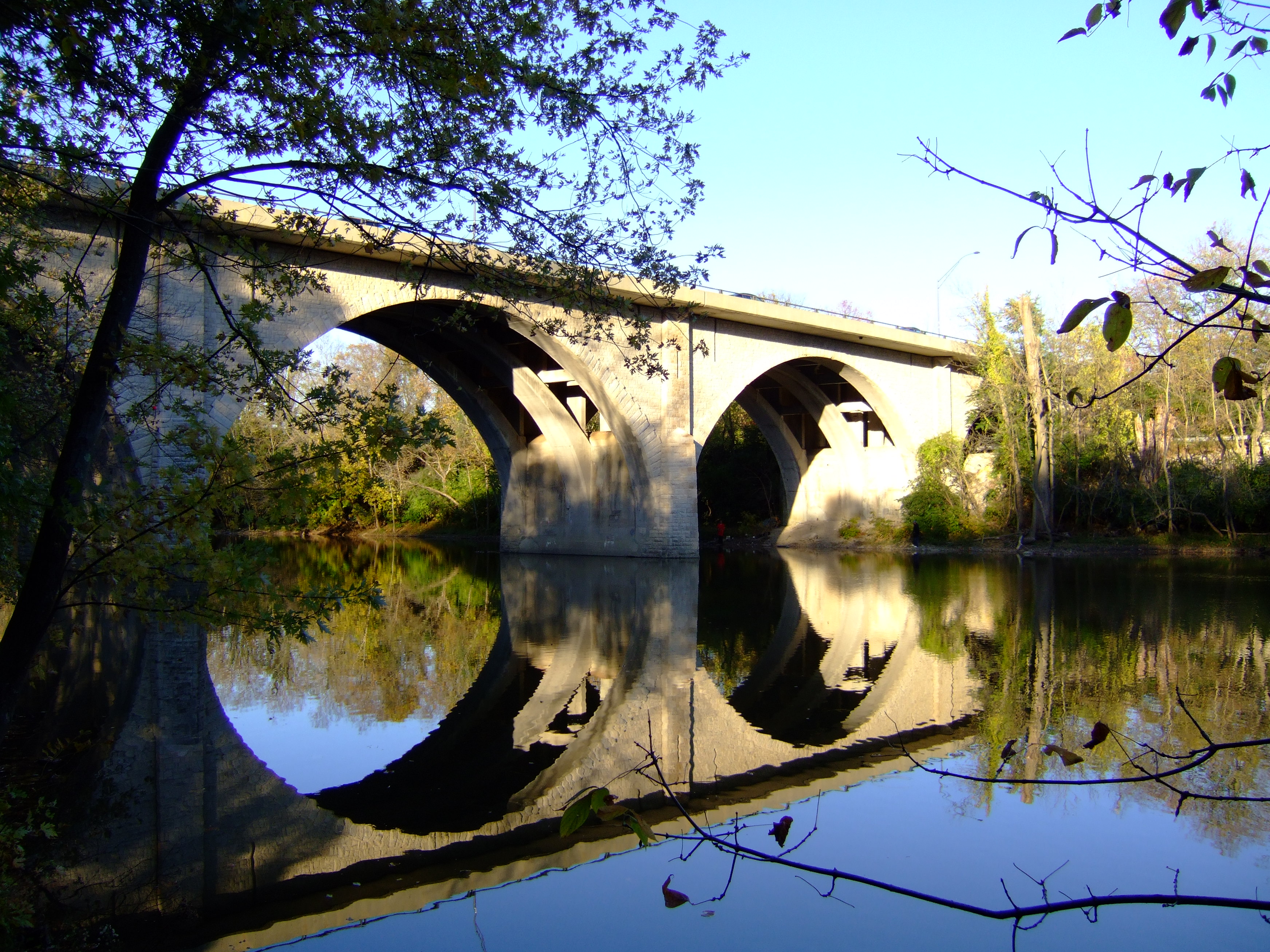
The Scioto River passes through Dublin. In this area the river and its tributaries cut deep gorges through the limestone bedrock, and the riverbed is stony. Some of these tributaries feature waterfalls.
Topography
Located on the Glaciated Allegheny Plateau, Dublin has relatively flat topography. Nevertheless, there are numerous ravines surrounding the tributaries of the Scioto River, which make for steep cliffs in some areas. Elevations range from 780 feet (238 m) above sea level where the Scioto River leaves the city at Hayden Run Road, while the high point is 1000 feet (305 m) at Glacier Ridge Metro Park.[5][6]
Transportation
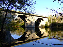 State Route 161 crossing the Scioto River
Being a modern American suburb, the city is primarily accessed by car. In addition to Interstate 270, U.S. Highway 33, State Route 161, and State Route 745 pass through the city. There is a 77-mile (124-km) network of bike trails that run throughout the city. Long term plans include expanding the trails further, as well as connecting them to the regional trail system to facilitate travel to downtown Columbus. COTA provides limited service in the southeast part of the city. Routes 56 and 58 provide express service from the commercial areas around Frantz and Rings Roads to Downtown Columbus during rush hour periods.
Economy
Dublin is home to the headquarters of a number of companies, including Wendy's, Cardinal Health, Ashland Inc., IGS Energy, OCLC, and MindLeaders. Other organizations with significant operations include Nationwide Insurance, Verizon Business, Verizon Wireless, and Tickets Galore. The city is attempting to attract new technology oriented businesses as well. Dublin Methodist Hospital, part of the OhioHealth system, opened in January 2008. The city is in the process of creating a city wide internet (mesh wifi) hotspot; being developed by DHB Networks.[citation needed]
Demographics
Historical populations Census Pop. %± 1880 314 — 1890 296 −5.7% 1900 275 −7.1% 1910 239 −13.1% 1920 211 −11.7% 1930 224 6.2% 1940 237 5.8% 1950 289 21.9% 1960 552 91.0% 1970 681 23.4% 1980 3,855 466.1% 1990 16,366 324.5% 2000 31,392 91.8% 2010 41,751 33.0% US Census[7] As of the census[1] of 2000, there were 31,392 people, 11,209 households, and 8,675 families[not in citation given] residing in the city. The population density was 1,486.1 people per square mile (573.9/km²). There were 12,038 housing units at an average density of 569.9 per square mile (220.1/km²). The racial makeup of the city was 89.66% White, 1.73% African American, 0.08% Native American, 7.36% Asian, 0.02% Pacific Islander, 0.20% from other races, and 0.95% from two or more races. Hispanic or Latino of any race were 1.01% of the population.
As of 2010, the Asian population is: 6.9% Indian, 3.1% Chinese, 2.6% Japanese, 1.3% Korean, 0.2% Vietnamese.
There were 11,209 households out of which 46.6% had children under the age of 18 living with them, 70.7% were married couples living together, 5.0% had a female householder with no husband present, and 22.6% were non-families. 18.5% of all households were made up of individuals and 3.8% had someone living alone who was 65 years of age or older. The average household size was 2.80 and the average family size was 3.24.
In the city the population was spread out with 32.1% under the age of 18, 4.8% from 18 to 24, 33.4% from 25 to 44, 24.3% from 45 to 64, and 5.4% who were 65 years of age or older. The median age was 35 years. For every 100 females there were 98.1 males. For every 100 females age 18 and over, there were 96.4 males.
According to a 2007 estimate,[8] the median income for a household in the city was $110,310, and the median income for a family was $126,402. Males had a median income of $75,279 versus $43,903 for females. The per capita income for the city was $41,122. About 2.1% of families and 2.7% of the population were below the poverty line, including 2.7% of those under age 18 and 4.0% of those age 65 or over.
Education
The Dublin City School District has three high schools (Coffman, Scioto, and Jerome), four middle schools (Sells, Davis, Grizzell, and Karrer) and thirteen elementary schools. As of autumn 2006, the approximate student enrollment was 13,200. In 1996, the documentary Children in America's Schools with Bill Moyers based on the book stated Dublin as the best school district in the country. Columbus State Community College and Franklin University have branches in the city.
Parks and Recreation
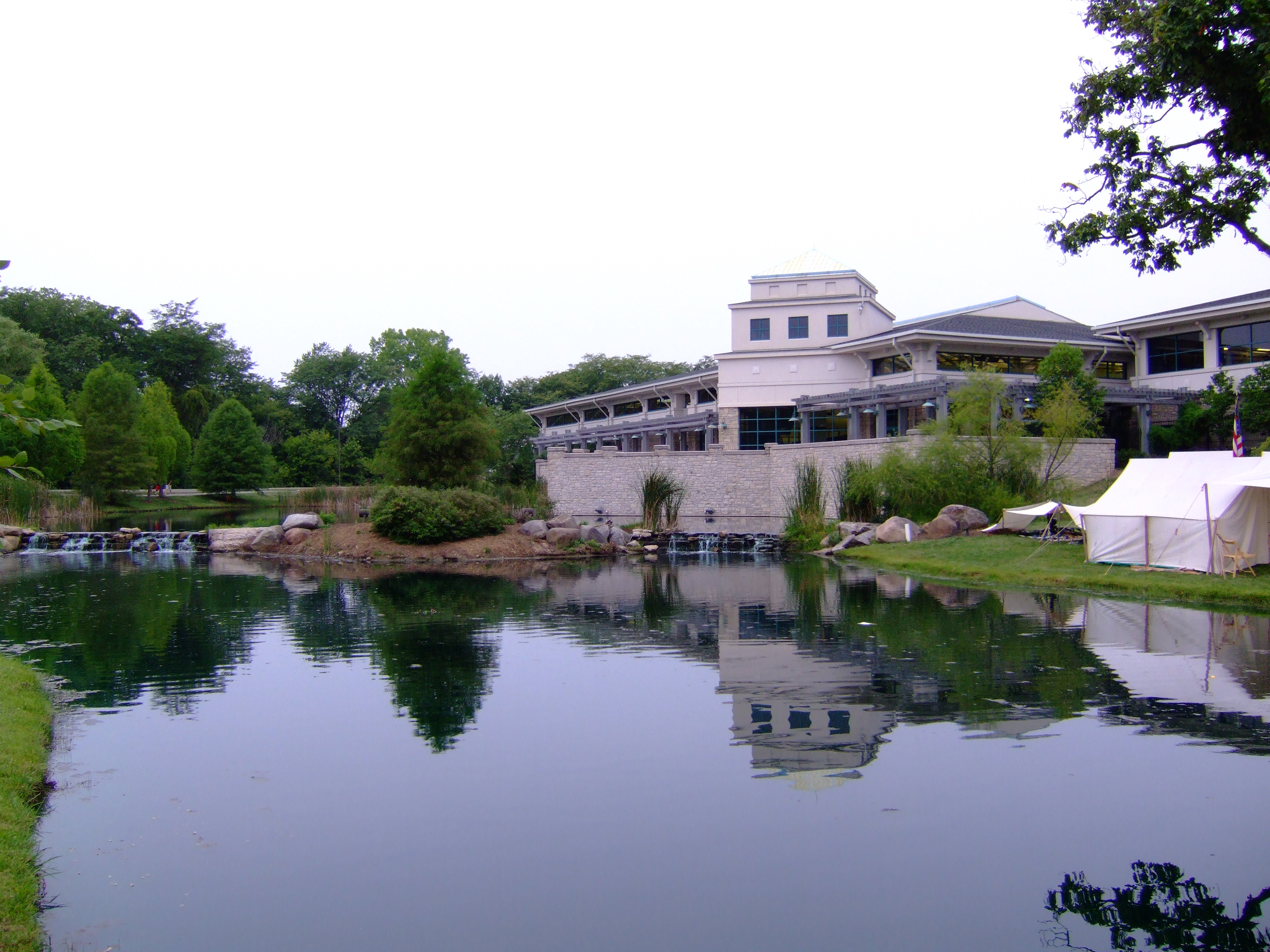
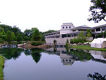 Dublin Community Recreation Center
Dublin features 1,000 acres (4.0 km2) of parks, including 77 miles (124 km) of scenic bike trails and 39 developed parks with wooded natural areas and river frontage. Several Dublin parks are located along the Scioto River, including the two Dublin Kiwanis Riverway parks. The river is accessible at several points for small watercraft, and the nearby Griggs and O'Shaughnessy reservoirs allow motorboating and sailing.
Several of Dublin's parks are home to a unique assortment of outdoor sculptures—part of the Art in Public Places collection, established by the Dublin Arts Council. In 1989, the council developed the program to enhance the quality of life for residents, and to establish a public art tour throughout the city to attract visitors. It has since become a nationally recognized program. The series includes a 12 ft (3.7 m) tall stone portrait of local legend, "Leatherlips" (the Wyandot Native American Chief known for the strength of his word); Field of Corn—featuring 109 human-sized cement ears of corn that seem to sprout from one Dublin field; and a copper house that honors the region's native American culture.
Ballantrae Park is located at the entrance of its namesake subdivision. Sitting upon a 20-foot-tall hillock, there is a 15-foot (4.6 m) bronze sculpture called “Dancing Hares”.[9] An interactive play fountain is found at the base of the hill.
Notable residents
- Nick Goings - National Football League fullback
- Jack Nicklaus - PGA champion
- Holly Sonders - Golf Channel Personality & Co-host of Morning Drive
- Chinedum Ndukwe - National Football League safety
- Brady Quinn - National Football League quarterback
- Chris Quinn - National Basketball Association guard
- Jay Richardson - National Football League defensive end
See also
References
- ^ a b "American FactFinder". United States Census Bureau. http://factfinder.census.gov. Retrieved 2008-01-31.
- ^ "US Board on Geographic Names". United States Geological Survey. 2007-10-25. http://geonames.usgs.gov. Retrieved 2008-01-31.
- ^ http://www.ohiomagazine.com/Main/Articles/Green_All_Over_3461.aspx
- ^ "US Gazetteer files: 2010, 2000, and 1990". United States Census Bureau. 2011-02-12. http://www.census.gov/geo/www/gazetteer/gazette.html. Retrieved 2011-04-23.
- ^ USGS 7.5 Minute Topographic Map, Northwest Columbus (OH)
- ^ USGS 7.5 Minute Topographic Map, Shawnee Hills (OH)
- ^ Data in historical populations table from US Census, 1890, http://books.google.com/books?id=40kUAAAAYAAJ&dq=census%20pataskala&pg=RA1-PA151#v=onepage&q&f=false; US Census, 1920, http://books.google.com/books?id=oei2AAAAIAAJ&dq=census%20pataskala&pg=PA565#v=onepage&q=census%20pataskala&f=false; US Census, 1950, http://books.google.com/books?id=32pQAAAAYAAJ&dq=census%20pataskala%201930&pg=SA35-PA18#v=onepage&q&f=false; US Census, 1970, http://books.google.com/books?id=4j0YAAAAYAAJ&dq=1970%20census%20ohio%20%22heath%22&pg=SA37-PA15#v=onepage&q&f=false; US Census, 2000, http://books.google.com/books?id=9A1ElkbD3YcC&lpg=PP13&dq=1990%20census%20ohio&pg=PA21#v=onepage&q&f=false; "American Factfinder". US Census Bureau. http://factfinder2.census.gov/main.html..
- ^ Dublin city, Ohio - Fact Sheet - American FactFinder
- ^ "Rabbits pulled out of donor's hat for Dublin's public art". Columbus Dispatch. 2007-01-10. http://www.dispatch.com/live/contentbe/dispatch/2007/01/10/20070110-C6-01.html. Retrieved 2009-09-28.
External links
- City of Dublin official site
- Convention & Visitors Bureau
- Dublin, Ohio at the Open Directory Project
Municipalities and communities of Delaware County, Ohio Cities Columbus‡ | Delaware | Dublin‡ | Powell | Westerville‡

Villages Ashley | Galena | Ostrander | Shawnee Hills | Sunbury
Townships Unincorporated
communitiesAfrica | Kilbourne | Lewis Center | Radnor
Ghost town Carpenter's Mill
Footnotes ‡This populated place also has portions in an adjacent county or counties
Municipalities and communities of Franklin County, Ohio Cities Bexley | Canal Winchester‡ | Columbus‡ | Dublin‡ | Gahanna | Grandview Heights | Grove City | Groveport | Hilliard | New Albany‡ | Pickerington‡ | Reynoldsburg‡ | Upper Arlington | Westerville‡ | Whitehall | Worthington

Villages Brice | Harrisburg‡ | Lithopolis‡ | Lockbourne | Marble Cliff | Minerva Park | Obetz | Riverlea | Urbancrest | Valleyview
Townships CDPs Unincorporated
communitiesFootnotes ‡This populated place also has portions in an adjacent county or counties
Municipalities and communities of Union County, Ohio Cities Dublin‡ | Marysville

Villages Townships Unincorporated
communitiesAllen Center | Arnold | Bridgeport | Broadway | Byhalia | Chuckery | Claibourne | Dipple | Essex | Irwin | Jerome | Lunda | New California | New Dover | Peoria | Pharisburg | Pottersburg | Raymond | Somersville | Watkins | Woodland | York Center
Footnotes ‡This populated place also has portions in an adjacent county or counties
Categories:- Cities in Ohio
- Populated places in Delaware County, Ohio
- Populated places in Franklin County, Ohio
- Populated places in Union County, Ohio
- Columbus, Ohio metropolitan area
- Populated places established in 1802


Wikimedia Foundation. 2010.