- Ostrander, Ohio
-
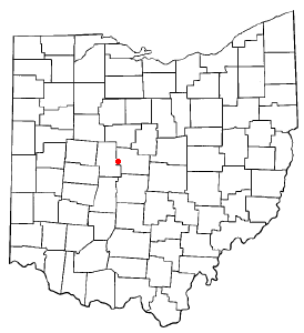
Ostrander, Ohio — Village — Location of Ostrander, Ohio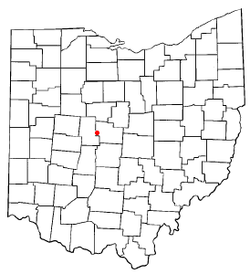
Coordinates: 40°15′57″N 83°12′40″W / 40.26583°N 83.21111°WCoordinates: 40°15′57″N 83°12′40″W / 40.26583°N 83.21111°W Country United States State Ohio County Delaware Area – Total 0.3 sq mi (0.9 km2) – Land 0.3 sq mi (0.9 km2) – Water 0.0 sq mi (0.0 km2) Elevation[1] 932 ft (284 m) Population (2000) – Total 405 – Density 1,218.5/sq mi (470.5/km2) Time zone Eastern (EST) (UTC-5) – Summer (DST) EDT (UTC-4) ZIP code 43061 Area code(s) 740 FIPS code 39-58940[2] GNIS feature ID 1044206[1] Ostrander is a village in Delaware County, Ohio, United States. The population was 405 at the 2000 census.
Contents
Geography
Ostrander is located at 40°15′57″N 83°12′40″W / 40.26583°N 83.21111°W (40.265769, -83.211148)[3].
According to the United States Census Bureau, the village has a total area of 0.3 square miles (0.78 km2), all of it land.
Demographics
As of the census[2] of 2000, there were 405 people, 148 households, and 111 families residing in the village. The population density was 1,218.5 people per square mile (473.9/km²). There were 156 housing units at an average density of 469.3 per square mile (182.5/km²). The racial makeup of the village was 98.02% White, 0.25% African American, 0.25% Native American, and 1.48% from two or more races.
There were 148 households out of which 39.2% had children under the age of 18 living with them, 61.5% were married couples living together, 8.1% had a female householder with no husband present, and 25.0% were non-families. 17.6% of all households were made up of individuals and 8.8% had someone living alone who was 65 years of age or older. The average household size was 2.74 and the average family size was 3.14.
In the village the population was spread out with 27.9% under the age of 18, 8.9% from 18 to 24, 35.1% from 25 to 44, 19.3% from 45 to 64, and 8.9% who were 65 years of age or older. The median age was 34 years. For every 100 females there were 90.1 males. For every 100 females age 18 and over, there were 87.2 males.
The median income for a household in the village was $49,583, and the median income for a family was $49,375. Males had a median income of $36,250 versus $27,500 for females. The per capita income for the village was $27,751. About 6.3% of families and 5.8% of the population were below the poverty line, including 9.4% of those under age 18 and 8.6% of those age 65 or over.
Notable natives
Ben Curtis - pro golfer
Public services
Law enforcement in Ostrander is the responsibility of the Ostrander Police Department; fire protection is provided by the Scioto Township Fire Department, and emergency medical services are provided by the Delaware County EMS.[4][5][6]
References
- ^ a b "US Board on Geographic Names". United States Geological Survey. 2007-10-25. http://geonames.usgs.gov. Retrieved 2008-01-31.
- ^ a b "American FactFinder". United States Census Bureau. http://factfinder.census.gov. Retrieved 2008-01-31.
- ^ "US Gazetteer files: 2010, 2000, and 1990". United States Census Bureau. 2011-02-12. http://www.census.gov/geo/www/gazetteer/gazette.html. Retrieved 2011-04-23.
- ^ Ostrander Police Department
- ^ Scioto Township Fire Department
- ^ Delaware County EMS
Municipalities and communities of Delaware County, Ohio Cities Columbus‡ | Delaware | Dublin‡ | Powell | Westerville‡

Villages Ashley | Galena | Ostrander | Shawnee Hills | Sunbury
Townships Unincorporated
communitiesAfrica | Kilbourne | Lewis Center | Radnor
Ghost town Carpenter's Mill
Footnotes ‡This populated place also has portions in an adjacent county or counties
Categories:- Villages in Ohio
- Populated places in Delaware County, Ohio
- Columbus, Ohio metropolitan area

Wikimedia Foundation. 2010.