- Georgetown, Washington, D.C.
Infobox nrhp2
name = Georgetown Historic District
nhld=yes
caption =
location = Roughly bounded by Whitehaven St., Rock Creek Park, Potomac River, and Georgetown University campus
nearest_city =
lat_degrees = 38
lat_minutes = 54
lat_seconds = 34
lat_direction = N
long_degrees = 77
long_minutes = 3
long_seconds = 54
long_direction = W
locmapin = District of Columbia
area =
built =
architect =
architecture =
designated_nhld =May 28 ,1967
added =May 28 ,1967
visitation_num =
visitation_year =
refnum =67000025
mpsub =
governing_body =Georgetown is a
neighborhood located in the Northwest quadrant ofWashington, D.C. , along thePotomac River waterfront. Founded in 1751, the city of Georgetown substantially predated the establishment of the city of Washington and theDistrict of Columbia . Georgetown retained its separate municipal status until 1871, when it was assimilated into the District of Columbia. Today, the primary commercial corridors of Georgetown are M Street and Wisconsin Avenue, which contain high-end shops, bars, and restaurants. Georgetown is home to the main campus ofGeorgetown University and the Old Stone House, the oldest standing building in Washington. The embassies ofFrance ,Mongolia ,Sweden ,Thailand ,Venezuela , andUkraine are located in Georgetown.History
Early history
In 1632, English fur trader Henry Fleet discovered a Native American village called Tohoga on the site of present-day Georgetown, and established trade there. [cite book |title=A Walk Through Georgetown |author=Delany, Kevin |publisher=Kevin Delany Publications |date=1971] Georgetown was incorporated as a town and first regularly settled in 1751, when the area was part of the British colony of the
Province of Maryland . Georgetown was located on land that was owned by George Gordon andGeorge Beall .Situated on the
fall line , Georgetown was the farthest point upstream to which oceangoing boats could navigate thePotomac River . Gordon constructed atobacco inspection house along the Potomac in approximately 1745. Tobacco was already being transferred from land to waterways at this location, when the inspection house was built. Warehouses, wharves, and other buildings were then constructed around the inspection house, and it quickly became a small community. It did not take long before Georgetown grew into a thriving port, facilitating trade and shipments oftobacco and other goods from colonial Maryland. [Mitchell, P. (1991), p. 1] One of the most prominent tobacco export businesses was Forrest, Stoddert and Murdock, which was formed in 1783 in Georgetown, byUriah Forrest ,Benjamin Stoddert , and John Murdock. [Ecker (1933), p. 12] Georgetown was established in 1751 when the Maryland Legislature purchased sixty acres of land for the town from Gordon and Beall at the price of £280. [Ecker (1933), pp. 1-6] Since Georgetown was founded during the reign ofGeorge II of Great Britain , some speculate that the town was named after him. Another theory is that the town was named after its founders, George Gordon and George Beall.Post-Revolution
The Maryland Legislature formally issued the town charter and incorporated the town in 1789. [Mitchell, P. (1991), pp. 1-2] Robert Peter, who was among the first to establish a business (tobacco export) in the town, became Georgetown's first mayor in 1790. [Ecker (1933), p. 8]
Benjamin Stoddert was a major figure in early Georgetown history. Arriving there in 1783, having previously served as Secretary to the Board of War under the Articles of Confederation, he partnered with GeneralUriah Forrest to become an original proprietor of thePotomac Company . Stoddert purchased stock in the federal government under Hamilton's assumption-of-debt plan. He ultimately ownedHalcyon House at the corner of 34th and Prospect Streets.The terms of the land transfer to the federal government to create the national capital were worked out in Georgetown by Stoddert and other Potomac landowners at a dinner at Forrest's home in Georgetown on
March 28 ,1791 . Stoddert bought land within the boundaries of the federal district, some of it at the request of Washington for the government and some on speculation. The speculative purchases were not, however, profitable and caused Stoddert much difficulty before his appointment asSecretary of the Navy toJohn Adams . Stoddert was rescued from his debts with the help ofWilliam Marbury , later of "Marbury v. Madison " fame, and also a Georgetown resident. TheForrest-Marbury House onM Street is currently the embassy ofUkraine .Col. John Beatty established the first church in Georgetown, a Lutheran church on High Street.
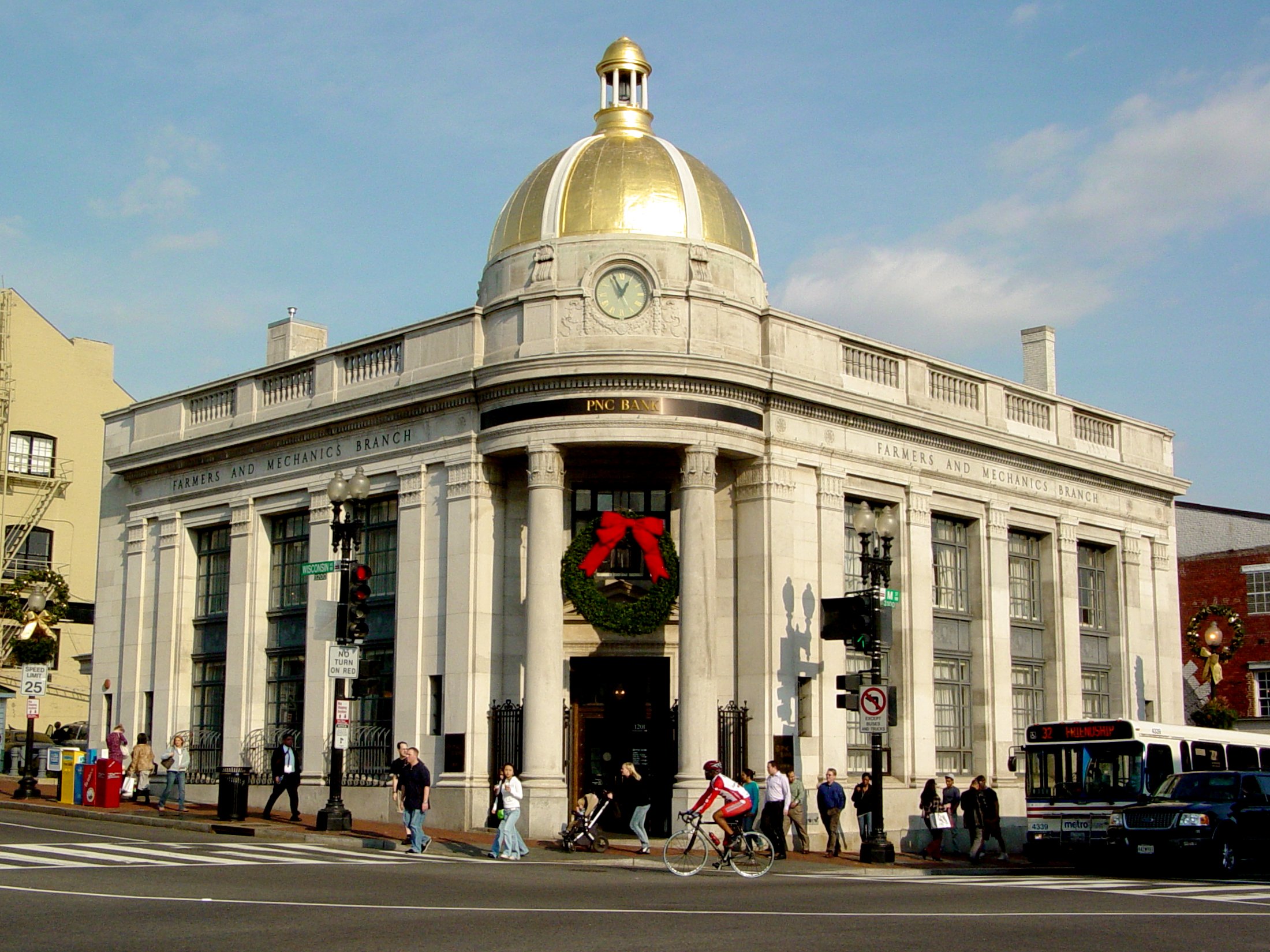
Stephen Bloomer Balch established a Presbyterian Church in 1784. In 1795, the Trinity Catholic Church was built, along with a parish school-house. St. John's Episcopal Church was built in 1803. Banks in Georgetown included the Farmers and Mechanics Bank, which was established in 1814. Other banks included the Bank of Washington, Patriotic Bank, Bank of the Metropolis, and the Union and Central Banks of Georgetown. Newspapers in Georgetown included the "Republican Weekly Ledger", which was the first paper, started in 1790. "The Sentinel" was first published in 1796 by Green, English & Co. Charles C. Fulton began publishing the "Potomac Advocate", which was started by Thomas Turner. Other newspapers in Georgetown included the "Georgetown Courier" and the "Federal Republican". William B. Magruder, the first postmaster, was appointed onFebruary 16 ,1790 , and in 1795, a custom house was established on Water Street. General James M. Lingan served as the first collector of the port. [cite news |title=An Old City's History: The Simple Annals of Our Venerable Suburb |publisher=The Washington Post |date=July 24, 1878] USCensusPop
1800= 2993
1810= 4948George Washington frequented Georgetown, includingSuter's Tavern where he worked out many land deals from there to acquire land for the Federal City. [cite journal |author=Holmes, Oliver W. |title=Suter's Tavern: Birthplace of the Federal City |journal=Records of the Columbia Historical Society |volume=73-74 |pages=pp. 1–34] In the 1790s, City Tavern, the Union Tavern, and the Columbian Inn opened and were popular throughout the 19th century. [cite journal |author=Holmes, Oliver W. |title=The City Tavern: A Century of Georgetown History, 1797-1898 |journal=Records of the Columbia Historical Society |volume=50 |pages=pp. 1–35] Of thesetaverns , only the City Tavern remains today, as a private social club (theCity Tavern Club ) located near the corner of Wisconsin Avenue and M Street.Thomas Jefferson lived for some time in Georgetown while he served asUnited States Secretary of State under PresidentGeorge Washington . [Ecker (1933), p. 47] Georgetown was home toFrancis Scott Key who arrived as a young lawyer in 1808 and resided on M Street. Dr. William Beanes, a relative of Key, captured the rear guard of the British Army while it was burning Washington during theWar of 1812 . When the mass of the army retreated, they retrieved their imprisoned guard and took Dr. Beanes as a captive to their fleet near Baltimore. Key went to the fleet to request the release of Beanes, was held until the bombardment of Fort McHenry was completed, and gained the inspiration for "The Star-Spangled Banner ".By the 1820s, thePotomac River had become silted up and was not navigable up to Georgetown. Construction of theChesapeake & Ohio Canal began in July 1828, to link Georgetown toHarper's Ferry inWest Virginia . The canal was completed onOctober 10 ,1850 , at a cost $77,041,586. The canal turned out not to be profitable, never living up to expectations with construction of theBaltimore & Ohio Railroad . [From its beginning to December 1876, the canal earned $35,659,055 in revenue, while expending $35,746,301. - cite news |title=An Old City's History: The Simple Annals of Our Venerable Suburb |publisher=The Washington Post |date=July 24, 1878] The Canal nonetheless provided an economic boost for Georgetown. In the 1820s and 1830s, Georgetown was an important shipping center. Tobacco and other goods were transferred between the canal and shipping on the Potomac River. As well, salt was imported fromEurope , and sugar and molasses were imported from theWest Indies . [cite news |title=An Old City's History: The Simple Annals of Our Venerable Suburb |publisher=The Washington Post |date=July 24, 1878] These shipping industries were later superseded by coal and flour industries, which flourished with the C & O Canal providing cheap power for mills and other industry. [Gutheim and Lee (2006), p. 49]African-American history
Georgetown historically had a large
African-American population, including both slaves and free blacks. Slave labor was widely used in construction of new buildings in Washington, in addition to provide labor on tobacco plantations in Maryland and Virginia. Slave trading in Georgetown dates back as early as 1760, when John Beattie established his business on O Street and conducted business at other locations around Wisconsin Avenue. Slave trading continued until the mid-19th century, when it was banned. [Mitchell, P. (1991), p. 2] Other slave markets ("pens") were located in Georgetown, including one at McCandless' Tavern near M Street and Wisconsin Avenue. [Gutheim and Lee (2006), p. 51] Congress abolished slavery in Washington and Georgetown on April 16, 1862. [ [http://www.h-net.org/~dclist/timeline1.html H-DC Discussion Network ] ] ManyAfrican American s moved to Georgetown following the Civil War, establishing a thriving community.In the late 18th and 19th centuries, African Americans comprised a substantial portion of Georgetown's population. The 1800 census reported the population in Georgetown at 5,120, which included 1,449 slaves and 227 free blacks. [Mitchell, P. (1991), p. 2] A testament to the African-American history that remains today is the Mount Zion United Methodist Church, which is the oldest
African-American congregation in Washington. Prior to establishing the church, free blacks and slaves went to the Dumbarton Methodist Church where they were restricted to a hot, overcrowded balcony. The church was originally located in a small brick meetinghouse on 27th Street, but it was destroyed in the 1880s due to fire. The church was rebuilt on the present site. [Mitchell, M. (1983), p. 10] Mount Zion Cemetery offered free burials for Washington's earlier African-American population. [ [http://www.cr.nps.gov/nr/travel/wash/dc10.htm Washington, DC-Mt. Zion Cemetery ] ]Post-Civil War
After the
American Revolution , Georgetown became an independent municipal government of the federal District of Columbia, along with the City of Washington, the City of Alexandria, and the newly created County of Washington and County of Alexandria (nowArlington County, Virginia ). It was officially known as "Georgetown, D.C." In 1862, the Washington and Georgetown Railroad Company began ahorsecar line running along M Street in Georgetown and Pennsylvania Avenue in Washington, easing travel between the two cities. Georgetown's corporate charter, along with Washington's, was formally revoked by Congress effective June 1, 1871, at which point its governmental powers were vested within the District of Columbia. [ [http://memory.loc.gov/cgi-bin/ampage?collId=llsl&fileName=016/llsl016.db&recNum=463 United States Statutes at Large, Volume 16, pg 428, § 40.] ] The streets in Georgetown were renamed in 1880 to conform to thestreet name s in use in Washington. [cite journal |author=King, Leroy O., Jr. |title=100 Years of Capital Traction: The Story of Streetcar Lines in the Nation's Capital|journal=Taylor Publishing Company, Dallas, Texas, 1972, Third printing 1989|pages=pp. 8, Library of Congress card number 72–97549, ISBN 0–9600938–1–8]By the late 1800s, flour milling and other industries in Georgetown were declining, in part due to the fact that the canals and other waterways continually silted up. [Gutheim and Lee (2006), p. 58] Nathaniel Michler and S.T. Abert led efforts to dredge the channels and remove rocks around the Georgetown harbor, though these were temporary solutions and Congress showed little interest in the issue. [Gutheim and Lee (2006), p. 94] An 1890 flood and expansion of the railroads brought destitution to the C&O Canal, and Georgetown became a depressed
slum , with alleys choked by tiny dwellings lacking plumbing or electricity. Shipping trade vanished between the Civil War and World War I. [cite journal |author=Smith, A. Robert and Sevareid, Eric |title=Washington: Magnificent Capital |journal=Doubleday & Company, New York, 1965 |pages=pp. 154, Library of Congress card number 65–24912] As a result, many older homes were preserved relatively unchanged.Alexander Graham Bell 's earliest switching office for theBell System was located on a site just below the C&O Canal, and it remains in use as a phone facility to this day."From a pre-Civil War population of 6,798 whites, 1,358 free Negroes, and 577 slaves, Georgetown's population had grown to 17,300 but half these residents were poverty-stricken Negroes." [cite journal |author=Smith, A. Robert and Sevareid, Eric |title=Washington: Magnificent Capital |journal=Doubleday & Company, New York, 1965 |pages=pp. 154, Library of Congress card number 65–24912]
Early Twentieth
In 1915, the Buffalo Bridge (on Q Street) opened and connected this part of Georgetown with the rest of the city east of Rock Creek Park. Soon thereafter, new construction of large apartment buildings began on the edge of Georgetown. In the early 1920s, John Ihlder led efforts to take advantage of new
zoning laws to get restrictions enacted on construction in Georgetown. [Mitchell, M. (1983), p. 2] A 1933 study by Horace Peaslee and Allied Architects laid out ideas for how Georgetown could be preserved. [Gutheim and Lee (2006), p. 199]The C & O Canal, then owned by the
Baltimore & Ohio Railroad , formally ceased operations in March 1924. After severe flooding in 1936, B & O Railroad sold the canal to theNational Park Service in October 1938. [ [http://www.h-net.org/~dclist/timeline1.html H-DC Discussion Network ] ] The waterfront area retained its industrial character in the first half of the 20th century. Georgetown was home to a lumber yard, a cement works, the Washington Flour mill, and a meat rendering plant, and its skyline was dominated by the smokestacks of a garbage incinerator and the twin stacks of the power generating plant for the old Capital Traction streetcar system, located at the foot of Wisconsin Avenue, which closed in 1935 and which was not razed until October 1968. In 1949, the city constructed theWhitehurst Freeway , an elevatedhighway above K Street, to allow motorists entering the District over the Key Bridge to bypass Georgetown entirely on their way downtown.Gentrification
As the only existing town at the time, Georgetown was the fashion and cultural center of the newly-formed District of Columbia. As Washington grew, however, the center of social Washington moved east across Rock Creek to the new Victorian homes that sprang up around the city's traffic circles, and to the
Gilded Age mansions along Massachusetts Avenue. While many "old families" stayed on in Georgetown, the neighborhood's population became poorer and more racially diverse by the early 20th century. Its demographics started to shift again whengentrification began during the 1930s, as a number of members of the administration of PresidentFranklin D. Roosevelt moved into the area. By the 1950s, a wave of new post-war residents arrived. Many of these new residents were well-educated, from elite backgrounds and they took a keen interest in the neighborhood's historic nature. At about the same time, the Citizens Association of Georgetown was formed.The area reached the height of fashionability when Georgetown resident
John F. Kennedy was elected president. Kennedy lived in Georgetown in the 1950s as both a Congressman and a Senator. Parties hosted by his wife, Jackie, and many other Georgetown hostesses drew political elites away from downtown clubs and hotels or the upper 16th Street corridor. Kennedy went to his presidential inauguration from his townhouse at 3307 N Street in January 1961. Today Georgetown is one of the most affluent neighborhoods of Washington DC and home to many of the city's politicians andlobbyists . Current inhabitants include Massachusetts SenatorJohn Kerry , past Washington Post EditorBen Bradlee , Washington Post Watergate reporter and current assistant managing editorBob Woodward , former Secretary of StateMadeleine Albright , Clinton aideGeorge Stephanopoulos , and Montana SenatorMax Baucus , among others. High-end developments and gentrification have revitalized Georgetown's formerly blighted industrial waterfront. The District's old refuse incinerator and smokestack, preserved for years as an abandoned but historic landmark, was redeveloped in 2003 to become the most pronounced feature of a new Ritz-Carlton Hotel.Geography
Georgetown is bounded by the
Potomac River on the south, Rock Creek to the east,Burleith andGlover Park to the north, withGeorgetown University on the west end of the neighborhood. Much of Georgetown is surrounded by parkland and green space that serve as buffers from development in adjacent neighborhoods, and provide recreation.Rock Creek Park , theOak Hill Cemetery , Montrose Park and Dumbarton Oaks are located along the north and east edge of Georgetown, east of Wisconsin Avenue. [Mitchell, M. (1983), pp. 14-15] The neighborhood is situated on bluffs overlooking the Potomac River. As a result, there are some rather steep grades on streets running north-south. The famous "Exorcist" steps" connecting M Street to Prospect Street were necessitated by the hilly terrain of the neighborhood.The primary commercial corridors of Georgetown are M Street and Wisconsin Avenue, whose high
fashion stores draw large numbers of tourists as well as local shoppers year-round. There is also theWashington Harbour complex on K Street, on the waterfront, featuring outdoor bars and restaurants popular for viewing boat races. Between M and K Streets runs the historicChesapeake and Ohio Canal , today plied only by tour boats; adjacent trails are popular with joggers or strollers.Historic landmarks
Georgetown is home to many historic landmarks including:
* Canal Square Building, 1054 31st Street, NW, former home of theTabulating Machine Company , a direct precursor ofIBM [ [http://www-03.ibm.com/ibm/history/exhibits/vintage/vintage_4506VV2027.html IBM Archives: Tabulating Machine Co. plant ] ] [ [http://www.seacatchrestaurant.com/history/ Georgetown Washington DC Restaurants & Seafood Dining - Sea Catch Restaurant & Raw Bar ] ]
* TheCity Tavern Club , built in 1796, is the oldest commercial structure in Washington, D.C.
* TheChesapeake and Ohio Canal , begun in 1829.
*Dumbarton Oaks , 3101 R Street, NW, former home ofJohn C. Calhoun , U.S. vice president, where theUnited Nations charter was outlined in 1944.
* Evermay, built in 1801 and restored by F. Lammot Belin [Mitchell, M. (1983), p. 10]
* TheForrest-Marbury House , 3350 M Street, NW, whereGeorge Washington met with local landowners to acquire theDistrict of Columbia . Currently the Embassy of theUkraine .
* Georgetown Lutheran Church was the first church in Georgetown, dates back to 1769. The current church structure, the fourth on the site, was built in 1914. [cite web |url=http://www.georgetownlutheran.com/history.html |title=Church History |publisher=Georgetown Lutheran Church |accessdate=2008-04-06]
* Georgetown Presbyterian Church was established in 1780 by ReverendStephen Bloomer Balch . Formerly located on Bridge Street (M Street), the current church building was constructed in 1881 on P Street. [cite web |url=http://www.gtownpres.org/history.asp |title=History |publisher=Georgetown Presbyterian Church |accessdate=2008-04-06]
*Healy Hall on Georgetown's campus, built in Flemish Romanesque style from 1877 to 1879 was designated a National Historic Landmark in 1987.
* Mount Zion United Methodist Church and Mount Zion Cemetery [ [http://www.cr.nps.gov/nr/travel/wash/dc10.htm Washington, DC-Mt. Zion Cemetery ] ]
* TheOak Hill Cemetery , a gift ofWilliam Wilson Corcoran whose Gothic chapel and gates were designed byJames Renwick , is the resting place ofAbraham Lincoln 's son Willie and other figures. [ [http://www.cr.nps.gov/nr/travel/wash/dc9.htm Washington, DC-Oak Hill Cemetery ] ]
* The Old Stone House, built in 1765, located on M Street is the oldest original structure in Washington, D.C. [ [http://www.nps.gov/rocr/oldstonehouse/http://www.nps.gov/rocr/oldstonehouse/ National Park Service - We're Sorry ] ]
* Tudor Place [ [http://www.tudorplace.org Tudor Place : Historic House and Garden ] ] and Dumbarton Court [ [http://www.dumbartoncourt.com Dumbarton Court - Georgetown, Washington, DC Best Address Real Estate ] ]Transportation
Georgetown's transportation importance was defined by its location just below the fall line of the
Potomac River . TheAqueduct Bridge , and later, theFrancis Scott Key Bridge , connected Georgetown withVirginia . Before the Aqueduct Bridge was built, a ferry service owned byJohn Mason connected Georgetown to Virginia. [Ecker (1933), p. 39] In 1788, a bridge was constructed overRock Creek to connect Bridge Street (M Street ) with the Federal City. [Ecker (1933), p. 53]Georgetown was located at the juncture of the Alexandria Canal and the
Chesapeake and Ohio Canal . The C&O Canal, begun in Georgetown in 1829, reachedCumberland, Maryland in 1851, and operated until 1924.Wisconsin Avenue is on the alignment of the tobaccohogshead rolling road from ruralMaryland , and the Federal Customs House was located on 31st Street (now utilized as the post office.) The city's oldest bridge, the sandstone bridge which carries Wisconsin Avenue, N.W. over the C&O Canal, and which dates to 1831, was reopened to traffic onMay 16 ,2007 , after a $3.5 million restoration. It is the only remaining bridge of five constructed in Georgetown by the Chesapeake & Ohio Canal Company.Several streetcar line and interurban railways interchanged passengers in Georgetown. The station was located in front of the stone wall on Canal Road (currently occupied by a gas station) adjacent to the "Exorcist steps", and the former
D.C. Transit car barn at the end of the Key Bridge. Four suburban Virginia lines, connecting throughRosslyn, Virginia , provided links from the D.C. streetcar network to Mount Vernon,Falls Church ,Great Falls ,Fairfax ,Vienna ,Leesburg , andPurcellville . Streetcar operations in Washington, D.C. endedJanuary 28 ,1962 . TheBaltimore and Ohio Railroad built a branch line fromSilver Spring, Maryland to Water Street in Georgetown in an abortive attempt to construct a southern connection toAlexandria, Virginia . It served as an industrial line to aGeneral Services Administration power plant on K Street (now razed) until at least 1982. The abandoned right-of-way has since been converted into theCapital Crescent Trail – a rails-to-trails route – and the power plant into a condo. It has long been speculated in Washington that the well-to-do and influential residents of Georgetown scuttled the placement of a planned Metrorail stop in their neighborhood. In reality, the planners of the Metro never seriously considered locating a station in Georgetown. Zachary Schrag, author of "The Great Society Subway", explains that this decision was due to several factors, a primary one being the engineering issues presented by the extremely steep grade from the Potomac River (under which the subway tunnel would run) to the center of Georgetown. It is true that some Georgetown residents wrote letters against a Georgetown station, but no serious plans for a station were ever drafted in the first place. [cite book |author=Schrag, Zachary |url=http://www.schrag.info/research/greatsocietysubway.html |title=The Great Society Subway |publisher=The Johns Hopkins University Press |date=2006]Since then, there have been discussions about adding an additional subway line and tunnel under the Potomac to service the area, though no plans are currently being discussed. Three stations are located roughly one mile (1.6 km) from the center of Georgetown: Rosslyn (across the Key Bridge in Arlington), Foggy Bottom-GWU, and Dupont Circle. Georgetown is served by the 30-series, D-Series, and G2 Metrobuses, as well as the
DC Circulator .Education
Georgetown University
The main campus of
Georgetown University is located on the western edge of the Georgetown neighborhood. Father John Carroll foundedGeorgetown University as a Jesuitprivate university in 1789, though its roots extend back to 1634.cite journal |title= Miniatures of Georgetown, 1634 to 1934 |first= Edward A. |last= Fitzpatrick |journal= The Journal of Higher Education |volume= 7 |issue= 1 |month= January |year= 1936 |pages= 56–57 |url= http://links.jstor.org/sici?sici=0022-1546%28193601%297%3A1%3C56%3ALAOA%3E2.0.CO%3B2-B |accessdate= 2007-11-14 |doi= 10.2307/1974310] Although the school struggled financially in its early years, Georgetown expanded into a branched university after theAmerican Civil War under the leadership of university presidentPatrick Francis Healy .As of 2007 , the university has nowrap|6,853 undergraduate students and nowrap|4,490 graduate students on the main campus.cite web |url= http://explore.georgetown.edu/documents/?DocumentID=742&PageTemplateID=52 |title= Georgetown At A Glance |work= [http://communications.georgetown.edu/ Office of Communications] |publisher= Georgetown University |date=December 12 ,2006 |accessdate= 2007-03-04]The main campus is just over 100
acre s (0.4 km²) in area and includes 58 buildings, student residences capable of accommodating 80 percent of undergraduates, various athletic facilities, and the medical school. Most buildings employcollegiate Gothic architecture and Georgian brick architecture. Campus green areas include fountains, a cemetery, large clusters of flowers, groves of trees, and open quadrangles. [cite news |url= http://explore.georgetown.edu/news/?ID=25425 |title= Georgetown Goes Greener |date=July 5 ,2007 |work= Blue & Gray |accessdate= 2007-07-18] The main campus has traditionally centered on Dahlgren Quadrangle, although Red Square has replaced it as the focus of student life. [cite web |url= http://www.thehoya.com/eg/campus/locations/redsquare.cfm |title= Red Square |work=The Hoya |accessdate= 2007-07-24 |first= Bernadette |last= SimpaoDead link|date=December 2007]Healy Hall , built in Flemish Romanesque style from 1877 to 1879, is the architectural gem of Georgetown's campus, and is aNational Historic Landmark . [cite journal |url= http://links.jstor.org/sici?sici=0037-9808(197210)31%3A3%3C208%3AGUHB%3E2.0.CO%3B2-0 |title= Georgetown University's Healy Building |first= Hardy |last= George |journal= The Journal of the Society of Architectural Historians |volume= 31 |issue= 3 |month= October |year= 1972 |pages= 208 |accessdate= 2007-08-16 |doi= 10.2307/988766]Primary and secondary education
Throughout the eighteenth, nineteenth, and twentieth centuries the concentration of wealth in Georgetown sparked the growth of many
university-preparatory school s in and around the neighborhood. One of the first schools was the Columbian Academy on N Street, which was established in 1781 with Reverend Stephen Balch serving as the headmaster. [cite journal |author=Clark, Allen C. |title=Rev. Stephen Bloomer Balch, a Pioneer Preacher of Georgetown |journal=Records of the Columbia Historical Society |pages=pp. 73–95]Private schools currently located in Georgetown include
Georgetown Visitation Preparatory School , while other schools in the area includeGeorgetown Day School , theNational Cathedral School , St. Albans School, and several others.Georgetown Preparatory School , while founded in Georgetown, moved in 1915 to its present location several miles north of Georgetown in Montgomery County.District of Columbia Public Schools operates area public schools, including Hyde Elementary School on O Street. [" [http://www.k12.dc.us/dcps/OFM/boundaries/Hyde-p.pdf Hyde Elementary School School Elementary School Boundary] ." "District of Columbia Public Schools ." AccessedSeptember 17 ,2008 .] Hardy Middle School and Wilson High School both serve Georgetown. [" [http://www.k12.dc.us/dcps/OFM/boundaries/Hardy-p.pdf Hardy (Rosario) Middle School School Middle School Boundary] ." "District of Columbia Public Schools ." AccessedSeptember 17 ,2008 .] [" [http://www.k12.dc.us/dcps/OFM/boundaries/Wilson-p.pdf Wilson Senior High School High School Boundary] ." "District of Columbia Public Schools ." AccessedSeptember 17 ,2008 .]Popular culture
Several movies have been filmed in Georgetown, including 1973
horror film "The Exorcist", which was set in the neighborhood and partially filmed there. In the movie's climactic scene, the protagonist is hurled down the 75-step staircase at the end of 36th Street, NW, which connects Prospect Street with M Street below. The staircase has come to be known as the "Exorcist steps". [cite news |author=Slovick, Matt |url=http://www.washingtonpost.com/wp-srv/style/longterm/movies/features/dcmovies/exorcist.htm |title=D.C. Movies: The Exorcist |publisher=The Washington Post] A false front was built onto the house at the top of the steps so that the bedroom windows would immediately overlook the steps. The real structure has considerable set-back.In 1976, "All the President's Men" showed Georgetown’s skyline in the distance as an aerial shot eventually focuses in on the
Watergate . During the making of the film, sandwiches were ordered from theBooeymonger ,Fact|date=May 2008 a Georgetown institution.Bob Woodward ,Ben Bradlee , andKatharine Graham , all portrayed in the film, lived in Georgetown at the time.The 1985 Brat Pack film "St. Elmo's Fire" was set in Georgetown, though the campus fraternity row portions were filmed at the University of Maryland campus in College Park. (Like most Jesuit colleges,
Georgetown University does not recognizefraternities orsororities , though several exist.)The 1987 film "No Way Out" featured a Georgetown Metro stop as a plot device, even though no such station exists; the subway station shots were filmed in
Baltimore, Maryland . Chase scenes for the film were shot on theWhitehurst Freeway . Other films with scenes in Georgetown are "The Man with One Red Shoe" (1985, an earlyTom Hanks film), "Chances Are" (1989), "Timecop " (1993), "True Lies " (1993), "Dave" (1993), "The Jackal " (1996, private homes), "Dick" (1998, C&O Canal), "Election " (1999), "Minority Report " (2001),"The Recruit " (2003), "The Girl Next Door" (2004), "Wedding Crashers " (2005), "Transformers " (2007), and "Burn After Reading " (2008).The television series "
The West Wing " shot a scene for the episode "Commencement" – in which the president's daughter was kidnapped in a night club on K Street, NW – beneath the Whitehurst Freeway.Notes
References
*
*
*
*
* Weiss, Eric M., "Public Works - Oldest Bridge Reopens", "Washington Post ", Thursday,May 17 ,2007 , page B-5.Further reading
* [http://www.georgetowndc.com/aboutgeorgetown.php Historical Overview of Georgetown] , from the Georgetown Partnership.
* Griffith, Gary. " [http://www.westendguide.us/whurst0104.htm Whitehurst Freeway Coming Down?] " at [http://www.westendguide.us/ WestEndGuide.us]
* King, Leroy O. "100 Years of Capital Traction - The Story of Streetcars in the Nations Capital", Taylor Publishing Company, Dallas, Texas, Third printing, 1989, ISBN 0-9600938-1-8.
* [http://www.washingtonpost.com/wp-dyn/content/article/2006/07/14/AR2006071401398.html Georgetown's Hidden History] , from the "Washington Post ", by Andrew Stephen,July 16 ,2006
* [http://www.rootsweb.com/~dcgenweb/georgetown.htm Georgetown's early history]
* [http://www.nps.gov/nr/travel/wash/dc15.htm Georgetown Historic District] , National Park Service.External links
* [http://www.cagtown.org/ Citizens Association of Georgetown]
* [http://www.georgetowndc.com/ GeorgetownDC.com]
*" [http://www.georgetowndc.com/georgetowncurrent/ The Georgetown Current] " (neighborhoodnewspaper )
*" [http://www.georgetowner.com/ The Georgetowner] " (neighborhood magazine)
*Gnis|531663
Wikimedia Foundation. 2010.