- Cumberland, Maryland
-
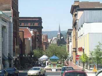
City of Cumberland — City — Downtown Cumberland
SealNickname(s): "Queen City" Motto: Come for a Visit, Stay for Life! Location in Allegany County and in Maryland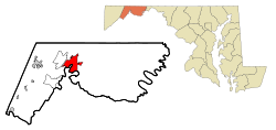
Coordinates: 39°38′52″N 78°45′46″W / 39.64778°N 78.76278°WCoordinates: 39°38′52″N 78°45′46″W / 39.64778°N 78.76278°W Country United States State Maryland County Allegany Founded 1787 Incorporated 1815 Government - Type weak-mayor form with City Adminstrator - Mayor Brian Grim - City administrator Jeff Rhodes (acting) Area - City 9.1 sq mi (23.5 km2) - Land 9.1 sq mi (23.5 km2) - Water 0.0 sq mi (0.0 km2) Elevation 627 ft (191 m) Population (2010) - City 20,859 - Density 2,298.9/sq mi (887.6/km2) - Metro 103,299 - Demonym Cumberlander Time zone Eastern (EST) (UTC-5) - Summer (DST) EDT (UTC-4) ZIP codes 21501-21505 Area code(s) 301, 240 FIPS code 24-21325 GNIS feature ID 0590057 Website www.ci.cumberland.md.us Cumberland is a city in the far western, Appalachian portion of Maryland, United States. It is the county seat of Allegany County, and the primary city of the Cumberland, MD-WV Metropolitan Statistical Area. At the 2010 census, the city had a population of 20,859, and the metropolitan area had a population of 103,299. Cumberland is a regional business and commercial center for Western Maryland and the Potomac Highlands of West Virginia. Historically Cumberland was known as the Queen City of the Alleghenies.
Demographics
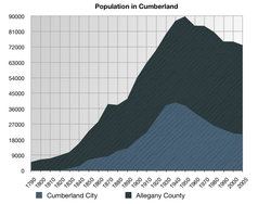 A graph showing the population in Cumberland and Allegany County
At the 2000 census[1], there were 21,518 people, 9,538 households and 5,436 families residing in the city. The population density was 2,372.7 per square mile (916.0/km2). There were 11,143 housing units at an average density of 1,228.7 per square mile (474.3/km2). The racial makeup of the city was 92.54% White, 5.06% African American, 0.26% Native American, 0.61% Asian, 0.02% Pacific Islander, 0.26% from other races, and 1.24% from two or more races. Hispanic or Latino of any race were 0.70% of the population.
There were 9,538 households, of which 25.1% had children under the age of 18 living with them, 39.7% were married couples living together, 13.8% had a female householder with no husband present, and 43.0% were non-families. 37.8% of all households were made up of individuals and 18.5% had someone living alone who was 65 years of age or older. The average household size was 2.20 and the average family size was 2.90.
City residents have an older demographic profile than the U.S. generally. 22.7% is under the age of 18, 8.2% is from 18 to 24, 25.1% is from 25 to 44, 23.3% is from 45 to 64, and 20.7% is 65 years of age or older. The median age is 41 years compared to a U.S. average of 35.3. Females outnumber males. For every 100 females there are 86.2 males. For every 100 females age 18 and over, there were 81.3 males.
Population by year Year Cumberland
pop.Allegany
pop.Urban
pop.Rural
pop.1790 4,809 1800 6,303 1810 6,909 1820 8,654 1830 1,162 10,590 1840 2,384 15,690 1850 6,105 22,769 1860 7,300 28,348 1870 8,056 38,536 1880 11,300 38,012 1890 12,729 41,571 1900 17,568 53,694 1910 21,839 62,411 1920 29,837 69,938 1930 37,747 79,098 1940 39,483 86,973 50,705 30,054 1950 37,679 89,556 ~52,905 36,651 1960 33,415 84,169 47,723 ~36,446 1970 29,724 84,044 44,207 39,304 1980 25,933 80,548 58,777 ~22,666 1990 23,706 74,946 2000 21,518 74,930 2010 20,859 75,087 The median household income $25,142, and the median family income was $34,500. Males had a median income of $29,484 versus $20,004 for females. The per capita income for the city was $15,813. About 15.3% of families and 19.8% of the population were below the poverty line, including 29.4% of those under age 18 and 10.3% of those age 65 or over. The Cumberland, MD-WV Metropolitan Statistical Area ranked 305th out of 318 metropolitan areas in per capita income.[2][3]
In 2007, Forbes ranked the Cumberland Metro as having the 6th lowest cost of living in the USA based on an index of cost of housing, utilities, transportation and other expenditures[4]
In 2007, The Baltimore Sun newspaper, citing the National Association of Realtors figures on home prices, stated that while most areas were then stagnant, Cumberland home prices were rising by more than 17%, the highest in the country.[5])
In July 2007, Washington Post writer Stephanie Cavanaugh wrote that the great quality of living in Cumberland had attracted many urbanites to the area.[6]
According to the 2000 Census, educational achievement levels of the city residents lag behind those of Allegany County and the state of Maryland. High school diploma attainment figures for residents 25 years of age and older were lower than the state average (83.8%), with Allegany County at 79.9% and Cumberland at 79.3%. Furthermore, only 13.0% of city residents 25 years of age and older held at least an undergraduate degree. The comparable figures for Allegany County and Maryland residents were 14.1% and 31.4% respectively.
Ancestries are:
- Population trends
Population decline from 1950-1990 was due to a string of industrial plant closures. Unwilling to meet union demands plants such as Pittsburgh Plate Glass, Allegany Munitions and Celanese closed down and relocated. The 1987 closure of the Kelly Springfield Tire Plant marked a turning point, as the last major manufacturing plant in the city limits to close its doors.
The population of the city has continued to decline since 1990, with the 2010 census population of 20,859 the lowest since the 1900 census.
References:
- For 1870-1960: Allegany County data Historical Census Browser
- For 1930-2000: See Geostat Center Collection: County and City Data Books (1930-2000)
- For 1830-1873: See Lowdermilk
- For 1900-1920: See Maryland Manual, 1928, Volume 144, page 202
Geography
Cumberland is located in the Ridge and Valley physiographic province of the Appalachian Mountains at 39°38′52″N 78°45′46″W / 39.647687°N 78.762869°W (39.647687, -78.762869),[7] at the junction of the North Branch of the Potomac River and Wills Creek. Interstate 68 runs through the city in an east/west direction, as does Alternate U.S. 40, the Old National Road. U.S. Highway 220 runs north/south. The majority of the land within the city lies in a valley created by the junction of these two streams. Parts of Wills Mountain, Haystack Mountain, and Shriver Ridge are also within the city limits.
The abandoned Chesapeake and Ohio Canal, now the Chesapeake and Ohio Canal National Historical Park, has its western terminus in Cumberland. The canal's towpath is still maintained, allowing travel by foot or bicycle between Cumberland and Washington, D.C., a distance of about 185 miles (298 km).
The city has a total area of 9.1 square miles (24 km2), of which 9.1 square miles (24 km2) is land and 0.11% is water.[8]
Cumberland was the terminus, and namesake, of the Cumberland Road (begun in 1811) that extended westward to the Ohio River at Wheeling, West Virginia, the first portion of the National Road which eventually reached Ohio, Indiana, and Illinois.
Neighborhoods and surrounding areas
- Downtown -- The Downtown Cumberland Historic District, also referred to as the Downtown Cumberland Mall, is the main shopping and dining district for the city.
- North End is a neighborhood in Cumberland bounded by Wills Creek to the south, Frederick Street to the East, and the city line on the west and north. Once known as "The Queen City", the neighborhood is a mix of residential, industrial, and commercial buildings. Some of the large industries found in this neighborhood include breweries, glass factories, and tanneries. These industries are now defunct, although many of the industrial buildings are still used for warehousing.
- Most of the residential housing stock in North End was constructed to house industrial workers, and date from the middle and late 19th century. The housing stock is characterized by adjoining brick rowhouses and duplexes, set on small lots with narrow streets. As you move east to west through the neighborhood, the house lots become larger, the streets wider, and the housing stock more recent. Due to the age of the housing stock, many North End streets contain large numbers of vacant and deteriorating buildings. This neighborhood has been targeted by the City Government for housing rehabilitation and blight removal.
- Most of the commercial businesses in North End are located on Mechanic and Centre streets, including various restaurants, small boutiques, convenience stores, and car dealerships.
- South Cumberland, also known as South End, is the largest neighborhood in Cumberland both geographically and by population. It is bounded by the CSX mainline to the south, Williams Street to the north, the Potomac River to the west, and the city line to the east. It is home to two national historic districts: the Chapel Hill Historic District and Rolling Mill Historic District.[9] The neighborhood is historically and currently a mix of residential, industrial, and commercial buildings.
- The residential character of the neighborhood is highly varied. Much of the housing stock in the area around Virginia Ave dates from the late 19th and early 20th century and was constructed to house workers from the neighborhood's industrial concerns. As with many of the city's older neighborhoods, this area contains many vacant and deteriorating structures. Local community groups, such as the Chapel Hill West neighborhood group, have taken positive steps to help improve aging structures, and beautify the area. The streets around Memorial Hospital are characterized by larger lots and sizeable free-standing homes. Many of the health care professionals that work at the hospital live in this area. Lastly, the blocks near the eastern edge of the neighborhood were developed in the middle of the 20th century and contain wider streets and a variety of housing styles and materials.
- There are still many industrial enterprises located in South End. The western part of the neighborhood specifically contains many warehouses and other small industries.
- The commercial main street of South End is Virginia Avenue, which historically acted as the main shopping area for the residents of South End and contained men's and women's clothing stores, movie theaters, and specialty retail stores. Virginia Avenue's commercial importance has declined since the middle of the 20th century due to the opening of enclosed shopping centers and strip malls. The Avenue (as locals call it) still contains numerous antique shops, bars, and specialty stores. Location of Greenway Avenue Stadium, the joint home of the Fort Hill Sentinels and Allegany Campers.
- West Side is a neighborhood in Cumberland bounded by the Potomac River to the south, Wills Creek to the north and east, the city line on the west. The neighborhood is a mix of residential, governmental, and some commercial buildings. West Side was the first part of Cumberland to be settled by the British colonists. Fort Cumberland, a military and trade outpost was built on a hill just west of Wills Creek in the 1750s. The early growth of the city was centered around the fort. The oldest existing building in West Side, and for that matter, all of Cumberland, The Headquarters of George Washington was built during this time period. The ground formerly occupied by Fort Cumberland is now home to many county government offices. The Allegany County Courthouse, County Library, and County Board of Education are among the most government buildings. The majority of the buildings surrounding these governmental offices are used for commercial purposes. Many law offices, accounting firms, real estate offices, doctor's office, and many other small businesses are located in this area. Allegany High School, which serves Cumberland's North and West sides, as well as the outlying communities of La Vale and Cresaptown, is located in this area on Rose Hill.
- Residential land use becomes dominant as you move west from the site of former fort. Many of Cumberland's largest and most valuable houses are located here. The housing stock ranges in age from the mid-19th century closer to the former fort, to the middle of the 20th century near the city line to the west. This includes the Greene Street Historic District, listed on the National Register of Historic Places in 2005 and Washington Street Historic District listed in 1973.[9] Some of Cumberland's newest developments are located on Haystack Mountain near the city line.
- The only substantial industrial land use in West Side is Riverside Industrial Park. This site was the former location of the Kelly Springfield Tire factory. Most of the factory has been torn down, including its impressive twin smoke stacks. Some of the outbuildings are still standing and used for warehousing.
- East Side is a neighborhood in Cumberland bounded by Williams St. to the south, Frederick St. to the west, and the city line to the north and east. The predominate land uses in East Side are residential and recreational. Two large hills, McKaig's Hill and Fort Hill dominate the landscape of East Side. There is little flat land and thus the residential development is less dense in East Side when compared to other parts of the city. The small amount of at-grade land is located at the western edge of the neighborhood. This area, now known as Decatur Heights, is a mid to late 19th century residential neighborhood contains both rowhouses and impressive free standing homes. The Decatur Heights Historic District, listed on the National Register of Historic Places in 2005.[9] East Side contains several new housing developments, one located on Decatur St., the other located towards the top of McKaig's Hill.
Due to its steep topography, East Side is heavily forested. The largest park in the city, Constitution Park is located in this neighborhood. Constitution Park contains a public swimming pool, basketball courts, tennis courts, and playground equipment. - Little Egypt
- Bowling Green
- Wills Mountain
- Haystack Mountain
- Shriver Ridge
Nearby cities and towns
All of the following cities are in Maryland, unless otherwise noted,[10] and are in order of distance.
- 1.1 miles (1.8 km) Ridgeley, West Virginia
- 2.9 miles (4.7 km) La Vale
- 2.3 miles (3.7 km) Carpendale, West Virginia
- 3.0 miles (4.8 km) Wiley Ford, West Virginia
- 3.3 miles (5.3 km) Evitts Creek
- 3.5 miles (5.6 km) Bowling Green
- 4.0 miles (6.4 km) Potomac Park
- 4.4 miles (7.1 km) Corriganville
- 6.6 miles (10.6 km) Cresaptown
- 6.6 miles (10.6 km) Bel Air
- 6.6 miles (10.6 km) Ellerslie
- 8.1 miles (13.0 km) Spring Gap
- 8.4 miles (13.5 km) Rocket Center, West Virginia
- 8.4 miles (13.5 km) Pinto
- 8.4 miles (13.5 km) Eckhart Mines
- 9.5 miles (15.3 km) Mount Savage
- 9.9 miles (15.9 km) Wellersburg, Pennsylvania
- 11.5 miles (18.5 km) Rawlings
- 11.7 miles (18.8 km) Frostburg
- 11.3 miles (18.2 km) Midlothian
- 12.7 miles (20.4 km) Fort Ashby, West Virginia
- 12.8 miles (20.6 km) Flintstone
- 13.2 miles (21.2 km) Hyndman, Pennsylvania
- 14.8 miles (23.8 km) Oldtown
- 13.4 miles (21.6 km) Midland
- 15.5 miles (24.9 km) Centerville, Pennsylvania
- 16.4 miles (26.4 km) Lonaconing
- 19.8 miles (31.9 km) Barton
- 19.8 miles (31.9 km) Fairhope, Pennsylvania
- 20.4 miles (32.8 km) McCoole
- 20.7 miles (33.3 km) Keyser, West Virginia
- 24.3 miles (39.1 km) Westernport
- 24.6 miles (39.6 km) Piedmont, West Virginia
- 25.1 miles (40.4 km) Luke
- 25.4 miles (40.9 km) Grantsville
- 26.1 miles (42.0 km) Paw Paw, West Virginia
- 27.3 miles (43.9 km) Romney, West Virginia
- 27.5 miles (44.3 km) Berlin, Pennsylvania
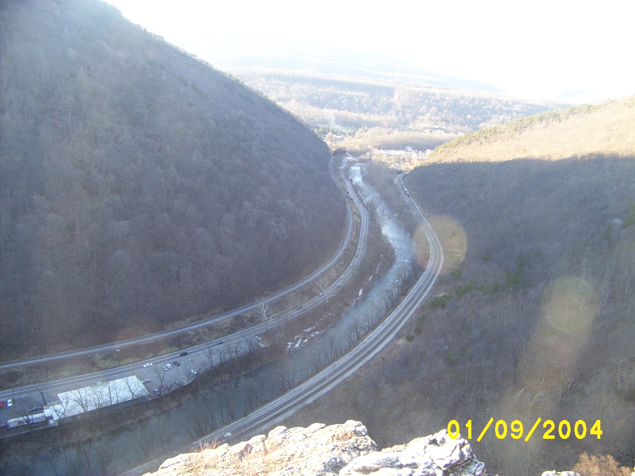
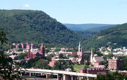
Cumberland Narrows
 The Cumberland Narrows west of Cumberland, Maryland, along Wills Creek, with Haystack Mountain on the left and Wills Mountain on the right. The easy crossing of the rugged Wills Mountain Anticline through this water gap is used by the Western Maryland Scenic Railroad (left), the Old National Road (Alternate U.S. 40) (center, left of the creek), and the CSX Railroad (right).
Cumberland is located at the eastern entrance to the Cumberland Narrows (or simply "The Narrows"), a water gap along Wills Creek that crosses the central ridge of the Wills Mountain Anticline at a low elevation between Wills Mountain to the north and Haystack Mountain to the south. Cliffs and talus of the two mountains' Tuscarora quartzite caprock are prominent within the Narrows. These geological features provide Cumberland a western backdrop of the two mountains and the narrow gap between them.
The Cumberland Narrows acts as a western gateway from Cumberland to the Appalachian Plateau and the Ohio River Valley beyond. The Old National Road, now Alternate U.S. 40, passes through the Narrows, along with the former Baltimore and Ohio Railroad's main line between Baltimore/Washington and Pittsburg, now part of the CSX system, and a former line of the Western Maryland Railroad, now used by the steam- and diesel-powered excursion trains of the Western Maryland Scenic Railroad.
A prominent rocky outcropping at the south end of Wills Mountain in the Cumberland Narrows is known as Lover's Leap.
History
Cumberland is named after the son of King George II, Prince William, the Duke of Cumberland. It is built on the site of the old Fort Cumberland, the starting point for British General Edward Braddock's ill-fated attack on the French strong-hold of Fort Duquesne (located on the site of present-day Pittsburgh) during the French and Indian War. (See Braddock expedition.)
Cumberland was also an outpost of Colonel George Washington during the French and Indian War and his first military headquarters was built here. Washington later returned to Cumberland as President in 1794 to review troops that had been assembled to thwart the Whiskey Rebellion.
 map of Braddock's Military Road
Cumberland was a key road, railroad and canal junction during the 19th century and at one time the second largest city in Maryland (second to the port city of Baltimore — hence its nickname "The Queen City"). The surrounding hillsides provided coal, iron ore and timber that helped supply the Industrial Revolution. In addition, the city was a major manufacturing center, with industries in glass, breweries, fabrics and tinplate. However, following World War II, it began to lose much of its industrial importance and its population declined from 39,483 in the 1940 census to fewer than 22,000 today.[11][12]
Climate
Cumberland lies within the northern periphery of the Humid subtropical climate zone, experiencing temperatures significantly lower than the central and eastern part of Maryland. The region experiences four distinct seasons, including warm to moderately hot summers and chilly to moderately cold winters. The warmest month is July, with an average temperature of 74.5 °F (23.6 °C). The coldest month is January, with an average temperature of 30 °F (−1.1 °C). Average annual snowfall totals 34.1 inches (870 mm).
Climate data for Cumberland, MD Month Jan Feb Mar Apr May Jun Jul Aug Sep Oct Nov Dec Year Average high °F (°C) 40
(4)45
(7)55
(13)67
(19)76
(24)84
(29)87
(31)86
(30)79
(26)67
(19)55
(13)44
(7)65.4 Average low °F (°C) 20
(−7)23
(−5)30
(−1)39
(4)48
(9)57
(14)62
(17)60
(16)53
(12)40
(4)32
(0)25
(−4)40.75 Precipitation inches (mm) 2.89
(73.4)2.43
(61.7)3.30
(83.8)3.16
(80.3)3.97
(100.8)3.12
(79.2)3.42
(86.9)3.53
(89.7)3.18
(80.8)2.69
(68.3)2.91
(73.9)2.61
(66.3)37.21
(945.1)Source: TWC,[13] Education
The offices of Allegany County Public Schools are located in Cumberland. ACPS compete in a number of academic competitions for students, including the Stock Market Game, Science Olympiad, Science Fair, Spell-A-Thon, Maryland Facts Quiz Bowl, the National Children's Creative Writing Contest Elementary and Middle School Spectra Quiz Bowl, Math Counts, Mock Trial Teams, Secretarial Science Contest Scripps-Howard Spelling Bee, Voice of Democracy, and the Maryland Science Quest.
Athletic programs also abound, with competition in everything from football, soccer, baseball, volleyball and track to tennis, bowling, wrestling and golf.
Schools
- High schools
- Private schools
- Bishop Walsh School
- Calvary Christian Academy
- Lighthouse Christian Academy
- Middle schools
- Washington Middle School
- Braddock Middle School
- Elementary schools
- Bel Air Elementary School
- John Humbird Elementary School
- Northeast Elementary School
- South Penn Elementary School
- West Side Elementary School
- Creasptown Elementary School
- Cash Valley Elementary School
- Parkside Elementary School
- Flintstone Elementary School
Area colleges and universities
All of those listed are within a short drive from Cumberland, though only one is located in Cumberland itself.
- Allegany College of Maryland (Cumberland and Bedford, Pennsylvania)
- Robert C. Byrd Institute (Rocket Center, West Virginia)
- Frostburg State University (Frostburg, Maryland)
- Potomac State College of West Virginia University (Keyser, West Virginia)
- Garrett College (McHenry, Maryland)
Libraries
Approximately 39,000 people hold library cards in Allegany County ("Most citizens give libraries high grades", Cumberland Times News, October 10, 2006). Regional Libraries include:
- Washington Street Library
- Frostburg Public Library
- Lavale Public Library
- South Cumberland Public Library, Allegany County
- Westernport Public Library, Allegany County
- Lewis J. Ort Library (Frostburg State University)
- Allegany College Library
- Western Maryland Public Library System
Employers
Significant city employers include:
- Western Maryland Health System, which employs approximately 2,300 people, making it Cumberland's largest employer.
- Allegany County government.
- CSX: Located 177 miles (285 km) west of Baltimore, Md., the Cumberland Locomotive Maintenance Facility is a vital point on CSX's Chicago to Baltimore mainline. It employs 273 people at Cumberland shops and 600 men and women in Cumberland.
- Allegany College of Maryland employs approximately 800 people.
- the call center of ACS Inc., which employs about 400 people.
- City of Cumberland, employing approximately 300 people.
- Hunter Douglas: a 378,000-square-foot (35,100 m2) facility, with 580 plus employees, which makes this location the largest Hunter Douglas fabrication plant in the world. The company is Allegany County's sixth largest employer.
- Western Correctional Institution State Prison, employs 550 people; a number of other people are employed at the Federal Prison and the new Maximum Security Prison all in close proximity to Cumberland
- Infospherix employs approximately 375 - 400 people. Infospherix is a call center that handles inbound reservations for state camp grounds, as well as several Federal contracts. Infospherix was formerly known as BioSpherics.
- Ray Of Hope, Inc. an organization that provides assisted living units for mentally and physically handicapped adults for over 20 years.
Hospitals
- Western Maryland Regional Medical Center
- Thomas B. Finan Center
Utilities
Water and sewer service is supplied by the City of Cumberland. The municipal watershed is located to the north within the State of Pennsylvania. Water is drawn from two lakes on city land, Gordon and Koon.[14] Electricity service supplied by Allegheny Power, while natural gas service is supplied by Columbia Gas of Maryland. There was once a working oil well that pumped crude oil from a location near the Fruit Bowl in the Cumberland Narrows.
Government and infrastructure
Mayor and City Council
The Mayor and City Council of Cumberland form a part-time government, which only meets on the 1st and 3rd Tuesday of the month. The current mayor is Brian Grim. The current city council members are Butch Hendershot, David Kauffman, Mary Beth Pirolozzi, and Nicholas Scarpelli.[15]
Law enforcement
 Badge of the Cumberland Police Department.
The city is primarily policed by the Cumberland Police Department (CPD). The CPD is a full-service agency consisting of a patrol section, detective bureau, specialized services, and other services. It is occasionally aided by the Maryland State Police and the Allegany County Sheriff's Office as directed by authority.
The Cumberland Police Department was founded by an act of legislation in March 1852. In 1907, Officer August Baker was killed by gunfire while trying to apprehend a drunk and disorderly William Burns from an area that is now known as South Wineow Street. Subsequently, after the officer's death, an angry mob broke Burns out of jail using a telephone pole. After gaining entry into the jail, the mob beat the murder suspect, Burns, almost to death. They then drug him into the street, and shot him twelve times to death.[16][17] In 2009, the CPD was involved in the investigation of a local homicide, which is uncommon for the area.[18] The suspect was investigated by CPD C3I detectives and ultimately plead guilty to the first-degree murder.[19][20] In February 2010, the CPD in conjunction with C3I investigated a double-homicide that garnered state-wide attention.[21]
The Cumberland Police Department is currently headed by Chief Charles H. Hinnant, who is assisted by one Deputy Chief and five Lieutenants.[22] The CPD is a progressive department and has a diverse Specialized Unit Section with the following teams:[23]
- K-9 Unit
- Bicycle Patrol
- Motorcycle Patrol
- Cumberland Emergency Response Team (CERT)
- Combined County Criminal Investigation Unit (C3I)
- School Resources C3I Narcotics Task Force
- Honor Guard
State representation
The North Branch Correctional Institution, operated by the Maryland Department of Public Safety and Correctional Services, is located in unincorporated Allegany County, near Cumberland.[24] The prison began housing male death row inmates, who were moved from the Maryland Correctional Adjustment Center, in June 2010.[25]
Cumberland is Represented by 1 Democrat in the House of Delegates by the name of Kevin Kelly and 1 Republican in the House of Delegates by name of Leroy Myers. Cumberland is also represented in the State Senate by a Republican by the name of George Edwards.
Federal Representation
Cumberland is represented in the US House of Representatives by Republican Roscoe Bartlett. Cumberland lays deep inside of the Maryland 6th Congressional District. Cumberland in the US Senate is Represented by 2 Democrats by the names of Barbara Mikulski and Ben Cardin.
Local government
The City of Cumberland is run on a non-partisan system of government that was adopted in the early 1980s by voter approval. Prior to the early 1980s Cumberland elected its government by political parties. The government is also a weak-mayor form of government. Day to day operations are headed by a full time City Administrator, a system that was implemented by the old partisan Mayor and City Council in 1979. As of July 20, 2011 Jeff Rhodes was acting City Administrator.[26]
Transportation
Within the city
The primary public transportation in the City of Cumberland is bus service provided by Allegany County Transit. This service is fairly extensive, consisting of five scheduled routes that reach most areas of the City and providing access to most public facilities. The bus depot is located in the South End to the west of Virginia Avenue on Lafayette Avenue. The Allegany County Transit Authority also serves LaVale, Frostburg, and Cresaptown.
Highways
Cumberland's roadway system consists of a series of interconnected grids defined by natural and man-made barriers including steep slopes, the Potomac River, Wills Creek, rail lines, and I-68. Originally developed for a larger population than currently lives in Cumberland, the overall system is generally adequate to accommodate existing levels of traffic. Major highway arteries serving the Cumberland area include:
Railways
Amtrak, the national passenger rail system, provides intercity service to Cumberland via the Capitol Limited, which runs between Washington, D.C., and Chicago, Illinois. The Cumberland Amtrak Station is located downtown at Queen City Drive and East Harrison Street.
The Western Maryland Scenic Railroad operates steam and diesel excursion trains from Cumberland to Frostburg and back.
Airports
Cumberland is almost equidistant from four major airports: Washington National Airport, Dulles International Airport, Baltimore Washington International Airport, and Pittsburgh International Airport, all of which are at least two and one-half hours by car from the city. The Greater Cumberland Regional Airport (Airport-ID: CBE) provides local air transportation to the Cumberland area. The airport is located in West Virginia, to the south of the Potomac River, which forms the boundary between the City of Cumberland and Mineral County, West Virginia. Formerly owned by the City of Cumberland, the airport is now owned and operated by a bi-state intergovernmental airport authority whose members are four representatives from West Virginia and five from Maryland. In addition, Mexico Farms Airport (Airport-ID: 1W3) is also located in Cumberland.
Local media
Main article: Media in Cumberland, MD-WV-PACumberland has several media outlets; most carry some form of satellite programming. WCBC-AM and WFRB-FM have some local news content, but do not actively collect it. The closest public radio station is WFWM, Frostburg, MD. Allegany Magazine is a recent media addition.
Aside from some local news programming, virtually no mass media content originates from Cumberland. The local media tends to re-broadcast Hagerstown and Washington, D.C. television stations for news coverage.
Cable customers of Cumberland mainly receive service from Atlantic Broadband. Cumberland's Atlantic Broadband customers receive two NBC affiliates, WJAC-TV from Johnstown, PA and WHAG-TV from Hagerstown, MD. ABB customers also receive three CBS affiliates: WTAJ-TV from Altoona, PA, WJZ-TV from Baltimore, MD, and WUSA (TV) from Washington, DC. ABB customers can also receive two Fox affiliates, WTTG-TV from Washington, DC and WWCP-TV from Altoona, PA, as well as one ABC affiliate, WJLA-TV from Rosslyn, VA.
Tourism
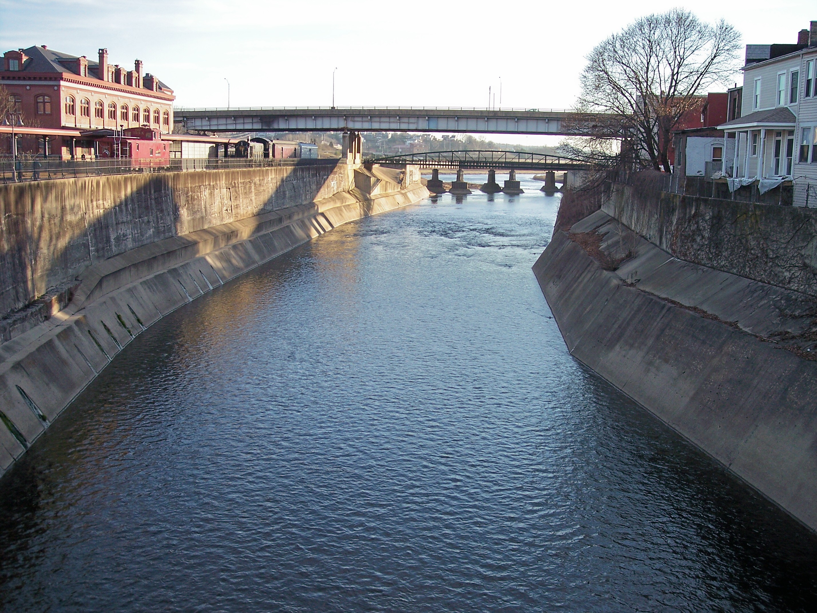
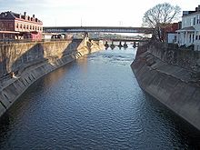 Wills Creek
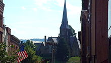 Downtown Cumberland
 Western Maryland Scenic Railroad
Tourist attractions in the area include:
- Western Maryland Scenic Railroad
- Chesapeake and Ohio Canal National Historical Park Terminus at Canal Place
- Chesapeake and Ohio Canal National Historical Park Towpath
- Allegheny Highlands Trail of Maryland
- Allegany Arts Council
- Rocky Gap State Park
- Cumberland Narrows along Wills Creek, on Alternate U.S. 40
- New Embassy Theater
Annual and seasonal events
- Heritage Day Festival, Washington St. (Mid June)
- Farmer's Market, every Saturday downtown (From June to November)
- Sunday in the Park: free concerts every Sunday evening in Constitution Park Amphitheater in South Cumberland, sponsored by the Allegany Arts Council. (From May to September)
- Canal/Rail Fest, located at Canel Place (mid July)
- Allegany County Fair and Expo (mid July)
- Homecoming: ALCO v. FHS: First or second weekend before Thanksgiving at Greenway Ave Stadium. Homecoming is the final regular season football game for Cumberland's two public high schools Allegany High School and Fort Hill High School. Attendance at the game averages between 8,000 - 10,000 (approximately one-half of the population of the city).
- Tri-State Concert Series concerts throughout the year from the golden age of rock-n-roll, swing, and big-band as well as popular country and choral music.
- Western Maryland Street Rod Roundup: Over 1000 pre-1949 street rods featuring rod jousting, crafts, food, entertainment, parts vendors, vote for your favorite car. Allegany County Fairgrounds (Labor Day Weekend)
- Annual Tree Lighting Ceremony and Open-House: This event centers around the annual lighting of the City Christmas Tree in the heart of Downtown Cumberland where streets filled with Cumberland residents come to see the mayor throw the switch on the tree and participate in the sights, sounds and joy of the holiday season. During the event there are several live musical performances at prominent businesses in the city center, including holiday choral and jazz vocal performances; as well as, galleries exhibiting local artists, including ceramics, photography, metal sculpture, jewelry and water color. (First day after Thanksgiving, aka Black Friday)
- "The Ball Drop" every New Year's Eve in Downtown Cumberland.
- Bluegrass Jam Session: Every Sunday evening at the Queen City Creamery from 4:00 pm to 8:00 pm or later. Free admission.
- The Great Allegany Run: Every October. 15K run from Mount Savage, Maryland to Downtown Cumberland; 5K run in Cumberland; 2-mile (3.2 km) walk on C&O Canal; and Kids' Run.
- Halloween Parade: Every October in South Cumberland.
- Homecoming Parade: Every November in downtown Cumberland.
- "Firemans Sportsman Bash
Architecture
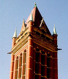 Allegany County Courthouse
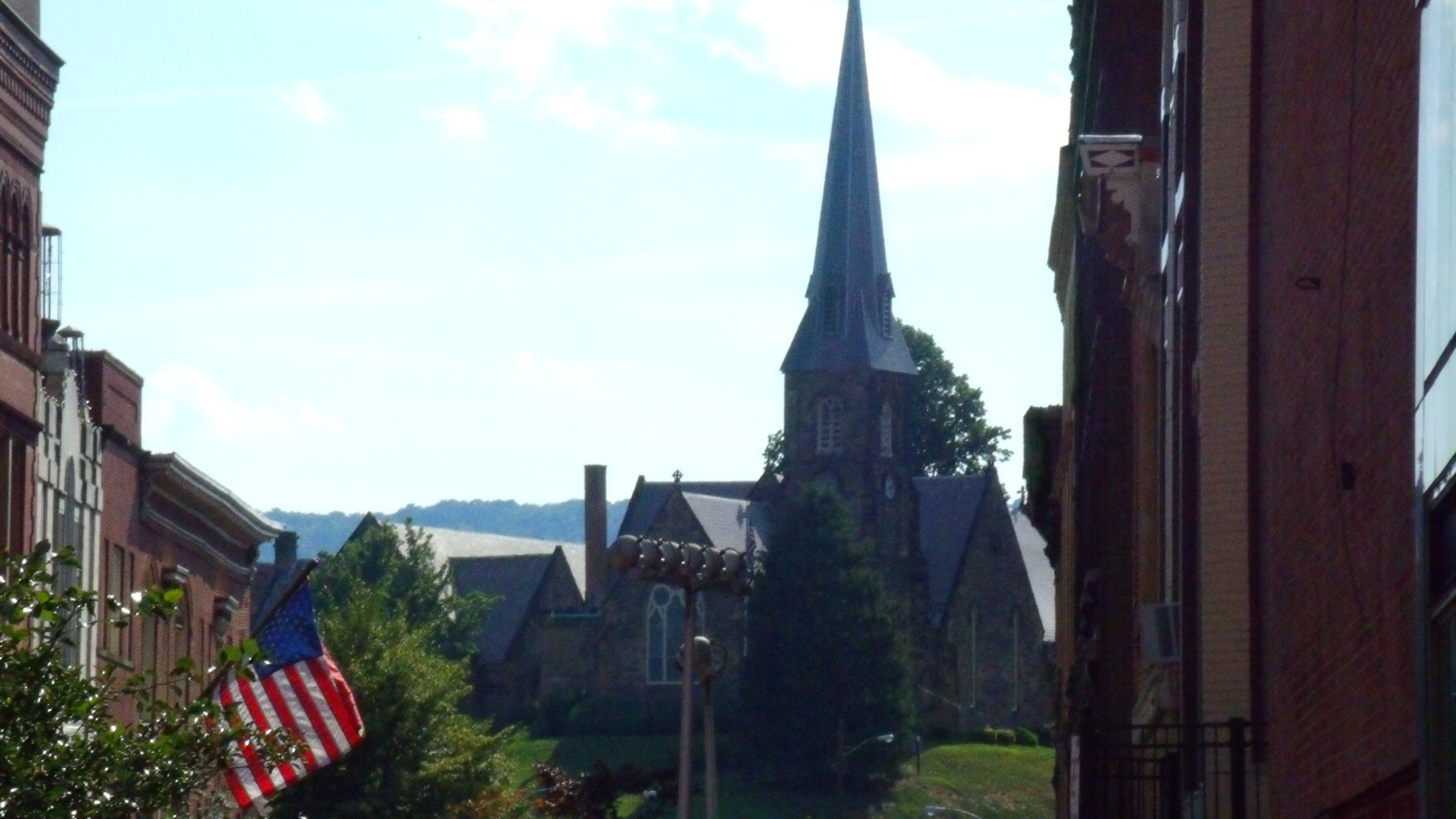
Some of Cumberland's most architecturally significant homes are located in the Washington Street Historic District. Considered the elite residential area when the city was at its economic peak, Washington Street was home to the region's leading citizens including the president of the C&O Canal. Significant public buildings include the Allegany County Courthouse, Allegany County Library, and Emmanuel Episcopal Church, located on the site of Fort Cumberland. It features Gothic Revival architecture with three large Tiffany windows, fort tunnels, and ammunition magazine cellars.[27]
The 1850 Emmanuel Episcopal Church, standing at the eastern end of the Washington Street Historic District, is one of Maryland's most outstanding examples of early Gothic Revival architecture.
The Allegany County Courthouse dominates the city's skyline. It was designed in 1893 by local architect Wright Butler.
The Queen City Hotel was built by the B&O during the 1870s. The battle to preserve it was lost when the building was demolished in 1972.
Temple B’er Chayim's 1865 gothic revival building is one of the oldest surviving synagogue buildings in the United States.
Sister city
Noted residents and natives
- Rebeca Arthur (born 1963) actress (Perfect Strangers (television show), Get Shorty)
- J. Glenn Beall, Jr. (1927–2006) former U.S. Senator
- Rob Breedlove (born 1938) former American Football linebacker who played eight seasons in the National Football League with the Washington Redskins and the Pittsburgh Steelers from 1960 to 1967
- Wright Butler architect of Allegany Courthouse
- Kia Corthron (born 1961) playwright, screenwriter, attended Allegany High School
- James Deetz (1930–2000) father of historical archeology
- Eddie Deezen (born 1958) comic actor
- Patrick Hamill (1817–1895), U.S. Congressman for Maryland's 4th District 1869-1871, buried in Odd Fellow's Cemetery
- Drew Hankinson (born 1983), wrestles for the World Wrestling Entertainment as Festus
- Tom Hull (born 1952) former American football linebacker who played two seasons in the National Football League with the San Francisco 49ers and the Green Bay Packers in 1974 and 1975
- William H. Macy (born 1950) actor, attended Allegany High School. While at Allegany High School William was a junior and senior class president of his graduating class.
- Mark Manges (born 1956) quarterback for the University of Maryland, College Park (1974–77), appeared on the cover of Sports Illustrated magazine Oct 1976 issue
- John Van Lear McMahon (1800–1871) Maryland legislature and historian
- Kelly L. Moran (born 1960) author of the book Shelley Chintz which was published in 2001 ISBN 0-9676925-0-4. Designer/Builder of the Stone Cottage. Attended Bruce High School.
- Sam Perlozzo (born 1951) former Major League Baseball player and former manager of the Baltimore Orioles (2005–2007) attended Bishop Walsh High School
- Bruce Price (1845–1903) architect of Cumberland Emmanuel Church
- Rosenbaum founders of Rosenbaum Brothers Department Store in 1849
- Casper R. Taylor, Jr (born 1934), Member of House of Delegates 1975-2003, Speaker of House 1994-2003
- George L. Wellington (1852–1927) Former United States Senator
- Steve Whiteman- Singer of 80s metal band KIX
- Jane Frazier lived in a log house built in 1754 just beyond the Cumberland city limits. It was while returning to her home from the Fort Cumberland Trading Post several miles away that Jane was captured by Indians and taken to the Great Miami River in Ohio. A Frazier family member later wrote a book about the incident call "Red Morning"
- Indian Will a well-known Native American who lived in a former settlement of the Shawnee Indians at the site of present day Cumberland, Maryland in the 18th century. Both Wills Creek and Wills Mountain are named after him.
- Frederick John Bahr (1837–1885) an immigrant from Baden, Germany, who bought Wills Mountain including the narrows and Lovers Leap to avoid the encroachment of the Civil War and settled there with his family in a cabin on the top of the mountain.
- J. V. Cunningham (1911–1985). poet, writer, and professor for Standford University. Born in Cumberland. (See Oxford Companion to Twentieth-Century Poetry, page 110)
- Edward Otho Cresap Ord (1818–1883). Born in Cumberland. He was the designer of Fort Sam Houston, and a U.S. Army officer who saw action in the Seminole War, the Indian Wars, and the American Civil War
- Samuel Magill, established the first newspaper in Cumberland the Allegany Freeman published weekly from 1813 to 1816 (See Lowdermilk, page 301)
- List of mayors of Cumberland, Maryland
- Francis Xavier Seelos (1819–1867), pastor of SS. Peter & Paul's Catholic Church 1857-1862, beatified by the Vatican in 2000 (final stage of canonization process)
Notes
- ^ "American FactFinder". United States Census Bureau. http://factfinder.census.gov. Retrieved 2008-01-31.
- ^ 'Local area personal income', 1998-2000', Bureau of Economic Analysis, republished by HighBeam Encyclopia, 2002.
- ^ Dataplace: Cumberland, MD-WV MAS
- ^ Special Report: Best Places For Business And Careers, Forbes, April 2007.
- ^ The Baltimore Sun, 29 June 2007
- ^ Washington Post Real Estate section, 14 July 2007
- ^ "US Gazetteer files: 2010, 2000, and 1990". United States Census Bureau. 2011-02-12. http://www.census.gov/geo/www/gazetteer/gazette.html. Retrieved 2011-04-23.
- ^ According to the United States Census Bureau
- ^ a b c "National Register Information System". National Register of Historic Places. National Park Service. 2008-04-15. http://nrhp.focus.nps.gov/natreg/docs/All_Data.html.
- ^ All distances from urban core of Cumberland were calculated by http://maps.google.com, 2007
- ^ All Abroad for Cumberland: Cumberland History
- ^ Parts of this article are copied from the Cumberland History, a National Park Service website whose contents are in the public domain.
- ^ "Average Monthly Temperatures for Cumberland, MD". The Weather Channel. July 2011. http://www.weather.com/weather/wxclimatology/monthly/graph/USMD0115. Retrieved July 22, 2011.
- ^ City of Cumberland: Public Works Department
- ^ "Mayor & Council". City of Cumberland, Maryland. http://www.ci.cumberland.md.us/new_site/index.php/contents/view/6. Retrieved 2011-01-09.
- ^ Cumberland Times-News - Plaque to honor fallen city police officer
- ^ http://www.odmp.org/officer/17429-patrolman-august-baker
- ^ http://www.fedstats.gov/mapstats/crime/county/24001.html
- ^ http://www.allbusiness.com/crime-law-enforcement-corrections/criminal-offenses-crimes/14009606-1.html
- ^ http://www.newstribune.info/news/x1566714192/NEWS-BREAK-Nephew-charged-in-Cumberland-womans-murder
- ^ http://articles.baltimoresun.com/2010-02-14/news/bal-cumberland-shooting0214_1_c3i-cumberland-man-suspect Baltimore Sun
- ^ http://www.ci.cumberland.md.us/cpd/command.html
- ^ http://www.ci.cumberland.md.us/cpd/specialized.html
- ^ "North Branch Correctional Institution." North Branch Correctional Institution. Retrieved on September 22, 2010.
- ^ Calvert, Scott and Kate Smith. "Death row inmates transferred to W. Maryland." The Baltimore Sun. June 25, 2010. Retrieved on September 22, 2010.
- ^ Elaine Blaisdell (July 20, 2011). "No job listing for administrator position, yet". Cumberland Times-News. http://times-news.com/local/x202401024/No-job-listing-for-administrator-position-yet. Retrieved August 30, 2011.
- ^ All Aboard For Cumberland: Washington Street
- ^ "Mayor and City Council Year 2000 Minutes". City of Cumberland, MD. July 11, 2000. http://www.ci.cumberland.md.us/citygovt/minutes/min2000-list/2000minutes/2000minutes_27.html. Retrieved 2007-07-07.[dead link]
References
- Will H. Lowdermilk, History of Cumberland, first published 1878, reprinted by Clearfield Co., October 1997, Paperback, ISBN 0-8063-7983-9. Full Text Online
- Amanda Paul, Tom Robertson, Joe Weaver, Cumberland, Arcadia Publishing, Copyright Oct 1, 2003, Paperback, ISBN 0-7385-1498-5
- Joseph H Weaver, Cumberland, 1787-1987: A Bicentennial History, Published by the City of Cumberland and the Cumberland Bicentennial Committee, January 1, 1987, ASIN B0007165K6
- Mike High, The C&O Canal Companion, Johns Hopkins University Press, 2001, ISBN 0-8018-6602-2
- Mark D. Sabatke, Discovering The C&O Canal, Schreiber Publishing, 2003, ISBN 1-887563-67-9
- Allan Powell, Fort Cumberland, Publisher Allan R Powell, 1989, ISBN 0-9619995-2-7
- Albert L Feldstein, Feldstein's Historic postcard album of Allegany County, Commercial Press Print. Co, 1984, ASIN B0006YQW5C
- Albert L. Feldstein, Feldstein's Historic Coal Mining and Railroads of Allegany County, Maryland, Publisher Albert L Feldstein, 2000, ISBN 0-9701605-0-X (This book consists of 135 historic Allegany County, Maryland coal mining and railroad related photographs. These are primarily from the early 20th century. Accompanying each depiction is a historical narrative with facts, figures, dates and other information. Included within this number are 23 biographies of individuals associated with the history of coal mining in the region.)
- Albert L. Feldstein, Allegany County (Images of America: Maryland), Arcadia Publishing, 2006, ISBN 0-7385-4381-0 (features Allegany's towns and communities, downtown business scenes, residential areas, industries, historic buildings, churches, schools, hospitals, floods, parades, coal mining, railroad stations, and historic and natural landmarks. In some cases, the personal messages sent on the back of the postcards are included.)
- Census of population and housing (2000): Maryland Summary Social, Economic, and Housing Summary, DIANE Publishing, ISBN 1-4289-8582-4
External links
- Cumberland, Maryland municipal government
- Downtown Cumberland, Maryland
- U.S. Geological Survey Geographic Names Information System: Cumberland US Geological Survey
- Cumberland, Maryland at the Open Directory Project
City of Cumberland Subject areas Attractions • Climate • Demographics • Festivals/Events • Education • Geography • History • Media • People • Sports • Major employers • Transportation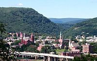
Top subjects Allegany Arts Council • Allegany College of Maryland • Allegany Community Symphony Orchestra • Allegany Magazine • Chesapeake and Ohio Canal National Historical Park • Constitution Park • Cumberland Times-News • Cumberland Theatre • Greater Cumberland Regional Airport • Mountain Discoveries • Railfest • Western Maryland Scenic RailroadNeighborhoods Bowling Green • Downtown • East Side • Little Egypt • Haystack Mountain • North End • Shriver Ridge • South Cumberland • West Side • Wills MountainMunicipalities and communities of Allegany County, Maryland County seat: Cumberland Cities Cumberland | Frostburg
Towns Barton | Lonaconing | Luke | Midland | Westernport
CDPs Other
communitiesAmcelle | Barrelville | Bel Air | Bellegrove | Bier | Borden Shaft | Bowling Green | Carlos | Clarysville | Corriganville | Cresaptown | Danville | Dawson | Detmold | Dickens | Eckhart Mines | Ellerslie | Evitts Creek | Flintstone | Franklin | George's Creek | Klondike | Little Orleans | McCoole | McKenzie | Mexico | Midlothian | Moscow | Mount Savage | Narrows Park | Nikep | North Branch | Oldtown | Pekin | Pinto | Pleasant Valley | Potomac Park | Rawlings | Spring Gap | Town Creek | Vale Summit | Woodland | Zihlman
County seats of Maryland Cities Annapolis | Cambridge | Cumberland | Frederick | Hagerstown | Rockville | Salisbury | Westminster
Independent municipality Towns Bel Air | Centreville | Chestertown | Denton | Easton | Elkton | La Plata | Leonardtown | Oakland | Princess Anne | Snow Hill | Upper Marlboro
CDPs Law enforcement agencies in Maryland State County Departments Municipal Departments Aberdeen · Annapolis · Baltimore Police Department · Bel Air Police Department · Bowie · Cumberland · District Heights · Greenbelt · Hagerstown · Landover Hills · Laurel · Ocean City · Rockville · Salisbury · Seat Pleasant · Takoma · University Park · Upper MarlboroSheriff's Offices University Bowie State · Frostburg State · Salisbury · Towson · University of Baltimore · University of Maryland, Baltimore County · University of Maryland, College Park Police DepartmentCategories:- Cumberland, Maryland
- Cities in Maryland
- Populated places in Allegany County, Maryland
- National Road
- County seats in Maryland
- Cumberland, MD-WV MSA
- Populated places established in 1787


Wikimedia Foundation. 2010.