- Frostburg, Maryland
Infobox Settlement
official_name = Frostburg, Maryland
settlement_type =City
nickname =
motto =
imagesize =
image_caption =
image_
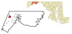
mapsize = 250x200px
map_caption = Location inMaryland
mapsize1 =
map_caption1 =
subdivision_type = Country
subdivision_name =United States
subdivision_type1 = State
subdivision_name1 =Maryland
subdivision_type2 = County
subdivision_name2 = Allegany
government_type =
leader_title =Mayor
leader_name =Arthur T. Bond
established_title = Incorporated
established_date = 1816
area_magnitude =
area_total_km2 = 7.9
area_total_sq_mi = 3.1
area_land_km2 = 7.9
area_land_sq_mi = 3.1
area_water_km2 = 0.0
area_water_sq_mi = 0.0
area_water_percent =
area_urban_km2 =
area_urban_sq_mi =
area_metro_km2 =
area_metro_sq_mi =
population_as_of = 2000
population_note =
population_total = 7873
population_metro =
population_urban =
population_density_km2 = 994.8
population_density_sq_mi = 2576.5
timezone = Eastern
utc_offset = -5
timezone_DST = Eastern
utc_offset_DST = -4
latd = 33 |latm = 39 |lats = 17 |latNS = N
longd = 78 |longm = 55 |longs = 40 |longEW = W
elevation_m = 631
elevation_ft = 2070
website = [http://www.ci.frostburg.md.us www.ci.frostburg.md.us]
postal_code_type =ZIP code
postal_code = 21532
area_code = 301
blank_name = FIPS code
blank_info = 24-30900
blank1_name = GNIS feature ID
blank1_info = 0584526
footnotes = :"For the NSA computer, seeFROSTBURG ."Frostburg is a city in Allegany County,
Maryland ,United States located at the head of theGeorges Creek Valley . It is part of the 'Cumberland, MD-WV Metropolitan Statistical Area '. The population was 7,873 at the 2000census . Located eight miles (13 km) west ofCumberland, Maryland , the town is one of the first cities on the "National Road ",US 40 , and the western terminus of theWestern Maryland Scenic Railroad . Since 1991, the city has been served byInterstate 68 .Frostburg is the home of
Frostburg State University , an university with 5,400 students within theUniversity System of Maryland .The City of Frostburg is a community with a population of approximately 8,075 year round residents.
Geography
Frostburg is located at coor dms|39|39|17|N|78|55|40|W|city (39.654687, -78.927773)GR|1.
According to the
United States Census Bureau , the city has a total area of 3.1 square miles (7.9 km²), all of it land.Frostburg is located in the
Allegheny Mountains on the eastern slope ofBig Savage Mountain . The closest cities to Frostburg areCumberland, Maryland , convert|8|mi|km to the east, andMorgantown, West Virginia , convert|62|mi|km to the west.Schools and universities
*Beall Elementary School, Grades K-5
*Frost Elementary School, Grades K-5
*Mount Savage School, Grades K-8, inMount Savage, Maryland
*Mountain Ridge High School , Grades 9-12
*St. Michael's Elementary School
*Frostburg State University - previously named "Frostburg State College" and originally named "State Normal School Number 2 at Frostburg" [http://www.frostburg.edu/about/history.htm History of Frostburg State University] ]Weather
Frostburg is located in the
Allegheny Mountains and has an average elevation of convert|2000|ft|m above sea level. Because of the elevation and location near theAllegheny Front , about 2900+ feet, Frostburg has a colder, wetter climate than the rest of Allegany County. Average summer temperatures peak at only convert|79|°F|°C|abbr=on in July. In December, January, and February, average monthly temperatures range from 32-37°F, which combined with moderate precipitation can leave large portions of the town and surrounding landscape to be snow and ice-covered for weeks or even months straight. Driving conditions onI-68 andUS 40 can be very hazardous despite timely state and local road maintenance services. Frostburg averages over convert|100|in|m of snowfall a year and significant amounts can fall as early as October and as late as May.On June 2, 1998, an F4
tornado struck Frostburg, damaging 125 homes and Frost Elementary School. [http://www.erh.noaa.gov/er/lwx/Storms/Frostburg.htm June 2, 1998 PA-MD-WV Tornado Outbreak] ] This tornado is a counterexample for the myth that tornadoes do not occur in rough terrain.
=Demographics= As of thecensus GR|2 of 2000, there were 7,873 people, 2,840 households, and 1,252 families residing in the city. Thepopulation density was 2,576.5 people per square mile (993.4/km²). There were 3,123 housing units at an average density of 1,022.0/sq mi (394.1/km²). The racial makeup of the city was 90.42% White, 6.40% African American, 0.23% Native American, 0.98% Asian, 0.09% Pacific Islander, 0.50% from other races, and 1.38% from two or more races. Hispanic or Latino of any race were 1.22% of the population. There were 2,840 households out of which 18.2% had children under the age of 18 living with them, 34.0% were married couples living together, 7.3% had a female householder with no husband present, and 55.9% were non-families. 37.5% of all households were made up of individuals and 16.5% had someone living alone who was 65 years of age or older. The average household size was 2.18 and the average family size was 2.85.In the city the population was spread out with 12.4% under the age of 18, 41.0% from 18 to 24, 17.2% from 25 to 44, 14.2% from 45 to 64, and 15.2% who were 65 years of age or older. The median age was 24 years. For every 100 females there were 81.4 males. For every 100 females age 18 and over, there were 79.2 males.
The median income for a household in the city was $21,215, and the median income for a family was $53,234. Males had a median income of $35,417 versus $26,094 for females. The
per capita income for the city was $13,821. About 6.1% of families and 30.5% of the population were below thepoverty line , including 12.9% of those under age 18 and 13.4% of those age 65 or over.City officials
*Mayor: Arthur T. Bond
*City Administrator: John R. Kirby, Jr.
*Chief of Police: William Evans [ [http://www.ci.frostburg.md.us/dofficials.htm Frostburg Department Officials ] ]Notable Residents
*
James Glenn Beall , Republican U.S. Senator from Maryland, 1953 - 1965.
*Stephen Dunn (1939-), poet and winner of thePulitzer Prize for Poetry . [Strauss, Robert. [http://query.nytimes.com/gst/fullpage.html?res=9B05E4D7173DF934A15757C0A9659C8B63 "Ode to Joi(sey)"] , "The New York Times ",April 27 ,2003 . AccessedOctober 9 ,2007 . "Mr. Dunn, who used to live in Port Republic, a remote town in the interior of South Jersey, now divides his time between Ocean City and his wife's hometown, Frostburg, Md."]
*John J. Hafer , former Maryland State Senator
*Bob Robertson , professional baseball player
*Ray Kuhlman , pilot and minor league baseball owner
* Fred Davis, former Sheriff ofCharles County ,Maryland , 1994 - 2006
*James Sprigg was aUnited States Representative fromKentucky Notable Landmarks
*Frostburg is home to the
God's Ark of Safety ministry and its associated roadside landmark, a skeletal steel structure representing the biblicalNoah's Ark being built on theI-68 highway hillside since 1976. [Cleary, Caitlin. [http://post-gazette.com/pg/06106/682602-85.stm "If the flood comes too soon, this ark won't be quite ready"] . "Pittsburgh Post-Gazette ",April 16 ,2006 . AccessedApril 16 ,2006 .]Nearby Places
Cities
*
Cumberland, Maryland
*Hagerstown, Maryland
*Morgantown, West Virginia Smaller communities
*
Barton, Maryland
*Callimont, Pennsylvania
*Carpendale, West Virginia
*Cresaptown, Maryland
*Klondike, Maryland
*La Vale, Maryland
*Lonaconing, Maryland
*Midland, Maryland
*Wellersburg, Pennsylvania
*Woodland, Maryland
*Eckhart Mines, Maryland Local Art & Culture
* [http://www.frostburgpalace.org Frostburg Palace Theatre Mission]
*Arion Band is a community band based in Frostburg. Established in 1877, the band has now been performing for 129 years. The band gives five to ten performances in the Frostburg and Cumberland areas during the summer.References
See also
*
External links
* [http://www.ci.frostburg.md.us City website]
* [http://www.frostburgfirst.org Historic Frostburg: A Maryland Main Street Community]
* [http://frostmuseum.allconet.org Frostburg Museum]
* [http://www.thrashercarriage.com Thrasher Carriage Museum]

Wikimedia Foundation. 2010.