- La Vale, Maryland
Infobox Settlement
official_name = La Vale, Maryland
settlement_type = CDP
nickname =
motto =
imagesize =
image_caption =
image_
imagesize =
image_caption =
image_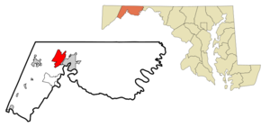
mapsize = 250x200px
map_caption = Location of LaVale, Maryland
mapsize1 =
map_caption1 =subdivision_type = Country
subdivision_name =United States
subdivision_type1 = State
subdivision_name1 =Maryland
subdivision_type2 = County
subdivision_name2 = Allegany
government_footnotes =
government_type =
leader_title =
leader_name =
leader_title1 =
leader_name1 =
established_title =
established_date =unit_pref = Imperial
area_footnotes =area_magnitude =
area_total_km2 = 21.0
area_land_km2 = 21.0
area_water_km2 = 0.0
area_total_sq_mi = 8.1
area_land_sq_mi = 8.1
area_water_sq_mi = 0.0population_as_of = 2000
population_footnotes =
population_total = 4613
population_density_km2 = 219.3
population_density_sq_mi = 567.9timezone = Eastern (EST)
utc_offset = -5
timezone_DST = EDT
utc_offset_DST = -4
elevation_footnotes =
elevation_m = 239
elevation_ft = 784
latd = 39 |latm = 39 |lats = 17 |latNS = N
longd = 78 |longm = 48 |longs = 46 |longEW = Wpostal_code_type =
ZIP code s
postal_code = 21502, 21504
area_code = 301
blank_name = FIPS code
blank_info = 24-46075
blank1_name = GNIS feature ID
blank1_info = 0590618
website =
footnotes =La Vale is a
census-designated place (CDP) in Allegany County,Maryland ,United States . It is part of the 'Cumberland, MD-WV Metropolitan Statistical Area '. The population was 4,613 at the 2000 census.Geography
La Vale is located at coor dms|39|39|17|N|78|48|46|W|city (39.654737, -78.812691)GR|1.
According to the
United States Census Bureau , the CDP has a total area of 8.1square mile s (21.0km² ), all of it land.Demographics
As of the
census GR|2 of 2000, there were 4,613 people, 1,924 households, and 1,377 families residing in the CDP. Thepopulation density was 567.9 people per square mile (219.3/km²). There were 2,045 housing units at an average density of 251.8/sq mi (97.2/km²). The racial makeup of the CDP was 97.59% White, 0.65% African American, 0.04% Native American, 1.02% Asian, 0.02% Pacific Islander, 0.13% from other races, and 0.54% from two or more races. Hispanic or Latino of any race were 0.48% of the population.There were 1,924 households out of which 26.7% had children under the age of 18 living with them, 61.7% were married couples living together, 7.6% had a female householder with no husband present, and 28.4% were non-families. 25.1% of all households were made up of individuals and 14.2% had someone living alone who was 65 years of age or older. The average household size was 2.38 and the average family size was 2.82.
In the CDP the population was spread out with 20.6% under the age of 18, 7.0% from 18 to 24, 24.3% from 25 to 44, 27.6% from 45 to 64, and 20.6% who were 65 years of age or older. The median age was 44 years. For every 100 females there were 94.6 males. For every 100 females age 18 and over, there were 89.0 males.
The median income for a household in the CDP was $42,911, and the median income for a family was $48,494. Males had a median income of $33,125 versus $23,179 for females. The
per capita income for the CDP was $20,989. About 4.8% of families and 7.3% of the population were below thepoverty line , including 4.9% of those under age 18 and 5.1% of those age 65 or over.ummary of Town
LaVale is located in the shadow of Haystack Mountain. To the east is Cumberland and the very scenic Narrows. To the west is Piney Mountain and Frostburg. LaVale is on the Old
National Pike . LaVale is a business center that contains the largest concentration of retail and the only indoor shopping mall, Country Club Mall, in Cumberland Metro.Major Roads
*
Interstate 68
*US Alternate Route 40
*Maryland Route 53
*Maryland Route 49 chools
* Parkside Elementary School
* Cash Valley Elementary SchoolNearby Cities and Towns
*Frostburg
*Cumberland
*Bowling Green
*Cresaptown
*Barton
*Westernport
*Luke
*Midland
*Keyser,West Virginia
*Wiley Ford,West Virginia
*Ridgeley,West Virginia
*Piedmont,West Virginia See also
*
References
External links
* [http://www.shopcountryclubmall.com Country Club Mall]
Wikimedia Foundation. 2010.