- Cresaptown, Maryland
-
Cresaptown — Unincorporated community — Location within the state of Maryland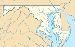
 Cresaptown
Coordinates: 39°35′34″N 78°50′0″W / 39.59278°N 78.833333°WCoordinates: 39°35′34″N 78°50′0″W / 39.59278°N 78.833333°W Country United States State Maryland County Allegany Time zone Eastern (EST) (UTC-5) – Summer (DST) EDT (UTC-4) ZIP codes FIPS code GNIS feature ID Cresaptown is a community located in Allegany County, Maryland, United States of America. It is an unincorporated community which, for United States Census Bureau purposes, is united with Bel Air to form the census-designated place of Cresaptown-Bel Air. Cresaptown's post office was established December 22, 1800. Cresaptown is several miles southwest of Cumberland, Maryland.
Contents
History
Prior to 1728, Cresaptown was the site of a former Shawnee Indian village along the Potomac River. The inhabitants of this region were a portion of the Shawanese tribe, a sub-division of the Algonquian group, one of the most warlike combinations of that period. The warriors engaged in hunting and fishing for food and furs, while their families were left at home to tend the maize and grass that grew in the rich soil of the Potomac valley. The maize was ground into corn meal and made into Shawnee cake a popular diet of the Shawnees living in the valley. [1]
The Shawanees in the valley lived in shelters composed of two forked posts that were driven into the ground and on these was laid a ridge pole. small saplings, cut to a length of about eight feet, were laid against the pole, one end resting on the ground, forming a shelter similar to a V shaped tent. This was covered with bark and skins and made tight enough to protect against rain or snow. The floors were spread with furs, which made sure for seats or beds.[1] The Location of Maryland deathrow is also in this town. <http://www.deathpenaltyinfo.org/state_by_state> If you would like to learn more about the death penalty please visit the site listed.
The 372nd Military Police Company, known for participating in Abu Ghraib prisoner abuse, is based here, though is slated to move to Grand Prairie, Texas.
Nearby Cities
See also
- Thomas Cresap
- Regional Businesses
References
- ^ a b William Harrison Lowdermilk, "History of Cumberland, Md", Harvard University, 1878, page 19-20
Municipalities and communities of Allegany County, Maryland Cities 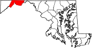
Towns Barton | Lonaconing | Luke | Midland | Westernport
CDPs Other
communitiesAmcelle | Barrelville | Bel Air | Bellegrove | Bier | Borden Shaft | Bowling Green | Carlos | Clarysville | Corriganville | Cresaptown | Danville | Dawson | Detmold | Dickens | Eckhart Mines | Ellerslie | Evitts Creek | Flintstone | Franklin | George's Creek | Klondike | Little Orleans | McCoole | McKenzie | Mexico | Midlothian | Moscow | Mount Savage | Narrows Park | Nikep | North Branch | Oldtown | Pekin | Pinto | Pleasant Valley | Potomac Park | Rawlings | Spring Gap | Town Creek | Vale Summit | Woodland | Zihlman
Categories:- Populated places in Allegany County, Maryland
- Unincorporated communities in Maryland
- Populated places in the Cumberland, MD-WV MSA
- Cumberland, MD-WV MSA
- Maryland geography stubs


Wikimedia Foundation. 2010.