- Mount Savage, Maryland
-
Mount Savage — Unincorporated community — Location within the state of Maryland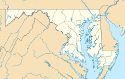

Coordinates: 39°41′44″N 78°52′47″W / 39.69556°N 78.87972°WCoordinates: 39°41′44″N 78°52′47″W / 39.69556°N 78.87972°W Country United States State Maryland County Allegany Elevation 1,234 ft (376 m) Population (2000) – Total 2,272 Time zone Eastern (EST) (UTC-5) – Summer (DST) EDT (UTC-4) ZIP codes FIPS code GNIS feature ID Mount Savage is an unincorporated community in Allegany County, Maryland, United States. A small blue-collar community, Mount Savage lies at the base of Big Savage Mountain in the Allegheny Mountains, between the cities of Frostburg and Cumberland. It began as a small farming settlement in the mid-19th century, but it was not until 1844 that the region was put on the nation's map with the pressing of the first iron rail in the United States. After this claim to fame, Mount Savage became the fifth largest city in Maryland. Named as the headquarters for the Mount Savage Railroad and later the Cumberland and Pennsylvania Railroad, the area was deemed an industrial center. In addition to the rail businesses, Mount Savage attracted a foundry, two brick refractories, and several local merchants. In this company town, the industries shaped the economy and topography of Mount Savage, building housing for workers and donating land for schools, churches, and other public buildings. It was a cultural melting pot attracting English businessmen and Irish, Scottish, Welsh, Italian, and German workers. With this diverse mix of cultures, the identity of Mount Savage was molded into a close-knit community. Despite the loss of the industries to the region, Mount Savage continues to celebrate its hard-working traditions. The Mount Savage Historic District was listed on the National Register of Historic Places in 1983.[1]
Contents
Early history
The name origin of Mount Savage is derived from a land surveyor, Thomas Savage, who happened to be traveling through the area in 1736.[2] The Archibald Arnold family later settled "Arnold's Settlement," more commonly known today as "Mount Savage," around 1774.[3] The town is the oldest in Allegany County to have a group of the same family to pioneer a town.[4] The Arnolds were known to be Catholic farmers originating from Southern Maryland.[5]:1 The Arnold family settled northeast of the current town, along a Native American Trail which was known as "Turkey Foot Road." The Arnolds established a hotel, "Arnold's Hotel," which welcomed the intrigued pioneers who were heading out west and towards the Ohio River Valley. They also had a self-sustaining farm which became part of the present-day Glen Savage Dairy Farm.[5]:1 The traditional site of the hotel is along an 1804 alteration to the Turkey Foot Road.[6] The Arnold family eventually owned most of the land of the present day Mt. Savage, Archibald sometimes purchasing 1,000 acres (4.0 km2) at a time.[5]:1 Some areas of land that Arnold purchased were documented only as "Move About," "Tomahawk" and "Durbin's Neglect."[4] In the early 19th century Mt. Savage was primarily a self-sufficient farming community with no real need to embark onto enterprises with neighboring towns or industries. Mt. Savage was the only town west of Cumberland with a Catholic church, so many families from neighboring states and towns traveled there for Mass.[5]:2 Upon completion of the National Road, settlers headed west by the thousands, flooding the Cumberland-Mt. Savage area and calling attention to Mt. Savage's mineral wealth.
Industrial history
The Maryland and New York Iron and Coal Company was incorporated in 1837. This important company was established by an Englishman, Benjamin Howell, who was one of the many curious travelers along the National Road. The company built the Mount Savage Iron Works, which utilized the iron ore that was abundant in the Mt. Savage area. Following the construction of blast furnaces in 1839, the company built the Mount Savage Railroad in 1844 to connect the town to Cumberland and with the Baltimore and Ohio Railroad (B&O). The company produced about 200 tons of iron a week in 1845.[5]:3 The Mount Savage works was the only company in America to manufacture heavy railroad iron at that time. With the flourishing industry upon Mt. Savage, clay, brick, coal and locomotives were also being manufactured and transported to neighboring towns and states by way of the new railroad system. The most prosperous coal mines were the Eckhart Mines, located right outside Mt. Savage, which produced bituminous coal. The Mt. Savage railroad system was now the main supplier to the B&O as well as the Chesapeake and Ohio Canal. By 1852 the iron works was considered to be the largest in the United States.[7] By 1864, the Union Mining Company was established in Allegany County. This company controlled most of the clay and brick exports. Little Mt. Savage had officially grown into a legendary, American industrial center.
Demographics
As of the 2000 census,[8] there were 2272 people in 886 households living within the boundaries of Mount Savage. 679 of those were family households. The racial makeup of Mount Savage was 99.1% White, 0.3% African American, 0% Native American, 0.2% Asian, 0% Pacific Islander, and 0.3% other races. Hispanic or Latino of any race were 0.5% of the population.
There were 886 households out of which 32.6% had children under the age of 18 living with them, 60.3% were married couples living together, 11.7% had a female householder with no husband present and 23.4% were non-family households. 20.2% of all households were made up of individuals and 10.8% had someone living alone who was 65 years or older. The average household size was 2.56 and the average family size was 2.94
In Mount Savage the population was spread out with 26.1% below the age of 20, 32.5% from 20 to 44, 25.2% from 45 to 64, and 16.2% who were 65 and older. The median age was 40. 48.1% of the population was male and 51.9% of the population was female.
In 2000, the median household income was $33,047 and the median household income for a family was $36,791. The median income for a male was $27,829 verses $21,083 for females. The per capita income for Mount Savage was $16,073. 10.1% of families and 21.% of the population were below the poverty line, including 15.6% of those under the age of 18 and 11.1% of those 65 year and older.
Geography
The elevation is 1,234 feet (376 m).
Historic sites and museums
- Mount Savage Museum & Historical Park
- Union Mining Company Office Building
- C&P Railroad Office building
- Remains of the Iron Furnace where the First Iron Rail was Rolled.
Footnotes
- ^ "National Register Information System". National Register of Historic Places. National Park Service. 2008-04-15. http://nrhp.focus.nps.gov/natreg/docs/All_Data.html.
- ^ Paul, Amanda (2004). Mount Savage. Charleston, SC: Arcadia. p. 9. ISBN 9780738516806. http://books.google.com/books?id=6orIk3ak45UC&lpg=PP1&pg=PP1#v=onepage&q=&f=false.
- ^ ”The United States Catholic Magazine and Monthly Review.”, January 1844
- ^ a b Anonymous. "Arnold's Settlement." Heritage Press. Vol. 1, No. 8 (1972), p. 1.
- ^ a b c d e Charles Carney. "The History of Mount Savage." University of Maryland, May 1967.
- ^ L. Dietle & M. McKenzie. “In Search of the Turkey Foot Road.” Mount Savage Historical Society, 2010.
- ^ "Opening of the Mount Savage Railroad Extended" (PDF). New York Times. 1852-09-28. http://query.nytimes.com/mem/archive-free/pdf?res=9A0DE2DD1231E13BBC4051DFBF668389649FDE. Retrieved 2010-01-02.
- ^ ZIP 21545 2000 census data
See also
- Mount Savage Historic District
- Eckhart Mines, Maryland
- Cumberland Area Regional Businesses
Further reading
- Mount Savage Historical Society. "Mount Savage, Maryland: Home of the first iron rail rolled in America"
- Mount Savage Historical Society. "History of Union Mining Company"
External links
Municipalities and communities of Allegany County, Maryland Cities 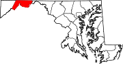
Towns Barton | Lonaconing | Luke | Midland | Westernport
CDPs Other
communitiesAmcelle | Barrelville | Bel Air | Bellegrove | Bier | Borden Shaft | Bowling Green | Carlos | Clarysville | Corriganville | Cresaptown | Danville | Dawson | Detmold | Dickens | Eckhart Mines | Ellerslie | Evitts Creek | Flintstone | Franklin | George's Creek | Klondike | Little Orleans | McCoole | McKenzie | Mexico | Midlothian | Moscow | Mount Savage | Narrows Park | Nikep | North Branch | Oldtown | Pekin | Pinto | Pleasant Valley | Potomac Park | Rawlings | Spring Gap | Town Creek | Vale Summit | Woodland | Zihlman
Categories:- Populated places in Allegany County, Maryland
- Populated places in the Cumberland, MD-WV MSA
- Cumberland, MD-WV MSA
- Early American industrial centers
- Unincorporated communities in Maryland


Wikimedia Foundation. 2010.