- Bel Air, Harford County, Maryland
Infobox Settlement
official_name = Bel Air, Maryland
nickname =
motto =
imagesize =
image_caption =
image_
imagesize =
image_caption =
image_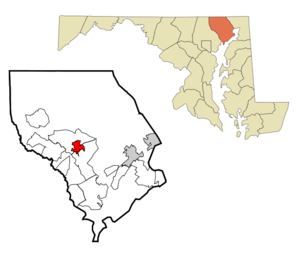
mapsize = 250px
map_caption = Location inMaryland
subdivision_type = County
subdivision_name = Harford County
leader_title =Mayor
leader_name = Terence O. Hanley
established_title = Founded
established_title2 = Incorporated
established_date = 1856
established_date2 = 1945
area_magnitude =
area_total_km2 = 7.3
area_total_sq_mi = 2.8
area_land_km2 = 7.3
area_land_sq_mi = 2.8
area_water_km2 = 0
area_water_sq_mi = 0
area_water_percent = 0.0
area_urban_km2 =
area_urban_sq_mi =
area_metro_km2 =
area_metro_sq_mi =
population_as_of = 2000
population_note =
population_total = 10080
population_metro = 72000
population_urban =
population_density_km2 = 1385.0
population_density_sq_mi =
timezone = Eastern
utc_offset = -5
timezone_DST = Eastern
utc_offset_DST = -4
latd=39 |latm=32 |lats=12 |latNS= N
longd=76 |longm=20 |longs=54 |longEW= W
elevation_m =
elevation_ft =
website = [http://www.belair.bel-air.md.us www.belair.bel-air.md.us]
footnotes = Bel Air is the county seat of Harford County,Maryland ,United States . The population was 10,080 at the 2000 census. Bel Air formally refers to the town proper; if Bel Air North and Bel Air South were included in the designation, the population would be about 75,000.Bel Air is Harford County's commercial and nightlife center, with more retail stores and restaurants than other towns in the county.
Geography
Bel Air is located at coor dms|39|32|12|N|76|20|54|W|city (39.536707, -76.348280)GR|1.
According to the
United States Census Bureau , the town has a total area of 2.8square mile s (7.3km² ), all of it land.Transportation
Bel Air is located on U.S. 1, and several miles north of I-95. Route 1 has both a bypass around Bel Air and Hickory, and a business route snaking through downtown. Both are connected by
Maryland Route 24 to I-95 in Edgewood.The
Maryland and Pennsylvania Railroad ("Ma and Pa") ran through town in the early part of the 20th century, but the tracks have since been dismantled. TheMa and Pa Trail walking trail runs its course, creating shortcuts through wooded portions of town, around Heavenly Waters Park. The main link runs from Williams Street downtown, and east to the Harford County Equestrian Center. A second link already built in Forest Hill was planned to merge with the main trail, but as of late 2006 the link has not been constructed.A six-level
parking garage is located on Hickory Avenue downtown, with plans to build a second parking garage elsewhere in town.Demographics
As of the
census of 2000, there were 10,080 people, 4,235 households, and 2,511 families residing in the town. Thepopulation density was 3,583.7 people per square mile (1,385.0/km²). There were 4,444 housing units at an average density of 1,580.0/sq mi (610.6/km²). The racial makeup of the town was 92.82% White, 4.38% African American, 0.20% Native American, 1.41% Asian, 0.03% Pacific Islander, 0.27% from other races, and 0.90% from two or more races. Hispanic or Latino of any race were 1.22% of the population.There were 4,235 households out of which 28.2% had children under the age of 18 living with them, 45.2% were married couples living together, 10.4% had a female householder with no husband present, and 40.7% were non-families. 35.2% of all households were made up of individuals and 14.8% had someone living alone who was 65 years of age or older. The average household size was 2.25 and the average family size was 2.94.
In the town the population was spread out with 22.1% under the age of 18, 8.2% from 18 to 24, 30.5% from 25 to 44, 21.8% from 45 to 64, and 17.4% who were 65 years of age or older. The median age was 39 years. For every 100 females there were 94.0 males. For every 100 females age 18 and over, there were 91.1 males.
The median income for a household in the town was $44,135, and the median income for a family was $58,299. Males had a median income of $42,412 versus $29,207 for females. The
per capita income for the town was $23,737. 6.4% of the population and 4.0% of families were below the poverty line. Out of the total people living in poverty, 7.6% are under the age of 18 and 6.5% are 65 or older.Property taxes
[http://marylandlandtax.org/calculator/mapping/report?county_id=13&jurisdiction_id=13300&addr=&j=Municipal&class_id=1&prinres=H&census_tract=&submit=Submit+Query Property Tax Information]
History
Bel Air's identity has gone through several incarnations since 1780. Landowner Aquilla Scott planned the town on a portion of inherited land known as "Scott's Improvement Enlarged," which he called "Scott's Old Fields." Four years later, the town had expanded as local politicians, merchants and innkeepers purchased lots from Scott, and the county commissioners decided to change its name to the more appealing "Belle Aire." In his deeds, Scott dropped one letter, renaming the town, "Bell Aire." Around 1798, court records decided to drop two more letters and "Bel Air" was born.
During this period, Bel Air began to show strong communal legs. In 1782, just two years after its conception, it became Harford's county seat, and Daniel Scott (Aquilla's son) started building a courthouse on Main Street, which is still the town's main road. In the late 18th century, Bel Air's city limits encompassed both sides of Main Street, but the days following the Civil War ignited a building and land-development boom that remains in full swing today.
Several fires swept through the downtown area in the early 20th century, notably in 1900 and 1942. In 1972, a fire decimated the street, causing $2 million worth of damage.
In 1970, notorious
Black Panthers memberH. Rap Brown was on a safety-relocation trial in the courthouse for instigating a riot after a rally in Cambridge. Radicals sent to eliminate Brown drove to Bel Air in a car laden with plastic explosives, intending to take down the courthouse, but the car exploded too early, leaving a crater in the road less than a mile away. The trial was eventually moved again.The town once boasted a regionally featured horse track, which stood where the Harford Mall is today.
Noted natives and residents
*
John Wilkes Booth -- American stage actor and assassin of PresidentAbraham Lincoln .
*Edwin Thomas Booth -- Brother ofJohn Wilkes Booth , son ofJunius Brutus Booth . Considered one of the greatest Shakespearean actors of the 1800s.
*Augustus Bradford -- 32nd Governor of Maryland, 1862 - 1866.
*Cigar -- Champion Racehorse
*Blaze Foster -- ActorThe Brave One, Wifey
*Julienne Irwin -- contestant inAmerica's Got Talent , a nationally broadcast talent show
*Kimmie Meisner -- Figure Skating Olympian, 2006 World Champion & 2007 U.S. Figure Skating Champion
*Jay Witasick -- Pitcher forTampa Bay Rays Schools
Colleges and universities
*
Harford Community College Primary and secondary schools
Public Schools
The
Harford County Public Schools serve Bel Air, in addition to the rest of the county.Elementary schools
Bel Air Elementary School, Fountain Green Elementary School, Hickory Elementary School, Homestead/Wakefield Elementary School, John Archer School, Prospect Mill Elementary School, Ring Factory Elementary School, Forest Lakes Elementary School
Middle schools
Bel Air Middle School , Southampton Middle School, Patterson Mill Middle School, Fallston Middle SchoolHigh schools
Bel Air High School,
C. Milton Wright High School ,Harford Technical High School (by application only),Patterson Mill High School ,Fallston High School Private schools
* St. Margaret's School
* John Carroll School
*Harford Day School
*Bel Forest Academy Small airports
The two small plane airports in the metropolitan area are:
Forest Hill [http://www.topozone.com/map.asp?lat=39.58&lon=-76.375]
Fallston Airport [http://www.topozone.com/map.asp?lat=39.50139&lon=-76.41139]
Wikimedia Foundation. 2010.