- National Register of Historic Places listings in Harford County, Maryland
-
 Location of Harford County in Maryland
This is a list of the National Register of Historic Places listings in Harford County, Maryland.
This is intended to be a complete list of the properties and districts on the National Register of Historic Places in Harford County, Maryland, United States. Latitude and longitude coordinates are provided for many National Register properties and districts; these locations may be seen together in a Google map.[1]
There are 79 properties and districts listed on the National Register in the county, including 1 National Historic Landmark.
Contents: Counties in Maryland Allegany - Anne Arundel - Baltimore (city) - Baltimore County - Calvert - Caroline - Carroll - Cecil - Charles - Dorchester - Frederick - Garrett - Harford - Howard - Kent - Montgomery - Prince George's - Queen Anne's - Somerset - St. Mary's - Talbot - Washington - Wicomico - Worcester -
- This National Park Service list is complete through NPS recent listings posted November 10, 2011.[2]
Current listings
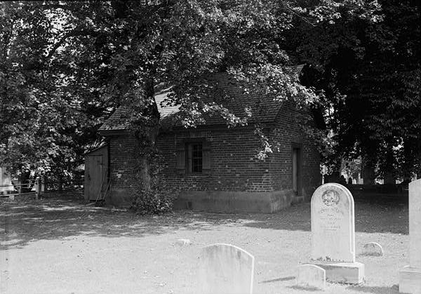
[3] Landmark name [4] Image Date listed Location City or town Summary 1 James B. Baker House December 10, 1982 452 W. Bel Air Ave.
39°30′45″N 76°10′25″W / 39.5125°N 76.173611°WAberdeen 2 Bel Air Armory September 25, 1985 N. Main St.
39°32′15″N 76°21′01″W / 39.5375°N 76.350278°WBel Air 3 Bel Air Courthouse Historic District July 25, 1985 Office, Courtland, and Main Sts.
39°32′08″N 76°20′59″W / 39.535556°N 76.349722°WBel Air 4 Berkley Crossroads Historic District July 17, 2003 Berkley Road and Castleton Rd.
39°39′46″N 76°12′19″W / 39.662778°N 76.205278°WDarlington 5 Berkley School July 22, 1988 Castleton Rd., Maryland Route 623
39°39′29″N 76°12′21″W / 39.658056°N 76.205833°WDarlington 6 Best Endeavor December 28, 1990 1612 Calvary Rd.
39°30′12″N 76°15′55″W / 39.503333°N 76.265278°WChurchville 7 Bon Air November 10, 1977 Laura Brook Rd.
39°30′28″N 76°25′00″W / 39.507778°N 76.416667°WFallston 8 Broad Creek Soapstone Quarries 
May 12, 1975 Address Restricted Whiteford 9 Broom's Bloom December 19, 1991 1616 S. Fountain Green Rd.
39°30′44″N 76°17′01″W / 39.512222°N 76.283611°WBel Air 10 Chestnut Ridge December 1, 1983 3850 W. Chapel Rd.
39°33′34″N 76°10′53″W / 39.559444°N 76.181389°WAberdeen 11 Church of the Holy Trinity December 27, 2002 2929 Level Rd.
39°33′39″N 76°14′48″W / 39.560833°N 76.246667°WChurchville 12 Churchville Presbyterian Church August 21, 1986 Intersection of Maryland Routes 22 and 136
39°33′34″N 76°15′10″W / 39.559444°N 76.252778°WChurchville 13 D. H. Springhouse May 8, 1973 About 6 miles (9.7 km) northeast of Bel Air on Sandy Hook Rd.
39°37′17″N 76°18′37″W / 39.621389°N 76.310278°WBel Air 14 Darlington Historic District September 10, 1987 Main St., Shuresville Rd., Quaker Ln., Richmond Ave., and Trappe Church Rd.
39°38′23″N 76°12′03″W / 39.639722°N 76.200833°WDarlington 15 Deer Creek Friends Meetinghouse 
April 23, 1980 Maryland Route 161
39°38′46″N 76°12′19″W / 39.646111°N 76.205278°WDarlington 16 Dibb House March 18, 1980 East of Bel Air at 1737 Churchville Rd.
39°32′56″N 76°18′11″W / 39.548889°N 76.303056°WBel Air 17 Fair Meadows November 25, 1980 Creswell Rd.
39°29′57″N 76°15′58″W / 39.499167°N 76.266111°WCreswell 18 Finney Houses Historic District June 16, 1989 Glenville Rd. near its junction with Maryland Route 155
39°34′20″N 76°14′20″W / 39.572222°N 76.238889°WChurchville 19 Gladden Farm May 28, 1993 3881 Rocks Station Rd.
39°38′27″N 76°24′22″W / 39.640833°N 76.406111°WStreet 20 Graham-Crocker House March 17, 1980 30 N. Main St.
39°32′12″N 76°21′01″W / 39.536667°N 76.350278°WBel Air 21 Gray Gables March 27, 1986 4528 Conowingo Rd.
39°39′13″N 76°13′15″W / 39.653611°N 76.220833°WDarlington 22 Graystone Lodge August 30, 2007 1118 Bel Air Rd.
39°30′44″N 76°22′24″W / 39.512222°N 76.373333°WBel Air 23 Griffith House November 14, 1978 Southwest of Aberdeen at 1120 Old Philadelphia Rd.
39°29′18″N 76°11′41″W / 39.488333°N 76.194722°WAberdeen 24 Gunpowder Meetinghouse June 5, 1974 Magnolia Rd.
39°24′13″N 76°18′29″W / 39.403611°N 76.308056°WAberdeen Proving Ground 25 Harford Furnace Historic District July 18, 1990 Creswell and Goat Hill Rds.
39°29′36″N 76°15′38″W / 39.493333°N 76.260556°WBel Air 26 Harford National Bank March 20, 1980 Wall and Courtland Sts.
39°32′07″N 76°20′59″W / 39.535278°N 76.349722°WBel Air 27 Havre de Grace Historic District March 25, 1982 Roughly bounded by Chesapeake Bay, the Susquehanna River, U.S. Route 40, and Stokes, Juniata, and Superior Sts.
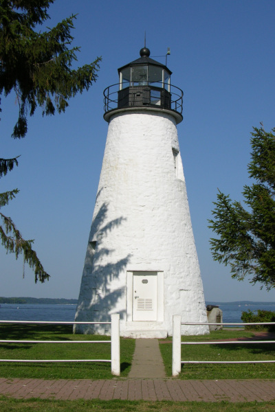
39°32′49″N 76°05′29″W / 39.546944°N 76.091389°WHavre de Grace 28 Havre de Grace Lighthouse 
April 2, 1976 Concord and Lafayette Sts.
39°32′26″N 76°05′07″W / 39.540556°N 76.085278°WHavre de Grace 29 Hays House January 3, 1980 324 S. Kenmore Ave.
39°31′57″N 76°20′52″W / 39.5325°N 76.347778°WBel Air 30 Hays-Heighe House February 11, 1972 401 Thomas Run Rd.
39°33′37″N 76°17′00″W / 39.560278°N 76.283333°WBel Air 31 Heighe House November 1, 1990 Junction of Southampton and Moores Mill Rds.
39°33′00″N 76°20′17″W / 39.55°N 76.338056°WBel Air 32 Hidden Valley Farm January 17, 1983 2916 Green Rd.
39°31′35″N 76°29′59″W / 39.526389°N 76.499722°WBaldwin 33 Husband Flint Mill Site June 18, 1975 Address Restricted Kalmia 34 Ivory Mills August 29, 1997 4916 Harford Creamery Rd.
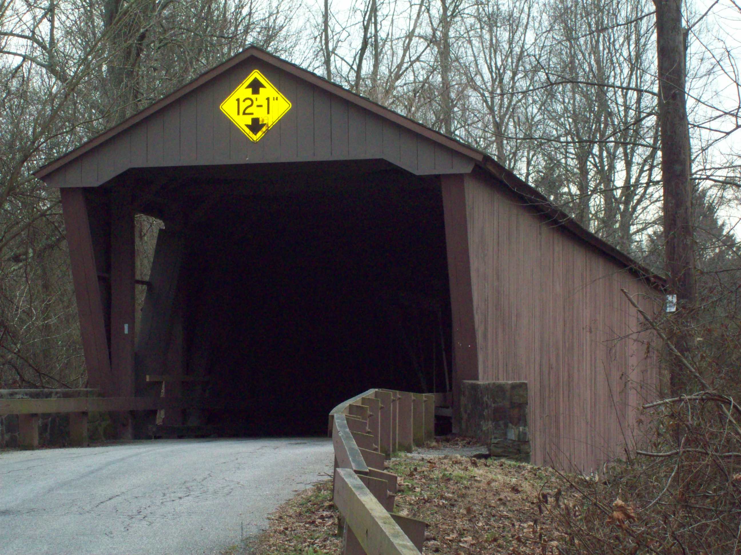
39°40′28″N 76°32′15″W / 39.674444°N 76.5375°WWhite Hall 35 Jericho Covered Bridge 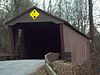
September 13, 1978 East of Kingsville on Franklinville Rd.
39°27′34″N 76°23′16″W / 39.459444°N 76.387778°WJerusalem 36 Jerusalem Mill Village 
August 20, 1987 Jerusalem and Jericho Rds.
39°27′41″N 76°23′23″W / 39.461389°N 76.389722°WJerusalem 37 Joshua's Meadows December 21, 1982 300 N. Tollgate Rd.
39°31′18″N 76°21′54″W / 39.521667°N 76.365°WBel Air 38 Ladew Topiary Gardens and House 
May 13, 1976 0.5 miles (0.80 km) northeast of Taylor on Maryland Route 146
39°34′52″N 76°30′44″W / 39.581111°N 76.512222°WTaylor Historic home and 1930s topiary gardens on a 250-acre (1.0 km2) estate. 39 Liriodendron September 27, 1980 501 and 502 W. Gordon St.
39°32′01″N 76°21′40″W / 39.533611°N 76.361111°WBel Air 40 Little Falls Meetinghouse May 7, 1980 Old Fallston Rd.
39°30′33″N 76°24′23″W / 39.509167°N 76.406389°WFallston 41 Lower Deer Creek Valley Historic District November 3, 1993 Roughly bounded by the Susquehanna River, Maryland Route 543, and Harmony, Church, and Trappe Rds.
39°36′43″N 76°14′05″W / 39.611944°N 76.234722°WDarlington 42 MARTHA LEWIS (skipjack) December 11, 2008 Millard Tydings Memorial Park, Commerce St. at S. Strawberry La.
39°32′18″N 76°05′25″W / 39.53839°N 76.09023°WHavre de Grace Chesapeake Bay Skipjack Fleet TR 43 McComas Institute September 8, 1980 North of Joppa on Singer Rd.
39°28′02″N 76°21′30″W / 39.467222°N 76.358333°WJoppa 44 Medical Hall Historic District August 28, 1973 West of Churchville off Maryland Route 154
39°34′24″N 76°16′20″W / 39.573333°N 76.272222°WChurchville 45 Mill Green Historic District June 3, 1993 Junction of Mill Green and Prospect Rds.
39°39′50″N 76°19′34″W / 39.663889°N 76.326111°WStreet 46 Mount Adams October 27, 1988 1912 Fountain Green Rd.
39°30′27″N 76°16′52″W / 39.5075°N 76.281111°WBel Air 47 My Lady's Manor April 15, 1978 Maryland Route 138
39°35′15″N 76°34′16″W / 39.5875°N 76.571111°WJarrettsville 48 Nelson-Reardon-Kennard House April 15, 1991 3604 Philadelphia Rd.
39°27′51″N 76°16′45″W / 39.464167°N 76.279167°WAbingdon 49 Norris-Stirling House May 30, 1979 Ring Factory Rd.
39°29′26″N 76°21′31″W / 39.490556°N 76.358611°WBel Air 50 Odd Fellows Lodge August 22, 1975 21 Pennsylvania Ave.
39°32′13″N 76°20′56″W / 39.536944°N 76.348889°WBel Air 51 Old Joppa Site August 24, 1979 Address Restricted Joppatowne 52 Olney July 9, 1987 1001 Old Joppa Rd.
39°28′39″N 76°22′11″W / 39.4775°N 76.369722°WJoppa 53 Pooles Island Lighthouse 
February 19, 1997 Northwestern portion of Poole's Island and southeast of Rickett Point at Aberdeen Proving Ground Edgewood 54 Poplar Hill May 28, 1976 115 Poplar Hill Rd.
39°29′46″N 76°10′17″W / 39.496111°N 76.171389°WAberdeen 55 Presbury Meetinghouse May 23, 1974 Austin and Parrish Rds.
39°23′15″N 76°18′24″W / 39.3875°N 76.306667°WAberdeen Proving Ground 56 Priest Neal's Mass House and Mill Site March 15, 1990 2618 Cool Spring Rd.
39°35′55″N 76°15′33″W / 39.598611°N 76.259167°WBel Air 57 Proctor House March 23, 1990 54 E. Gordon St.
39°32′24″N 76°21′06″W / 39.54°N 76.351667°WBel Air 58 Rigbie House August 14, 1973 Southeast of Berkley off Maryland Route 623
39°39′37″N 76°12′12″W / 39.660278°N 76.203333°WBerkley 59 Rockdale June 30, 1982 North of Fallston at 1724 Carrs Mill Rd.
39°32′03″N 76°24′19″W / 39.534167°N 76.405278°WFallston 60 St. George's Parish Vestry House 
March 26, 1976 1522 Perryman Rd.
39°28′27″N 76°12′16″W / 39.474167°N 76.204444°WPerryman 61 St. Ignatius Church April 16, 1974 533 E. Jarrettsville Rd.
39°34′25″N 76°21′19″W / 39.573611°N 76.355278°WForest Hill 62 St. Mary's Church March 30, 1973 South of Emmorton on Maryland Route 24
39°29′16″N 76°19′04″W / 39.487778°N 76.317778°WEmmorton 63 Silver Houses Historic District September 7, 1984 South of Darlington on Maryland Route 161
39°36′22″N 76°11′47″W / 39.606111°N 76.196389°WDarlington 64 Sion Hill 
April 30, 1990 2026 Level Rd.
39°33′42″N 76°07′32″W / 39.561667°N 76.125556°WHavre de Grace Historic home of U.S. Navy officers including Commodore John Rodgers. 65 Slate Ridge School 
July 16, 1987 Old Pylesville Rd.
39°42′45″N 76°20′25″W / 39.7125°N 76.340278°WWhiteford 66 Sophia's Dairy September 20, 1973 Southwest of Aberdeen off U.S. Route 40
39°28′24″N 76°14′03″W / 39.473333°N 76.234167°WAberdeen 67 Southern Terminal, Susquehanna and Tidewater Canal May 28, 1976 North of Erie St. between Conesteo St. and the Susquehanna River
39°33′24″N 76°05′41″W / 39.556667°N 76.094722°WHavre de Grace 68 Col. John Streett House July 16, 1990 Northern side of Holy Cross Rd. east of Deer Creek
39°39′27″N 76°26′04″W / 39.6575°N 76.434444°WStreet 69 Swansbury July 15, 1994 Beard's Hill Rd. Extended, northeast of Aberdeen
39°31′18″N 76°09′11″W / 39.521667°N 76.153056°WAberdeen 70 Thomas Run Church 
January 3, 1978 Northeast of Bel Air off Maryland Route 136
39°35′32″N 76°17′34″W / 39.592222°N 76.292778°WBel Air 71 Tudor Hall March 14, 1973 Northeast of Bel Air off Maryland Route 22
39°33′15″N 76°18′11″W / 39.554167°N 76.303056°WBel Air 72 The Vineyard July 22, 1994 1201 Conowingo Rd. (U.S. Route 1)
39°33′56″N 76°20′34″W / 39.565556°N 76.342778°WBel Air 73 Webster's Forest September 1, 1983 500 Asbury Rd.
39°32′32″N 76°15′51″W / 39.542222°N 76.264167°WChurchville 74 Whitaker's Mill Historic District July 16, 1990 1210, 1212, and 1213 Whitaker Mill Rd.
39°29′51″N 76°21′15″W / 39.4975°N 76.354167°WJoppa 75 Whiteford-Cardiff Historic District November 15, 2005 Whiteford Rd., Platted Parry St., Quarry Rd., west of Main St.; split between Maryland and Pennsylvania
39°42′56″N 76°20′19″W / 39.715556°N 76.338611°WWhiteford 76 Wildfell September 20, 1973 Northwest of Darlington on U.S. Route 1
39°39′04″N 76°13′11″W / 39.651111°N 76.219722°WDarlington 77 Winsted September 19, 1979 North of Aberdeen at 3844 W. Chapel Rd.
39°33′36″N 76°10′54″W / 39.56°N 76.181667°WAberdeen 78 Woodside November 1, 1979 Northwest of Abingdon at 400 Singer Rd
39°28′47″N 76°19′22″W / 39.479722°N 76.322778°WAbingdon 79 Woodview October 25, 1990 1236 Somerville Rd.
39°29′47″N 76°20′56″W / 39.496389°N 76.348889°WBel Air See also
- List of National Historic Landmarks in Maryland
- National Register of Historic Places listings in Maryland
References
- ^ The latitude and longitude information provided in this table was derived originally from the National Register Information System, which has been found to be fairly accurate for about 99% of listings. For about 1% of NRIS original coordinates, experience has shown that one or both coordinates are typos or otherwise extremely far off; some corrections may have been made. A more subtle problem causes many locations to be off by up to 150 yards, depending on location in the country: most NRIS coordinates were derived from tracing out latitude and longitudes off of USGS topographical quadrant maps created under the North American Datum of 1927, which differs from the current, highly accurate WGS84 GPS system used by Google maps. Chicago is about right, but NRIS longitudes in Washington are higher by about 4.5 seconds, and are lower by about 2.0 seconds in Maine. Latitudes differ by about 1.0 second in Florida. Some locations in this table may have been corrected to current GPS standards.
- ^ "National Register of Historic Places: Weekly List Actions". National Park Service, United States Department of the Interior. Retrieved on November 10, 2011.
- ^ Numbers represent an ordering by significant words. Various colorings, defined here, differentiate National Historic Landmark sites and National Register of Historic Places Districts from other NRHP buildings, structures, sites or objects.
- ^ "National Register Information System". National Register of Historic Places. National Park Service. . http://nrhp.focus.nps.gov/natreg/docs/All_Data.html.
U.S. National Register of Historic Places in Maryland Lists by county Allegany • Anne Arundel • Baltimore County • Calvert • Caroline • Carroll • Cecil • Charles • Dorchester • Frederick • Garrett • Harford • Howard • Kent • Montgomery • Prince George's • Queen Anne's • Somerset • St. Mary's • Talbot • Washington • Wicomico • Worcester

Lists by city Other lists Municipalities and communities of Harford County, Maryland Cities 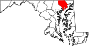
Town CDPs Aberdeen Proving Ground | Bel Air North | Bel Air South | Edgewood | Fallston | Jarrettsville | Joppatowne | Perryman | Pleasant Hills | Riverside
Other
communitiesAbingdon | Benson | Berkley | Cardiff | Castleton | Churchville | Clayton | Creswell | Darlington | Dublin | Emmorton | Fairview | Forest Hill | Glenwood | Joppatowne | Hopewell Village | Joppa | Kalmia | Norrisville | Pylesville | Street | Taylor | Whiteford
Categories:- National Register of Historic Places in Maryland by county
- Harford County, Maryland
-


Wikimedia Foundation. 2010.