National Register of Historic Places listings in Howard County, Maryland

National Register of Historic Places listings in Howard County, Maryland
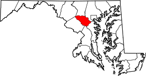
Location of Howard County in Maryland

This is a list of the National Register of Historic Places listings in Howard County, Maryland.

This is intended to be a complete list of the properties and districts on the National Register of Historic Places in Howard County, Maryland, United States. Latitude and longitude coordinates are provided for many National Register properties and districts; these locations may be seen together in a Google map.[1]

There are 37 properties and districts listed on the National Register in the county, including 4 National Historic Landmarks.

Contents: Counties in Maryland
Allegany - Anne Arundel - Baltimore (city) - Baltimore County - Calvert - Caroline - Carroll - Cecil - Charles - Dorchester - Frederick - Garrett - Harford - Howard - Kent - Montgomery - Prince George's - Queen Anne's - Somerset - St. Mary's - Talbot - Washington - Wicomico - Worcester
This National Park Service list is complete through NPS recent listings posted November 10, 2011.[2]
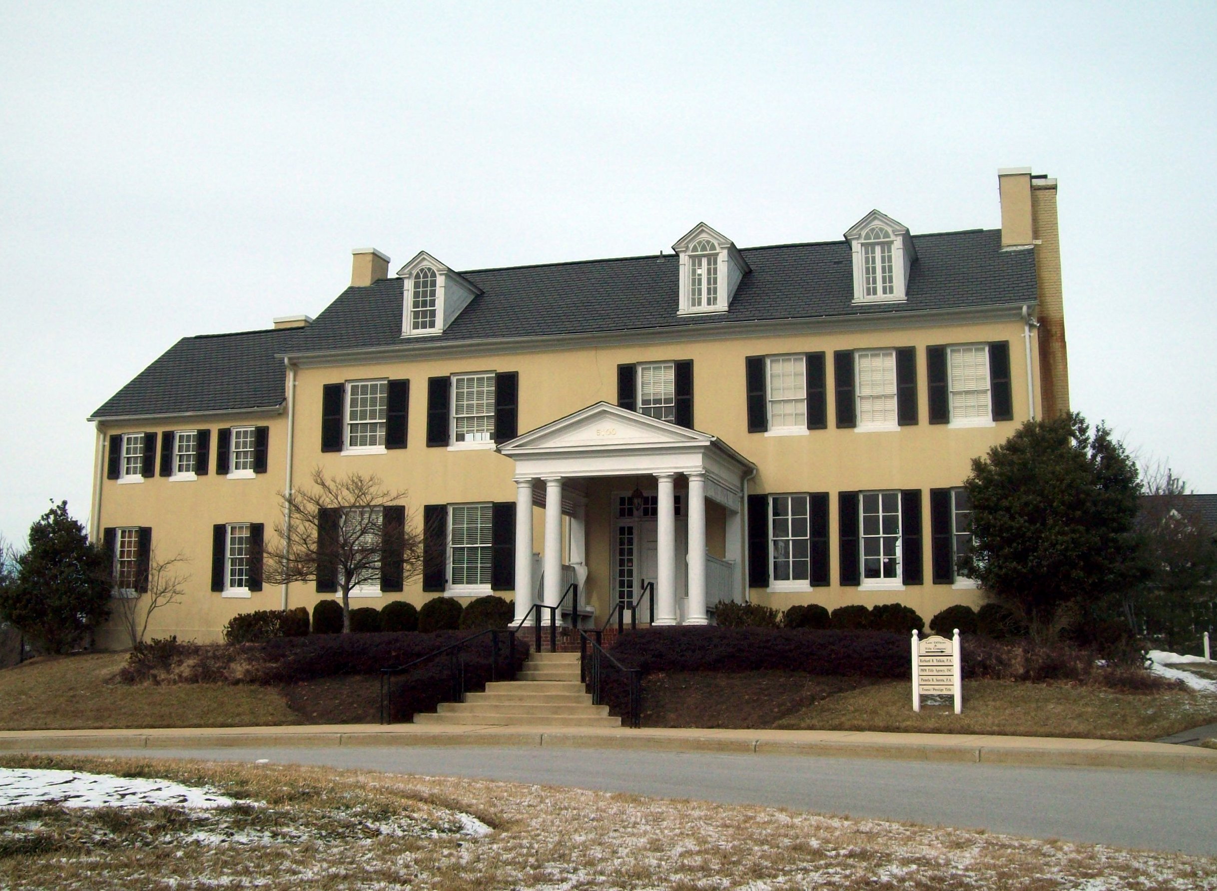
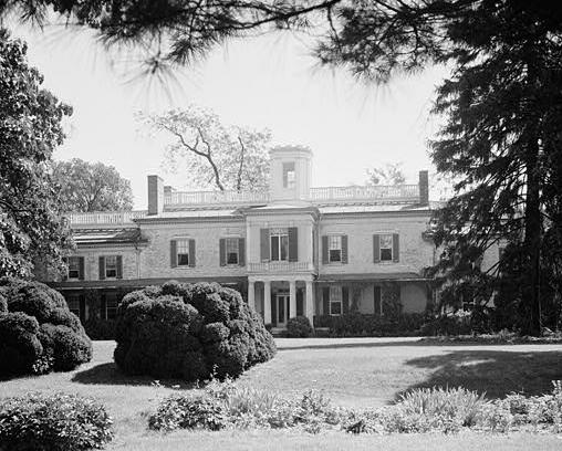
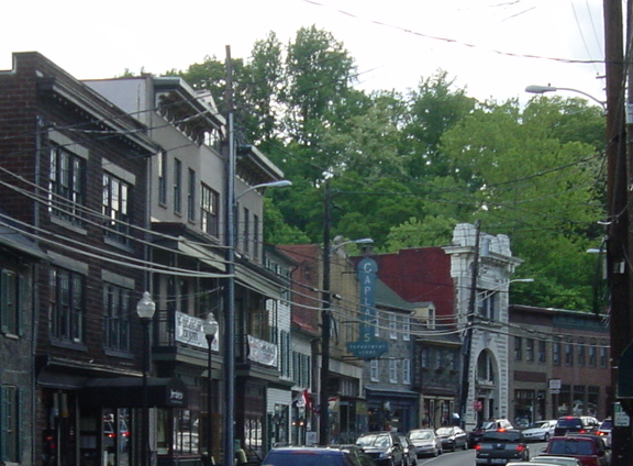
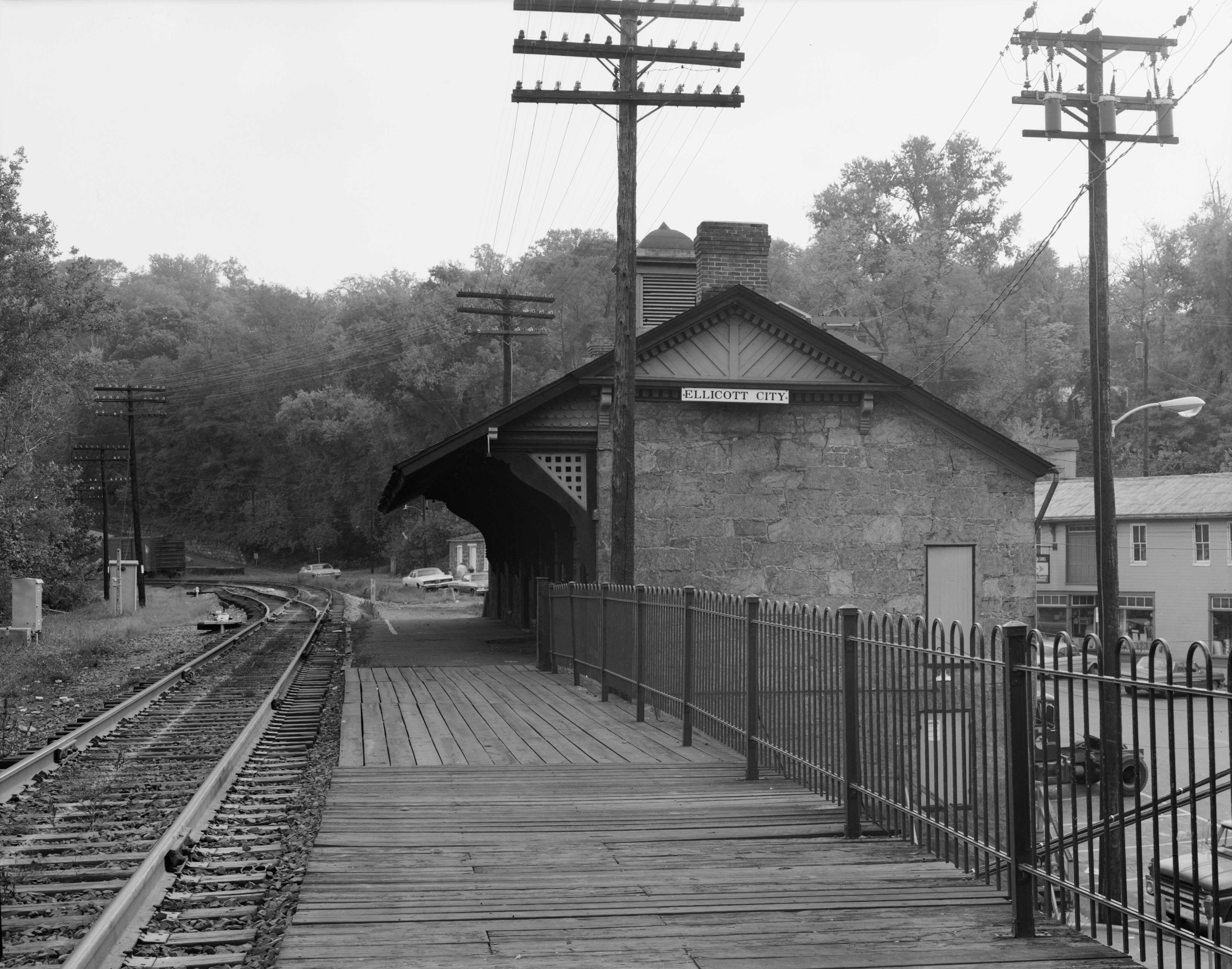

Current listings

[3] Landmark name [4] Image Date listed Location City or town Summary
1 Commodore Joshua Barney House 01978-08-25August 25, 1978 North of Savage at 7912 Savage-Guilford Rd.
39°0917N 76°4954W / 39.154722°N 76.831667°W / 39.154722; -76.831667 (Commodore Joshua Barney House)
Savage
2 Bollman Suspension and Trussed Bridge
Bollman Suspension and Trussed Bridge
01972-10-18October 18, 1972 Spanning the Little Patuxent River near the junction of Gorman Rd. and Foundry St.
39°0805N 76°4931W / 39.134722°N 76.825278°W / 39.134722; -76.825278 (Bollman Suspension and Trussed Bridge)
Savage
3 Brick House on the Pike 01996-01-11January 11, 1996 9465 Baltimore National Pike
39°1645N 76°5038W / 39.279167°N 76.843889°W / 39.279167; -76.843889 (Brick House on the Pike)
Ellicott City
4 Burleigh
Burleigh
01982-11-30November 30, 1982 3950 White Rose Way
39°1545N 76°5204W / 39.262469°N 76.867878°W / 39.262469; -76.867878 (Burleigh)
Ellicott City Also known as Burleigh Manor
5 Cherry Grove, HO-1 02007-06-21June 21, 2007 2937 Jennings Chapel Rd.
39°1739N 77°0538W / 39.294272°N 77.093813°W / 39.294272; -77.093813 (Cherry Grove, HO-1)
Woodbine
6 Christ Church Guilford
Christ Church Guilford
01978-01-30January 30, 1978 North of Guilford at 6800 Oakland Mills Rd.
39°1104N 76°4941W / 39.184444°N 76.828056°W / 39.184444; -76.828056 (Christ Church Guilford)
Guilford
7 Curtis-Shipley Farmstead
Curtis-Shipley Farmstead
02006-12-12December 12, 2006 5771 Waterloo Rd.
39°1253N 76°4803W / 39.214722°N 76.800833°W / 39.214722; -76.800833 (Curtis-Shipley Farmstead)
Ellicott City
8 Daniels Mill
Daniels Mill
01973-04-11April 11, 1973 Daniels Rd.
39°1902N 76°4847W / 39.317222°N 76.813056°W / 39.317222; -76.813056 (Daniels Mill)
Daniels
9 Dorsey Hall
Dorsey Hall
02001-12-28December 28, 2001 5100 Dorsey Hall Dr.
39°1443N 76°5005W / 39.245278°N 76.834722°W / 39.245278; -76.834722 (Dorsey Hall)
Columbia
10 Doughoregan Manor
Doughoregan Manor
01971-11-11November 11, 1971 8 miles west of Ellicott City on Manor Lane
39°1637N 76°5325W / 39.276944°N 76.890278°W / 39.276944; -76.890278 (Doughoregan Manor)
Ellicott City
11 Elkridge Furnace Complex
Elkridge Furnace Complex
01990-06-28June 28, 1990 5730 and 5741-5745 Furnace Ave., 5735 Race Rd.
39°1247N 76°4212W / 39.213056°N 76.703333°W / 39.213056; -76.703333 (Elkridge Furnace Complex)
Elkridge
12 Ellicott City Historic District
Ellicott City Historic District
01978-07-31July 31, 1978 Maryland Route 144
39°1611N 76°4800W / 39.269722°N 76.8°W / 39.269722; -76.8 (Ellicott City Historic District)
Ellicott City
13 Ellicott City Station
Ellicott City Station
01968-11-24November 24, 1968 South of the Patapsco River Bridge
39°1602N 76°4743W / 39.267222°N 76.795278°W / 39.267222; -76.795278 (Ellicott City Station)
Ellicott City
14 Elmonte
Elmonte
01978-08-25August 25, 1978 9095 Furrow Avenue
39°1828N 76°4925W / 39.307778°N 76.823611°W / 39.307778; -76.823611 (Elmonte)
Ellicott City
15 Enniscorthy
Enniscorthy
01986-05-08May 8, 1986 3412 Folly Quarter Rd.
39°1642N 76°5412W / 39.278333°N 76.903333°W / 39.278333; -76.903333 (Enniscorthy)
Ellicott City
16 Glenelg Manor
Glenelg Manor
01983-02-03February 3, 1983 Southeast of Glenelg at 12793 Folly Quarter Road
39°1506N 76°5741W / 39.251667°N 76.961389°W / 39.251667; -76.961389 (Glenelg Manor)
Glenelg
17 Hobson's Choice 01984-09-13September 13, 1984 3145 Florence Rd.
39°1824N 77°0532W / 39.306667°N 77.092222°W / 39.306667; -77.092222 (Hobson's Choice)
Woodbine
18 The Lawn 01984-10-29October 29, 1984 6036 Old Lawyers Hill Rd.
39°1316N 76°4309W / 39.221111°N 76.719167°W / 39.221111; -76.719167 (The Lawn)
Elkridge
19 Lawyers Hill Historic District
Lawyers Hill Historic District
01993-09-23September 23, 1993 Area surrounding Lawyers Hill and Old Lawyers Hill Rds. and Elibank Dr.
39°1312N 76°4353W / 39.22°N 76.731389°W / 39.22; -76.731389 (Lawyers Hill Historic District)
Elkridge
20 Linnwood
Linnwood
02006-12-12December 12, 2006 2327 Daniels Rd.
39°1827N 76°4823W / 39.3075°N 76.806389°W / 39.3075; -76.806389 (Linnwood)
Ellicott City
21 MacAlpine
MacAlpine
02004-12-23December 23, 2004 3621 Macalpine Rd.
39°1615N 76°4946W / 39.270763°N 76.829497°W / 39.270763; -76.829497 (MacAlpine)
Ellicott City
22 Montrose
Montrose
02000-12-13December 13, 2000 13370 Brighton Dam Rd.
39°1204N 76°5839W / 39.201111°N 76.9775°W / 39.201111; -76.9775 (Montrose)
Clarksville
23 Old National Pike Milestones 01975-11-27November 27, 1975 U.S. Route 40, Alternate U.S. Route 40, and Scenic U.S. Route 40, and Maryland Routes 44 and 165
39°2513N 77°1601W / 39.420278°N 77.266944°W / 39.420278; -77.266944 (Old National Pike Milestones)
Lisbon
24 Patterson Viaduct Ruins
Patterson Viaduct Ruins
01976-06-03June 3, 1976 South of Catonsville at the Patapsco River
39°1500N 76°4551W / 39.25°N 76.764167°W / 39.25; -76.764167 (Patterson Viaduct Ruins)
Ilchester
25 Richland Farm
Richland Farm
02008-03-26March 26, 2008 4730 Sheppard Ln.
39°1440N 76°5645W / 39.244444°N 76.945833°W / 39.244444; -76.945833 (Richland Farm)
Clarksville
26 Roberts Inn
Roberts Inn
02006-08-02August 2, 2006 14610 Frederick Rd.
39°1927N 77°0112W / 39.324167°N 77.02°W / 39.324167; -77.02 (Roberts Inn)
Cooksville
27 Round About Hills
Round About Hills
02008-11-20November 20, 2008 15505 Cattail Oaks
39°1600N 77°0210W / 39.266667°N 77.036111°W / 39.266667; -77.036111 (Round About Hills)
Glenwood
28 Savage Mill
Savage Mill
01974-04-18April 18, 1974 Southwestern corner of Foundry Rd. and Washington St.
39°0807N 76°4937W / 39.135278°N 76.826944°W / 39.135278; -76.826944 (Savage Mill)
Savage
29 Savage Mill Historic District
Savage Mill Historic District
01975-02-20February 20, 1975 North of the Little Patuxent River off U.S. Route 1
39°0812N 76°4938W / 39.136667°N 76.827222°W / 39.136667; -76.827222 (Savage Mill Historic District)
Savage
30 Temora
Temora
01976-04-30April 30, 1976 4252 Columbia Rd.
39°1514N 76°4928W / 39.253889°N 76.824444°W / 39.253889; -76.824444 (Temora)
Ellicott City
31 Thomas Viaduct, Baltimore & Ohio Railroad
Thomas Viaduct, Baltimore & Ohio Railroad
01966-10-15October 15, 1966 Over the Patapsco River between Relay and Elkridge
39°1319N 76°4249W / 39.221944°N 76.713611°W / 39.221944; -76.713611 (Thomas Viaduct, Baltimore & Ohio Railroad)
Relay
32 Trinity Church
Trinity Church
01974-05-06May 6, 1974 7474 Washington Boulevard
39°1048N 76°4613W / 39.18°N 76.770278°W / 39.18; -76.770278 (Trinity Church)
Elkridge
33 Troy 01979-06-22June 22, 1979 Interstate 95 and Maryland Route 176 (6500 Mansion Lane)
39°1144N 76°4542W / 39.195556°N 76.761667°W / 39.195556; -76.761667 (Troy)
Elkridge
34 Union Chapel
Union Chapel
01975-03-17March 17, 1975 1 mile north of Glenwood on Maryland Route 97
39°1745N 77°0131W / 39.295833°N 77.025278°W / 39.295833; -77.025278 (Union Chapel)
Glenwood
35 Waverley
Waverley
01974-10-18October 18, 1974 2335 Marriottsville Road
39°1806N 76°5355W / 39.301667°N 76.898611°W / 39.301667; -76.898611 (Waverley)
Marriottsville
36 White Hall
White Hall
01977-08-12August 12, 1977 West of Ellicott City at 4130 Chatham Rd.
39°1529N 76°5012W / 39.258056°N 76.836667°W / 39.258056; -76.836667 (White Hall)
Ellicott City
37 Woodlawn
Woodlawn
01983-02-03February 3, 1983 9254 Old Annapolis Rd.
39°1405N 76°4933W / 39.234722°N 76.825833°W / 39.234722; -76.825833 (Woodlawn)
Columbia

See also

References

  1. ^ The latitude and longitude information provided in this table was derived originally from the National Register Information System, which has been found to be fairly accurate for about 99% of listings. For about 1% of NRIS original coordinates, experience has shown that one or both coordinates are typos or otherwise extremely far off; some corrections may have been made. A more subtle problem causes many locations to be off by up to 150 yards, depending on location in the country: most NRIS coordinates were derived from tracing out latitude and longitudes off of USGS topographical quadrant maps created under the North American Datum of 1927, which differs from the current, highly accurate WGS84 GPS system used by Google maps. Chicago is about right, but NRIS longitudes in Washington are higher by about 4.5 seconds, and are lower by about 2.0 seconds in Maine. Latitudes differ by about 1.0 second in Florida. Some locations in this table may have been corrected to current GPS standards.
  2. ^ "National Register of Historic Places: Weekly List Actions". National Park Service, United States Department of the Interior. Retrieved on November 10, 2011.
  3. ^ Numbers represent an ordering by significant words. Various colorings, defined here, differentiate National Historic Landmark sites and National Register of Historic Places Districts from other NRHP buildings, structures, sites or objects.
  4. ^ "National Register Information System". National Register of Historic Places. National Park Service. . http://nrhp.focus.nps.gov/natreg/docs/All_Data.html. 

Wikimedia Foundation. 2010.

Игры ⚽ Нужно решить контрольную?

Look at other dictionaries:

Share the article and excerpts

Direct link
https://en-academic.com/dic.nsf/enwiki/11800468 Do a right-click on the link above
and select “Copy Link”