- National Register of Historic Places listings in South and Southeast Baltimore
-
NRHP listings in South and Southeast Baltimore
The locations of the National Register properties and districts listed below (at least for all showing latitude and longitude coordinates below) may be seen in a Google map by clicking on "Map of all coordinates".[1]
-
- This National Park Service list is complete through NPS recent listings posted November 10, 2011.[2]
Main:List of RHPs in Baltimore
Current listings
Landmark name Image Date listed Location District[3] Summary 1 Bagby Furniture Company Building October 22, 1998 509 S. Exeter St.
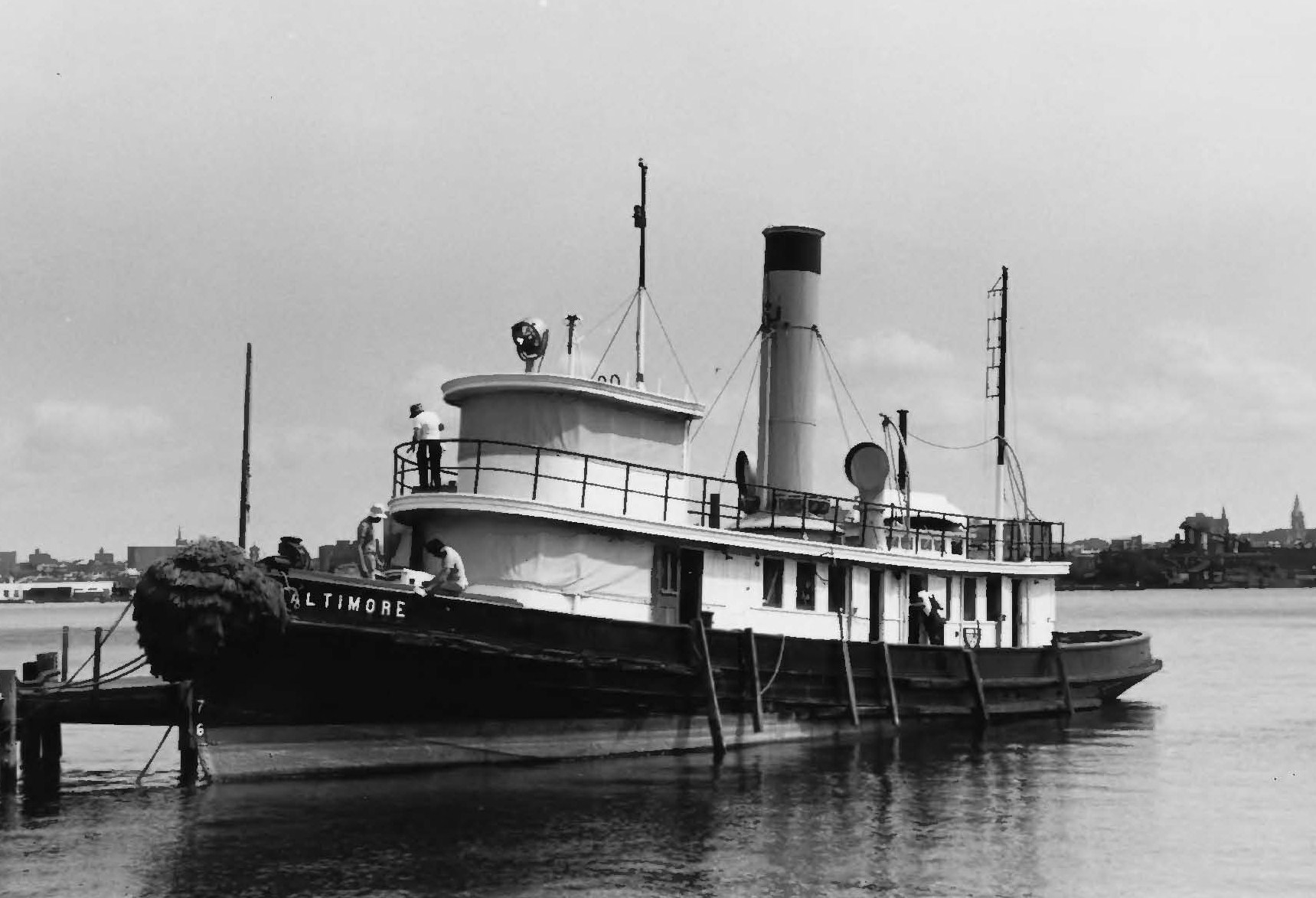
39°17′5″N 76°36′0″W / 39.28472°N 76.6°WSoutheast 2 BALTIMORE (tug) 
November 4, 1993 1415 Key Highway
39°16′28″N 76°36′1″W / 39.27444°N 76.60028°WSouth 3 Baltimore and Ohio Locust Point Grain Terminal Elevator December 23, 2004 1700 Beason St.
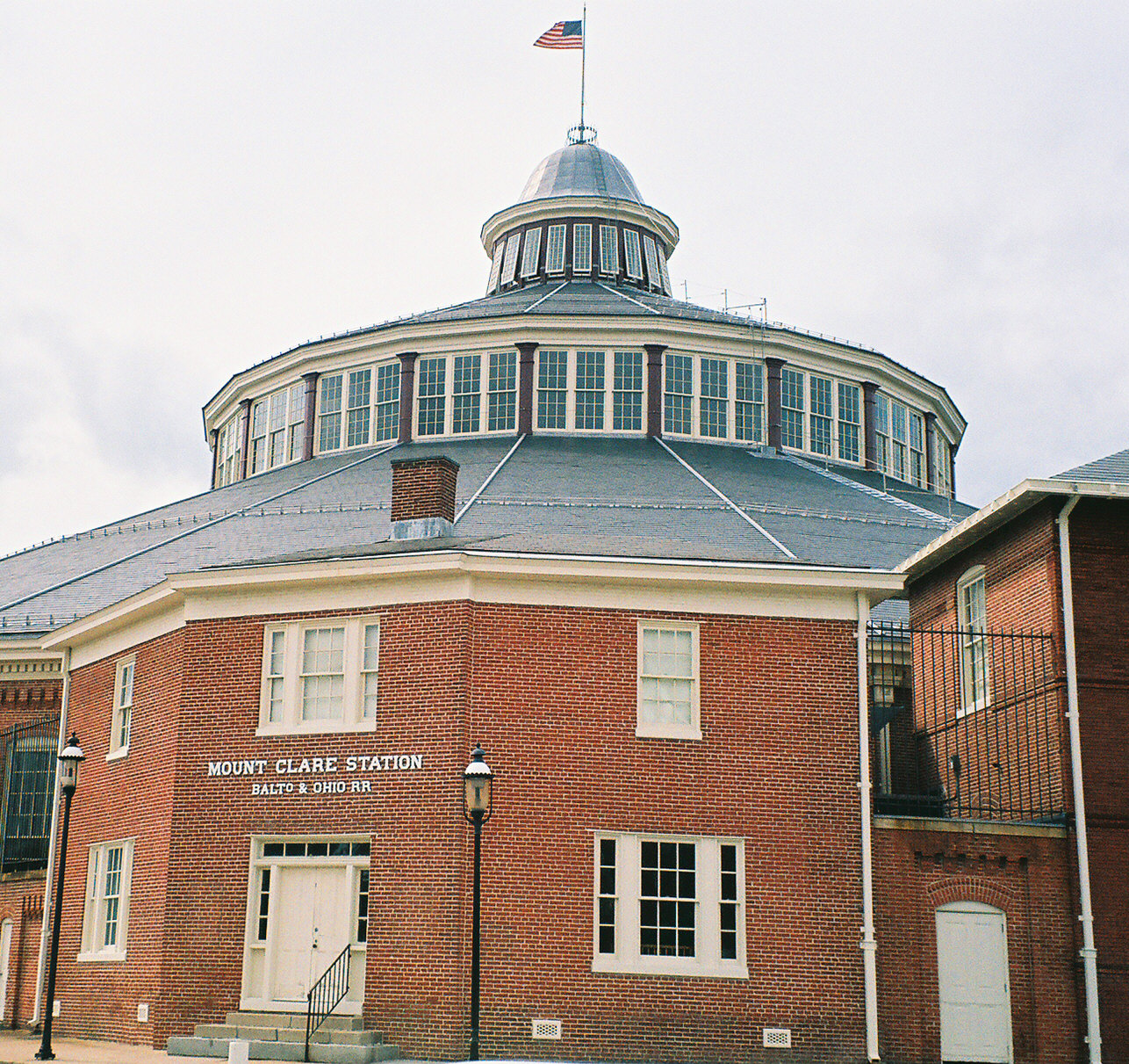
39°16′19″N 76°35′20″W / 39.27194°N 76.58889°WSouth 4 Baltimore and Ohio Transportation Museum and Mount Clare Station 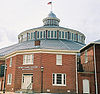
October 15, 1966 Pratt and Poppleton Sts.
39°17′7″N 76°37′57″W / 39.28528°N 76.6325°WSouth 5 BANCROFT (motor vessel) March 27, 1980 Fell's Point
39°16′54″N 76°35′30″W / 39.28167°N 76.59167°WSoutheast 6 Bankard-Gunther Mansion August 6, 1980 2102 E. Baltimore Street
39°17′31″N 76°35′14″W / 39.29194°N 76.58722°WSoutheast 7 Barre Circle Historic District January 10, 1983 Roughly bounded by Scott St., Ramsey St., Boyd St., and Harbor City Boulevard./S. Fremont St.
39°17′8″N 76°37′43″W / 39.28556°N 76.62861°WSouth 8 Building at 239 North Gay Street October 7, 1994 239 N. Gay St.
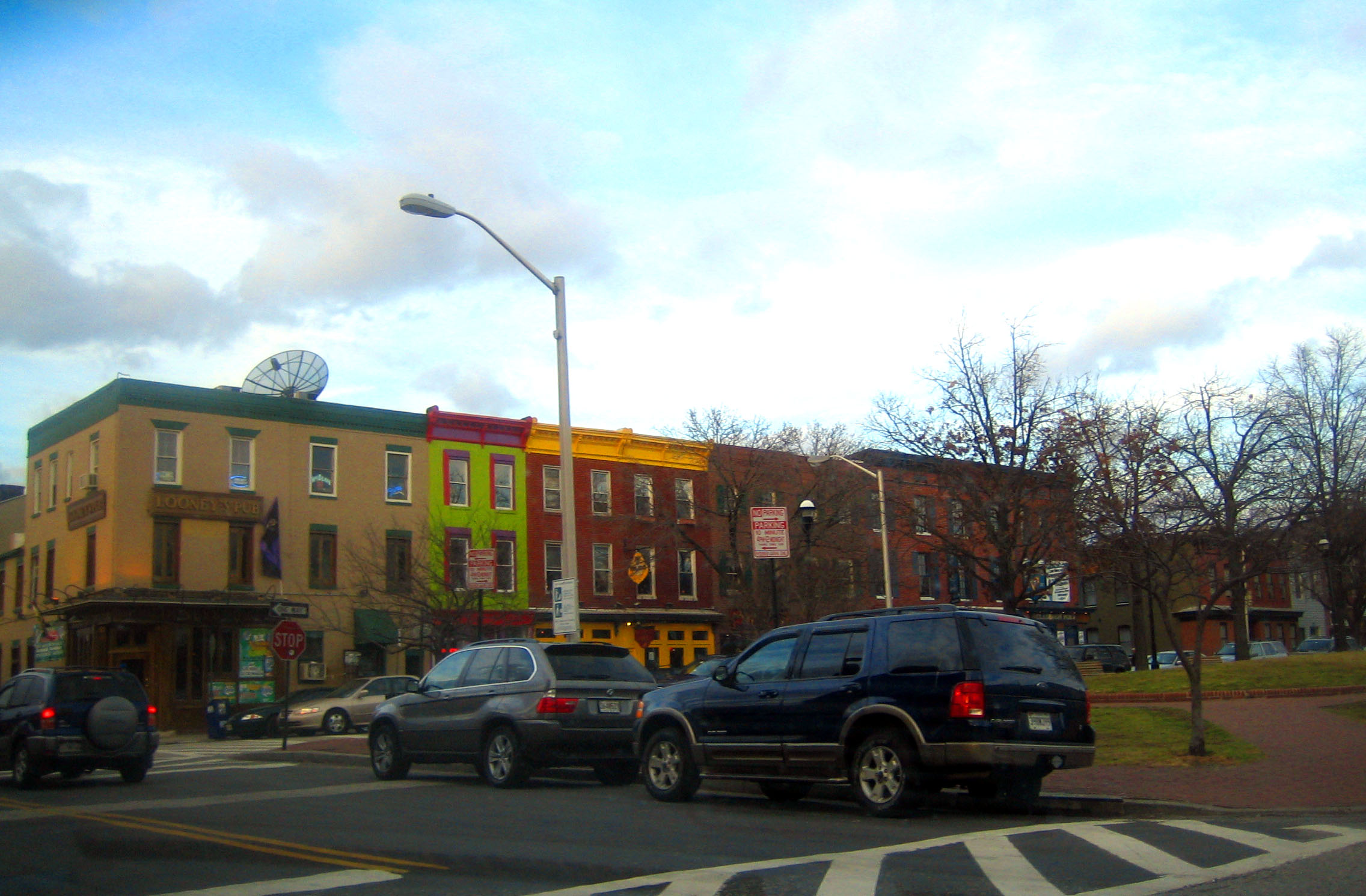
39°17′38″N 76°36′29″W / 39.29389°N 76.60806°WSoutheast 9 Butchers Hill Historic District December 28, 1982 Roughly bounded by Patterson Park Ave. and Fayette, Pratt, Chapel, Washington, and Chester Sts.
39°17′29″N 76°35′13″W / 39.29139°N 76.58694°WSoutheast 10 Canton Historic District 
January 29, 1980 Eastern Ave. and Waterfront, Conklin, and Chester Sts.
39°16′53″N 76°34′34″W / 39.28139°N 76.57611°WSoutheast 11 Carroll Mansion May 25, 1973 800 E. Lombard St.
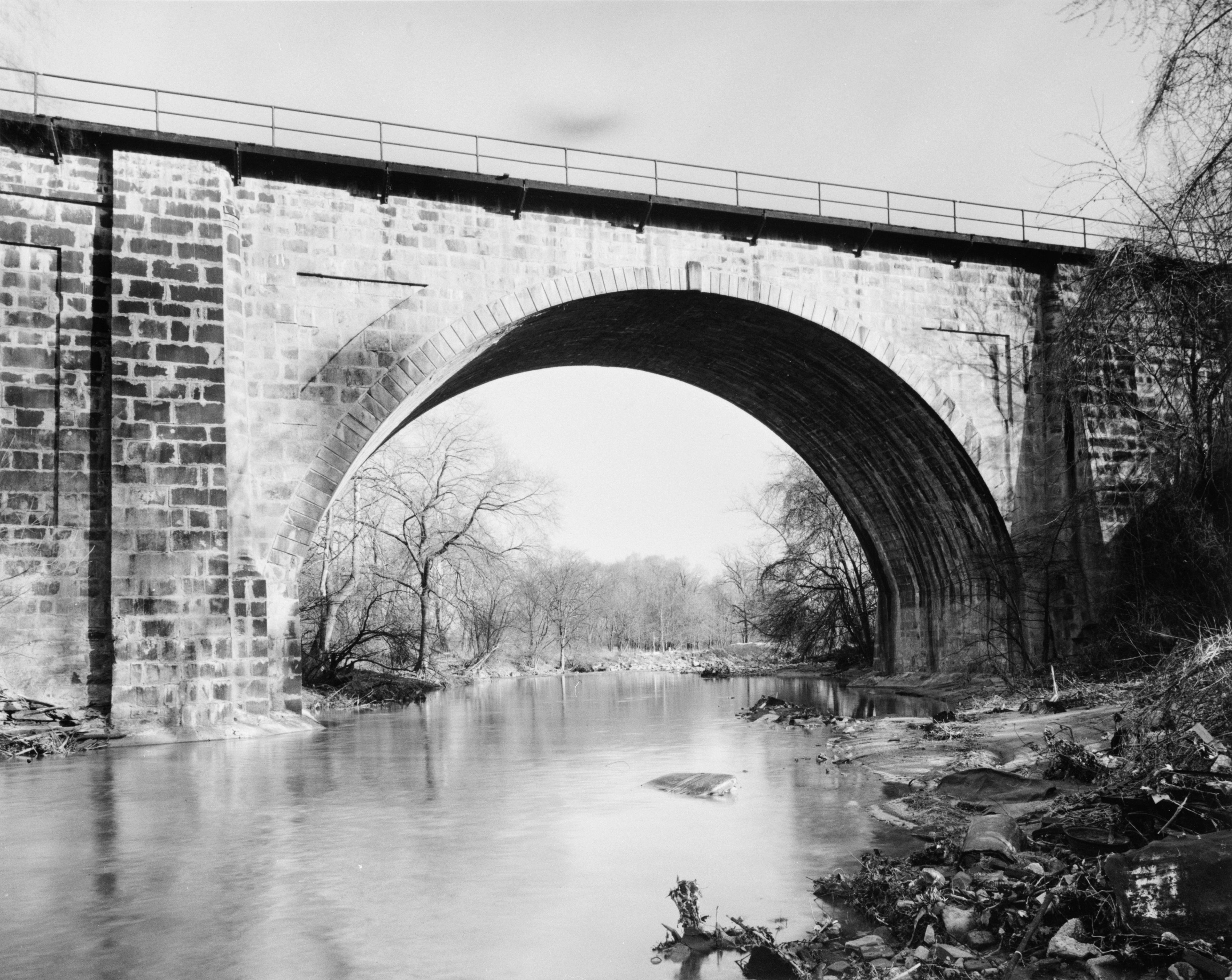
39°17′19″N 76°36′17″W / 39.28861°N 76.60472°WSoutheast 12 Carrollton Viaduct 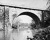
November 11, 1971 Gwynn's Falls near Carroll Park
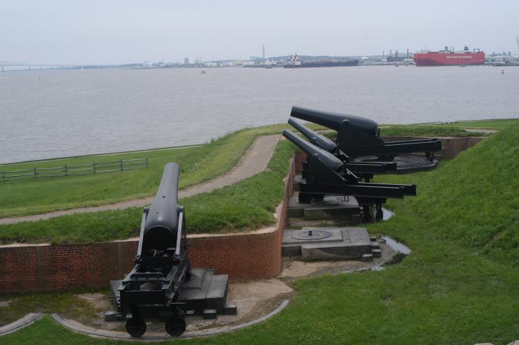
39°16′31″N 76°39′19″W / 39.27528°N 76.65528°WSouth 13 Chizuk Amuno Synagogue April 19, 1978 27-35 Lloyd St.
39°17′24″N 76°36′4″W / 39.29°N 76.60111°WSoutheast 14 Coca-Cola Baltimore Branch Factory May 4, 2001 1215 E. Fort Ave.
39°16′7″N 76°35′53″W / 39.26861°N 76.59806°WSouth 15 Douglass Place September 15, 1983 516-524 S. Dallas St.
39°17′6″N 76°35′47″W / 39.285°N 76.59639°WSoutheast 16 Dorguth Memorial United Methodist Church August 14, 1979 Scott and Carroll St.
39°16′56″N 76°37′44″W / 39.28222°N 76.62889°WSouth 17 Dundalk Historic District December 8, 1983 Roughly bounded by Liberty Parkway, Dunman, Willow Spring, and Sunship Rds., and Chesapeake and Patapsco Aves.
39°15′35″N 76°31′26″W / 39.25972°N 76.52389°WSoutheast 18 Eastern Female High School September 10, 1971 249 Aisquith St.
39°17′40″N 76°36′6″W / 39.29444°N 76.60167°WSoutheast 19 Equitable Gas Works December 29, 2003 1401 Severn St.
39°16′31″N 76°37′56″W / 39.27528°N 76.63222°WSouth 20 Federal Hill Historic District 
April 17, 1970 Bounded by Baltimore Harbor and Hughes, Hanover, and Cross Sts.
39°16′44″N 76°36′36″W / 39.27889°N 76.61°WSouth 21 Federal Hill South Historic District December 22, 2003 Roughly bounded by Cross St., Olive St., Marshall St., Ostend St., Fort Ave., and Covington St.
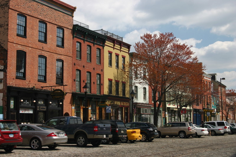
39°16′33″N 76°36′39″W / 39.27583°N 76.61083°WSouth 22 Fells Point Historic District 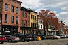
March 28, 1969 Bounded on the north by Aliceanna St., on the east by Wolfe St., on the south by Baltimore Harbor, and on the west by Dallas St.
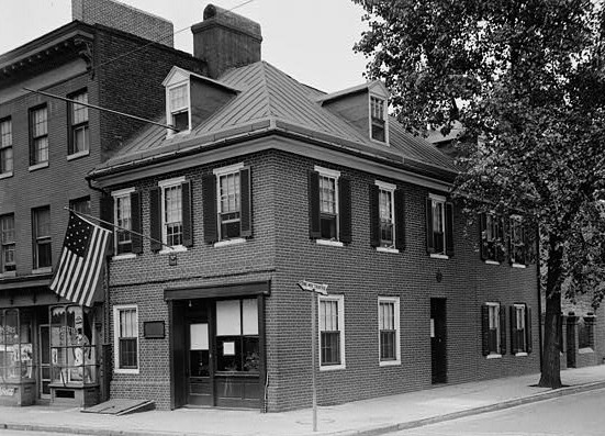
39°16′59″N 76°35′34″W / 39.28306°N 76.59278°WSoutheast Includes later boundary increase. 23 Flag House 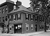
December 3, 1969 844 E. Pratt St.
39°17′15″N 76°36′13″W / 39.2875°N 76.60361°WSoutheast 24 Fort McHenry National Monument and Historic Shrine 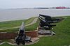
October 15, 1966 Locust Point, at the eastern end of Fort Ave.
39°15′49″N 76°34′48″W / 39.26361°N 76.58°WTBD 25 Gay Street Historic District November 21, 2003 Bounded by N. Gay, Fallsway, Low and N. Exeter Sts.
39°17′35″N 76°36′26″W / 39.29306°N 76.60722°WSoutheast 26 Hendler Creamery December 20, 2007 1100 E. Baltimore St. and 1107 E. Fayette St.
39°17′28″N 76°36′8″W / 39.29111°N 76.60222°WSoutheast 27 Holy Cross Roman Catholic Church December 30, 2002 106-112 E. West St.
39°16′34″N 76°36′40″W / 39.27611°N 76.61111°WSouth 28 House at 9 North Front Street June 14, 1979 9 N. Front St.
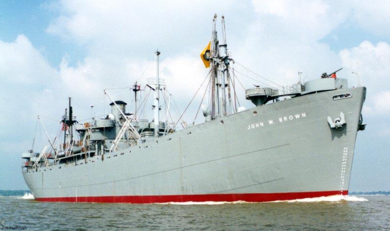
39°17′26″N 76°36′19″W / 39.29056°N 76.60528°WSoutheast 29 SS JOHN W. BROWN (Liberty Ship) 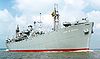
November 17, 1997 Pier 1, Clinton St.
39°16′4″N 76°34′12″W / 39.26778°N 76.57°WSoutheast 30 Johns Hopkins Hospital Complex 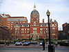
February 24, 1975 601 N. Broadway
39°17′50″N 76°35′37″W / 39.29722°N 76.59361°WSoutheast 31 Leadenhall Street Baptist Church March 16, 1979 1021-1023 Leadenhall St.
39°16′38″N 76°37′3″W / 39.27722°N 76.6175°WSouth 32 Little Montgomery Street Historic District April 15, 1982 W. Montgomery and Leadenhall Sts.
39°16′48″N 76°37′0″W / 39.28°N 76.616667°WSouth 33 Lloyd Street Synagogue April 19, 1978 11 Lloyd St.
39°17′26″N 76°36′5″W / 39.29056°N 76.60139°WSoutheast A part of the Jewish Museum of Maryland. 34 Loft Historic District North 
January 3, 1985 Roughly bounded by Paca, Redwood, Eutaw, and Lombard Sts.
39°17′18″N 76°37′19″W / 39.28833°N 76.62194°WSouth 35 Loft Historic District South January 3, 1985 Along the 500 block of W. Pratt St., bounded by Green St. and the 100 block of S. Paca St.
39°17′10″N 76°37′23″W / 39.28611°N 76.62306°WSouth 36 Lord Baltimore Hotel 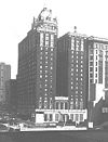
December 2, 1982 20 West Baltimore St.
39°17′23″N 76°36′58″W / 39.28972°N 76.61611°WSouth 37 Maryland White Lead Works December 27, 2002 921-979 E. Fort Ave.
39°16′14.3142″N 76°36′3.6642″W / 39.270642833°N 76.601017833°WSouth 38 McKim's School March 30, 1973 1120 E. Baltimore St.
39°17′28″N 76°36′4″W / 39.29111°N 76.60111°WSoutheast 39 H.L. Mencken House 
July 28, 1983 1524 Hollins Rd.
39°17′15″N 76°38′29″W / 39.2875°N 76.64139°WSouth 40 Montgomery Ward Warehouse and Retail Store September 14, 2000 1000 S. Monroe St.
39°16′34″N 76°38′41″W / 39.27611°N 76.64472°WSouth 41 Mount Auburn Cemetery September 7, 2001 2614 Annapolis Rd.
39°15′34″N 76°38′23″W / 39.25944°N 76.63972°WSouth 42 Mount Clare 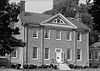
April 15, 1970 Carroll Park
39°16′44″N 76°38′37″W / 39.27889°N 76.64361°WSouth 43 National Brewing Company December 30, 2002 3601-3901 Dillon St.
39°16′51″N 76°33′53″W / 39.28083°N 76.56472°WSoutheast 44 National Enameling and Stamping Company December 27, 2002 1901 Light St.
39°16′4″N 76°36′38″W / 39.26778°N 76.61056°WSouth 45 Old Town Friends' Meetinghouse March 30, 1973 1201 E. Fayette St.
39°17′31″N 76°36′4″W / 39.29194°N 76.60111°WSoutheast 46 Parker Metal Decoration Company Plant November 22, 2000 333 W. Ostend St.
39°16′31″N 76°37′18″W / 39.27528°N 76.62167°WSouth 47 Patterson Park-Highlandtown Historic District December 27, 2002 Roughly bounded by Patterson Park Ave., E. Fayette St., and Pulaski Highway, Grundy St., Easter Ave., Patterson Park
39°17′30″N 76°34′23″W / 39.29167°N 76.57306°WSoutheast 48 Pigtown Historic District December 28, 2006 Roughly bounded by McHenry St. and Ramsay St., W. Barre, S. Paca, Ostend and Wicomico Sts., Bush and Bayard Sts, and the railroad line
39°16′49″N 76°37′56″W / 39.28028°N 76.63222°WSouth 49 Polish Home Hall December 26, 2007 4416 Fairhaven Ave.
39°13′31″N 76°35′25″W / 39.22528°N 76.59028°WSouth 50 Poppleton Fire Station September 8, 1983 756-760 W. Baltimore St.
39°17′20″N 76°37′44″W / 39.28889°N 76.62889°WSouth 51 Procter and Gamble Baltimore Plant October 28, 1999 1422 Nicholson St.
39°16′30″N 76°35′30″W / 39.275°N 76.59167°WSouth 52 Public School No. 25 September 25, 1979 S. Bond St.
39°17′6″N 76°35′43″W / 39.285°N 76.59528°WSoutheast 53 Reservoir Hill Historic District December 23, 2004 North Ave., Madison Ave., Druid Park Lake Dr., and Mt. Royal Terrace
39°18′54″N 76°38′0″W / 39.315°N 76.633333°WSouth 54 Ridgely's Delight Historic District June 6, 1980 Roughly bounded by S. Fremont Ave. and W. Pratt, Conway, and Russell Sts.
39°17′8″N 76°37′31″W / 39.28556°N 76.62528°WSouth 55 Rombro Building May 26, 2005 22-24 S. Howard St.
39°17′18″N 76°37′12″W / 39.28833°N 76.62°WSouth 56 St. Alphonsus' Church, Rectory, Convent and Halle May 23, 1973 112-116, 125-127 W. Saratoga St.
39°17′35″N 76°37′4″W / 39.29306°N 76.61778°WSoutheast 57 St. Elizabeth of Hungary November 4, 1994 Junction of E. Baltimore St. and Lakewood Ave.
39°17′33″N 76°34′45″W / 39.2925°N 76.57917°WSoutheast 58 St. Leo's Church 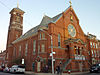
July 28, 1983 221 S. Exeter St.
39°17′15″N 76°36′3″W / 39.2875°N 76.60083°WSoutheast 59 St. Michael's Church Complex May 17, 1989 1900-1920 E. Lombard St.
39°17′26″N 76°35′24″W / 39.29056°N 76.59°WSoutheast 60 St. Paul's Cemetery 
June 30, 1988 Redwood St. and Martin Luther King Boulevard
39°17′15″N 76°37′41″W / 39.2875°N 76.62806°WSouth 61 St. Peter the Apostle Church and Buildings 
October 14, 1976 11 and 13 S. Poppleton St. and 848 Hollins St.
39°17′17″N 76°37′56″W / 39.28806°N 76.63222°WSouth 62 St. Vincent De Paul Roman Catholic Church February 12, 1974 120 N. Front St.
39°17′29″N 76°36′24″W / 39.29139°N 76.60667°WSoutheast 63 Shot Tower 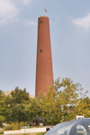
October 1, 1969 Southeastern corner of Fayette and Front Sts.
39°17′26″N 76°36′20″W / 39.29056°N 76.60556°WSoutheast Also known as Phoenix Shot Tower. 64 School No. 27 (Commodore John Rodgers Elementary School) March 21, 1986 2031 E. Fayette St.
39°17′38″N 76°35′16″W / 39.29389°N 76.58778°WSoutheast 65 Sonneborn Building October 29, 1982 110 S. Paca St.
39°17′11″N 76°37′21″W / 39.28639°N 76.6225°WSouth 66 South Central Avenue Historic District November 11, 2001 Approximately 8 blocks centering on Central Ave. between Pratt and Fleet Sts.
39°17′12″N 76°35′58″W / 39.28667°N 76.59944°WSoutheast 67 Southern District Police Station December 28, 2001 28 E. Ostend St.
39°16′30″N 76°36′47″W / 39.275°N 76.61306°WSouth 68 Turner-White Casket Co. Building January 26, 1995 509-511 W. Lombard St.
39°17′14″N 76°37′21″W / 39.28722°N 76.6225°WSouth 69 U.S. Post Office and Courthouse 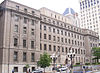
March 25, 1977 111 N. Calvert St.
39°17′27″N 76°36′44″W / 39.29083°N 76.61222°WSouth 70 Union Square-Hollins Market Historic District 
September 15, 1983 Roughly bounded by Fulton, Fayette, Pratt, and Schroeder Sts.
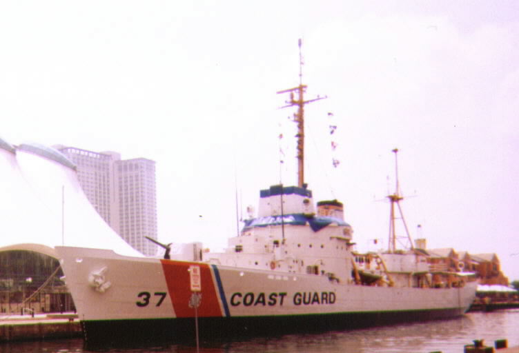
39°17′13″N 76°38′25″W / 39.28694°N 76.64028°WSouth See Union Square and Hollins Market 71 USCGC TANEY (WHEC-37) 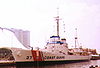
June 7, 1988 Pier 6
39°17′9″N 76°36′23″W / 39.28583°N 76.60639°WSouth 72 Walters Bath No. 2 June 19, 1979 900 Washington Boulevard
39°16′59″N 76°37′52″W / 39.28306°N 76.63111°WSouth 73 Wilkens-Robins Building December 3, 1980 308-312 W. Pratt St.
39°17′11″N 76°37′12″W / 39.28639°N 76.62°WSouth See also
References
- ^ The latitude and longitude information provided in this table was derived originally from the National Register Information System, which has been found to be fairly accurate for about 99% of listings. For about 1% of NRIS original coordinates, experience has shown that one or both coordinates are typos or otherwise extremely far off; some corrections may have been made. A more subtle problem causes many locations to be off by up to 150 yards, depending on location in the country: most NRIS coordinates were derived from tracing out latitude and longitudes off of USGS topographical quadrant maps created under the North American Datum of 1927, which differs from the current, highly accurate WGS84 GPS system used by Google maps. Chicago is about right, but NRIS longitudes in Washington are higher by about 4.5 seconds, and are lower by about 2.0 seconds in Maine. Latitudes differ by about 1.0 second in Florida. Some locations in this table may have been corrected to current GPS standards.
- ^ "National Register of Historic Places: Weekly List Actions". National Park Service, United States Department of the Interior. Retrieved on November 10, 2011.
- ^ Official Baltimore neighborhoods, defined here
U.S. National Register of Historic Places in Maryland Lists by county Allegany • Anne Arundel • Baltimore County • Calvert • Caroline • Carroll • Cecil • Charles • Dorchester • Frederick • Garrett • Harford • Howard • Kent • Montgomery • Prince George's • Queen Anne's • Somerset • St. Mary's • Talbot • Washington • Wicomico • Worcester

Lists by city Baltimore: (Central · North and Northwest · West and Southwest · East and Northeast · South and Southeast)Other lists Categories:- National Register of Historic Places in Maryland by county
- History of Baltimore, Maryland
-


Wikimedia Foundation. 2010.