- National Register of Historic Places listings in Central Baltimore
-
This is a list of National Register of Historic Places properties and districts in downtown Baltimore, Maryland, United States. Many other properties are located in other parts of the city; for these, see National Register of Historic Places listings in Baltimore, Maryland.
The locations of the National Register properties and districts listed below (at least for all showing latitude and longitude coordinates below) may be seen in a Google map by clicking on "Map of all coordinates".[1]
-
- This National Park Service list is complete through NPS recent listings posted November 10, 2011.[2]
Current listings
[3] Landmark name Image Date listed Location District[4] Summary 1 David Bachrach House September 5, 1985 2406-2408 Linden Ave.
39°18′51″N 76°38′10″W / 39.314167°N 76.636111°WCentral 2 Baltimore City College 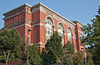
August 11, 1983 530 N. Howard St.
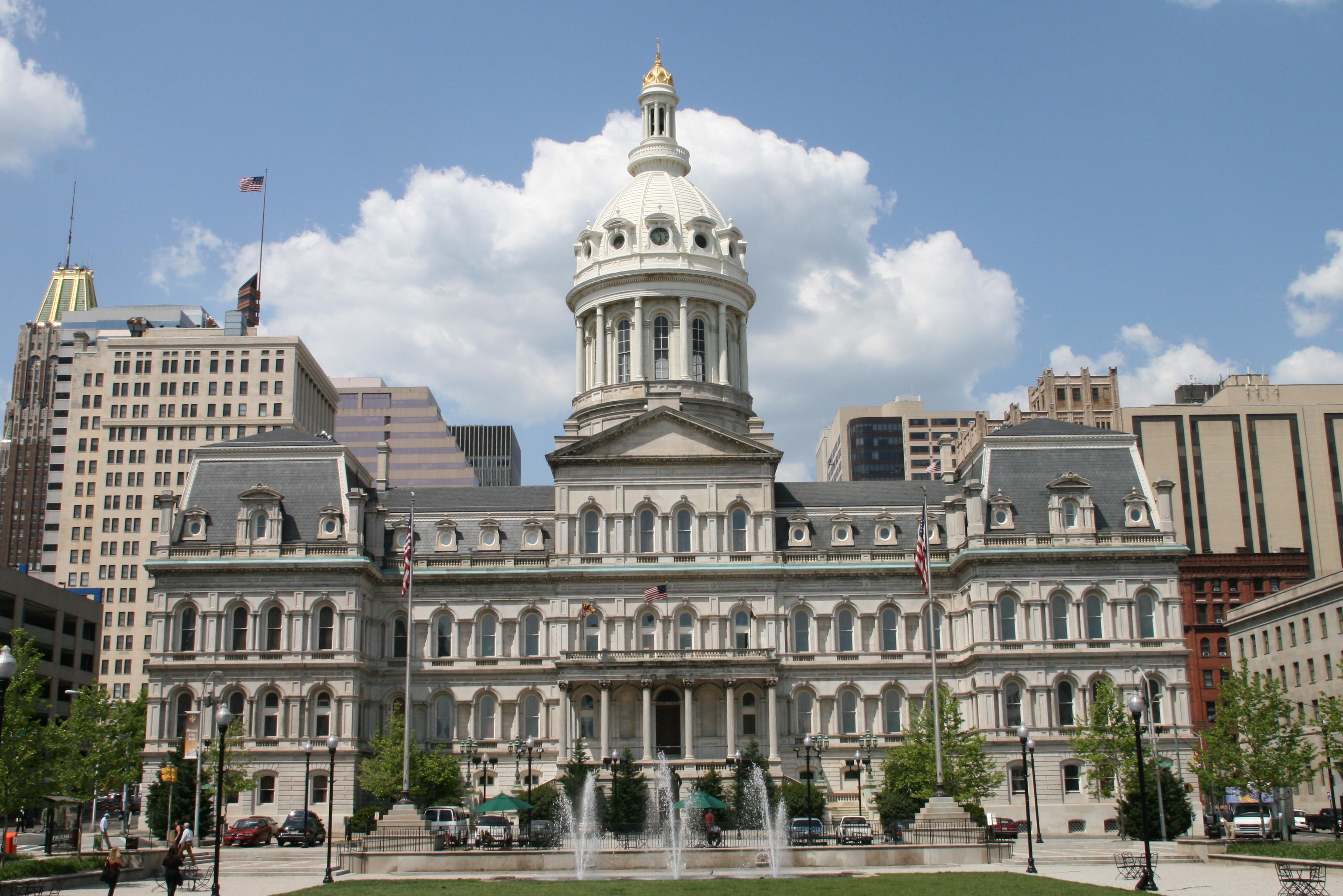
39°17′46″N 76°37′25″W / 39.296111°N 76.623611°WCentral 3 Baltimore City Hall 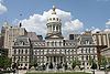
May 8, 1973 100 N. Holliday St.
39°17′27″N 76°36′39″W / 39.290833°N 76.610833°WCentral 4 Baltimore City Passenger Railway Power House and Car Barn 
September 9, 1998 1711-1717 N. Charles St.
39°18′33″N 76°36′59″W / 39.309167°N 76.616389°WCentral 5 Baltimore College of Dental Surgery May 8, 1987 429-433 N. Eutaw St.
39°17′41″N 76°37′16″W / 39.294722°N 76.621111°WCentral 6 Baltimore Equitable Society 
October 6, 1977 21 N. Eutaw St.
39°17′28″N 76°37′16″W / 39.291111°N 76.621111°WCentral 7 Baltimore Gas and Electric Company Building December 29, 2003 39 W. Lexington St.
39°17′35″N 76°37′02″W / 39.293056°N 76.617222°WCentral 8 Baltimore General Dispensary 
March 18, 1980 500 W. Fayette St.
39°17′26″N 76°37′22″W / 39.290556°N 76.622778°WCentral 9 Baltimore Grand January 14, 2000 401 W. Fayette St.
39°17′24″N 76°37′17″W / 39.29°N 76.621389°WCentral 10 Baltimore Hebrew Congregation Synagogue November 7, 1976 1901 Madison Ave.
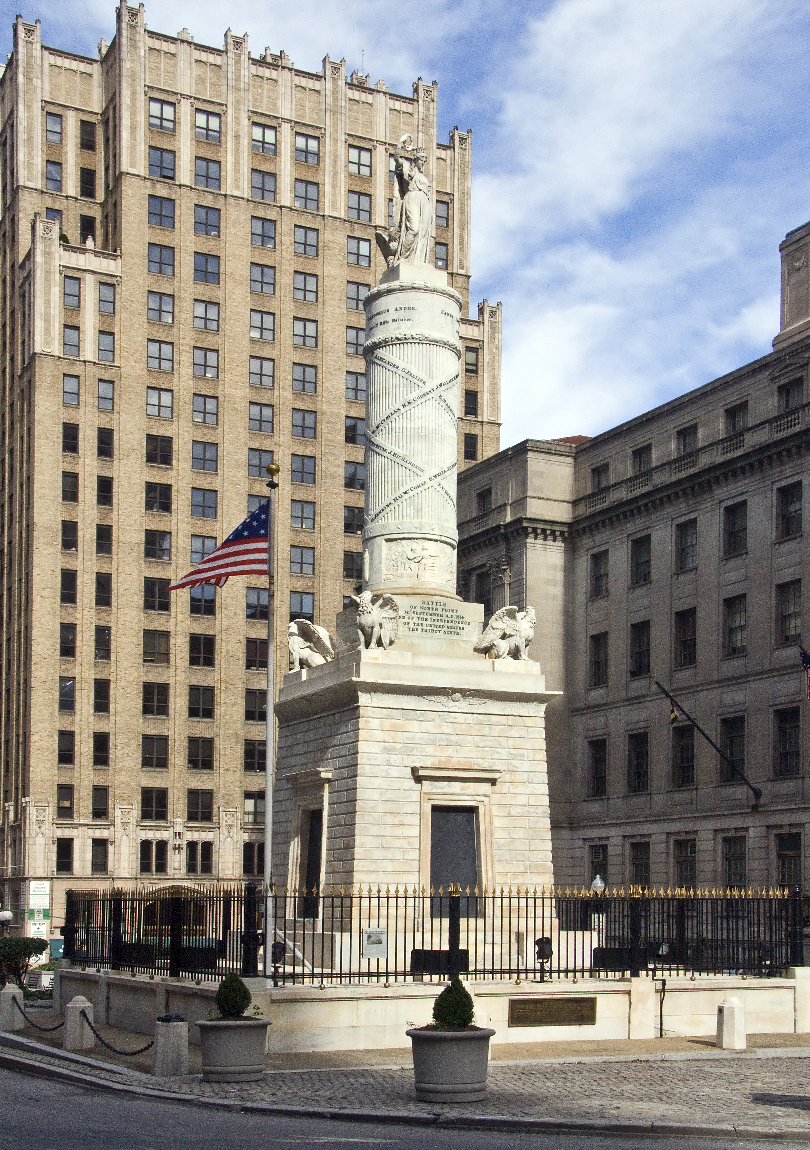
39°18′29″N 76°37′59″W / 39.308056°N 76.633056°WCentral 11 Battle Monument 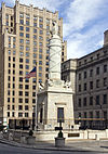
June 4, 1973 Calvert St. between Fayette and Lexington Sts.
39°17′26″N 76°36′45″W / 39.290556°N 76.6125°WCentral 12 Bellona-Gittings Historic District December 24, 2008 Bounded by E. Lake, Melrose, and Gittings Aves. and York, Charles, Charlesbrooke, and Overbrook Rds.
39°22′09″N 76°37′21″W / 39.369133°N 76.622497°WCentral 13 Belvedere Hotel 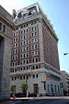
August 29, 1977 1 E. Chase St.
39°18′08″N 76°36′58″W / 39.302222°N 76.616111°WCentral 14 Benson Building March 26, 1980 4 E. Franklin St.
39°17′43″N 76°36′55″W / 39.295278°N 76.615278°WCentral 15 Bolton Hill Historic District 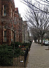
September 17, 1971 Roughly bounded by North Ave., Eutaw Pl., and the Pennsylvania Railroad tracks
39°18′25″N 76°37′36″W / 39.306944°N 76.626667°WCentral 16 Brewers Exchange March 28, 1985 20 Park Ave.
39°17′26″N 76°37′06″W / 39.290556°N 76.618333°WCentral 17 Brown's Arcade January 17, 1983 322-328 N. Charles St.
39°17′36″N 76°36′56″W / 39.293333°N 76.615556°WCentral 18 Alex Brown Building 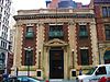
December 2, 1982 135 E. Baltimore St.
39°17′22″N 76°36′45″W / 39.289444°N 76.6125°WCentral 19 Building at 409 West Baltimore Street December 1, 1994 409 W. Baltimore St.
39°17′21″N 76°37′18″W / 39.289167°N 76.621667°WCentral 20 Building at 419 West Baltimore Street 
September 30, 1994 419 W. Baltimore St.
39°17′21″N 76°37′20″W / 39.289167°N 76.622222°WCentral 21 Building at 423 West Baltimore Street February 10, 1995 423 W. Baltimore St.
39°17′21″N 76°37′20″W / 39.289167°N 76.622222°WCentral 22 Buildings at 10, 12, 14, and 16 East Chase Street March 10, 1980 10, 12, 14, and 16 E. Chase St.
39°18′11″N 76°36′56″W / 39.303056°N 76.615556°WCentral 23 Buildings at 1601-1830 St. Paul Street and 12-20 E. Lafayette Street December 27, 1984 1601-1830 St. Paul St. and 12-20 E Lafayette St.
39°18′33″N 76°36′54″W / 39.309167°N 76.615°WCentral 24 Business and Government Historic District November 25, 1987 Roughly bounded by Saratoga St., City Boulevard, and Water, Lombard, and Charles Sts.
39°17′24″N 76°36′39″W / 39.29°N 76.610833°WCentral 25 Canton House December 13, 1978 300 Water St.
39°17′20″N 76°36′39″W / 39.288889°N 76.610833°WCentral 26 Cathedral Hill Historic District 
April 27, 1987 Roughly bounded by Hamilton, Saint Paul, Charles, Saratoga, and Cathedral Sts.
39°17′37″N 76°36′58″W / 39.293611°N 76.616111°WCentral 27 Cecil Apartments June 30, 2000 1123 N. Eutlaw St.
39°18′11″N 76°37′29″W / 39.303056°N 76.624722°WCentral 28 Chamber of Commerce Building February 2, 1983 17 Commerce St.
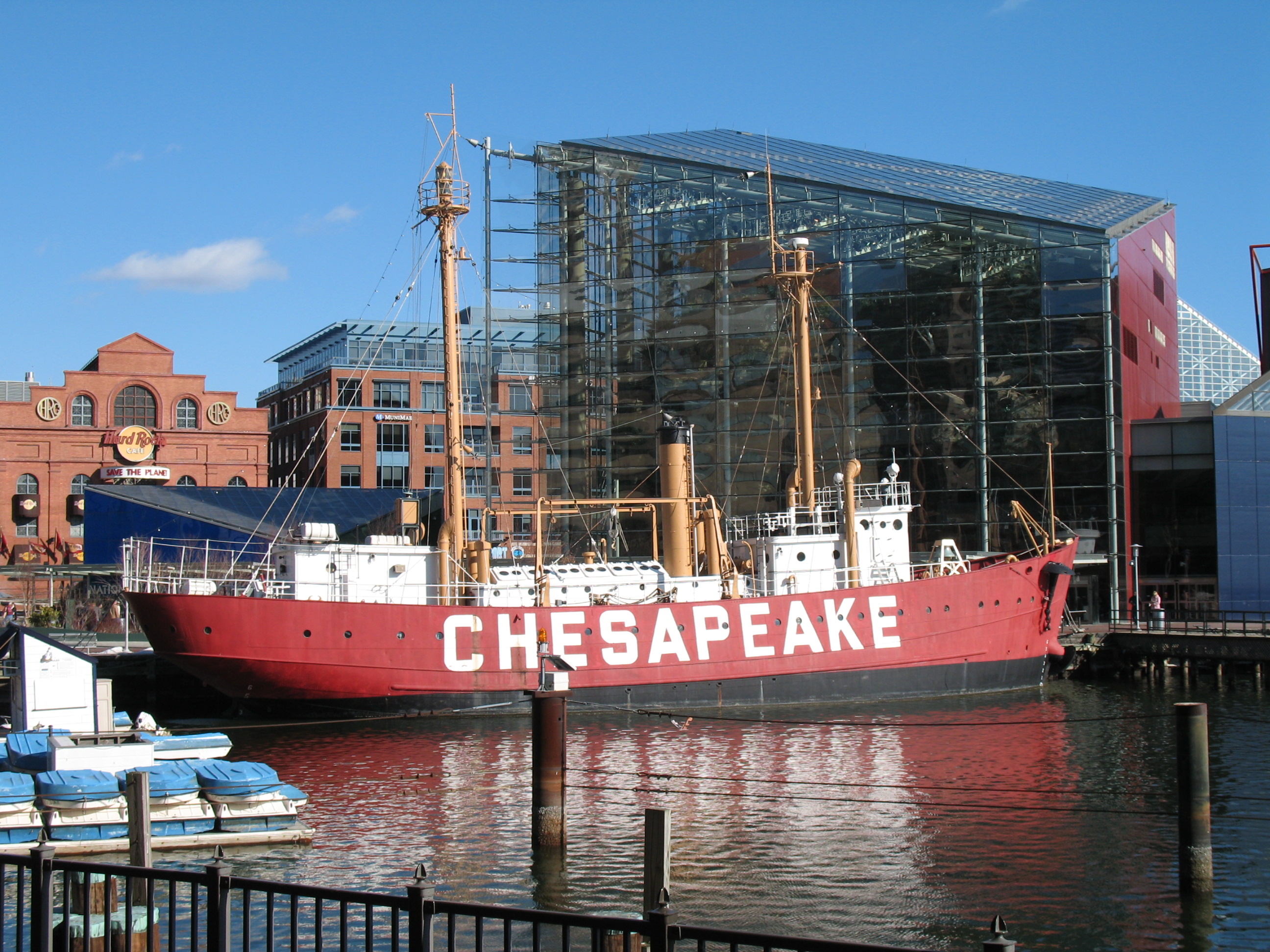
39°17′20″N 76°36′36″W / 39.288889°N 76.61°WCentral 29 CHESAPEAKE (lightship) 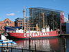
August 1, 1980 Inner Harbor
39°17′08″N 76°36′34″W / 39.285556°N 76.609444°WCentral 30 Clifton Park 
September 12, 2007 Bounded by Hartford Rd., Erdman Ave., Clifton Park Terrace, the Baltimore Belt Line, and Sinclair Ln.
39°19′15″N 76°34′58″W / 39.320858°N 76.582831°WCentral 31 U.S.S. CONSTELLATION 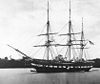
October 15, 1966 Pier 1, Pratt St.
39°17′10″N 76°36′42″W / 39.286111°N 76.611667°WCentral 32 Continental Trust Company Building 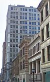
February 3, 1983 1 S. Calvert St.
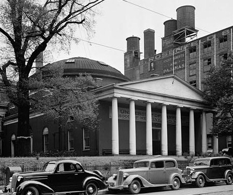
39°17′23″N 76°36′44″W / 39.289722°N 76.612222°WCentral 33 Davidge Hall, University of Maryland 
None 522 W. Lombard St.
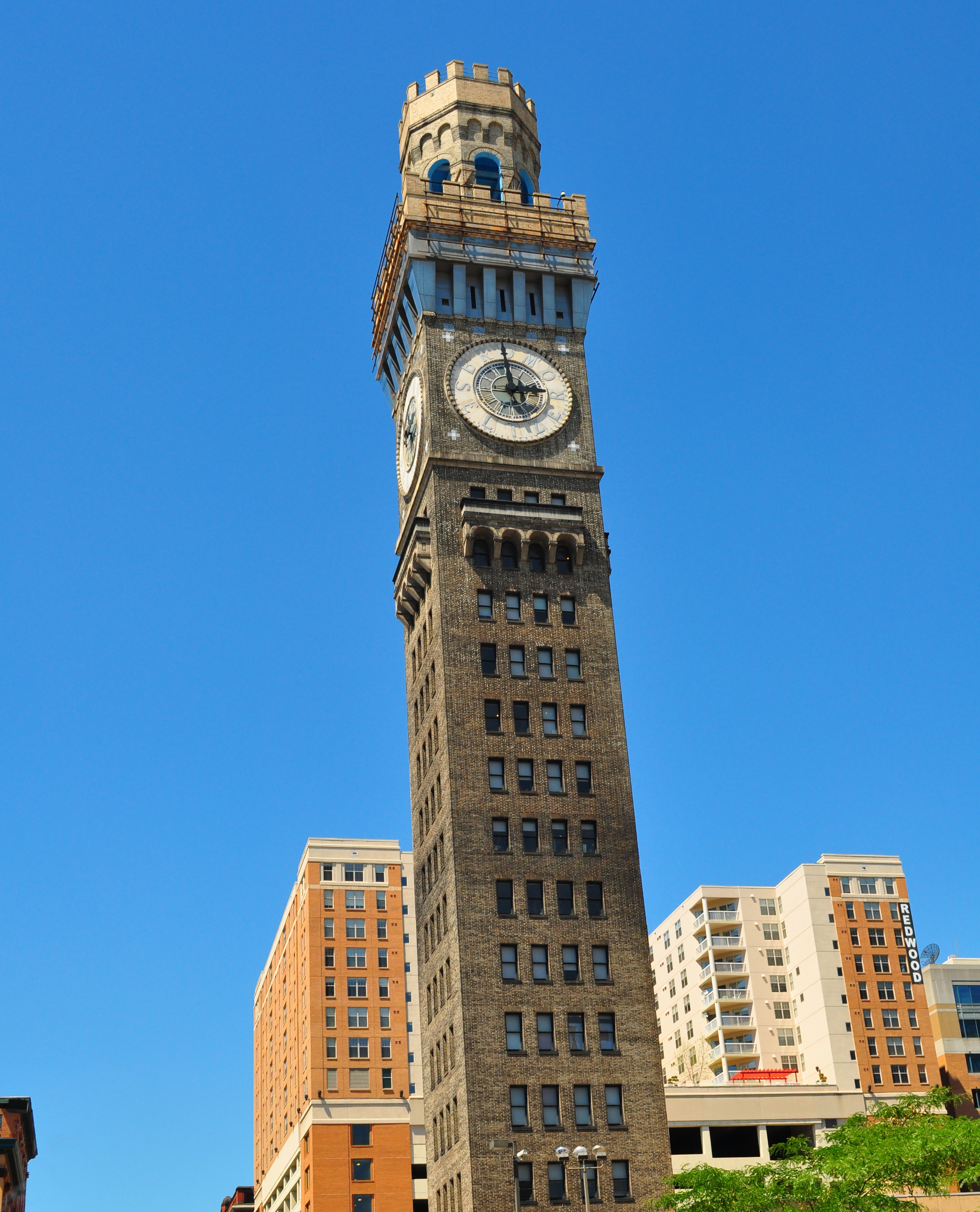
39°17′16″N 76°37′24″W / 39.287778°N 76.623333°WCentral Designated a National Historic Landmark September 25, 1997 (as College of Medicine of Maryland) 34 Emerson Bromo-Seltzer Tower 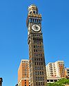
June 4, 1973 312-318 Lombard St.
39°17′16″N 76°37′15″W / 39.287778°N 76.620833°WCentral 35 Erlanger Buildings March 10, 1980 519-531 W. Pratt St.
39°17′10″N 76°37′22″W / 39.286111°N 76.622778°WCentral 36 Eutaw-Madison Apartment House Historic District May 12, 1983 2502 and 2525 Eutaw Pl., and 2601 Madison Ave.
39°18′55″N 76°38′18″W / 39.315278°N 76.638333°WCentral 37 Faust Brothers Building December 7, 1994 307-309 W. Baltimore St.
39°17′21″N 76°37′12″W / 39.289167°N 76.62°WCentral 38 Federal Reserve Bank of Richmond, Baltimore Branch January 27, 1983 114 E. Lexington St.
39°17′28″N 76°36′47″W / 39.291111°N 76.613056°WCentral 39 Fifth Regiment Armory September 25, 1985 210-247 W. Hoffman St.
39°18′12″N 76°37′19″W / 39.303333°N 76.621944°WCentral 40 First Presbyterian Church and Manse June 18, 1973 200-210 W. Madison St.
39°17′56″N 76°37′08″W / 39.298889°N 76.618889°WCentral 41 First Unitarian Church 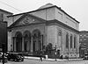
February 11, 1972 2-12 W. Franklin St.
39°17′43″N 76°36′58″W / 39.295278°N 76.616111°WCentral 42 L. Frank & Son Building January 19, 1995 407 W. Baltimore St.
39°17′21″N 76°37′18″W / 39.289167°N 76.621667°WCentral 43 Franklin Street Presbyterian Church and Parsonage November 5, 1971 100 W. Franklin St. (church), 504 Cathedral St. (parsonage)
39°17′43″N 76°37′02″W / 39.295278°N 76.617222°WCentral 44 Gandy Belting Company Building October 25, 1984 726-734 W. Pratt St.
39°17′11″N 76°37′39″W / 39.286389°N 76.6275°WCentral 45 Garrett Building December 16, 1982 233-239 Redwood St.
39°17′20″N 76°36′40″W / 39.288889°N 76.611111°WCentral 46 Gunther Brewing Company 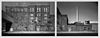
December 26, 2002 1200, 1211, and 1301 S. Conkling St., 3601 and 3701 O'Donnell St., the eastern side of S. Conkling St., and the rear eastern side of S. Conkling St.
39°16′46″N 76°34′00″W / 39.2795°N 76.566706°WCentral 47 Heiser, Rosenfeld, and Strauss Buildings March 10, 1980 32-42 S. Paca St.
39°17′16″N 76°37′21″W / 39.287778°N 76.6225°WCentral 48 Hippodrome 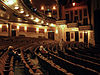
January 14, 2000 12 N. Eutaw St.
39°17′23″N 76°37′17″W / 39.289722°N 76.621389°WCentral 49 Home of the Friendless November 8, 2003 1313 Druid Hill Ave.
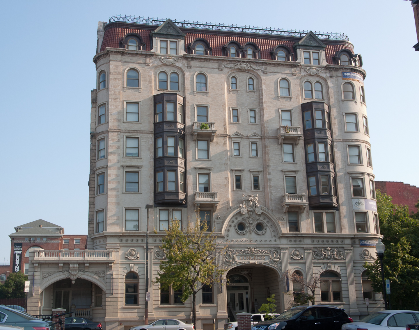
39°18′08″N 76°37′45″W / 39.302222°N 76.629167°WCentral 50 Hotel Kernan 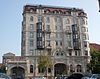
September 3, 1999 306-312 W. Franklin St.
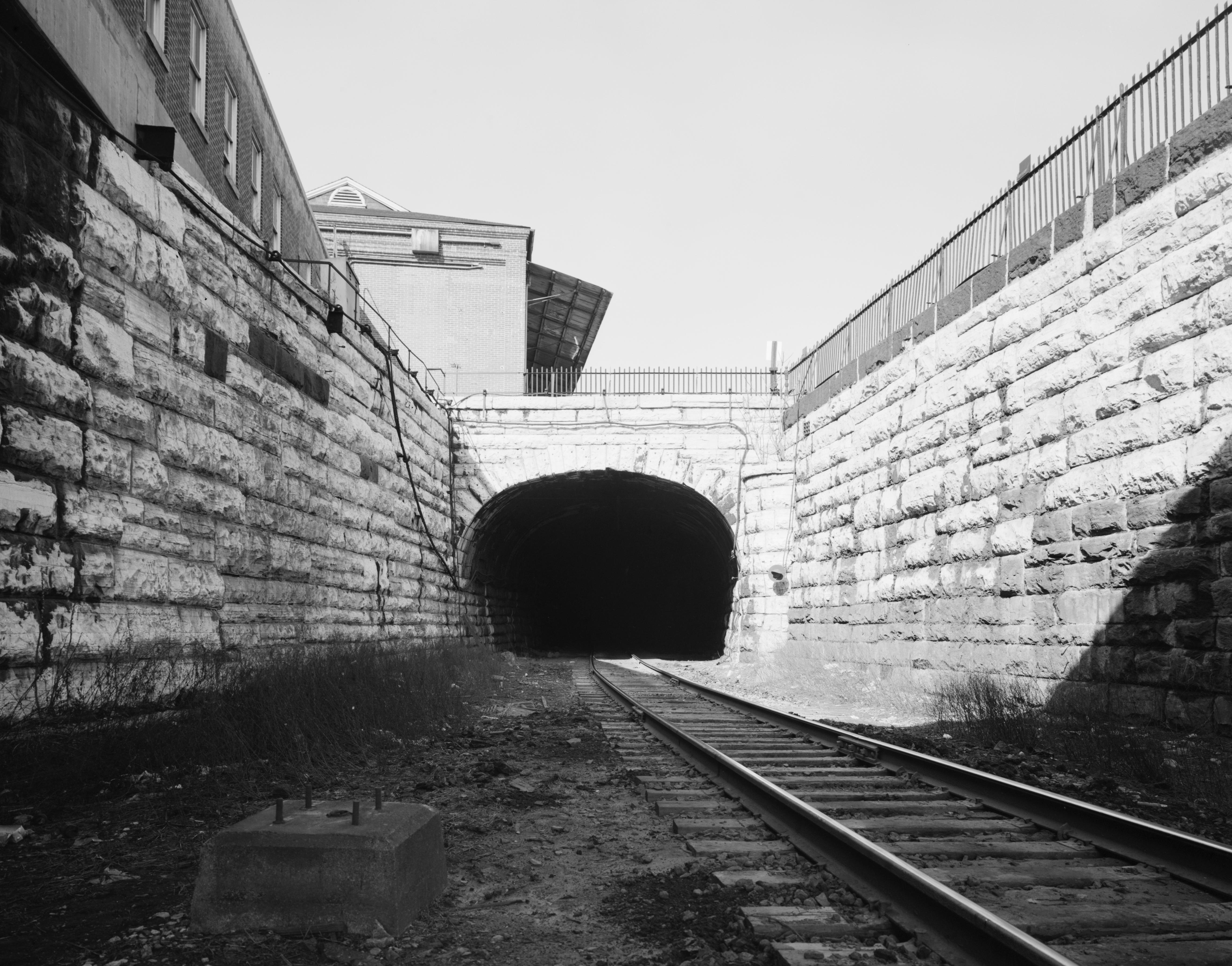
39°17′42″N 76°37′15″W / 39.295°N 76.620833°WCentral 51 Howard Street Tunnel 
July 2, 1973 Beneath Howard St. from Mt. Royal Station to Camden Station
39°18′17″N 76°37′15″W / 39.304722°N 76.620833°WCentral 52 Hutzler Brothers Palace Building June 7, 1984 210-218 N. Howard St.
39°17′32″N 76°36′31″W / 39.292222°N 76.608611°WCentral 53 Johnston Building September 26, 1994 26-30 S. Howard St.
39°17′17″N 76°37′11″W / 39.288056°N 76.619722°WCentral 54 George Knipp & Brother Building December 1, 1994 121 N. Howard St.
39°17′28″N 76°37′10″W / 39.291111°N 76.619444°WCentral 55 Krug Iron Works April 29, 1982 415 W. Saratoga St.
39°17′34″N 76°37′20″W / 39.292778°N 76.622222°WCentral 56 Lyric Theatre January 23, 1986 124 W. Mt. Royal Ave.
39°18′20″N 76°37′09″W / 39.305556°N 76.619167°WCentral 57 Madison Avenue Methodist Episcopal Church September 4, 1992 1327 Madison Ave.
39°18′14″N 76°37′40″W / 39.303889°N 76.627778°WCentral 58 Market Center 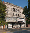
February 4, 2000 24 blocks surrounding the junction of Howard and Lexington Sts.
39°17′33″N 76°37′15″W / 39.2925°N 76.620833°WCentral 59 Mercantile Trust and Deposit Company March 17, 1983 202 E. Redwood St.
39°17′21″N 76°36′45″W / 39.289167°N 76.6125°WCentral 60 Mother Seton House June 13, 1972 600 N. Paca St.
39°17′44″N 76°37′23″W / 39.295556°N 76.623056°WCentral 61 Mount Royal Station 
June 18, 1973 1400 Cathedral St.
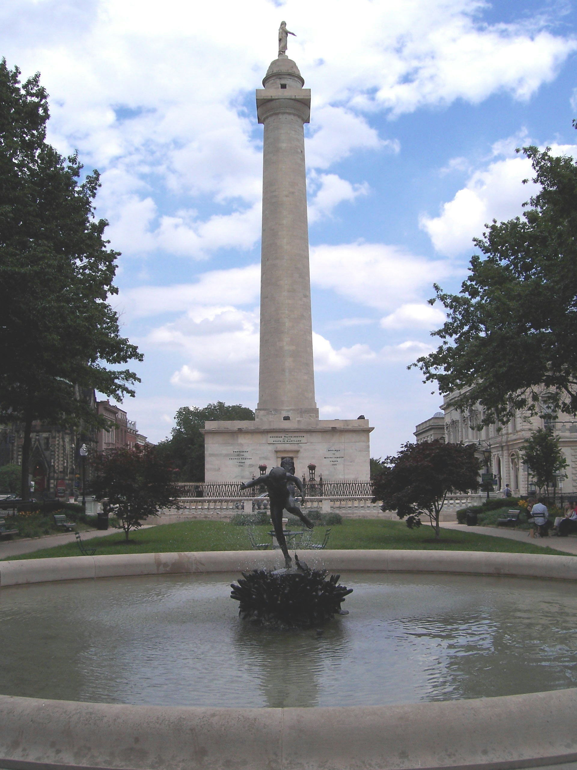
39°18′20″N 76°37′14″W / 39.305556°N 76.620556°WCentral 62 Mount Vernon Place Historic District 
November 11, 1971 Mount Vernon Pl. and Washington Pl.
39°17′52″N 76°36′56″W / 39.297778°N 76.615556°WCentral 63 Mount Vernon Place United Methodist Church and Asbury House 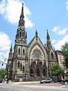
September 17, 1971 2-10 E. Mount Vernon Place
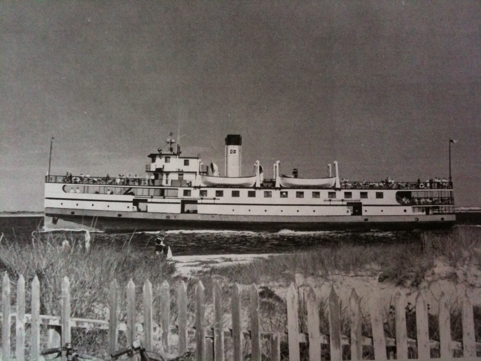
39°17′53″N 76°36′55″W / 39.298056°N 76.615278°WCentral 64 NOBSKA (steamship) 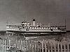
May 2, 1974 Inner harbor Central 65 Odd Fellows Hall March 25, 1980 300 Cathedral St.
39°17′35″N 76°37′02″W / 39.293056°N 76.617222°WCentral 66 Old National Pike Milestones November 27, 1975 U.S. Route 40, Alternate U.S. Route 40, and Scenic U.S. Route 40, and Maryland Routes 44 and 165
39°25′13″N 77°16′01″W / 39.420278°N 77.266944°WTBD, perhaps multiple 67 Old Pine Street Station 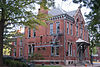
January 3, 1985 214 N. Pine St.
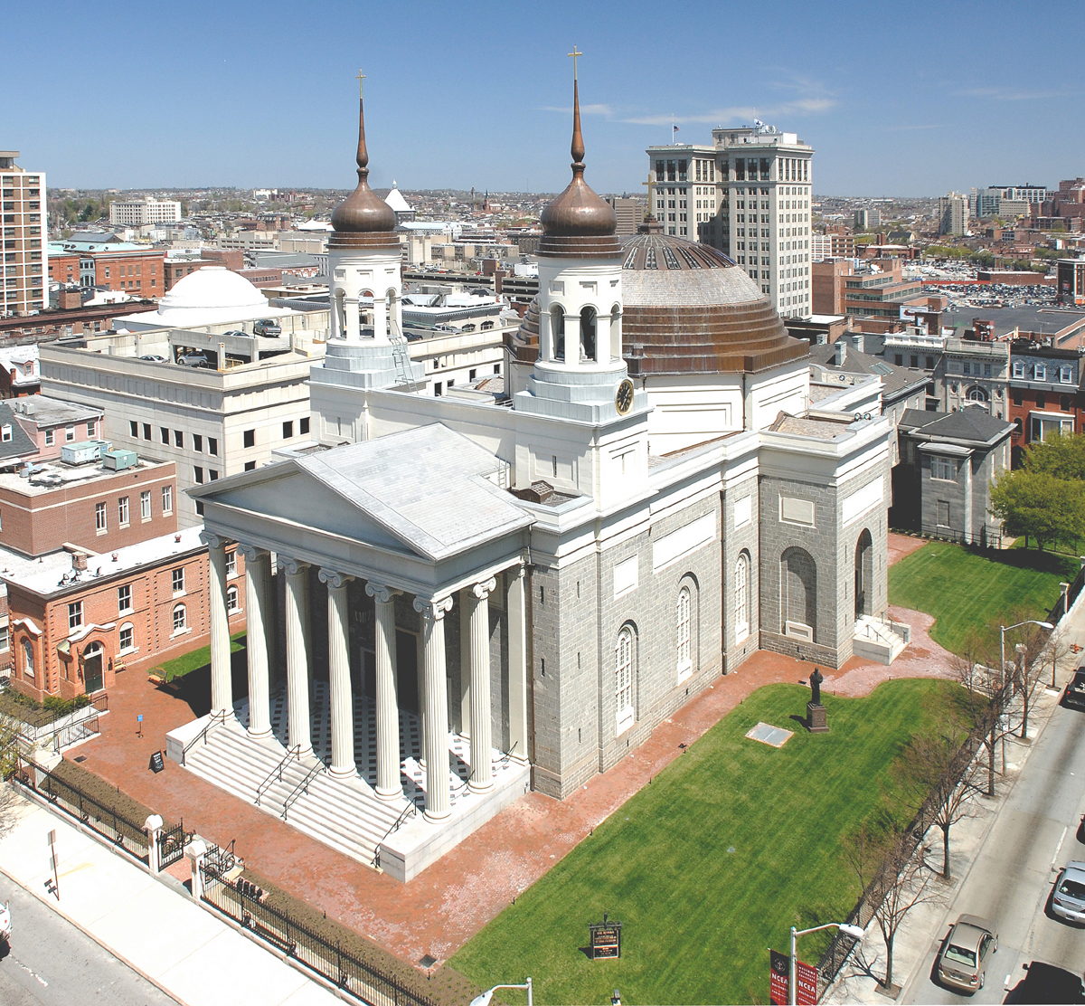
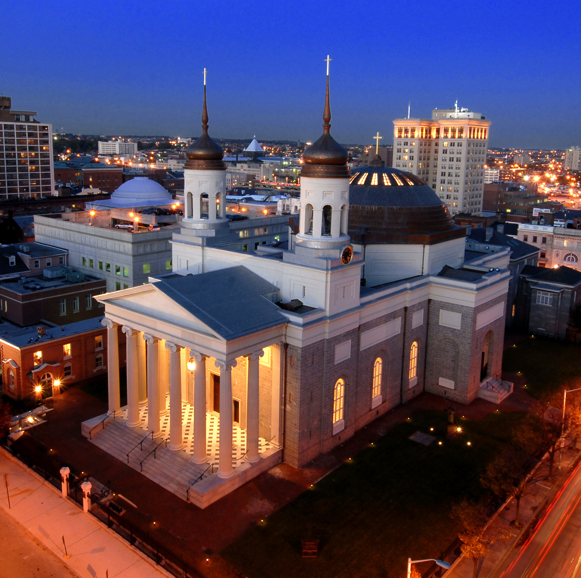
39°17′30″N 76°37′40″W / 39.291667°N 76.627778°WCentral 68 Old Roman Catholic Cathedral 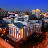
October 1, 1969 401 Cathedral St.
39°17′43″N 76°36′58″W / 39.295278°N 76.616111°WCentral 69 One Charles Center July 13, 2000 100 N. Charles St.
39°17′45″N 76°37′22″W / 39.295833°N 76.622778°WCentral 70 Orchard Street United Methodist Church November 12, 1975 510 Orchard St.
39°17′51″N 76°37′28″W / 39.2975°N 76.624444°WCentral 71 Otterbein Church October 28, 1969 112 W. Conway St.
39°17′04″N 76°37′02″W / 39.284444°N 76.617222°WCentral 72 Paca Street Firehouse 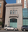
October 28, 1983 106 N. Paca St.
39°17′27″N 76°36′44″W / 39.290833°N 76.612222°WCentral 73 Park Circle Historic District December 4, 2008 Roughly bounded by Overview Ave., Shirley Ave., Cottage Ave., and Henry G. Parks Jr. Circle
39°19′40″N 76°39′36″W / 39.327642°N 76.660042°WCentral 74 Pascault Row 
January 29, 1973 651-665 W. Lexington St.
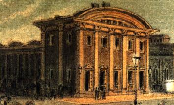
39°17′28″N 76°37′35″W / 39.291111°N 76.626389°WCentral 75 Peale's Baltimore Museum 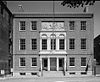
October 15, 1966 225 N. Holliday St.
39°17′31″N 76°36′38″W / 39.291944°N 76.610556°WCentral 76 Pennsylvania Station 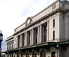
September 12, 1975 1525 N. Charles St.
39°18′28″N 76°36′57″W / 39.307778°N 76.615833°WCentral 77 Perkins Square Gazebo July 28, 1983 George St. and Myrtle Ave.
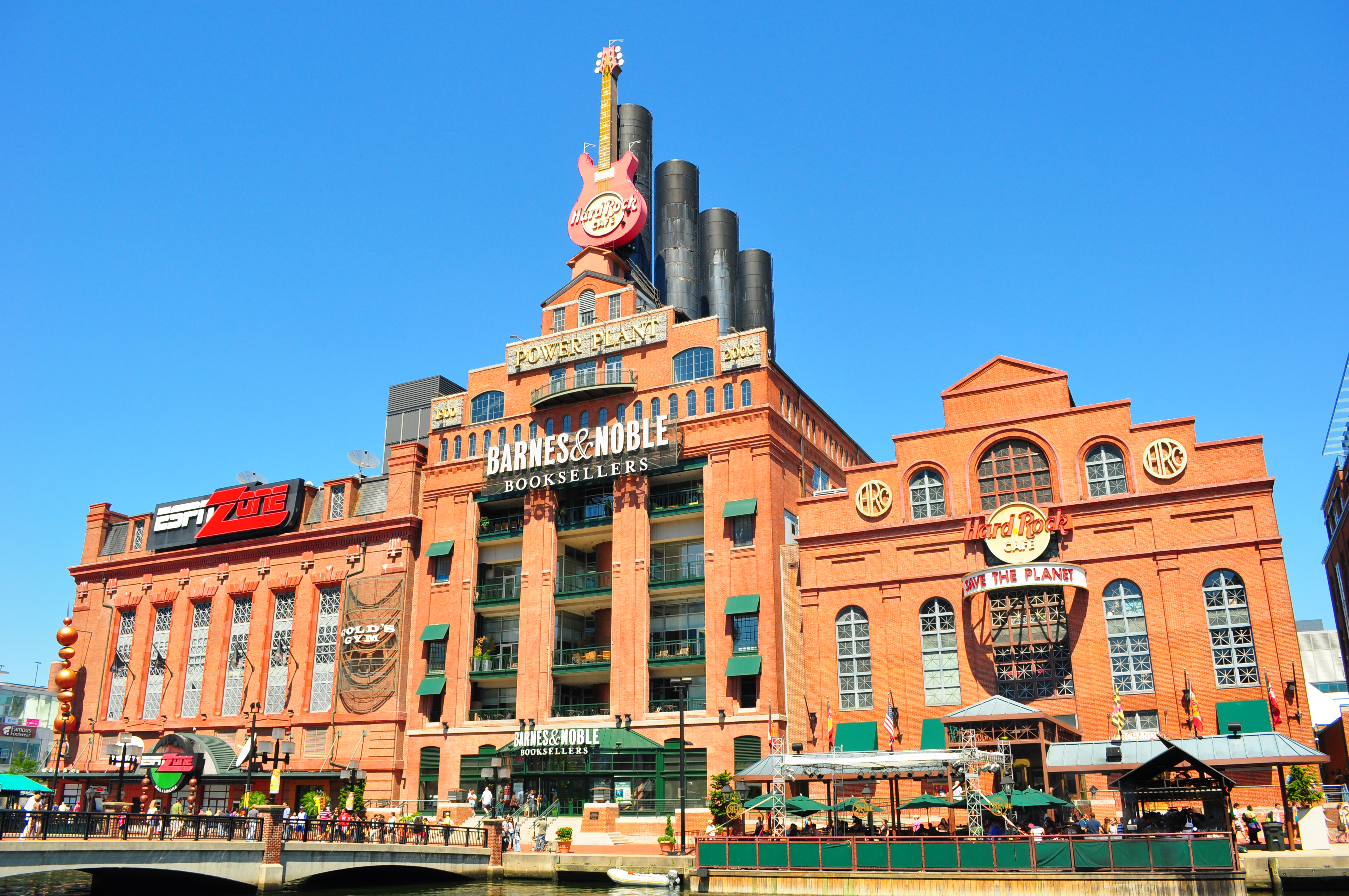
39°17′44″N 76°37′45″W / 39.295556°N 76.629167°WCentral 78 Pratt Street Power Plant 
April 9, 1987 601 E. Pratt St.
39°17′10″N 76°36′27″W / 39.286111°N 76.6075°WCentral 79 President Street Station 
September 10, 1992 Junction of President and Fleet Sts.
39°17′02″N 76°36′10″W / 39.283889°N 76.602778°WCentral 80 Ira Remsen House May 15, 1975 214 Monument St.
39°17′51″N 76°37′10″W / 39.2975°N 76.619444°WCentral 81 Rieman Block June 7, 1984 617-631 W. Lexington St.
39°17′28″N 76°37′31″W / 39.291111°N 76.625278°WCentral 82 Riverside Historic District April 30, 2008 Bounded by Race St. from the west, south to Winder, east to Webster, north to Heath, east to Boyle and north to Fort, then west to Marshall
39°16′13″N 76°36′33″W / 39.270253°N 76.609264°WCentral 83 Henry August Rowland House 
May 15, 1975 915 Cathedral St.
39°18′01″N 76°37′04″W / 39.300278°N 76.617778°WCentral 84 St. Mary's Seminary Chapel 
November 11, 1971 600 N. Paca St.
39°17′45″N 76°37′23″W / 39.295833°N 76.623056°WCentral 85 St. Paul's Church Rectory March 20, 1973 24 W. Saratoga St.
39°17′34″N 76°36′57″W / 39.292778°N 76.615833°WCentral 86 St. Paul's Protestant Episcopal Church March 30, 1973 233 N. Charles St.
39°17′31″N 76°36′54″W / 39.291944°N 76.615°WCentral 87 Sanitary Laundry Company Building 
October 14, 1994 118-120 N. Paca St.
39°17′27″N 76°37′22″W / 39.290833°N 76.622778°WCentral 88 Seton Hill Historic District 
July 30, 1975 Bounded by Pennsylvania Ave. and Franklin, Eutaw, McCulloh, and Orchard Sts.
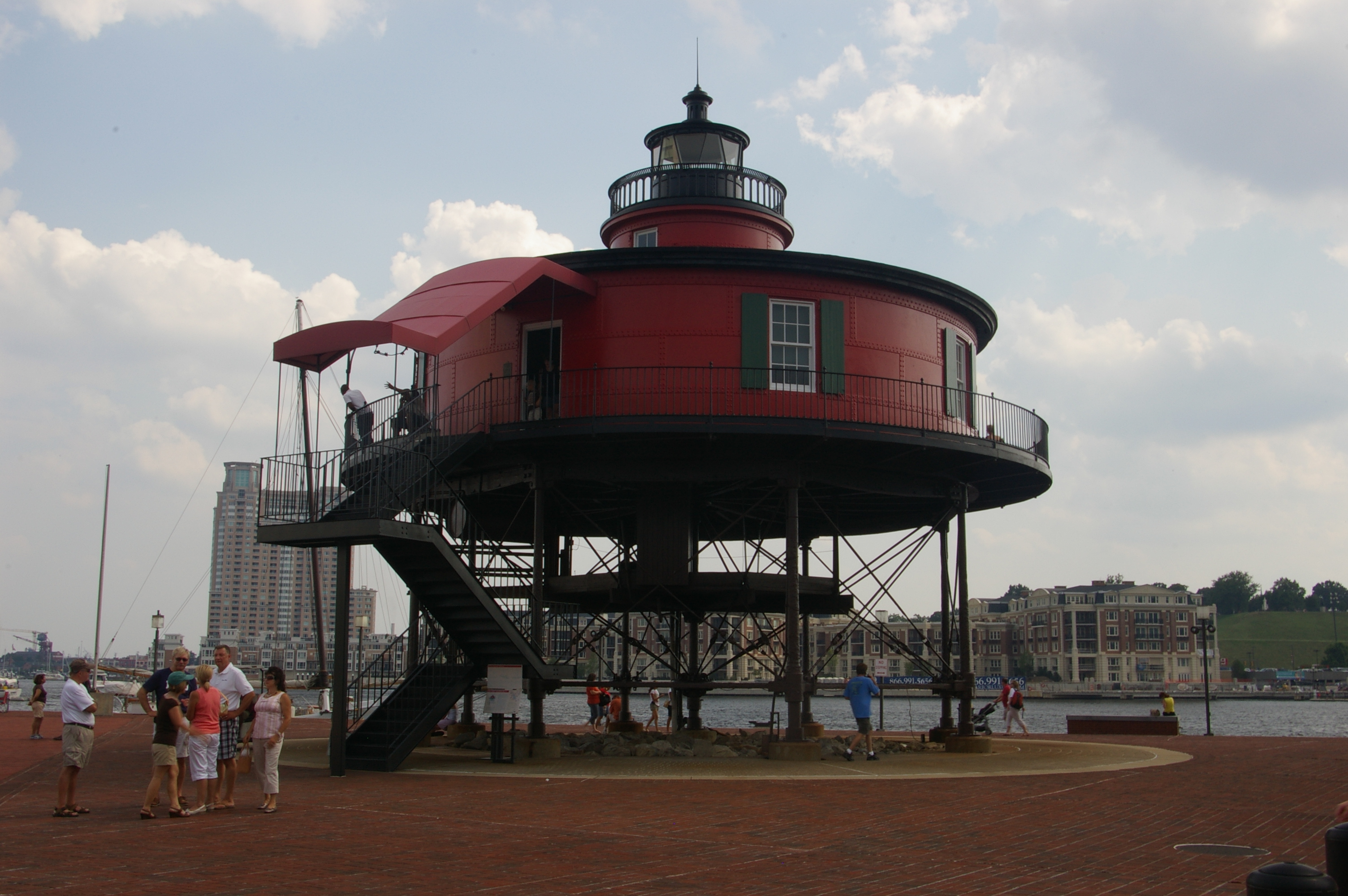
39°17′47″N 76°37′24″W / 39.296389°N 76.623333°WCentral 89 Seven-Foot Knoll Lighthouse 
August 22, 1989 Pier 5, Inner Harbor
39°17′02″N 76°36′21″W / 39.283889°N 76.605833°WCentral 90 Sharp Street Memorial United Methodist Church and Community House July 21, 1982 508-516 Dolphin St. and 1206-1210 Etting St.
39°18′03″N 76°37′44″W / 39.300833°N 76.628889°WCentral 91 Standard Oil Building December 1, 2000 501 St. Paul St.
39°17′43″N 76°36′49″W / 39.295278°N 76.613611°WCentral 92 Stewart's Department Store September 3, 1999 226-232 W. Lexington St.
39°17′31″N 76°37′10″W / 39.291944°N 76.619444°WCentral 93 Swiss Steam Laundry Building June 20, 1985 100-102 N. Greene St.
39°17′25″N 76°37′29″W / 39.290278°N 76.624722°WCentral 94 Terminal Warehouse November 14, 1978 211 E. Pleasant St.
39°17′36″N 76°36′40″W / 39.293333°N 76.611111°WCentral 95 U.S. Custom House 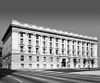
February 15, 1974 40 S. Gay St.
39°17′18″N 76°36′34″W / 39.288333°N 76.609444°WCentral 96 USS TORSK (submarine) 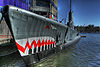
January 14, 1986 Pier IV, Pratt St.
39°17′05″N 76°36′33″W / 39.284722°N 76.609167°WCentral 97 Union Baptist Church December 30, 2009 1219 Druid Hill Ave.
39°18′06″N 76°37′41″W / 39.301689°N 76.628083°WCentral 98 United States Parcel Post Station December 27, 2002 1501 St. Paul St.
39°18′24″N 76°36′51″W / 39.306667°N 76.614167°WCentral 99 Upper Fells Point Historic District 
December 20, 2007 Roughly bounded by E. Baltimore St., S. Chapel St., E. Pratt St., S. Patterson Park Ave., and S. Chester, Gough, and S. Bethel Sts.
39°17′19″N 76°35′16″W / 39.288636°N 76.587833°WCentral 100 Upton July 27, 1994 811 W. Lanvale St.
39°17′53″N 76°37′56″W / 39.298056°N 76.632222°WCentral 101 William H. Welch House January 7, 1976 935 St. Paul St.
39°18′07″N 76°36′51″W / 39.301944°N 76.614167°WCentral 102 Westminster Presbyterian Church and Cemetery 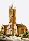
September 17, 1974 509 W. Fayette St.
39°17′24″N 76°37′26″W / 39.29°N 76.623889°WCentral 103 Woman's Industrial Exchange December 19, 1978 333 N. Charles St.
39°17′36″N 76°36′55″W / 39.293333°N 76.615278°WCentral 104 Young Men's and Young Women's Hebrew Association Building November 14, 1985 305-311 W. Monument St.
39°17′50″N 76°37′15″W / 39.297222°N 76.620833°WCentral See also
References
- ^ The latitude and longitude information provided in this table was derived originally from the National Register Information System, which has been found to be fairly accurate for about 99% of listings. For about 1% of NRIS original coordinates, experience has shown that one or both coordinates are typos or otherwise extremely far off; some corrections may have been made. A more subtle problem causes many locations to be off by up to 150 yards, depending on location in the country: most NRIS coordinates were derived from tracing out latitude and longitudes off of USGS topographical quadrant maps created under the North American Datum of 1927, which differs from the current, highly accurate WGS84 GPS system used by Google maps. Chicago is about right, but NRIS longitudes in Washington are higher by about 4.5 seconds, and are lower by about 2.0 seconds in Maine. Latitudes differ by about 1.0 second in Florida. Some locations in this table may have been corrected to current GPS standards.
- ^ "National Register of Historic Places: Weekly List Actions". National Park Service, United States Department of the Interior. Retrieved on November 10, 2011.
- ^ Numbers represent an ordering by significant words. Various colorings, defined here, differentiate National Historic Landmark sites and National Register of Historic Places Districts from other NRHP buildings, structures, sites or objects.
- ^ Official Baltimore neighborhoods, defined here
U.S. National Register of Historic Places in Maryland Lists by county Allegany • Anne Arundel • Baltimore County • Calvert • Caroline • Carroll • Cecil • Charles • Dorchester • Frederick • Garrett • Harford • Howard • Kent • Montgomery • Prince George's • Queen Anne's • Somerset • St. Mary's • Talbot • Washington • Wicomico • Worcester

Lists by city Baltimore: (Central · North and Northwest · West and Southwest · East and Northeast · South and Southeast)Other lists Categories:- National Register of Historic Places in Maryland by county
- History of Baltimore, Maryland
-


Wikimedia Foundation. 2010.