National Register of Historic Places listings in Calvert County, Maryland
- National Register of Historic Places listings in Calvert County, Maryland
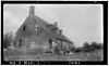
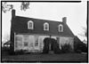
-

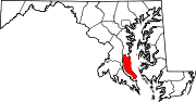
Location of Calvert County in Maryland
This is a list of the National Register of Historic Places listings in Calvert County, Maryland.
This is intended to be a complete list of the properties and districts on the National Register of Historic Places in Calvert County, Maryland, United States. Latitude and longitude coordinates are provided for many National Register properties and districts; these locations may be seen together in a Google map.[1]
There are 20 properties and districts listed on the National Register in the county, including 2 National Historic Landmarks.
-
- This National Park Service list is complete through NPS recent listings posted November 10, 2011.[2]
Current listings
| [3] |
Landmark name[4] |
Image |
Date listed |
Location |
City or Town |
Summary |
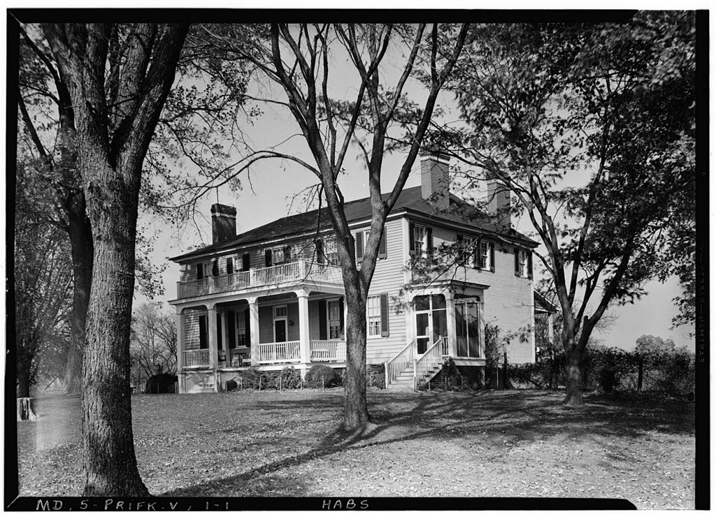
| 1 |
All Saints' Church |
 |
01973-03-14 March 14, 1973 |
100 Lower Marlboro Road, near the intersection of Southern Maryland Boulevard and Solomons Island Road
38°39′42″N 76°36′26″W / 38.66167°N 76.60722°W / 38.66167; -76.60722 (All Saints' Church) |
Sunderland |
|
| 2 |
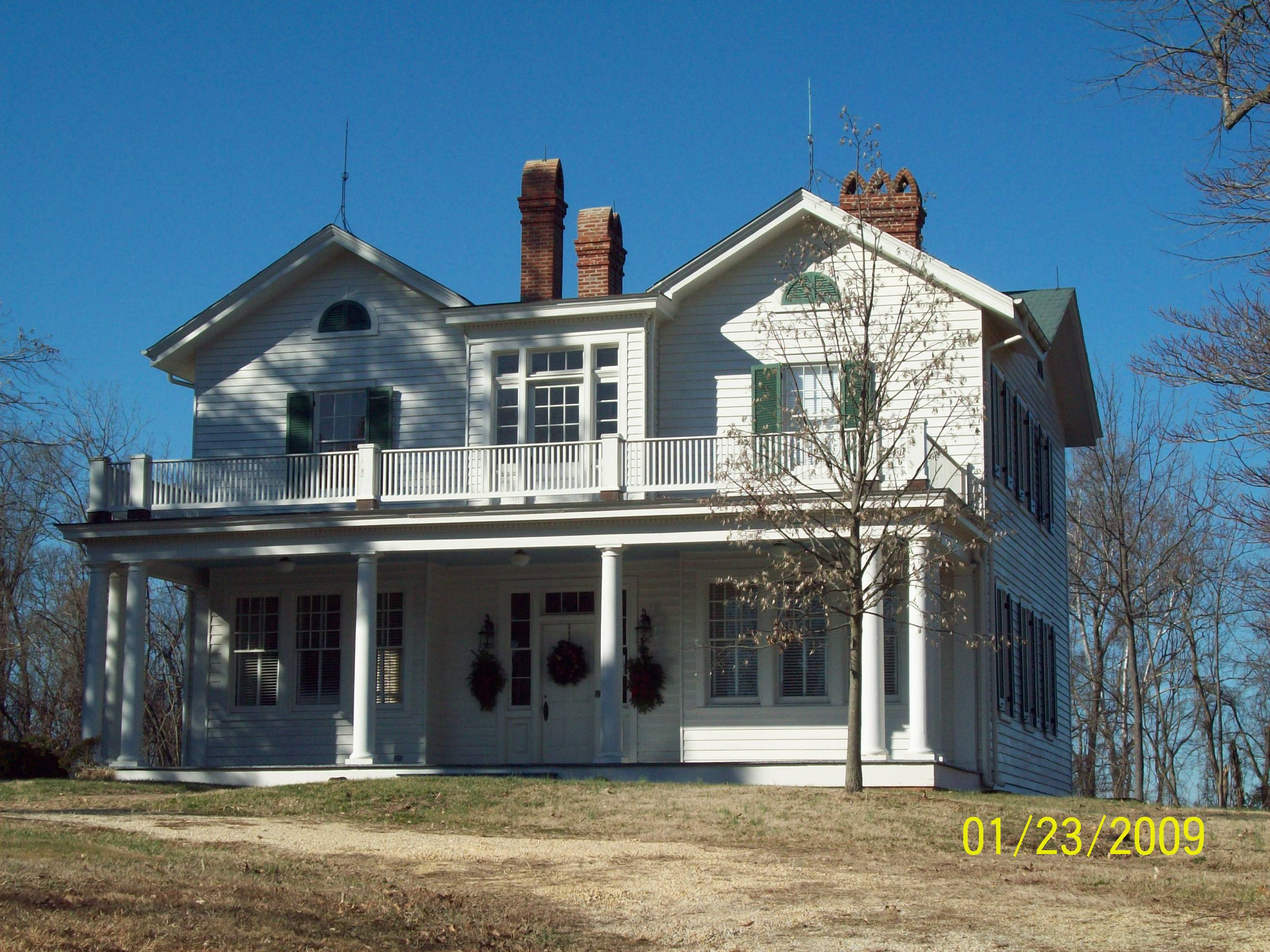
Cedar Hill |
 |
01973-05-22 May 22, 1973 |
2 miles west of Barstow on Buena Vista Rd.
38°31′57″N 76°37′58″W / 38.5325°N 76.63278°W / 38.5325; -76.63278 (Cedar Hill) |
Barstow |
|
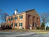
| 3 |
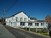
Chesapeake Beach Railway Station |
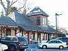 |
01980-09-11 September 11, 1980 |
8005 Bayside Rd.
38°41′24″N 76°32′3″W / 38.69°N 76.53417°W / 38.69; -76.53417 (Chesapeake Beach Railway Station) |
Chesapeake Beach |
|
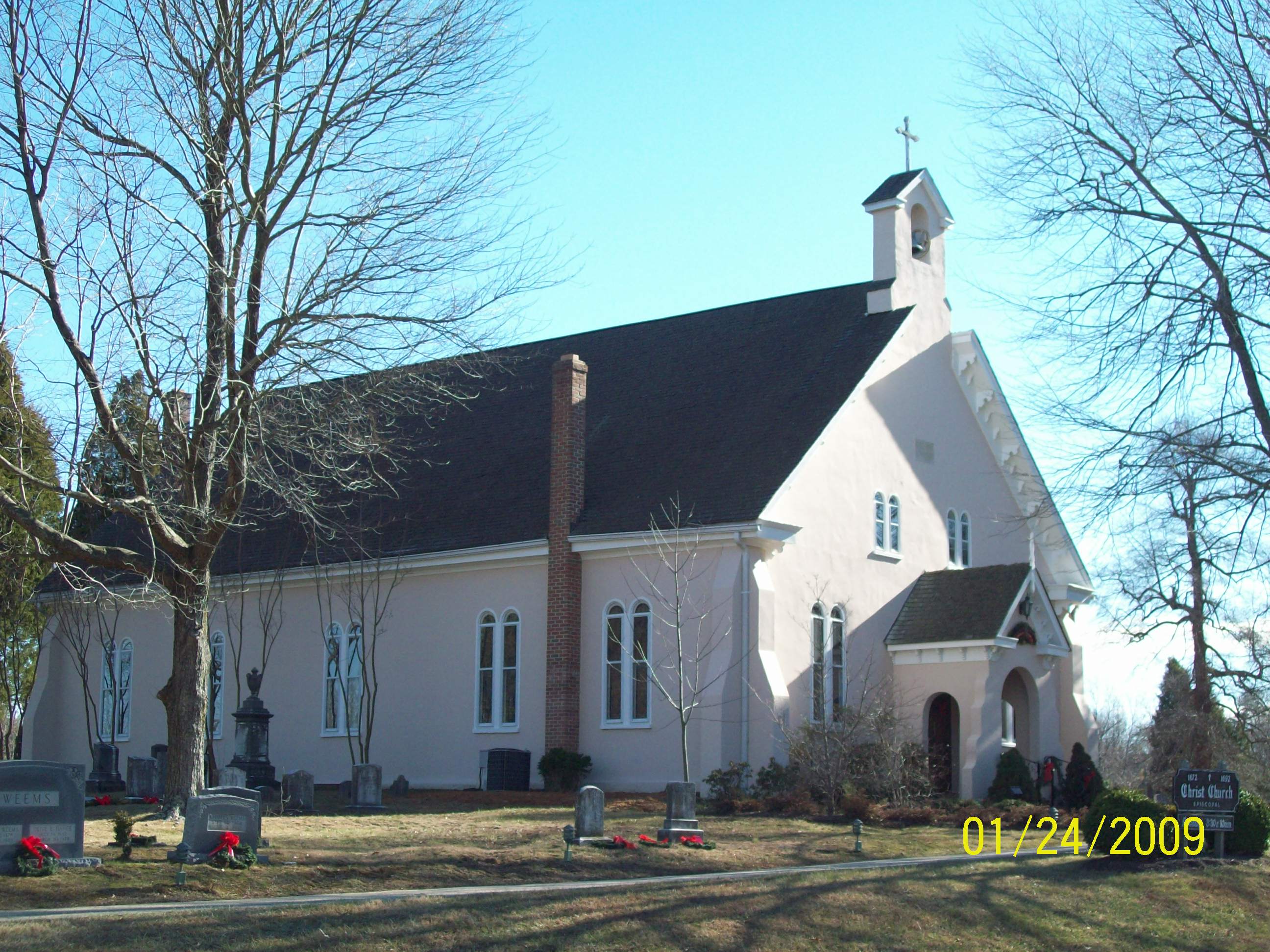
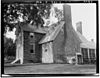
| 4 |
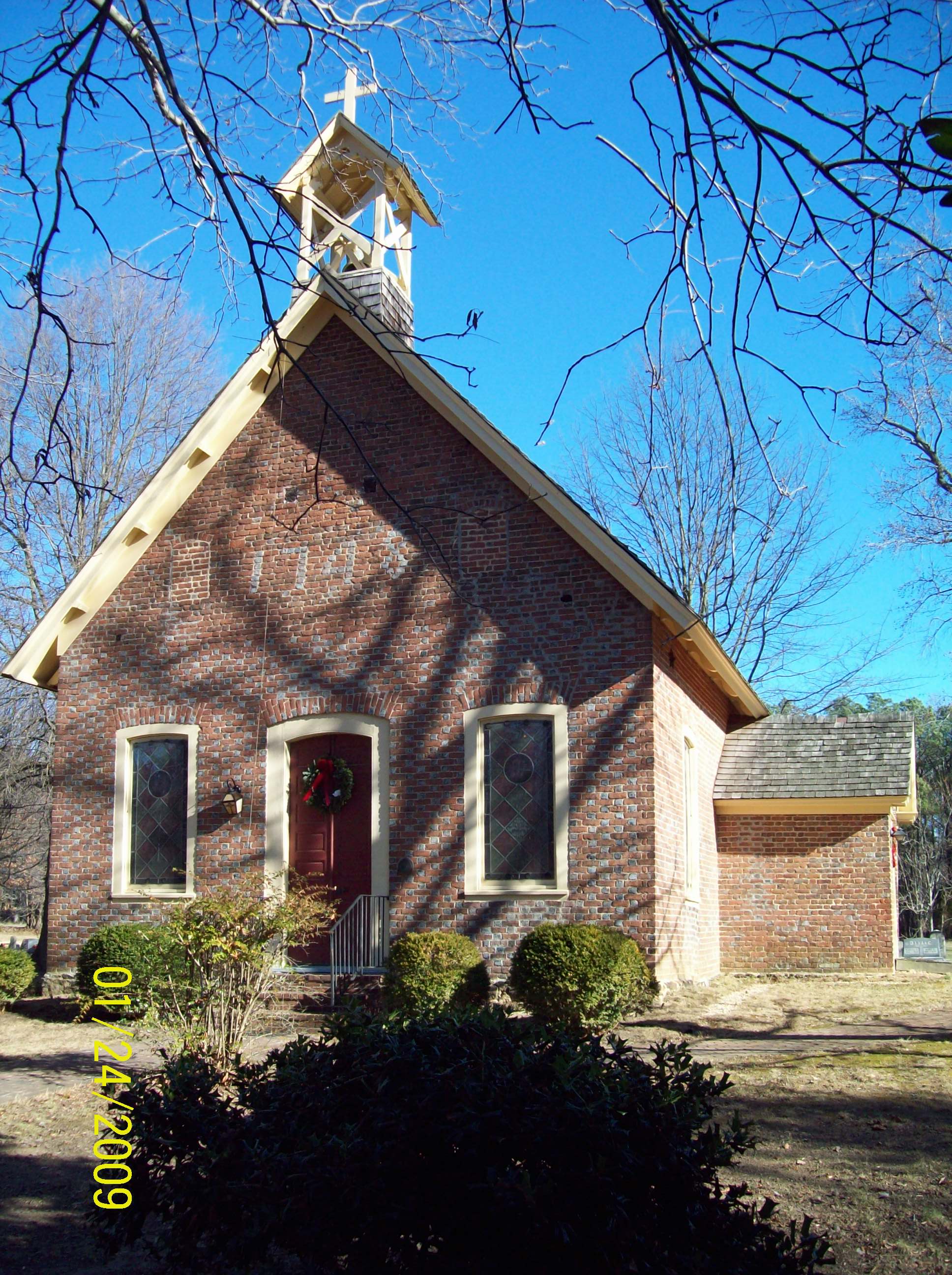
Christ Church |
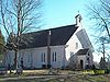 |
01975-11-12 November 12, 1975 |
Southwest of Port Republic on Broome Island Rd.
38°29′38″N 76°32′12″W / 38.49389°N 76.53667°W / 38.49389; -76.53667 (Christ Church) |
Port Republic |
|
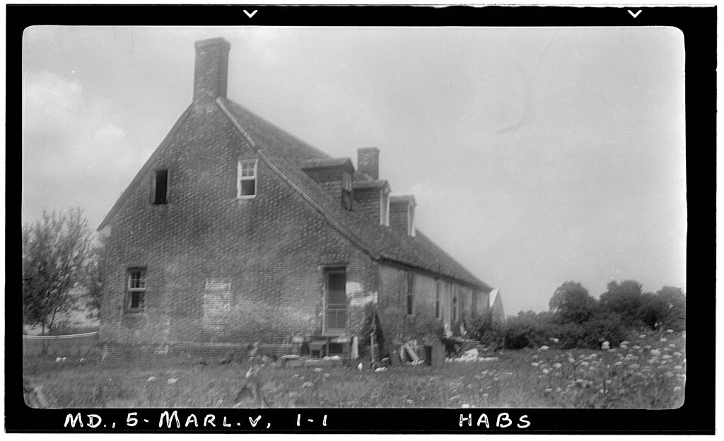
| 5 |
Cornehill |
|
01972-10-31 October 31, 1972 |
Emmanuel Church Rd.
38°35′20″N 76°33′19″W / 38.58889°N 76.55528°W / 38.58889; -76.55528 (Cornehill) |
Parran |
|
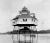
| 6 |
Cove Point Lighthouse |
 |
01973-04-11 April 11, 1973 |
3500 Lighthouse Boulevard, off Maryland Route 497
38°23′10″N 76°22′55″W / 38.38611°N 76.38194°W / 38.38611; -76.38194 (Cove Point Lighthouse) |
Lusby |
|
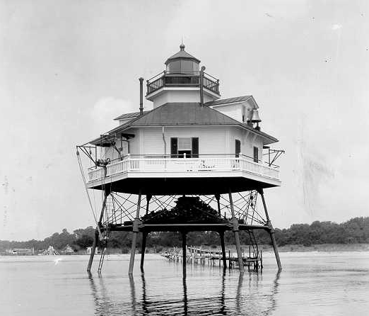
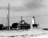
| 7 |
Drum Point Lighthouse |
 |
01973-04-11 April 11, 1973 |
West shore of Back Creek, Calvert Marine Museum
38°19′52″N 76°27′49″W / 38.33111°N 76.46361°W / 38.33111; -76.46361 (Drum Point Lighthouse) |
Solomons Island |
|
| 8 |
Grahame House |
 |
01972-04-26 April 26, 1972 |
Northeast of Maryland Routes 262 and 523
38°39′25″N 76°40′42″W / 38.65694°N 76.67833°W / 38.65694; -76.67833 (Grahame House) |
Lower Marlboro |
|
| 9 |
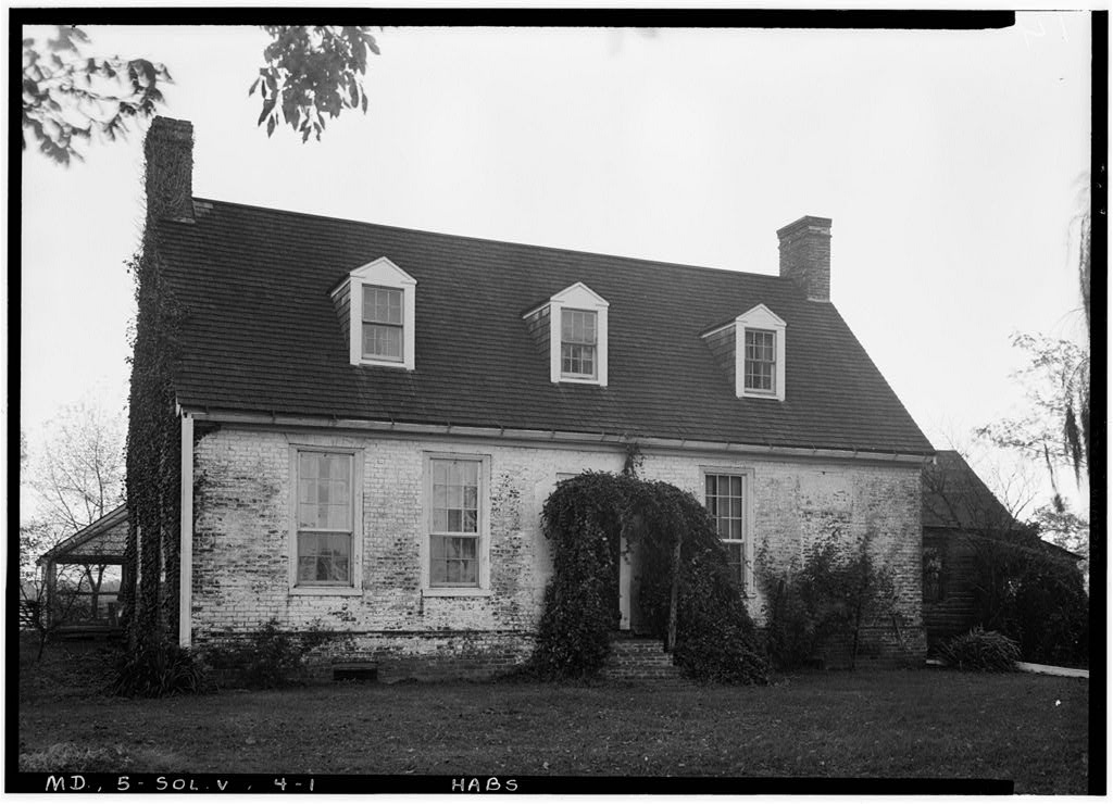
La Veille |
|
01973-09-20 September 20, 1973 |
West of Mutual on Ben La Veille Rd. off Maryland Route 264
38°28′33″N 76°35′25″W / 38.47583°N 76.59028°W / 38.47583; -76.59028 (La Veille) |
Mutual |
|
| 10 |
Linden |
 |
02000-03-24 March 24, 2000 |
70 Church St.
38°32′24″N 76°35′16″W / 38.54°N 76.58778°W / 38.54; -76.58778 (Linden) |
Prince Frederick |
|
| 11 |
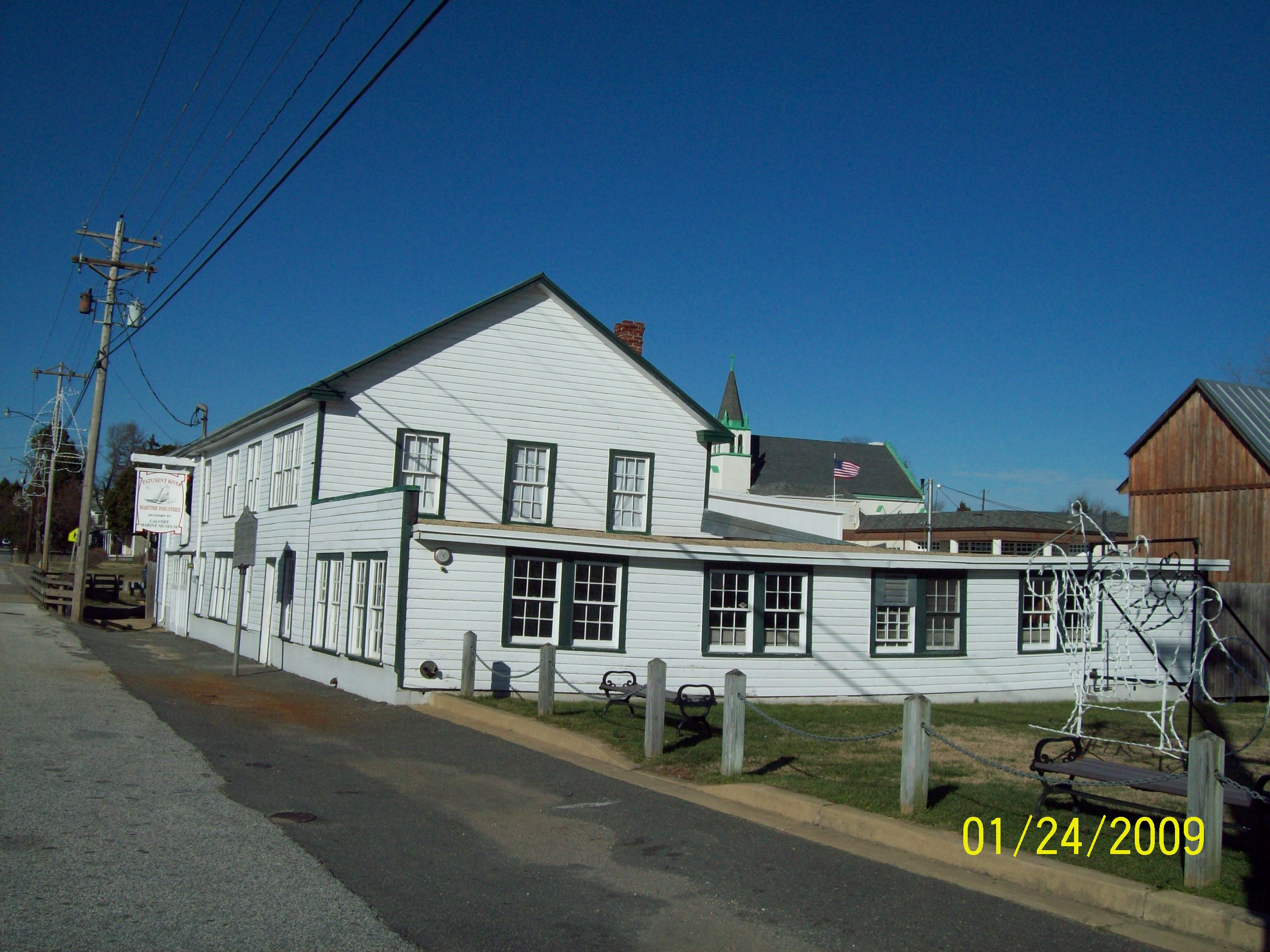
J. C. Lore Oyster House |
 |
01984-03-22 March 22, 1984 |
Maryland Route 2
38°19′26″N 76°27′40″W / 38.32389°N 76.46111°W / 38.32389; -76.46111 (Lore, J. C., Oyster House) |
Solomons |
|
| 12 |
Joseph D. Lyons House |
|
01998-07-22 July 22, 1998 |
7120 Wayside Dr.
38°40′38″N 76°35′54″W / 38.67722°N 76.59833°W / 38.67722; -76.59833 (Lyons, Joseph D., House) |
Sunderland |
|
| 13 |
Maidstone |
|
01971-06-21 June 21, 1971 |
Chesapeake Beach Rd.
38°44′5″N 76°37′38″W / 38.73472°N 76.62722°W / 38.73472; -76.62722 (Maidstone) |
Owings |
|
| 14 |
Middleham Chapel |
 |
01975-02-20 February 20, 1975 |
1 mile southeast of Lusby on Maryland Route 4
38°23′56″N 76°26′13″W / 38.39889°N 76.43694°W / 38.39889; -76.43694 (Middleham Chapel) |
Lusby |
|
| 15 |
Morgan Hill Farm |
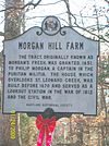 |
01976-04-03 April 3, 1976 |
Sollers Rd., west of Lusby
38°24′35″N 76°28′46″W / 38.40972°N 76.47944°W / 38.40972; -76.47944 (Morgan Hill Farm) |
Lusby |
|
| 16 |
Patterson's Archeological District |
 |
01982-04-12 April 12, 1982 |
Address Restricted |
Wallville |
|
| 17 |
Preston-on-the-Patuxent |
 |
01974-10-09 October 9, 1974 |
North of Johnstown off Sollers Mill Rd.
38°22′20″N 76°29′6″W / 38.37222°N 76.485°W / 38.37222; -76.485 (Preston-on-the-Patuxent) |
Johnstown |
|
| 18 |
Taney Place |
 |
01972-09-22 September 22, 1972 |
South of Adelina on Maryland Route 508
38°27′43″N 76°36′19″W / 38.46194°N 76.60528°W / 38.46194; -76.60528 (Taney Place) |
Adelina |
|
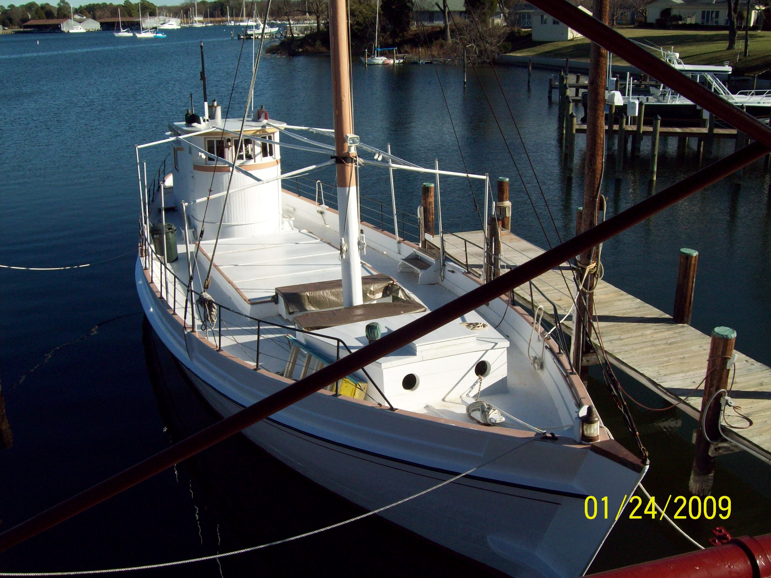
| 19 |
WM. B. TENNISON (Chesapeake Bay Bugeye) |
 |
01980-03-27 March 27, 1980 |
Calvert Marine Museum
38°19′30″N 76°27′39″W / 38.325°N 76.46083°W / 38.325; -76.46083 (TENNISON, WM. B. (Chesapeake Bay Bugeye)) |
Solomons |
|
| 20 |
Willow Glenn |
|
01973-07-02 July 2, 1973 |
Northwest of Barstow on Barstow Rd.
38°32′44″N 76°38′6″W / 38.54556°N 76.635°W / 38.54556; -76.635 (Willow Glenn) |
Barstow |
|
See also
References
- ^ The latitude and longitude information provided in this table was derived originally from the National Register Information System, which has been found to be fairly accurate for about 99% of listings. For about 1% of NRIS original coordinates, experience has shown that one or both coordinates are typos or otherwise extremely far off; some corrections may have been made. A more subtle problem causes many locations to be off by up to 150 yards, depending on location in the country: most NRIS coordinates were derived from tracing out latitude and longitudes off of USGS topographical quadrant maps created under the North American Datum of 1927, which differs from the current, highly accurate WGS84 GPS system used by Google maps. Chicago is about right, but NRIS longitudes in Washington are higher by about 4.5 seconds, and are lower by about 2.0 seconds in Maine. Latitudes differ by about 1.0 second in Florida. Some locations in this table may have been corrected to current GPS standards.
- ^ "National Register of Historic Places: Weekly List Actions". National Park Service, United States Department of the Interior. Retrieved on November 10, 2011.
- ^ Numbers represent an ordering by significant words. Various colorings, defined here, differentiate National Historic Landmark sites and National Register of Historic Places Districts from other NRHP buildings, structures, sites or objects.
- ^ "National Register Information System". National Register of Historic Places. National Park Service. 2008-04-24. http://nrhp.focus.nps.gov/natreg/docs/All_Data.html.
Wikimedia Foundation.
2010.
Look at other dictionaries:
National Register of Historic Places listings in Cecil County, Maryland — Location of Cecil County in Maryland This is a list of the National Register of Historic Places listings in Cecil County, Maryland. This is intended to be a complete list of the properties and districts on the National Register of Historic Places … Wikipedia
National Register of Historic Places listings in Baltimore County, Maryland — Location of Baltimore County in Maryland This is a list of the National Register of Historic Places listings in Baltimore County, Maryland. This is intended to be a complete list of the properties and districts on the National Register of… … Wikipedia
National Register of Historic Places listings in Carroll County, Maryland — Location of Carroll County in Maryland This is a list of the National Register of Historic Places listings in Carroll County, Maryland. This is intended to be a complete list of the properties and districts on the National Register of Historic… … Wikipedia
National Register of Historic Places listings in Charles County, Maryland — Location of Charles County in Maryland This is a list of the National Register of Historic Places listings in Charles County, Maryland. This is intended to be a complete list of the properties and districts on the National Register of Historic… … Wikipedia
National Register of Historic Places listings in Frederick County, Maryland — Location of Frederick County in Maryland This is a list of the National Register of Historic Places listings in Frederick County, Maryland. This is intended to be a complete list of the properties and districts on the National Register of… … Wikipedia
National Register of Historic Places listings in Montgomery County, Maryland — Location of Montgomery County in Maryland This is a list of the National Register of Historic Places listings in Montgomery County, Maryland. This is intended to be a complete list of the properties and districts on the National Register of… … Wikipedia
National Register of Historic Places listings in Washington County, Maryland — Location of Washington County in Maryland This is a list of the National Register of Historic Places listings in Washington County, Maryland. This is intended to be a complete list of the properties and districts on the National Register of… … Wikipedia
National Register of Historic Places listings in Allegany County, Maryland — Location of Allegany County in Maryland This is a list of the National Register of Historic Places listings in Allegany County, Maryland. This is intended to be a complete list of the properties and districts on the National Register of Historic… … Wikipedia
National Register of Historic Places listings in Harford County, Maryland — Location of Harford County in Maryland This is a list of the National Register of Historic Places listings in Harford County, Maryland. This is intended to be a complete list of the properties and districts on the National Register of Historic… … Wikipedia
National Register of Historic Places listings in Kent County, Maryland — Location of Kent County in Maryland This is a list of the National Register of Historic Places listings in Kent County, Maryland. This is intended to be a complete list of the properties and districts on the National Register of Historic Places… … Wikipedia