- Lusby, Maryland
Infobox Settlement
official_name = Lusby, Maryland
settlement_type = CDP
nickname =
motto =
imagesize =
image_caption =
image_
imagesize =
image_caption =
image_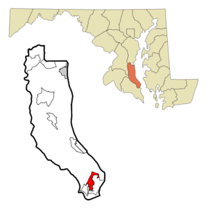
mapsize = 250x200px
map_caption = Location of Lusby, Maryland
mapsize1 =
map_caption1 =subdivision_type = Country
subdivision_name =United States
subdivision_type1 = State
subdivision_name1 =Maryland
subdivision_type2 = County
subdivision_name2 = Calvert
government_footnotes =
government_type =
leader_title =
leader_name =
leader_title1 =
leader_name1 =
established_title =
established_date =unit_pref = Imperial
area_footnotes =area_magnitude =
area_total_km2 = 9.5
area_land_km2 = 9.1
area_water_km2 = 0.4
area_total_sq_mi = 3.7
area_land_sq_mi = 3.5
area_water_sq_mi = 0.2population_as_of = 2000
population_footnotes =
population_total = 1666
population_density_km2 = 183.8
population_density_sq_mi = 476.1timezone = Eastern (EST)
utc_offset = -5
timezone_DST = EDT
utc_offset_DST = -4
elevation_footnotes =
elevation_m = 32
elevation_ft = 105
latd = 38 |latm = 21 |lats = 13 |latNS = N
longd = 76 |longm = 26 |longs = 12 |longEW = Wpostal_code_type =
ZIP code
postal_code = 20657
area_code = 410
blank_name = FIPS code
blank_info = 24-48800
blank1_name = GNIS feature ID
blank1_info = 0590708
website =
footnotes =Lusby is a
census-designated place (CDP) in Calvert County,Maryland ,United States . The population was officially 1,666 at the 2000 census, although residents of the Chesapeake Ranch Estates-Drum Point community also use the Lusby zip code designation, making Lusby in fact a much larger community. TheCalvert Cliffs Nuclear Power Plant , and a compressed natural gas plant run byDominion Resources , are both nearby. Dominion Cove Point is one of the nation's largestliquefied natural gas import facilities. A large housing development called Chesapeake Ranch Estates is nearby, as well as the tourist resort town of Solomons. Many residents commute to thePatuxent River Naval Air Station , toAndrews Air Force Base , or with difficulty to theWashington, D.C. area.Lusby's central business district has been growing rapidly in recent years. At least three shopping centers have either been built or have been approved, bringing in new grocery stores, restaurants, and other new businesses to the Lusby area. Several new roads are also in planning stages in order to ease traffic congestion to and from the Chesapeake Ranch Estates-Drum Point communities.
Lusby has one public
high school ,Patuxent High School , which opened in 1996. Patuxent's school mascot is the Panthers. There are also two public middle schools and two public elementary schools in Lusby.Lusby also features a community park, Cove Point Park, which has numerous baseball fields and a public swimming pool, and a public golf course, Chesapeake Hills Golf Course. There is also a private air field owned and operated by the Chesapeake Ranch Estates-Drum Point communities.
Places of note in the Lusby area include the Cove Point Lighthouse on the
Chesapeake Bay andCalvert Cliffs State Park .Geography
Lusby is located at coor dms|38|21|13|N|76|26|12|W|city (38.353555, -76.436615)GR|1.
According to the
United States Census Bureau , the CDP has a total area of 3.7square mile s (9.5km² ), of which, 3.5 square miles (9.1 km²) of it is land and 0.2 square miles (0.4 km²) of it (4.37%) is water.Demographics
As of the
census GR|2 of 2000, there were 1,666 people, 595 households, and 433 families residing in the CDP. Thepopulation density was 476.1 people per square mile (183.8/km²). There were 656 housing units at an average density of 187.5/sq mi (72.4/km²). The racial makeup of the CDP was 72.15% White, 24.73% African American, 0.18% Native American, 0.66% Asian, 0.66% from other races, and 1.62% from two or more races. Hispanic or Latino of any race were 2.76% of the population.There were 595 households out of which 35.5% had children under the age of 18 living with them, 57.0% were married couples living together, 11.3% had a female householder with no husband present, and 27.2% were non-families. 23.9% of all households were made up of individuals and 12.8% had someone living alone who was 65 years of age or older. The average household size was 2.79 and the average family size was 3.32.
In the CDP the population was spread out with 28.5% under the age of 18, 6.5% from 18 to 24, 31.9% from 25 to 44, 20.1% from 45 to 64, and 13.0% who were 65 years of age or older. The median age was 36 years. For every 100 females there were 93.5 males. For every 100 females age 18 and over, there were 93.7 males.
The median income for a household in the CDP was $40,769, and the median income for a family was $51,964. Males had a median income of $46,190 versus $26,429 for females. The
per capita income for the CDP was $19,932. About 5.3% of families and 4.5% of the population were below thepoverty line , including 4.3% of those under age 18 and 5.6% of those age 65 or over.References
External links
Wikimedia Foundation. 2010.