- Solomons, Maryland
Infobox Settlement
official_name = Solomons, Maryland
settlement_type = CDP
nickname =
motto =
imagesize =
image_caption =
image_
imagesize =
image_caption =
image_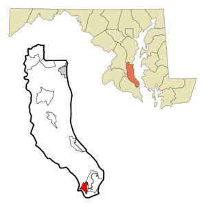
mapsize = 250x200px
map_caption = Location of Solomons, Maryland
mapsize1 =
map_caption1 =subdivision_type = Country
subdivision_name =United States
subdivision_type1 = State
subdivision_name1 =Maryland
subdivision_type2 = County
subdivision_name2 = Calvert
government_footnotes =
government_type =
leader_title =
leader_name =
leader_title1 =
leader_name1 =
established_title =
established_date =unit_pref = Imperial
area_footnotes =area_magnitude =
area_total_km2 = 5.5
area_land_km2 = 4.6
area_water_km2 = 0.9
area_total_sq_mi = 2.1
area_land_sq_mi = 1.8
area_water_sq_mi = 0.3population_as_of = 2000
population_footnotes =
population_total = 1536
population_density_km2 = 330.5
population_density_sq_mi = 856.1timezone = Eastern (EST)
utc_offset = -5
timezone_DST = EDT
utc_offset_DST = -4
elevation_footnotes =
elevation_m = 0
elevation_ft = 0
latd = 38 |latm = 20 |lats = 11 |latNS = N
longd = 76 |longm = 27 |longs = 51 |longEW = Wpostal_code_type =
ZIP code
postal_code = 20688
area_code = 410
blank_name = FIPS code
blank_info = 24-73325
blank1_name = GNIS feature ID
blank1_info = 1676619
website =
footnotes =Solomons is a community and
census-designated place (CDP) in Calvert County,Maryland ,United States . The population was 1,536 at the 2000 census. Solomons is considered a popular weekend destination spot amongst many living in theBaltimore-Washington Metropolitan Area .Geography
Solomons is located at coor dms|38|20|11|N|76|27|51|W|city (38.336431, -76.464102)GR|1.
According to the
United States Census Bureau , the CDP has a total area of 2.1square mile s (5.5km² ), of which, 1.8 square miles (4.6 km²) of it is land and 0.3 square miles (0.9 km²) of it (15.96%) is water.Solomons Island is on the north side of the mouth of
Patuxent River , where it meets theChesapeake Bay . It is just across from the U.S. Patuxent River Naval Air Station (on the south side of the mouth of the Patuxent River).History
Early settlers
Originally called
Bourne's Island (1680 ), thenSomervell's Island (1740 ), Solomons, also known as Solomons Island, takes its name from 19th century Baltimore businessman Isaac Solomon, who established a cannery there shortly after the Civil War. Solomons' home still stands on the front of the island.The area has, however, been inhabited since colonial times. The Webster Family opened up a grocery store in the late 18th century. The Store was the only one in the area and became a profitable business. This profit combined with cheap land prices led to the Webster Family (Now Glascock) owning a high percentage of Solomons, Maryland. [cite web
url=http://www.bayjournal.com/article.cfm?article=1982
title=Cove Point: Mariners’s safe harbor now threatened by ships
last= Mountford
first= Kent
publisher=Chesapeake Bay Journal
date=November 2001
accessdate=2008-05-12]Building ships for the fishing fleet
In the 19th century, shipyards developed to support the island's fishing fleet. The
Marsh Shipyard builtschooners andsloops , but became famous for itsbugeyes , the forerunner of the skipjack. In theWar of 1812 , CommodoreJoshua Barney 's flotilla sailed from here to attack British vessels on theChesapeake Bay . The deep, protected harbor has been a busy marine center ever since.Supporting the U.S. Navy during World War II
During
World War II , the island was chosen by the Allied command as the site for training amphibious invasion forces. The lessons learned at Solomons proved invaluable on D-Day, atTarawa ,Guadalcanal , and in numerous other military operations. Three naval bases were established at the mouth of the nearbyPatuxent River . These three facilities made a major contribution to the war effort and brought new jobs to local residents. Between1942 and1945 , the population of Solomons increased from 263 to more than 2,600. Over 60,000 troops trained at Solomons during the war.Ironically, many of the servicemen who trained at the Solomons Maryland base, were sent to fight at the
Solomon Islands in thePacific Ocean .Solomons was the site of the following U.S. Navy activities during the war: [cite web
url=http://www.ibiblio.net/hyperwar/USN/ref/USN-Act/MD.html
title=U.S. Naval Activities, World War II, By State[Maryland]
last=Clancey
first=Patrick
publisher=HyperWar Foundation
accessdate=2008-04-17]
* Naval Mine Warfare Test Station.
* Naval Amphibious Training Base.
* Mine Warfare Experimental Station.
* Naval Dispensary, Naval Amphibious Training BaseConstruction of the Governor Thomas Johnson Bridge
Solomons was a rather isolated boat-building town housing the University of Maryland
Chesapeake Biological Laboratory , until 1977 when theGovernor Thomas Johnson Bridge was built. The bridge leads from just off Solomons Island proper toSaint Mary's County, Maryland and thePatuxent Naval Air Station .Present-day attraction to tourists
The town now welcomes tourists with numerous marinas, seafood restaurants, gift shops, a boardwalk, an upscale gourmet grocery, a sculpture garden, a marine life museum where visitors can climb atop a former lighthouse, harbor cruises, and occasional famous performer concerts outdoors. Solomons also has three major hotels, a
U.S. Navy family recreation center, and a church retirement home.2006 Solomons Island Fire
On March 15, 2006, a large fire destroyed Bowen's Inn (established in the 1800s), The Lighthouse Inn restaurant (established in 1984), and a condominium building. The fire caused 5 million dollars in damages and was determined to be caused by a cigarette butt. High winds fueled the fire and distributed smaller fires all over the island as far as the Research Lab.
Demographics
As of the
census GR|2 of 2000, there were 1,536 people, 689 households, and 378 families residing in the CDP. Thepopulation density was 856.1 people per square mile (331.3/km²). There were 881 housing units at an average density of 491.0/sq mi (190.0/km²). The racial makeup of the CDP was 90.69% White, 6.64% African American, 0.13% Native American, 0.52% Asian, 0.33% from other races, and 1.69% from two or more races. Hispanic or Latino of any race were 0.78% of the population.There were 689 households out of which 15.4% had children under the age of 18 living with them, 47.8% were married couples living together, 4.8% had a female householder with no husband present, and 45.1% were non-families. 39.0% of all households were made up of individuals and 24.8% had someone living alone who was 65 years of age or older. The average household size was 1.97 and the average family size was 2.56.
In the CDP the population was spread out with 13.1% under the age of 18, 3.1% from 18 to 24, 21.0% from 25 to 44, 21.2% from 45 to 64, and 41.7% who were 65 years of age or older. The median age was 56 years. For every 100 females there were 80.1 males. For every 100 females age 18 and over, there were 76.8 males.
The median income for a household in the CDP was $48,532, and the median income for a family was $74,318. Males had a median income of $64,833 versus $34,313 for females. The
per capita income for the CDP was $33,049. About 2.1% of families and 3.4% of the population were below thepoverty line , including 7.0% of those under age 18 and none of those age 65 or over.References
External links
Wikimedia Foundation. 2010.