- Maryland Route 778
-
Maryland Route 778
Old Solomons Island Road Route information Maintained by MDSHA Length: 2.12 mi[1][2] (3.41 km) Major junctions South end:  MD 2 in Owings
 MD 260 in Owings
North end:  MD 261 in Friendship
Highway system Maryland highway system
Interstate • US • State • Minor • Former • Turnpikes←  MD 776
MD 781  →
→Maryland Route 778 (MD 778) is a state highway in the U.S. state of Maryland. Known as Old Solomons Island Road, the state highway runs 2.12 mi (3.41 km) from MD 2 in Owings north to MD 261 in Friendship. MD 778 and its unsigned auxiliary routes are segments of the old alignment of MD 2 in far northern Calvert County and southern Anne Arundel County.
Contents
Route description
MD 778 begins at an intersection with MD 2 (Solomons Island Road) near Owings. The roadway continues on the other side of MD 2 as county-maintained Grovers Turn Road. MD 778 immediately intersects unmarked MD 765H, an unnamed old alignment of MD 2, before continuing north over Hall Creek and meeting MD 260 (Chesapeake Beach Road) in the village of Owings.[3] Shortly after the intersection with MD 260, MD 778 enters Anne Arundel County.[1] The state highway continues north through farmland to its northern terminus in the village of Friendship.[3] From the northern terminus, MD 261 heads east as Friendship Road, a county-maintained portion of Friendship Road heads west toward MD 2, and Old Solomons Island Road continues north as a county highway toward a separate intersection with MD 2.[2][3]
Junction list
County Location Mile
[1][2]Destinations Notes Calvert Owings 0.00 Grovers Turn Road west Southern terminus MD 2 (Solomons Island Road) – Annapolis, Prince Frederick0.61 MD 260 (Chesapeake Beach Road) – Chesapeake Beach, Upper MarlboroAnne Arundel Friendship 2.12 MD 261 east (Friendship Road) / Friendship Road west / Old Solomons Island Road north – North BeachNorthern terminus Auxiliary routes
There are ten unsigned auxiliary routes of MD 778. These ten highways, all named Old Solomons Island Road, are old alignments of MD 2 between Friendship and Harwood in southern Anne Arundel County.
- MD 778D is a 0.17-mile (0.27 km) loop located on the northbound side of MD 2 in Harwood.[2][4]
- MD 778E is a 0.24-mile (0.39 km) loop located on the southbound side of MD 2 in Lothian. The southern connection to MD 2 is provided by MD 778Q.[2][5]
- MD 778F is a 0.48-mile (0.77 km) loop located on the southbound side of MD 2 in Tracys Landing, with termini on either side of MD 2's intersection with MD 256.[2][6]
- MD 778G is a 0.20-mile (0.32 km) loop located on the northbound side of MD 2 south of Tracys Landing.[2][7]
- MD 778I is a 0.08-mile (0.13 km) spur south of Harwood.[2]
- MD 778J is a 0.95-mile (1.53 km) loop and spur located on the northbound side of MD 2 between Tracys Landing and Lothian. There is a connection between MD 2 and MD 778J a short distance south of the northern terminus.[2][8]
- MD 778L is a 0.09-mile (0.14 km) spur south of Lothian.[2]
- MD 778M is a 0.05-mile (0.080 km) spur south of Lothian.[2]
- MD 778N is a 0.18-mile (0.29 km) loop located on the southbound side of MD 2 a short distance south of MD 423 near Friendship.[2]
- MD 778Q is a 0.02-mile (0.032 km) connector between MD 2 and MD 778E in Lothian.[2][9]
References
- ^ a b c "Highway Location Reference: Calvert County" (PDF). Maryland State Highway Administration. 2009. http://apps.roads.maryland.gov/KeepingCurrent/performTrafficStudies/dataAndStats/hwyLocationRef/2009_hlr_all/co04.pdf. Retrieved 2010-08-03.
- ^ a b c d e f g h i j k l m "Highway Location Reference: Anne Arundel County" (PDF). Maryland State Highway Administration. 2009. http://apps.roads.maryland.gov/KeepingCurrent/performTrafficStudies/dataAndStats/hwyLocationRef/2009_hlr_all/co02.pdf. Retrieved 2010-08-03.
- ^ a b c Google, Inc. Google Maps – Maryland Route 778 (Map). Cartography by Google, Inc. http://maps.google.com/maps?f=d&source=s_d&saddr=Old+Solomons+Island+Rd&daddr=MD-778+N%2FOld+Solomons+Island+Rd&hl=en&geocode=FXevTgIdzg5v-w%3BFSYTTwId4lNv-w&mra=ls&sll=38.733615,-76.587303&sspn=0.007683,0.01929&ie=UTF8&t=h&z=14. Retrieved 2010-08-03.
- ^ Google, Inc. Google Maps – Maryland Route 778D (Map). Cartography by Google, Inc. http://maps.google.com/maps?f=d&source=s_d&saddr=Unknown+road&daddr=Unknown+road&hl=en&geocode=FZrfUAIduRFv-w%3BFa7mUAIdUA5v-w&mra=ls&sll=38.855563,-76.607274&sspn=0.001917,0.004823&ie=UTF8&ll=38.855458,-76.607446&spn=0.001917,0.004823&t=h&z=18. Retrieved 2010-08-03.
- ^ Google, Inc. Google Maps – Maryland Route 778E (Map). Cartography by Google, Inc. http://maps.google.com/maps?f=d&source=s_d&saddr=Old+Solomons+Island+Rd&daddr=Old+Solomons+Island+Rd&hl=en&geocode=Fd1nUAId5fpu-w%3BFWdyUAIdU_Vu-w&mra=ls&sll=38.825997,-76.612414&sspn=0.001918,0.004823&ie=UTF8&t=h&z=17. Retrieved 2010-08-03.
- ^ Google, Inc. Google Maps – Maryland Route 778F (Map). Cartography by Google, Inc. http://maps.google.com/maps?f=d&source=s_d&saddr=Old+Solomons+Island+Rd&daddr=Old+Solomons+Island+Rd&hl=en&geocode=FaauTwIdDj1v-w%3BFZzITwIdpjxv-w&mra=ls&sll=38.782165,-76.595789&sspn=0.003839,0.009645&ie=UTF8&t=h&z=16. Retrieved 2010-08-03.
- ^ Google, Inc. Google Maps – Maryland Route 778G (Map). Cartography by Google, Inc. http://maps.google.com/maps?f=d&source=s_d&saddr=MD-2+S%2FSolomons+Island+Rd&daddr=Old+Solomons+Island+Rd&hl=en&geocode=FYijTwId-jZv-w%3BFYKrTwIdUjxv-w&mra=ls&sll=38.774855,-76.595714&sspn=0.003839,0.009645&ie=UTF8&ll=38.774646,-76.59668&spn=0.003839,0.009645&t=h&z=17. Retrieved 2010-08-03.
- ^ Google, Inc. Google Maps – Maryland Route 778J (Map). Cartography by Google, Inc. http://maps.google.com/maps?f=d&source=s_d&saddr=Old+Solomons+Island+Rd&daddr=Old+Solomons+Island+Rd&hl=en&geocode=FfMbUAIdEDJv-w%3BFSBBUAIdBR9v-w&mra=ls&sll=38.80598,-76.600295&sspn=0.003838,0.009645&ie=UTF8&t=h&z=15. Retrieved 2010-08-03.
- ^ Google, Inc. Google Maps – Maryland Route 778Q (Map). Cartography by Google, Inc. http://maps.google.com/maps?f=d&source=s_d&saddr=Old+Solomons+Island+Rd&daddr=Old+Solomons+Island+Rd&hl=en&geocode=Fd1nUAId5fpu-w%3BFXFoUAIdHvxu-w&mra=ls&sll=38.82525,-76.613645&sspn=0.003837,0.009645&ie=UTF8&t=h&z=20. Retrieved 2010-08-03.
Roads in Calvert County, Maryland State highways 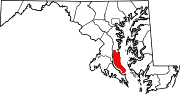 Categories:
- State highways in Maryland
- Roads in Calvert County, Maryland
- Roads in Anne Arundel County, Maryland


Wikimedia Foundation. 2010.