- Maryland Route 509
-
Maryland Route 509
Governor Run Road Route information Maintained by MDSHA Length: 0.95 mi[1] (1.53 km)
Official length; signed length is 1.14 miles (1.83 km)Major junctions West end:  MD 765 in Port Republic
East end: Dead end near Port Republic Location Counties: Calvert Highway system Maryland highway system
Interstate • US • State • Minor • Former • Turnpikes←  MD 508
MD 510  →
→Maryland Route 509 (MD 509) is a state highway in the U.S. state of Maryland. Known as Governor Run Road, the state highway runs 0.95 miles (1.53 km) from MD 765 east to a dead end at the Chesapeake Bay within Port Republic. MD 509 has an unofficial but signed 0.19-mile (0.31 km) western extension to MD 2 and MD 4. MD 509 was constructed in the early 1930s. The signed western extension was built in the early 1980s.
Contents
Route description
MD 509 begins at an intersection with MD 765 (St. Leonard Road) in Port Republic. The state highway heads east as a two-lane road through a forested area split by a trio of transmission lines that extend north from the Calvert Cliffs Nuclear Power Plant. Near its eastern terminus, MD 509 intersects Kenwood Beach Road, which serves the beach community of Kenwood Beach. After crossing Governor Run, the state highway reaches its eastern terminus at a dead end just west of the Chesapeake Bay shoreline.[1][2]
MD 509's official western terminus is at MD 765. However, the state highway is signed as MD 509 for 0.06 miles (0.097 km) along MD 765 north of the official western terminus. The signed route turns south onto unsigned MD 765B, which does not have a street name. Signed MD 509's western terminus is 0.13 miles (0.21 km) south of MD 765 at an intersection with MD 2 and MD 4, which run concurrently as Solomons Island Road. Therefore, MD 509 has a signed length of 1.14 miles (1.83 km).[1][3]
History
MD 509 was constructed east from MD 2 (now MD 765) to the bay by 1933.[4] The MD 2/MD 4 divided highway was constructed around 1981; the unofficial western extension of MD 509 was built by 1985.[5][6]
Junction list
The entire route is in Port Republic in Calvert County.
Mile
[1]Destinations Notes 0.00 
 MD 765 (St. Leonard Road) to MD 2 / MD 4 (Solomons Island Road) – St. Leonard, Prince Frederick
Official western terminus; signed route has a concurrency with MD 765 and turns south to MD 2 and MD 4 0.95 Dead end at Chesapeake Bay Eastern terminus 1.000 mi = 1.609 km; 1.000 km = 0.621 mi References
- ^ a b c d "Highway Location Reference: Calvert County" (PDF). Maryland State Highway Administration. 2009. http://www.marylandroads.com/Location/2009_CALVERT.pdf. Retrieved 2011-02-21.
- ^ Google, Inc. Google Maps – Maryland Route 509 (Map). Cartography by Google, Inc. http://maps.google.com/maps?f=d&source=s_d&saddr=MD-509+E%2FMD-765+S%2FSt+Leonard+Rd&daddr=MD-509+E%2FGovernor+Run+Rd&geocode=FQRySwIdaGNw-w%3BFTJ2SwIdZqZw-w&hl=en&mra=ls&sll=38.499029,-76.507223&sspn=0.007591,0.01929&ie=UTF8&ll=38.499684,-76.512072&spn=0.00759,0.01929&t=h&z=16. Retrieved 2011-02-21.
- ^ Google, Inc. Google Maps – Maryland Route 509: Unofficial but Signed (Map). Cartography by Google, Inc. http://maps.google.com/maps?f=d&source=s_d&saddr=MD-509+W%2FMD-765+N%2FSt+Leonard+Rd&daddr=MD-509+W%2FGovernor+Run+Rd&geocode=FQRySwIdaGNw-w%3BFSxtSwId-Fpw-w&hl=en&mra=ls&sll=38.49829,-76.517007&sspn=0.007591,0.01929&ie=UTF8&ll=38.498542,-76.521921&spn=0.003795,0.009645&t=h&z=17. Retrieved 2011-02-21.
- ^ Maryland Geological Survey. Map of Maryland Showing State Road System: State Aid Roads and Improved County Road Connections (Map) (1933 ed.).
- ^ Maryland State Highway Administration. Maryland: Official Highway Map (Map) (1981-82 ed.).
- ^ Maryland State Highway Administration. Maryland: Official Highway Map (Map) (1985-86 ed.).
External links
Roads in Calvert County, Maryland State highways 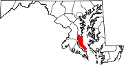 Categories:
- State highways in Maryland
- Roads in Calvert County, Maryland


Wikimedia Foundation. 2010.