- Chesapeake Ranch Estates, Maryland
-
The Chesapeake Ranch Estates (CRE), also known locally as the Ranch Club, is located in Lusby, Maryland, in southern Calvert County. CRE was founded in 1958 as is governed by a homeowners' association, which is officially called the "Property Owner's Association of the Chesapeake Ranch Estates" (POACRE). Today, CRE is now composed of over 4,000 homes[1].
Contents
Amenities
The CRE is close to the attractions of Solomons Island as well as in proximity to Naval Air Station Patuxent River. There are several public schools within a ten-mile radius of the community. The community maintains two private Chesapeake Bay beaches: Driftwood and Seahorse, and one manmade lake: Lake Lariat. CRE has horse stables, a small airfield, a horseshoes field, a duck pond, and a camp ground. CRE employs a small security force that works alongside the state police along with several members that live within the community itself.
CRE is also home to part of the formation collectively known as Calvert Cliffs. The cliffs are made of sedimentary material and stratification of the layers is clearly visible. Over 600 species of fossils have been identified from these cliffs[2]. The cliffs are easily accessible from Seahorse Beach, although access has been officially restricted due to the related death. The cliffs are clearly visible by boats which are not restricted from the area.
Originally, CRE was a gated community manned 24/7 by guards. Later, in the late 1990s a controversial vote was held open to all property owners, and the gates were voted to be taken down by simple majority. Today, access to the beaches and other similar amenities is still closed to non-members, however access to the roads is open to all.
Current issues
While main roads in CRE are paved, most of roads are made of gravel and currently in a state of disarray due to a lack of proper funds required to update them. The Homeowners association is aware of the widespread problem and has been used recently as a platform for the recent elections. Currently POACRE was approved by request to become a special tax district in the county, that would raise an estimated $5,750,000 needed to repair the roads[3].
Lake Lariat has a history of pollution ranging from runoff, to algae blooms, and also mercury[4]. A ongoing effort has been made to clean the lake, and freshwater clams have been placed in the lake to help alleviate the problems. The lake also has an ongoing fish consumption advisory since 2002 by the Maryland Department of the Environment due to confirmed high levels of mercury in fish tissue in the lake, five times past the legally allowable[5].
Recently, a growing movement has occurred to restructure POACRE or even make it a public subdivision as a solution to the growing numbers of problems that the original homeowners' association was not designed to handle when originally conceived[6].
One of the current issues stems from an apparent flaw in the community's governing covenants. This matter was the subject of litigation in the case of Hanson vs Calvert County, the case is settled, Calvert County and its co defendant, Property Owners of Chesapeake Ranch Estates won the case. It was alleged in this case that in 1989 the founders of POACRE illegally co-opted the powers of the developer (Chesapeake Ranch Club, Inc.) as Declarant of the covenants. CRC, Inc. continued to do business in receivership well into the mid- 1990's and never transferred covenant authority before its final dissolution.
It is further alleged in this matter that where Chesapeake Ranch and Drum Point were governed by the same covenant documents, which remain recorded in the land records of Calvert County, the POACRE organization fraudulently held an election of covenants that ignored Drum Point property owners denying them access to common properties they legally are entitled to. The covenants for Chesapeake Ranch Estates included the subdivisions of Drum Point and the Soundings according to officially recorded documents. The vote to take over the covenants was only held by certain residents of the Chesapeake Ranch Estates, excluding those in Drum Point and The Soundings.
Erosion rates have increased for homeowners abutting the cliffs endangering those particular homes Washington post
See also
- [[Chesapeake Ranch Estates-Drum Point,
Notes
- ^ http://www.poacre.org/outside_home.asp
- ^ http://www.dnr.state.md.us/publiclands/southern/calvertcliffs.html
- ^ http://www.co.cal.md.us/government/bocc/agendas2007/032707PreviousAgenda.asp
- ^ http://www.somdnews.com/stories/013008/rectop164235_32092.shtml
- ^ http://www.mde.state.md.us/Programs/WaterPrograms/TMDL/ApprovedFinalTMDL/TMDL_lakelariat_final_Hg.asp
- ^ http://www.chesapeakeranchestates.org/uploads/Other_governance_Pros___Cons.pdf
External links
- Property owner's association
- Chesapeake Ranch Estates/Drum Point Maryland
- homeowners battle time,beetle
Coordinates: 38°20′46″N 76°25′04″W / 38.34611°N 76.41778°W
Municipalities and communities of Calvert County, Maryland Towns 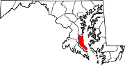
CDPs Other
communitiesAdelina | Barstow | Bowens | Broomes Island | Chaneyville | Chesapeake Ranch Estates | Dares Beach | Dowell | Johnstown | Lower Marlboro | Mutual | Parran | Pleasant Valley | Port Republic | Scientists Cliffs | Stoakley | Sunderland | Wallville
Categories:- Unincorporated communities in Maryland
- Populated places in Calvert County, Maryland

Wikimedia Foundation. 2010.