National Register of Historic Places listings in Garrett County, Maryland
- National Register of Historic Places listings in Garrett County, Maryland
-
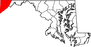
Location of Garrett County in Maryland
This is a list of the National Register of Historic Places listings in Garrett County, Maryland.
This is intended to be a complete list of the properties and districts on the National Register of Historic Places in Garrett County, Maryland, United States. Latitude and longitude coordinates are provided for many National Register properties and districts; these locations may be seen together in a Google map.[1]
There are 20 properties and districts listed on the National Register in the county, including 1 National Historic Landmark.
-
- This National Park Service list is complete through NPS recent listings posted November 10, 2011.[2]
Current listings
| [3] |
Landmark name [4] |
Image |
Date listed |
Location |
City or town |
Summary |
| 1 |
Anderson Chapel |
|
01984-06-07June 7, 1984 |
Swanton Hill and Pine Hill Rds.
39°27′34″N 79°13′53″W / 39.459444°N 79.231389°W / 39.459444; -79.231389 (Anderson Chapel) |
Swanton |
|
| 2 |
Baltimore and Ohio Railroad Station, Oakland |
|
01974-02-05February 5, 1974 |
Liberty St.
39°24′35″N 79°24′47″W / 39.409722°N 79.413056°W / 39.409722; -79.413056 (Baltimore and Ohio Railroad Station, Oakland) |
Oakland |
|
| 3 |
Bloomington Viaduct |
|
01976-11-21November 21, 1976 |
Over the Potomac River south of Maryland Route 135
39°28′37″N 79°04′05″W / 39.476944°N 79.068056°W / 39.476944; -79.068056 (Bloomington Viaduct) |
Bloomington |
|
| 4 |
Borderside |
|
01975-10-29October 29, 1975 |
Oakland-Westernport Rd.
39°28′43″N 79°04′21″W / 39.478611°N 79.0725°W / 39.478611; -79.0725 (Borderside) |
Bloomington |
|
| 5 |
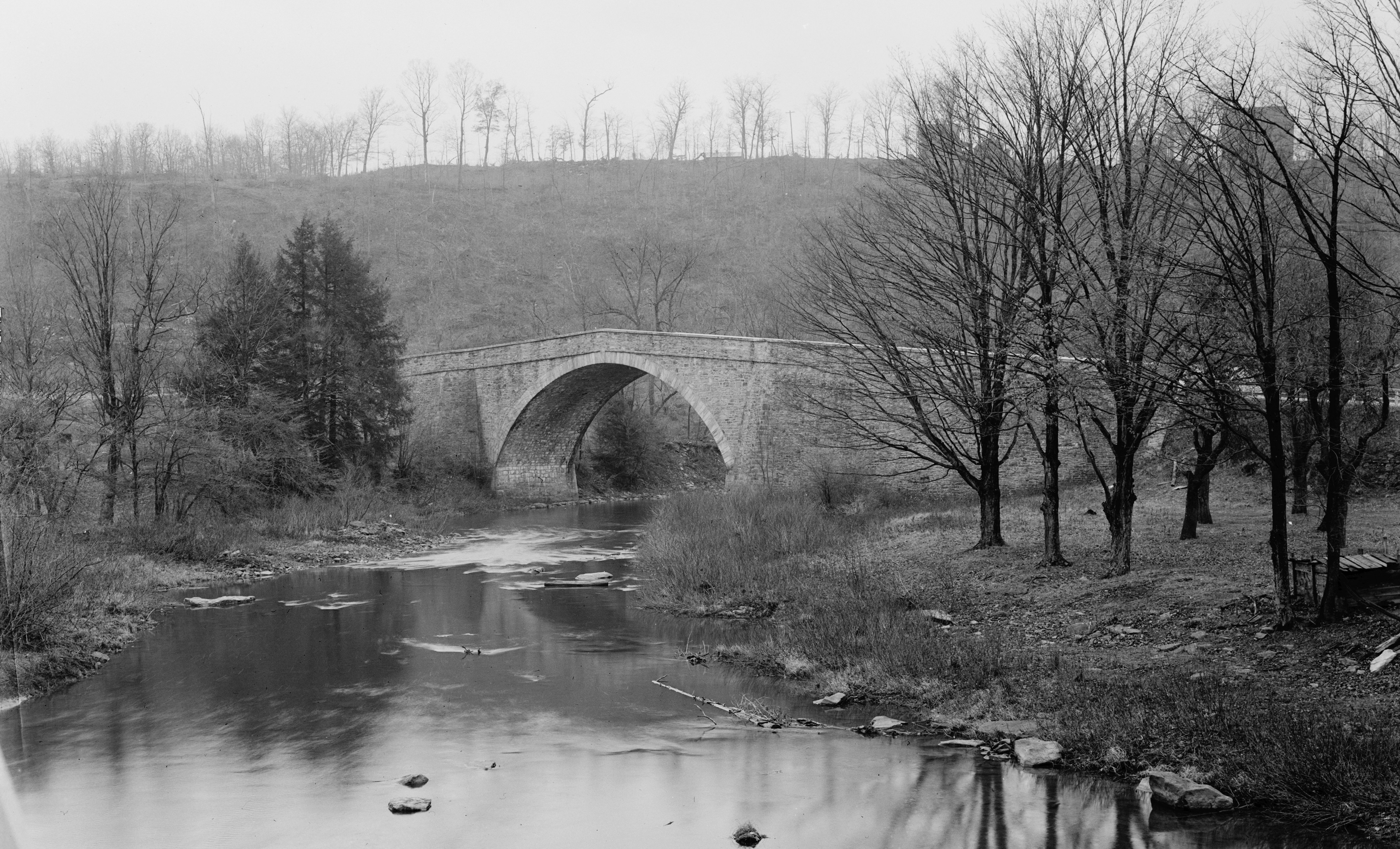
Casselman's Bridge, National Road |
|
01966-10-15October 15, 1966 |
East of Grantsville on U.S. Route 40
39°41′48″N 79°08′37″W / 39.696667°N 79.143611°W / 39.696667; -79.143611 (Casselman's Bridge, National Road) |
Grantsville |
|
| 6 |
Creedmore |
|
01984-12-27December 27, 1984 |
510 G St.
39°23′59″N 79°22′59″W / 39.399722°N 79.383056°W / 39.399722; -79.383056 (Creedmore) |
Mountain Lake Park |
|
| 7 |
James Drane House |
|
01985-01-11January 11, 1985 |
Accident-Bittinger Rd.
39°37′45″N 79°18′47″W / 39.629167°N 79.313056°W / 39.629167; -79.313056 (James Drane House) |
Accident |
|
| 8 |
Fuller-Baker Log House |
|
01971-02-12February 12, 1971 |
0.5 miles west of Grantsville on U.S. Route 40
39°41′45″N 79°10′20″W / 39.695833°N 79.172222°W / 39.695833; -79.172222 (Fuller-Baker Log House) |
Grantsville |
|
| 9 |
Garrett County Courthouse |
|
01975-11-12November 12, 1975 |
3rd and Alder Sts.
39°24′26″N 79°24′25″W / 39.407222°N 79.406944°W / 39.407222; -79.406944 (Garrett County Courthouse) |
Oakland |
|
| 10 |
Glamorgan |
|
01984-09-13September 13, 1984 |
Maryland Route 135
39°25′46″N 79°19′29″W / 39.429444°N 79.324722°W / 39.429444; -79.324722 (Glamorgan) |
Deer Park |
|
| 11 |
Hoye Site |
|
01975-05-12May 12, 1975 |
Address Restricted
|
Oakland |
|
| 12 |
Inns on the National Road |
|
01976-12-22December 22, 1976 |
East and west of Cumberland on U.S. Route 40 from Flintstone to Grantsville
39°40′49″N 78°52′12″W / 39.680278°N 78.87°W / 39.680278; -78.87 (Inns on the National Road) |
Grantsville |
|
| 13 |
Kaese Mill |
|
01984-09-13September 13, 1984 |
North of Accident
39°39′02″N 79°17′49″W / 39.650556°N 79.296944°W / 39.650556; -79.296944 (Kaese Mill) |
Accident |
|
| 14 |
Mercy Chapel at Mill Run |
|
01984-09-07September 7, 1984 |
Mill Run Rd.
39°42′40″N 79°21′42″W / 39.711111°N 79.361667°W / 39.711111; -79.361667 (Mercy Chapel at Mill Run) |
Selbysport |
|
| 15 |
Meyer Site |
|
01973-06-19June 19, 1973 |
Address Restricted
|
Westernport |
|
| 16 |
Mountain Lake Park Historic District |
|
01983-09-01September 1, 1983 |
Roughly bounded by Alleghany Dr., Oakland Ave., and D and N Sts.
39°23′49″N 79°22′53″W / 39.396944°N 79.381389°W / 39.396944; -79.381389 (Mountain Lake Park Historic District) |
Mountain Lake Park |
|
| 17 |
Oakland Historic District |
|
01984-01-26January 26, 1984 |
Roughly bounded by Oak, 8th, High, 3rd, Omaha, and Bartlet Sts.
39°24′35″N 79°24′20″W / 39.409722°N 79.405556°W / 39.409722; -79.405556 (Oakland Historic District) |
Oakland |
|
| 18 |
Pennington Cottage |
|
01976-05-17May 17, 1976 |
Deer Park Hotel Rd.
39°25′12″N 79°20′00″W / 39.42°N 79.333333°W / 39.42; -79.333333 (Pennington Cottage) |
Deer Park |
|
| 19 |
Stanton's Mill |
|
01983-01-17January 17, 1983 |
East of Grantsville on U.S. Route 40
39°41′46″N 79°08′24″W / 39.696111°N 79.14°W / 39.696111; -79.14 (Stanton's Mill) |
Grantsville |
|
| 20 |
Tomlinson Inn and the Little Meadows |
|
01973-09-20September 20, 1973 |
3 miles east of Grantsville on U.S. Route 40
39°41′54″N 79°05′10″W / 39.698333°N 79.086111°W / 39.698333; -79.086111 (Tomlinson Inn and the Little Meadows) |
Grantsville |
|
See also
References
- ^ The latitude and longitude information provided in this table was derived originally from the National Register Information System, which has been found to be fairly accurate for about 99% of listings. For about 1% of NRIS original coordinates, experience has shown that one or both coordinates are typos or otherwise extremely far off; some corrections may have been made. A more subtle problem causes many locations to be off by up to 150 yards, depending on location in the country: most NRIS coordinates were derived from tracing out latitude and longitudes off of USGS topographical quadrant maps created under North American Datum of 1927, which differs from the current, highly accurate GPS system used by Google maps. Chicago is about right, but NRIS longitudes in Washington are higher by about 4.5 seconds, and are lower by about 2.0 seconds in Maine. Latitudes differ by about 1.0 second in Florida. Some locations in this table may have been corrected to current GPS standards.
- ^ "National Register of Historic Places: Weekly List Actions". National Park Service, United States Department of the Interior. Retrieved on November 10, 2011.
- ^ Numbers represent an ordering by significant words. Various colorings, defined here, differentiate National Historic Landmark sites and National Register of Historic Places Districts from other NRHP buildings, structures, sites or objects.
- ^ "National Register Information System". National Register of Historic Places. National Park Service. . http://nrhp.focus.nps.gov/natreg/docs/All_Data.html.
Wikimedia Foundation.
2010.
Look at other dictionaries:
National Register of Historic Places listings in Montgomery County, Maryland — Location of Montgomery County in Maryland This is a list of the National Register of Historic Places listings in Montgomery County, Maryland. This is intended to be a complete list of the properties and districts on the National Register of… … Wikipedia
National Register of Historic Places listings in Washington County, Maryland — Location of Washington County in Maryland This is a list of the National Register of Historic Places listings in Washington County, Maryland. This is intended to be a complete list of the properties and districts on the National Register of… … Wikipedia
National Register of Historic Places listings in Baltimore County, Maryland — Location of Baltimore County in Maryland This is a list of the National Register of Historic Places listings in Baltimore County, Maryland. This is intended to be a complete list of the properties and districts on the National Register of… … Wikipedia
National Register of Historic Places listings in Frederick County, Maryland — Location of Frederick County in Maryland This is a list of the National Register of Historic Places listings in Frederick County, Maryland. This is intended to be a complete list of the properties and districts on the National Register of… … Wikipedia
National Register of Historic Places listings in Allegany County, Maryland — Location of Allegany County in Maryland This is a list of the National Register of Historic Places listings in Allegany County, Maryland. This is intended to be a complete list of the properties and districts on the National Register of Historic… … Wikipedia
National Register of Historic Places listings in Carroll County, Maryland — Location of Carroll County in Maryland This is a list of the National Register of Historic Places listings in Carroll County, Maryland. This is intended to be a complete list of the properties and districts on the National Register of Historic… … Wikipedia
National Register of Historic Places listings in Charles County, Maryland — Location of Charles County in Maryland This is a list of the National Register of Historic Places listings in Charles County, Maryland. This is intended to be a complete list of the properties and districts on the National Register of Historic… … Wikipedia
National Register of Historic Places listings in Harford County, Maryland — Location of Harford County in Maryland This is a list of the National Register of Historic Places listings in Harford County, Maryland. This is intended to be a complete list of the properties and districts on the National Register of Historic… … Wikipedia
National Register of Historic Places listings in Kent County, Maryland — Location of Kent County in Maryland This is a list of the National Register of Historic Places listings in Kent County, Maryland. This is intended to be a complete list of the properties and districts on the National Register of Historic Places… … Wikipedia
National Register of Historic Places listings in Somerset County, Maryland — Location of Somerset County in Maryland This is a list of the National Register of Historic Places listings in Somerset County, Maryland. This is intended to be a complete list of the properties and districts on the National Register of Historic… … Wikipedia