- U.S. Route 40 in Maryland
-
This article is about the section of U.S. Route 40 in Maryland. For the entire length of the highway, see U.S. Route 40.
U.S. Route 40
Route information Maintained by MDSHA, Baltimore DOT, and MdTA Length: 221.31 mi[1] (356.16 km) Major junctions West end:  US 40 near Addison, PA
 I-68 / US 219 near Grantsville
 US 220 in Cumberland

 I-70 / US 522 in Hancock
 I-81 near Hagerstown

 US 15 / US 340 in Frederick
 US 29 near Ellicott City
 US 1 in Baltimore
 MD 24 near Edgewood
East end: US 40 near Glasgow, DEHighway system United States Numbered Highways
List • Bannered • Divided • ReplacedMaryland highway system
Interstate • US • State • Minor • Former • Turnpikes←  MD 39
MD 39MD 41  →
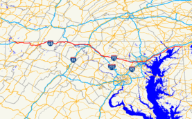
→U.S. Route 40 (US 40) in the U.S. state of Maryland runs from western Maryland to Cecil County in the state's northeastern corner. With a total length of over 200 miles (320 km), it is the longest numbered highway in Maryland. Almost half of the road overlaps with Interstate 68 or Interstate 70, while the old alignment is generally known as U.S. Route 40 Alternate, U.S. Route 40 Scenic, or Maryland Route 144. West of Baltimore, the portions where it does not overlap an Interstate highway are mostly two-lane roads. The portion east of Baltimore is a four-lane divided highway, known as the Pulaski Highway (named for Casimir Pulaski), except for the two-lane Thomas J. Hatem Memorial Bridge, a toll bridge over the Susquehanna River.
From Cumberland west to Pennsylvania, US 40 is the successor to the historic National Road. East of Cumberland, towards Baltimore, US 40 follows several former turnpikes, most notably the Cumberland Turnpike and Baltimore and Frederick-town Turnpike. The route from Baltimore northeast to the Delaware state line follows another historic corridor towards Philadelphia, including the old Baltimore and Havre-de-Grace Turnpike (now mostly bypassed as Maryland Route 7).
Contents
Route description
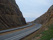 A 340-foot (100 m) deep cut in Sideling Hill makes room for the I-68/US 40 roadway.
U.S. Route 40 enters Maryland from Pennsylvania in far western Maryland's Garrett County, carrying the name "National Pike." It passes through rural farmland on this side of the state, intersecting U.S. Route 219 at its interchange with Interstate 68. Here it joins I-68, which it follows to Cumberland. The previous alignments of US 40, carrying the name "National Pike", are either U.S. Route 40 Alternate or Scenic US 40, which follow I-68 and US 40 very closely through the county and serve as main streets for the towns they pass through. US 40 follows I-68 through Cumberland and passes into Washington County.
The I-68/US 40 roadway passes through a 340-foot (100 m) deep cut in Sideling Hill. Just to the east of the cut is the site of the former Sideling Hill Exhibit Center, a museum (currently located in Hancock, MD) that highlighted Western Maryland geology.[2] Shortly after this, in Hancock where the state of Maryland narrows to less than two miles (3 km) across, Interstate 68 ends. US 40 then defaults onto Interstate 70 at Exit 1 of the latter route. U.S. Route 522 is also carried by I-70, but it leaves to the south at the very next exit.
Interstate 70 and US 40 pass close to the West Virginia border along the Chesapeake and Ohio Canal and Potomac River, then turns toward Hagerstown. Shortly before this, though, US 40 separates from I-70 to the north at exit 9 and passes through the town on Washington Avenue (eastbound) and Franklin Street (westbound), where it interchanges with Interstate 81. Heading southeast out of Hagerstown, US 40 diverges into two separate routes, US 40 and US 40 Alt. US 40 parallels I-70, its longtime travel partner, crossing it at exit 32 near Greenbrier State Park on the Baltimore National Pike alignment. US 40 Alt heads southeast on the Old National Pike alignment through Boonsboro, crossing South Mountain at Turner's Gap. The two routes converge just west of Frederick.
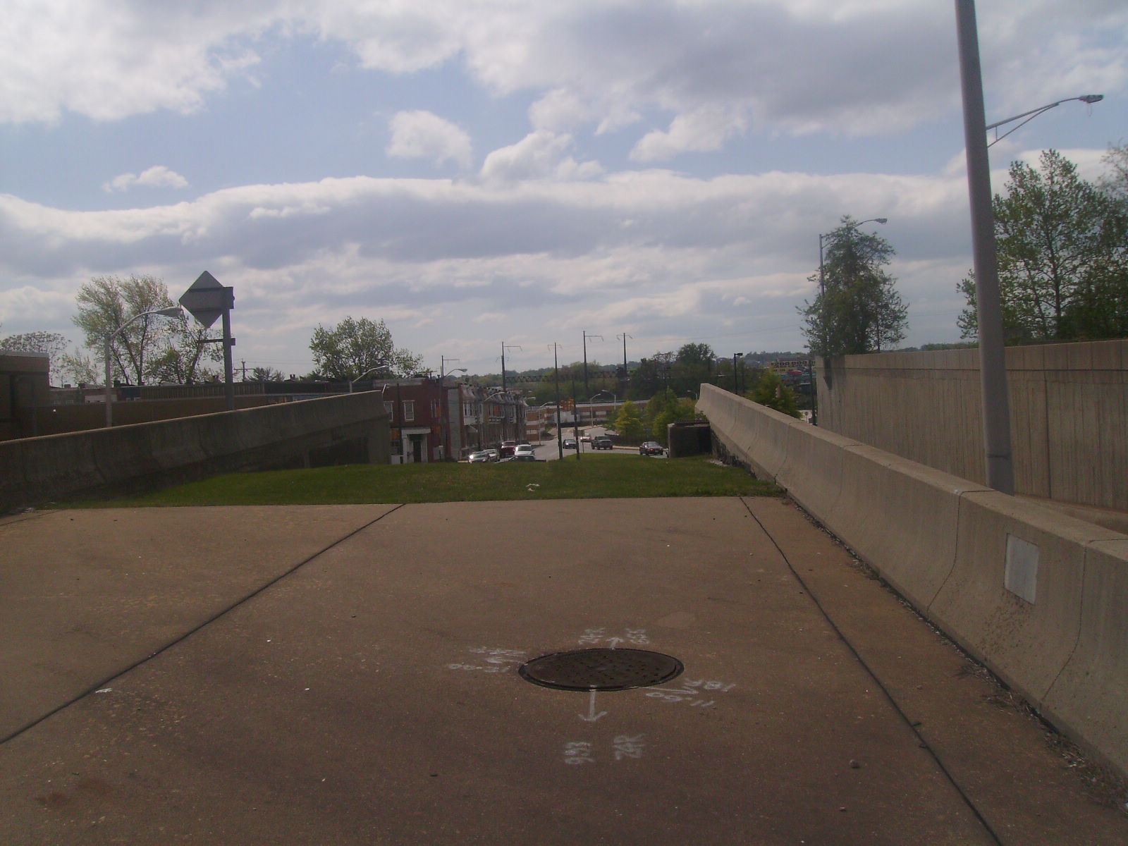
 The western end of the freeway stub in Baltimore City intended for use by the canceled I-170. This freeway is now used by US 40.
In Frederick, US 40 uses Patrick Street before merging onto the US 15 expressway for a short distance. It leaves US 15 and rejoins I-70 on the outskirts of Frederick. MD 144 once again takes over along the old alignment of US 40. It then passes through Carroll County and Howard County, where US 40 once again separates to the south in Ellicott City and heads toward Baltimore, interchanging with US 29 and Interstate 695 in the process. This section is known as the Baltimore National Pike.
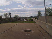
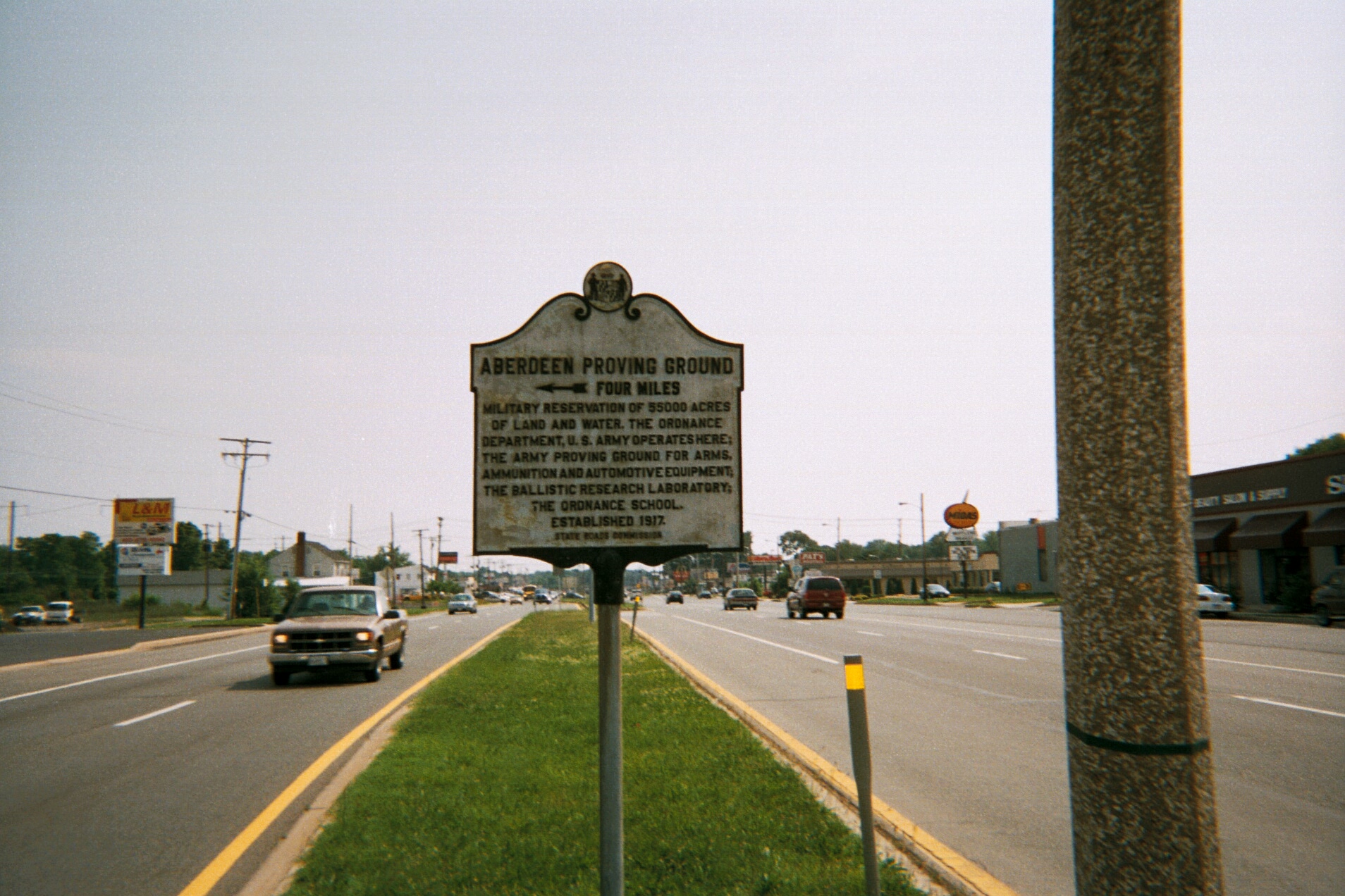
 US 40 in Aberdeen.
Inside Baltimore City, US 40 follows Edmondson Avenue, then passes south onto Franklin and Mulberry Streets as a one-way pair, shortly leaving to utilize the freeway stub meant to carry Interstate 170 for a short distance between Pulaski Street and Martin Luther King Jr. Boulevard. Through this area, an alignment called "Truck US 40" diverts larger vehicles onto an alternate route (largely via North Avenue), and also passes over Martin Luther King, Jr. Boulevard, which leads south to I-395. US 40 passes through the Mount Vernon neighborhood and a few blocks from Baltimore's Washington Monument.[3] It then rises onto the Orleans Street Viaduct, passing over Interstate 83 and through the downtown area. It follows Orleans Street until it meets the Pulaski Highway on the east side of the city. It carries this name on this four lane, divided highway alignment, having partial interchanges with Interstate 895 and 95 before exiting the city to the northeast.[4]
US 40, for the entire length of Pulaski Highway, closely parallels I-95. It also runs between Amtrak's Northeast Corridor and the CSX Philadelphia Subdivision. Pulaski Highway passes through Gunpowder Falls State Park near Joppa and the Aberdeen Proving Ground. Between Havre de Grace and Perryville it crosses the Susquehanna River on the Thomas J. Hatem Memorial Bridge. US 40 leaves Maryland in Elkton, crossing the border into Delaware.[4][5]
History
The National Road was opened from Cumberland on the Potomac River west and northwest into Pennsylvania, and beyond to Wheeling, Virginia on the Ohio River, in the 1810s. The turnpikes connecting Cumberland to Baltimore operated as the Cumberland Turnpike (Cumberland to Conococheague), Hagers-Town and Conococheague Turnpike (Conococheague to Hagerstown), Boonsborough Turnpike (Hagerstown to Boonsboro), and Baltimore and Frederick-town Turnpike (Boonsboro to Baltimore), completed in 1824. To the east of Baltimore, the Baltimore and Havre-de-Grace Turnpike went northeast from Baltimore to Havre de Grace, and public roads continued from Perryville, across the Susquehanna River from Havre de Grace to Elkton, where the Elk and Christiana Turnpike continued into Delaware.[citation needed]
Future
The US 40 bridge over the Patapsco River in Ellicott City, originally constructed in 1936, will be replaced in a project that started in the spring of 2011 and is expected to be completed in 2013. During the bridge replacement, temporary bridges will be constructed to serve traffic for the first time in a major bridge project in Maryland.[6]
Junction list
County Location Mile[1] Intersection Notes Garrett
(21.70 mi)Keysers Ridge 0.00 US 40 west (National Pike)Pennsylvania state line 3.25  MD 826 south
MD 826H 3.41 
US 40 Alt. east (National Pike)Grantsville 3.74 I-68 west (Garrett Highway) / US 219 southI-68/US 219 overlap begins; exit 14B of I-68 See Interstate 68 (67.27-mile overlap); Interstate 70 (8.16-mile overlap) Allegany
(40.27 mi)Washington
(45.95 mi)Park Head 79.17 I-70 eastI-70 overlap ends
Exit 9 of I-70Clear Spring 86.57  MD 68 south (Mill Street)
88.97  MD 57 north (St. Paul Road)
93.51  MD 63 (Greencastle Pike)
94.75  MD 144 east (Washington Street)
96.23 I-81Exit 6 of I-81 96.61  MD 910 south (Western Maryland Parkway)
MD 910C Hagerstown 97.63  US 11 (Burhans Boulevard)
98.05 Potomac Street To US 40 Alt. east; to MD 65 south; from MD 60 south 98.20 Locust Street To MD 60 north; from US 40 Alt. west; from MD 65 north 98.68  MD 64 east (Cleveland Avenue)
Beaver Creek 101.72 I-70Exit 32 of I-70 104.53  MD 66 (Mapleville Road)
Frederick
(29.24 mi)111.03  MD 17 (Wolfsville Road)
118.41 I-70 westExit 48 of I-70 Frederick 119.70
US 40 Alt. west (Old National Pike)121.09 US 15 north (Frederick Freeway); Patrick Street eastUS 15 overlap begins
Exit 13 of US 15; to MD 144 east via Patrick Street
121.82 US 15 south / US 340 west (Jefferson National Pike); US 15B north (Jefferson Street)US 15 overlap ends; exit 12B of US 15 122.44  I-70 west / I-270 south
I-70 overlap begins; exit 53B of I-70; exit 32 of I-270 See Interstate 70 (29.10-mile overlap) Carroll
(1.61 mi)Howard
(21.08 mi)151.54 I-70 eastI-70 overlap ends; exit 82 of I-70 154.13 MD 144 west (Frederick Road)Ellicott City 157.10 US 29 (Columbia Pike)Exit 24 of US 29 158.05  MD 984 east
Baltimore
(3.98 mi)Catonsville 162.29  I-695 (Baltimore Beltway)
Exit 15 of I-695 Baltimore City
(10.05 mi)165.93 
US 40 Truck east (Hilton Parkway)167.31
167.41 US 1 (Monroe Street, Fulton Avenue)168.36 Martin Luther King Jr. Boulevard 168.57
168.64
 MD 129 north / MD 295 south (Greene Street, Paca Street)
169.09
169.18 MD 2 south (St. Paul Street, Calvert Street)
171.86  MD 150 east (Haven Street)
172.59 
 US 40 Truck west / MD 151 (Erdman Avenue)
172.84  I-895 south
Exit 13 of I-895 173.58 Moravia Road west 173.76  I-95 south
Exit 61 of I-95 Baltimore
(11.54 mi)Rosedale 173.94  MD 7 east (Old Philadelphia Road)
MD 7BA 174.12 MD 7 east (Philadelphia Road)Rossville 176.63 I-695 (Baltimore Beltway)Exit 35 of I-695 177.96  MD 700 south (Martin Boulevard)
White Marsh 180.84  MD 43 west (White Marsh Boulevard)
Harford
(18.61 mi)187.54  MD 152 (Mountain Road)
189.21  MD 755 south (Edgewood Road)
189.78 MD 24MD 24D, to MD 24 193.81  MD 543 (Riverside Parkway)
196.13  MD 7 west / MD 159 south (Old Philadelphia Road)
Aberdeen 196.94  MD 715 east (Short Lane)
198.52  MD 132 (Belair Avenue)
199.03  MD 22 (Aberdeen Throughway)
200.28 MD 132 south (Oakington Road)201.72 MD 7 north (Revolution Street)Havre de Grace 203.10  MD 7 south (Otsego Street) / MD 155 west (Ohio Street)
204.03 Thomas J. Hatem Memorial Bridge over the Susquehanna River Cecil
(17.28 mi)Perryville 205.21  MD 222 (Perryville Road)
207.98 MD 7 south (Philadelphia Road)208.45 MD 7 north (Philadelphia Road)North East 212.33  MD 272 (Northeast Road)
Elkton 217.43  MD 7 south (Philadelphia Road) / MD 279 north (Elkton Road)
218.91  MD 213
220.25 MD 7 west (Delaware Avenue)221.08  MD 781 north (Delancy Road)
221.31 US 40 east (Pulaski Highway)Delaware state line References
- ^ a b Maryland State Highway Administration, Highway Location Reference, 2005
- ^ "Maryland's Geologic Features: Sideling Hill, Washington County". http://www.mgs.md.gov/esic/features/sidel.html. Retrieved 2011-07-24.
- ^ "Map of Mount Vernon Place". Mount Vernon Place: "The Heart of Baltimore". College of Library and Information Services, University of Maryland, College Park, Maryland. 1998. http://www.wam.umd.edu/~jlehnert/map.htm. Retrieved 2007-05-25.
- ^ a b "U.S. Highway 40 / Pulaski Highway". Maryland @ AAroads.com. 2005. http://www.aaroadtrips.com/us-040_md.html. Retrieved 2007-05-25.
- ^ Mapsource. Garmin Ltd.. 2003.
- ^ Dresser, Michael (September 23, 2010). "U.S. 40 bridge over Patapsco to be replaced". The Baltimore Sun (Baltimore, MD). http://www.baltimoresun.com/features/commuting/bs-md-patapsco-bridge-20100921,0,5853513.story. Retrieved September 27, 2010.
External links
U.S. Route 40Previous state:
PennsylvaniaMaryland Next state:
DelawareCategories:- U.S. Highways in Maryland
- U.S. Route 40
- Roads in Garrett County, Maryland
- Roads in Allegany County, Maryland
- Roads in Washington County, Maryland
- Roads in Frederick County, Maryland
- Roads in Carroll County, Maryland
- Roads in Howard County, Maryland
- Roads in Baltimore, Maryland
- Roads in Baltimore County, Maryland
- Roads in Harford County, Maryland
- Roads in Cecil County, Maryland


Wikimedia Foundation. 2010.