- White Marsh, Maryland
Infobox Settlement
official_name = White Marsh, Maryland
settlement_type = CDP
nickname =
motto =
imagesize =
image_caption =
image_
imagesize =
image_caption =
image_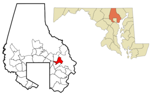
mapsize = 250x200px
map_caption = Location of White Marsh, Maryland
mapsize1 =
map_caption1 =subdivision_type = Country
subdivision_name =United States
subdivision_type1 = State
subdivision_name1 =Maryland
subdivision_type2 = County
subdivision_name2 = Baltimore
government_footnotes =
government_type =
leader_title =
leader_name =
leader_title1 =
leader_name1 =
established_title =
established_date =unit_pref = Imperial
area_footnotes =
area_magnitude =
area_total_km2 = 13.7
area_land_km2 = 13.7
area_water_km2 = 0.0
area_total_sq_mi = 5.3
area_land_sq_mi = 5.3
area_water_sq_mi = 0.0population_as_of = 2000
population_footnotes =
population_total = 8485
population_density_km2 = 618.9
population_density_sq_mi = 1603.0timezone = Eastern (EST)
utc_offset = -5
timezone_DST = EDT
utc_offset_DST = -4
elevation_footnotes =
elevation_m = 16
elevation_ft = 52
latd = 39 |latm = 23 |lats = 1 |latNS = N
longd = 76 |longm = 27 |longs = 30 |longEW = Wpostal_code_type =
ZIP code
postal_code = 21162
area_code = 410
blank_name = FIPS code
blank_info = 24-84350
blank1_name = GNIS feature ID
blank1_info = 0591542
website =
footnotes =White Marsh is an
unincorporated community and acensus-designated place in Baltimore County,Maryland ,United States . The population was 8,485 at the 2000 census.History
In 1965, the largely undeveloped northeast corridor was identified by
Baltimore County as the preferred site for intensive development. A town center was proposed to be located west of Belair Road at the planned intersection of White Marsh and Walther Boulevards.The Harry T. Campbell Sons Corporation owned thousands of acres of land to the east of the planned town center, on both sides of Interstate 95. The land was bought in the 1930s and was being mined of its natural sand and gravel deposits. The Campbell family merged its sand and gravel business with an international building supply company. A new family-owned entity was charged with rejuvenating the family's property in northeast Baltimore County, which was covered with deep craters and pits. In the late 1960s, Nottingham Properties began analyzing the feasibility of a new town in White Marsh. From the first the intent was to incorporate a variety of land uses and community services, including residential, retail, business and industrial.
In 1969, a planning analysis of regional growth found development potential in the northeast brought about by the construction of I-95. The County was planning a series of arterial roads travelling in a northeasterly direction from Baltimore County that would pass through the Campbell land. The County agreed to move the planned town center east, to be developed on 1500 acres (6 km²) of the Campbell land.
The plan was for a town center in an area created by a triangle of arterial roads. A mall would be at the center. The density of residential and business development would decline as it moved away from the mall. A residential sector was designated to the north, between Silver Spring Road and the planned White Marsh Boulevard. It would include all residential densities except high-rise. The area east of the town center to I-95 would be for office and research facilities. The Campbell land east of I-95 was slated for future industrial development.
Rezoning of the area was completed in 1970 and 1971. In 1979 the area was formally designated as a town center in the Baltimore County Master Plan.
From 1972-1981, the planning and development of the
White Marsh Mall occurred, with theRouse Company as owner and developer on land rented from Nottingham. In July 1973, Sears committed as an anchor store. In 1981, most stores opened. In 1992, Hecht's replacedHutzler's . The White Marsh Mall one of the largestregional mall s in the Baltimore area, with five anchor stores and 190 specialty shops in about 1.4 million square feet (130,000 m²). Next to the mall's property isIKEA . This location was the secondIKEA store built in the United States (1988). TheIKEA store is still there today.In addition to the Mall, 2,400 residential units have been built in the town center and 700,000 square feet (65,000 m²) of office and research and development space have been built.
The White Marsh Library opened on
January 25 ,1988 . It is part of theWhite Marsh Town Center , which includes the White Marsh Mall; the White Marsh Police Station, which opened in November 1987; the Nottingham Post Office, which opened in November 1990; and thousands of square feet of retail, industrial and office space, which are still being developed.Source: Baltimore County Public Library
Geography
White Marsh is located at coor dms|39|23|1|N|76|27|30|W|city (39.383621, -76.458315).GR|1
According to the
United States Census Bureau , the CDP has a total area of 5.3 square miles (13.7 km²), of which, 5.3 square miles (13.7 km²) of it is land and 0.19% is water.Nearby towns include Perry Hall to the north, Rosedale to the south, Middle River to the southeast and Parkville to the south.
Demographics
As of the
census GR|2 of 2000, there were 8,485 people, 3,337 households, and 2,355 families residing in the CDP. Thepopulation density was 1,603.0 people per square mile (619.3/km²). There were 3,420 housing units at an average density of 646.1/sq mi (249.6/km²). The racial makeup of the CDP was 87.78% White, 4.28% African American, 0.32% Native American, 5.40% Asian, 0.04% Pacific Islander, 0.92% from other races, and 1.27% from two or more races. Hispanic or Latino of any race were 2.19% of the population.There were 3,337 households out of which 33.6% had children under the age of 18 living with them, 58.1% were married couples living together, 9.3% had a female householder with no husband present, and 29.4% were non-families. 22.1% of all households were made up of individuals and 3.9% had someone living alone who was 65 years of age or older. The average household size was 2.54 and the average family size was 3.01.
In the CDP the population was spread out with 23.6% under the age of 18, 7.6% from 18 to 24, 34.2% from 25 to 44, 26.2% from 45 to 64, and 8.5% who were 65 years of age or older. The median age was 37 years. For every 100 females there were 94.5 males. For every 100 females age 18 and over, there were 91.5 males.
The median income for a household in the CDP was $61,627, and the median income for a family was $70,600. Males had a median income of $46,171 versus $32,966 for females. The
per capita income for the CDP was $26,317. About 3.1% of families and 2.7% of the population were below thepoverty line , including 2.0% of those under age 18 and 7.9% of those age 65 or over.Transportation
Roads
White Marsh Boulevard
Campbell Boulevard
Honeygo Boulevard
Perry Hall Boulevard
Interstate 95
Philadelphia Road
References
External links
Wikimedia Foundation. 2010.