- Rosedale, Maryland
-
Rosedale, Maryland — CDP — Location of Rosedale, Maryland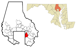
Coordinates: 39°19′42″N 76°30′40″W / 39.32833°N 76.51111°WCoordinates: 39°19′42″N 76°30′40″W / 39.32833°N 76.51111°W Country United States State Maryland County Baltimore Area - Total 7.1 sq mi (18.4 km2) - Land 6.9 sq mi (17.8 km2) - Water 0.2 sq mi (0.6 km2) Elevation 20 ft (6 m) Population (2000) - Total 19,199 - Density 2,790.2/sq mi (1,077.3/km2) Time zone Eastern (EST) (UTC-5) - Summer (DST) EDT (UTC-4) ZIP code 21237 Area code(s) 410 FIPS code 24-68400 GNIS feature ID 0591183 Rosedale is an unincorporated community and a census-designated place in Baltimore County, Maryland, United States. The population was 19,199 at the 2000 census.
Contents
History
Rosedale, a community northeast of the city of Baltimore, was a farming community from the time of the first settlers until suburban development began after World War II. State Route 7, which runs through the community, carried George Washington to New York in 1789 where he was inaugurated as the 1st American president.
The origin of the name Rosedale is not documented with certainty. However, a 1950 fourth grade class was told to interview family and friends about the history of the Rosedale community. From that activity came an explanation.
There was a young Englishman who had a farm on Hamilton Avenue just above Philadelphia Road which was covered with beautiful roses. Since his name was Dale and since the roses were so lovely, they felt that Rosedale would be an appropriate name.
The area was settled by many German and Polish immigrants in the latter part of the nineteenth century. An article written in 1940 on the occasion of their 59th wedding anniversary tells the story of one long-time farming family in the area.
Charles Schatzschneider was born in Germany in 1859 and came to Rosedale to do farm labor at age 13. He and his wife raised 15 children and saw the area grow from a wilderness to what they saw as a highly developed community with gas and electric lighting, water and sewerage systems and paved streets. The new electric trains which whizzed past their farm were a wonder to them.
When they came to the area, great three-masted schooners could sail all the way up Back River to the heading. Apparently in 1940, you could hardly get through in a rowboat.
The first school, a wooden building with only two rooms, was on the corner of Hamilton Avenue and Philadelphia Road. In 1950 it was a fire house and hall.
Rosedale grew steadily as a residential suburb beginning in the 1950s. Three quarters of the housing units existing in 1990 were built between 1854 and 1979.
Source: Rosedale Library
Education
List of Schools
Overlea High School
Rosedale Center
Golden Ring Middle School
Red House Run Elementary School
McCormick Elementary School
Shady Springs Elementary School
St. Clements Mary Hoffbauer Catholic School
Kingdom Academy
GLA Academy
Baltimore White Marsh Seventh day Adventist School
source: google "list of schools in 21237"Geography
Rosedale is located at 39°19′42″N 76°30′40″W / 39.32833°N 76.51111°W (39.328307, -76.511100)[1].
According to the United States Census Bureau, the CDP has a total area of 7.1 square miles (18 km2), of which, 6.9 square miles (18 km2) of it is land and 0.2 square miles (0.52 km2) of it (3.23%) is water.
Demographics
As of the census[2] of 2000, there were 19,199 people, 7,272 households, and 5,330 families residing in the CDP. The population density was 2,790.2 people per square mile (1,077.4/km²). There were 7,518 housing units at an average density of 1,092.6 per square mile (421.9/km²). The racial makeup of the CDP was 74.71% White, 21.20% African American, 0.24% Native American, 1.91% Asian, 0.06% Pacific Islander, 0.52% from other races, and 1.36% from two or more races. Hispanic or Latino of any race were 1.39% of the population.
There were 7,272 households out of which 30.1% had children under the age of 18 living with them, 54.0% were married couples living together, 14.2% had a female householder with no husband present, and 26.7% were non-families. 21.8% of all households were made up of individuals and 10.3% had someone living alone who was 65 years of age or older. The average household size was 2.64 and the average family size was 3.07.
In the CDP the population was spread out with 23.8% under the age of 18, 7.6% from 18 to 24, 28.2% from 25 to 44, 23.9% from 45 to 64, and 16.6% who were 65 years of age or older. The median age was 39 years. For every 100 females there were 91.2 males. For every 100 females age 18 and over, there were 88.5 males.
The median income for a household in the CDP was $47,801, and the median income for a family was $52,925. Males had a median income of $36,218 versus $29,278 for females. The per capita income for the CDP was $20,243. About 3.8% of families and 5.4% of the population were below the poverty line, including 6.6% of those under age 18 and 5.4% of those age 65 or over.
Transportation
Roads
Some major roads in Rosedale are:
- Franklin Square Drive
- Golden Ring Road (MD-588)
- Hamilton Avenue
- Hazelwood Avenue
- Kenwood Avenue (MD-588)
- Lillian Holt Drive
- Philadelphia Road (MD-7)
- Pulaski Highway (US-40)
- Rossville Boulevard
Public transportation
The Maryland Transit Administration provides bus service in the Rosedale area on routes 4, 35, 44, and 55.
Famous Natives and Residents of Note
- Jenny James, Playboy model
- Stacy Keibler, former Baltimore Ravens cheerleader, professional wrestling diva and wrestler for the WWE (2001–2006), and actress.
- Erin Nicole, former Baltimore Ravens cheerleader, Playboy model.
- Mike Rowe, American actor, and voice over artist. Famous voice of Dirty Jobs, Ghost Hunters, Deadliest Catch, and other television shows.
- Christi Shake, Playboy model.
References
- ^ "US Gazetteer files: 2010, 2000, and 1990". United States Census Bureau. 2011-02-12. http://www.census.gov/geo/www/gazetteer/gazette.html. Retrieved 2011-04-23.
- ^ "American FactFinder". United States Census Bureau. http://factfinder.census.gov. Retrieved 2008-01-31.
Categories:- Populated places in Baltimore County, Maryland
- Census-designated places in Maryland

Wikimedia Foundation. 2010.