- Bowleys Quarters, Maryland
Infobox Settlement
official_name = Bowleys Quarters, Maryland
settlement_type = CDP
nickname =
motto =
imagesize =
image_caption =
image_
imagesize =
image_caption =
image_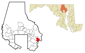
mapsize = 250x200px
map_caption = Location of Bowleys Quarters, Maryland
mapsize1 =
map_caption1 =subdivision_type = Country
subdivision_name =United States
subdivision_type1 = State
subdivision_name1 =Maryland
subdivision_type2 = County
subdivision_name2 = Baltimore
government_footnotes =
government_type =
leader_title =
leader_name =
leader_title1 =
leader_name1 =
established_title =
established_date =unit_pref = Imperial
area_footnotes =
area_magnitude =
area_total_km2 = 15.9
area_land_km2 = 8.4
area_water_km2 = 7.5
area_total_sq_mi = 6.1
area_land_sq_mi = 3.2
area_water_sq_mi = 2.9population_as_of = 2000
population_footnotes =
population_total = 6314
population_density_km2 = 754.8
population_density_sq_mi = 1954.8timezone = Eastern (EST)
utc_offset = -5
timezone_DST = EDT
utc_offset_DST = -4
elevation_footnotes =
elevation_m = 14
elevation_ft = 46
latd = 39 |latm = 19 |lats = 17 |latNS = N
longd = 76 |longm = 23 |longs = 18 |longEW = Wpostal_code_type =
postal_code =
area_code =
blank_name = FIPS code
blank_info = 24-08800
blank1_name = GNIS feature ID
blank1_info = 0589790
website =
footnotes =Bowleys Quarters is a
unincorporated community and acensus-designated place in Baltimore County,Maryland , with population of 6,314 in 2000.History
Bowleys Quarters was named for Daniel Bowley, a merchant and sea captain who owned some 2,000 acres (8 km²) around
Baltimore, Maryland , in the mid-1700s. Bowleys Quarters was used to house this settler's slaves. The area later became a game preserve for waterfowl and a place where presidents and others, includingBabe Ruth , came to hunt ducks. The area eventually became known as a vacation spot, and many summer homes were built along the water. Many blue-collar workers were attracted during the industrial boom of the 1920s through the 1950s. Many worked at the nearbyGlenn L. Martin company (now Lockheed Martin) andBethlehem Steel . The community experienced an economic downturn with downsizing of the Martin facility and other area businesses, and Bowleys Quarters became a mix of run-down homes juxtaposed with modern waterfront homes. Increased interest in waterfront property in the 1990s, combined with the devastation of Hurricane Isabel, has led to revitalization, with some new homes selling for more than $1 million. Once predominantly populated by low-income to middle-class families, the community is now highly desirable for waterfront living.In September 2003, Bowleys Quarters was substantially damaged by
Hurricane Isabel and the resulting flood. According to the "Baltimore Sun ", Isabel destroyed 210 houses in Bowleys Quarters and caused major damage to 632 others. [ [http://www.baltimoresun.com/news/weather/hurricane/bal-md.bowleys24oct24,1,7141457.story?coll=bal-hurricanes-storyutil "Embracing Isabel's 'silver lining'"] by Joe Nawrozki, "Baltimore Sun",October 24 ,2005 , retrievedApril 18 ,2006 ]Piney Grove United Methodist Church , located on Bowleys Quarters Road, is also located in the community.Geography
Bowleys Quarters is located at coor dms|39|19|17|N|76|23|18|W|city (39.321440, -76.388212)GR|1.
According to the
United States Census Bureau , the CDP has a total area of 6.1 square miles (15.9 km²), of which, 3.2 square miles (8.4 km²) of it is land and 2.9 square miles (7.5 km²) of it (47.39%) is water.Demographics
As of the
census GR|2 of 2000, there were 6,314 people, 2,483 households, and 1,748 families residing in the CDP. Thepopulation density was 1,954.8 people per square mile (754.8/km²). There were 2,721 housing units at an average density of 842.4/sq mi (325.3/km²). The racial makeup of the CDP was 91.65% White, 6.13% African American, 0.21% Native American, 0.65% Asian, 0.05% Pacific Islander, 0.29% from other races, and 1.03% from two or more races. Hispanic or Latino of any race were 0.57% of the population.There were 2,483 households, of which 33.3% had children under the age of 18 living with them, 54.0% were married couples living together, 11.3% had a female householder with no husband present, and 29.6% were non-families. 22.3% of all households were made up of individuals and 6.6% had someone living alone who was 65 years of age or older. The average household size was 2.54 and the average family size was 2.98.
In the CDP the population was spread out with 24.6% under the age of 18, 8.0% from 18 to 24, 34.0% from 25 to 44, 23.1% from 45 to 64, and 10.3% who were 65 years of age or older. The median age was 36 years. For every 100 females there were 98.3 males. For every 100 females age 18 and over, there were 96.8 males.
The median income for a household in the CDP was $52,250, and the median income for a family was $61,024. Males had a median income of $41,881 versus $27,265 for females. The
per capita income for the CDP was $23,295. About 5.5% of families and 6.6% of the population were below thepoverty line , including 7.8% of those under age 18 and 10.7% of those ages 65 or over.Footnotes
External links
Wikimedia Foundation. 2010.