- Maryland Route 91
-
This article is about the Maryland state highway. For the Baltimore bus route, see Route 91 (MTA Maryland).
Maryland Route 91
Gamber Road, Emory Road 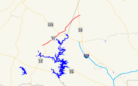
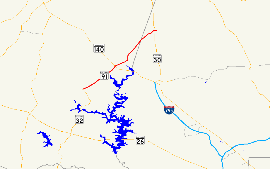
Route information Maintained by MDSHA Length: 7.86 mi[1][2] (12.65 km) Major junctions South end:  MD 32 in Gamber
 MD 140
North end:  MD 30 in Fowblesburg
Highway system Maryland highway system
Interstate • US • State • Minor • Former • Turnpikes←  MD 90
MD 90MD 92  →
→Maryland Route 91 is a short highway that runs through central Maryland. It is one of only four routes still surviving in the route cluster assigned to Carroll County in the 1933 route numbering plan.
Contents
Counties traversed
Route description
The route begins at an intersection with MD 32 in Gamber. It continues northeast and intersects MD 140 in Finksburg, near the eastern end of the Westminster Bypass. Continuing north, the road narrows from a wide two-lane configuration into a narrow two-lane country road; the designated route eventually terminates at MD 30 in Fowblesburg, with the physical road continuing onward to terminate at Old Hanover Rd.
The intersection between MD 91 and MD 140 does not allow left turns from MD 140 eastbound to MD 91 northbound; drivers must use a ramp from MD 140 east into a nearby strip mall and follow the strip mall exit roads to an intersection with MD 91, where they must turn left and cross MD 140 in order to continue on MD 91 north.
Junction list
County Location Mile[1][2] Destinations Notes Carroll Gamber 0.00 MD 32 (Sykesville Road) – Eldersburg, Westminster1.46 Deer Park Road 1.68  MD 879 (Old Gamber Road)
old alignment of MD 91 2.17 MD 879 (Old Gamber Road)old alignment of MD 91; loops to the northwest Finksburg 2.86 MD 879 (Old Gamber Road)southern terminus of old alignment of MD 91 through Finksburg 3.21 MD 140 (Westminster Pike) – Westminster, Reisterstownformer route of US 140 3.74 MD 879 south (Cedarhurst Road)northern terminus of old alignment of MD 91 through Finksburg Baltimore Fowblesburg 7.86 MD 30 (Hanover Pike) – Hampstead, ReisterstownReferences
- ^ a b Maryland State Highway Administration (2007). "Highway Location Reference: Carroll County" (PDF). http://apps.roads.maryland.gov/KeepingCurrent/performTrafficStudies/dataAndStats/hwyLocationRef/2007_hlr_all/co06.pdf. Retrieved 2009-05-14.
- ^ a b Maryland State Highway Administration (2007). "Highway Location Reference: Baltimore County" (PDF). http://apps.roads.maryland.gov/KeepingCurrent/performTrafficStudies/dataAndStats/hwyLocationRef/2007_hlr_all/co03.pdf. Retrieved 2009-04-15.
See also
Categories:- State highways in Maryland

Wikimedia Foundation. 2010.