- Maryland Route 128
-
Maryland Route 128
Butler Road 
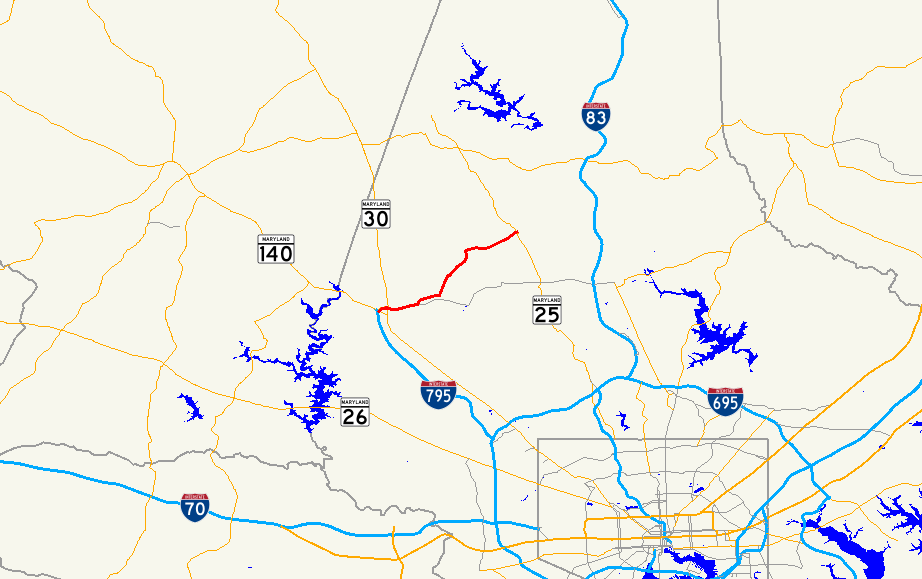
Route information Maintained by MDSHA Length: 7.62 mi[1] (12.26 km) Major junctions West end:  MD 30 in Reisterstown
East end:  MD 25 in Sparks
Highway system Maryland highway system
Interstate • US • State • Minor • Former • Turnpikes←  MD 125
MD 129  →
→Maryland Route 128, better known locally as Butler Road, is a road in Baltimore County, Maryland.
Contents
Route description
The road starts at the end of a spur of I-795 known as Maryland Route 795, where it intersects with Maryland Route 30 (Hanover Pike), and then passes to the east through historic Glyndon. In this area, a historic train station, which now serves as a post office, is located where the road crosses over the railroad tracks. Across from this station is the Glyndon Square shopping center.[1][2]
After historic Glyndon and passing through a small section of forest, MD 128 and Butler Road comes to a junction. The name of the road that continues straight changes to Worthington Avenue, which eventually becomes Greenspring Avenue. MD 128 turns north onto Worthington Avenue, and passes through open fields and woodland. It meets a wide intersection with Dover Road to the west side, and turns east again, continuing through more open field as it comes to its end at MD 25 in Butler.[1][2]
Junction list
The entire route is in Baltimore County.
Location Mile
[1]Roads intersected Notes Reisterstown 0.00  MD 30 (Hanover Pike) to I-795 – Baltimore, Westminster, Reisterstown, Hampstead
Western terminus Sparks 7.62 MD 25 (Falls Road)Eastern terminus References
- ^ a b c d Maryland State Highway Administration (2008). "Highway Location Reference: Baltimore County" (PDF). http://apps.roads.maryland.gov/KeepingCurrent/performTrafficStudies/dataAndStats/hwyLocationRef/2008_hlr_all/co03.pdf. Retrieved 2010-04-21.
- ^ a b Google, Inc. Google Maps – overview of Maryland Route 128 (Map). Cartography by Google, Inc. http://maps.google.com/maps?f=d&source=s_d&saddr=maryland+128+and+maryland+30&daddr=maryland+128+and+maryland+25&hl=en&geocode=&mra=ls&sll=39.140446,-77.191315&sspn=0.114767,0.338173&ie=UTF8&t=h&z=12. Retrieved 2010-04-28.
External links
Categories:- State highways in Maryland
- Roads in Baltimore County, Maryland

Wikimedia Foundation. 2010.