- Maryland Route 177
-
Maryland Route 177
Mountain Road 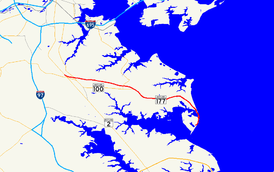
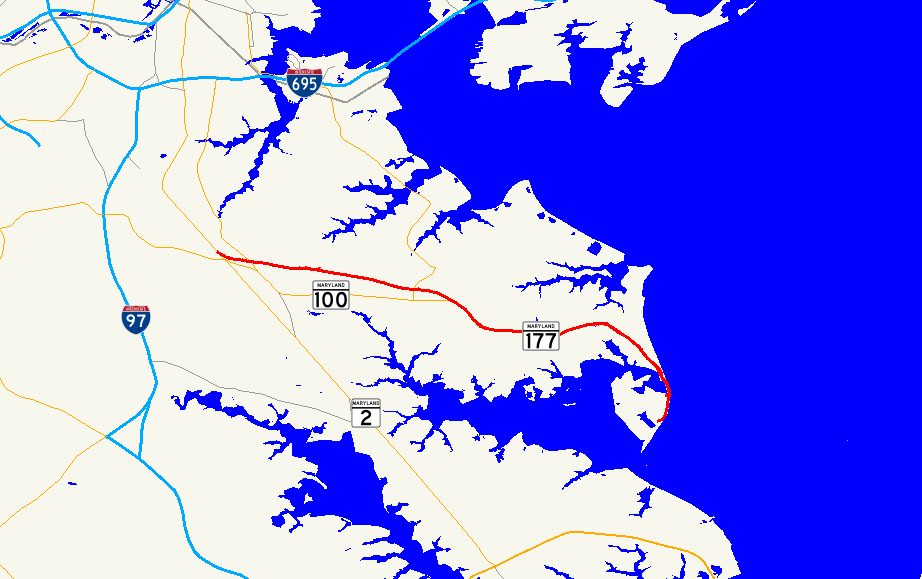
Route information Maintained by MDSHA Length: 10.92 mi[1] (17.57 km) Major junctions West end:  MD 2 in Pasadena
 MD 100
East end: end of state maintenance in Gibson Island Highway system Maryland highway system
Interstate • US • State • Minor • Former • Turnpikes←  MD 176
MD 178  →
→Maryland Route 177 is a state route in Anne Arundel County, beginning at MD 2 in Pasadena and ending at Gibson Island. It is named 'Mountain Road' for its entire length.
Contents
Route description
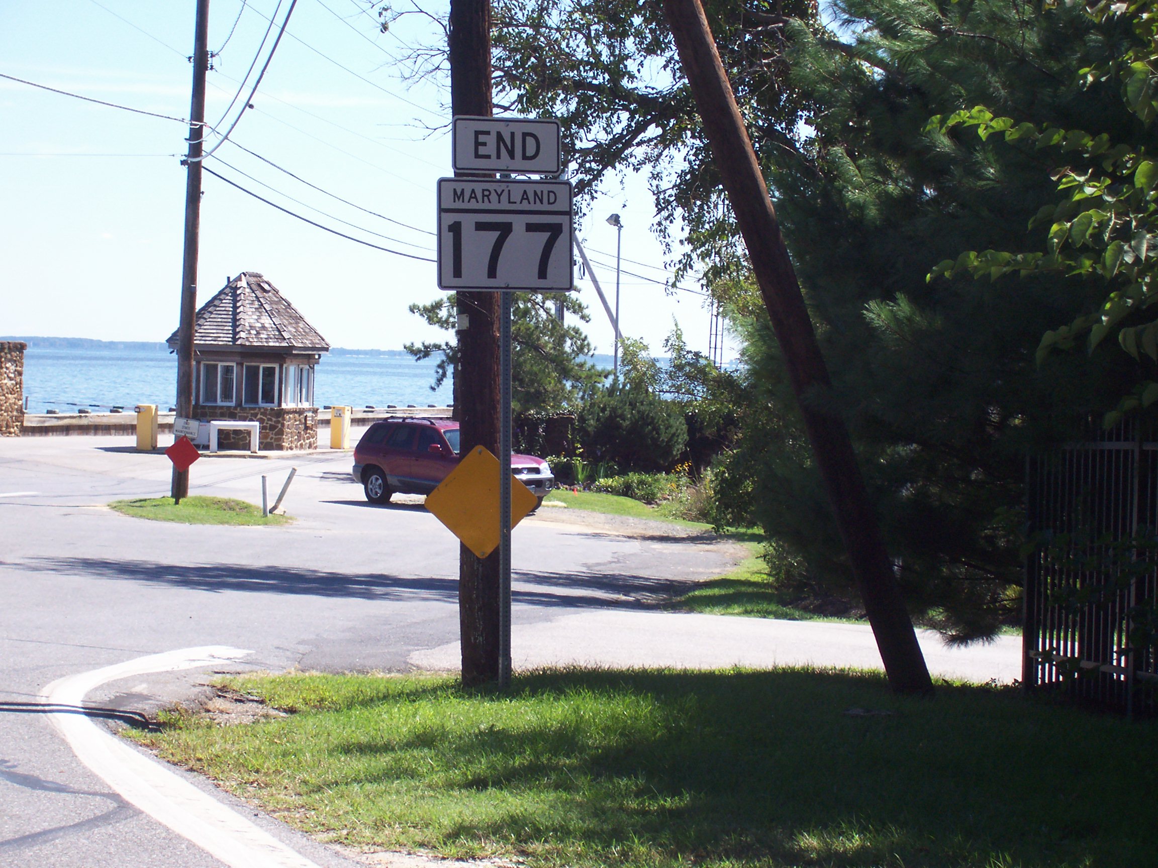
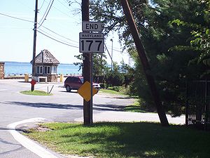 Eastern terminus of Maryland Route 177
The route is a busy suburban road, running through many large neighborhoods and communities. After branching off from MD 2 it runs east, crossing MD 10 and intersecting with MD 648. After overlapping one another for a short distance, MD 648 turns south at Lake Waterford Road while MD 177 continues east, crossing Edwin Raynor Blvd. and Hog Neck Rd. before reaching MD 100. After MD 100 the route continues to the east, heading for the Chesapeake Bay; its far eastern end, denuded of most of its traffic, eventually reaches Gibson Island, where the route terminates in a rudimentary turning circle.
Beyond the Lake Shore Athletic Complex, MD 177 is the only through road to the various communities on the peninsula formed by the Magothy River, including Lake Shore and Mt. Carmel.
The route is heavily congested between the intersection with MD 100 and the eastern terminus at Gibson Island. A lane control system was installed in the late 1990s to convert the center turn lane into a reversible lane; in peak hours, the lane controls switch the lane flow to the peak direction; in off-peak hours, the lane reverts to a center turn lane. Despite this, traffic levels remain uncomfortably high.
History
At one time it was planned to construct a second through road into the peninsula served by MD 177, but the state cancelled the project.
Junction list
The entire route is located within Anne Arundel County.
Location Mile[1] Roads intersected Notes 0.00 MD 2 (Governor Ritchie Highway)Western terminus 0.60  MD 10 (Arundel Expressway)
Interchange 0.80  MD 648 (Baltimore–Annapolis Boulevard)
0.94  MD 915 (Long Hill Road)
1.97 MD 648 (Waterford Road)4.22  MD 607 (Hog Neck Road)
5.07 MD 100 (Paul T. Pitcher Memorial Highway)5.33  MD 990
10.92 Road end Eastern terminus References
See also
Categories:- State highways in Maryland
- Roads in Anne Arundel County, Maryland

Wikimedia Foundation. 2010.