- Maryland Route 5
-
Maryland Route 5
Point Lookout Road, Three Notch Road, Leonardtown Road, Mattawoman Beantown Road, Branch Avenue 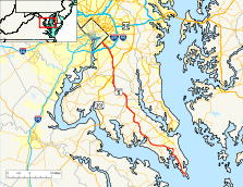
Route information Maintained by MDSHA Length: 74.34 mi[1][2][3] (119.64 km) Major junctions South end: Point Lookout Road in Point Lookout  MD 235 in Ridge
 MD 4 in Leonardtown
MD 235 in Oraville
 MD 6 in Charlotte Hall
 MD 231 in Hughesville
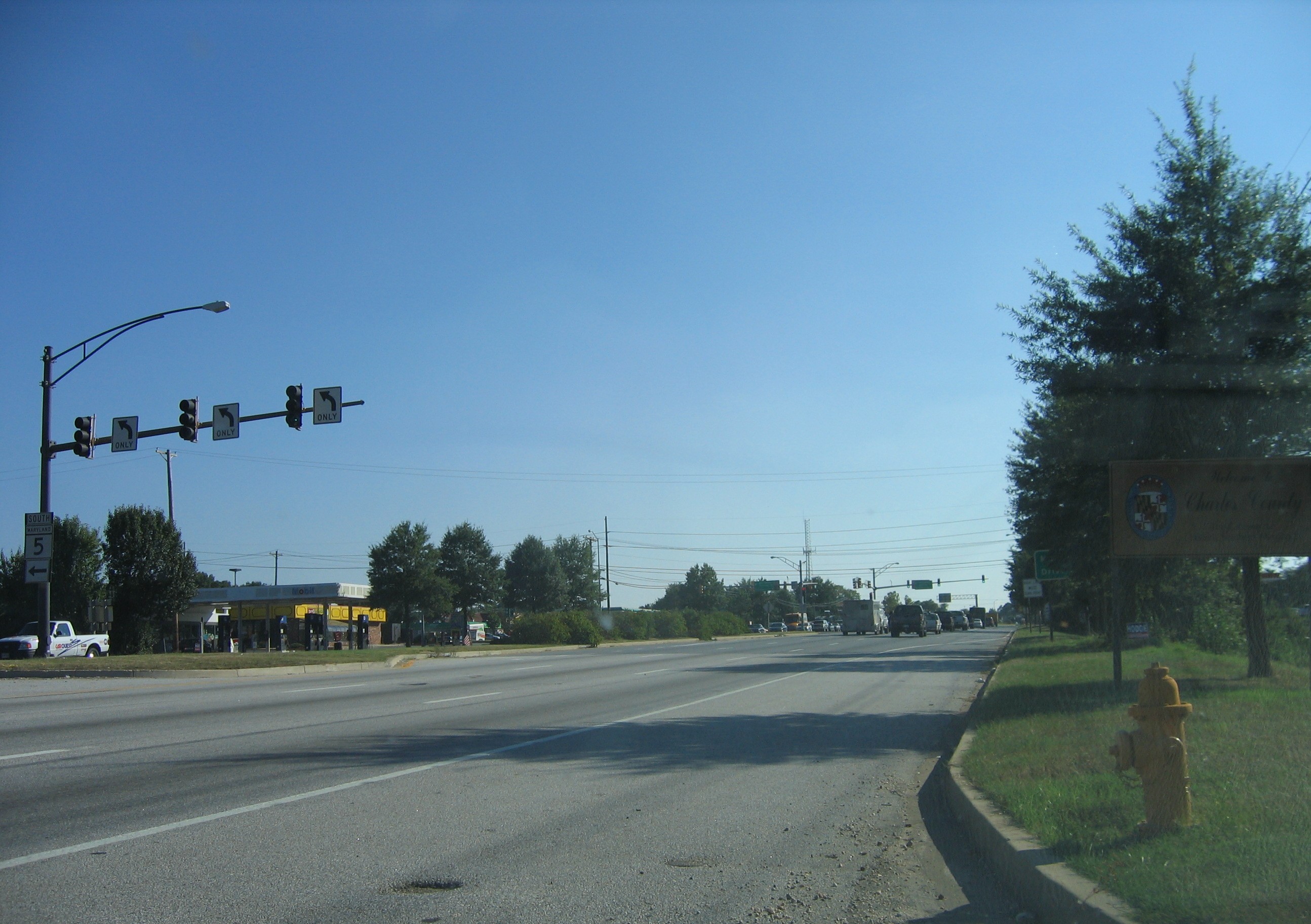
 US 301 in Waldorf
 MD 373 in Brandywine
 MD 337 in Camp Springs

 I-95 / I-495 in Camp Springs
 MD 414 in Marlow Heights
North end: Branch Avenue at Washington, D.C. border in Suitland Highway system Maryland highway system
Interstate • US • State • Minor • Former • Turnpikes← MD 4MD 6 →←  MD 624
MD 627  →
→Maryland Route 5 is a 74.34-mile (119.64 km) long state highway that runs north–south in the U.S. state of Maryland. The highway runs from Point Lookout in St. Mary's County north to the Washington, D.C. border in Suitland, Prince George's County.
MD 5 begins as the two-lane undivided Point Lookout Road which runs from Point Lookout, St. Mary's County, to an intersection with Maryland Route 235 in the northern part of the county. Point Lookout Road passes through rural areas as well as the county seat of Leonardtown. After the MD 235 intersection, the route becomes the four-lane divided Three Notch Road and continues into Charles County, where it becomes Leonardtown Road. Here, the route bypasses Hughesville and continues north toward the Waldorf area, which it bypasses to the east on Mattawoman Beantown Road. The route merges onto U.S. Route 301 (Crain Highway) and enters Prince George's County, splitting from US 301 at an interchange in Brandywine. From here, MD 5 continues north on Branch Avenue, running through suburban areas, before becoming a freeway as it passes Andrews Air Force Base and interchanges with the Capital Beltway. Past the Capital Beltway, the route runs through suburban areas of Hillcrest Heights and Suitland before reaching the D.C. border, where Branch Avenue continues toward Pennsylvania Avenue.
MD 5 was designated by 1927 to run from Point Lookout to the Washington, D.C. border in Suitland. By 1940, the route was directed to run to the D.C. border along Naylor Road. The routing was moved to Branch Avenue by 1960, when the route was also widened into a divided highway between the proposed Capital Beltway and just south of the Suitland Parkway. By 1975, the route to a divided highway between the northern intersection with MD 235 and the Capital Beltway with the exception of the portion through Hughesville. The route bypassed the center of Leonardtown by 1996 and by 1999, MD 5 was moved to Mattawoman Beantown Road to the east of Waldorf, replacing Maryland Route 205. In both cases, the former routings of MD 5 became Maryland Route 5 Business. In Prince George's County, several interchanges were built along MD 5 between MD 223 and the Capital Beltway. In 2007, a four-lane, divided bypass of Hughesville was completed, alleviating the traffic bottleneck within that town at the intersection of Maryland Route 231. The portion of MD 5 between US 301 and the Capital Beltway is slated to be upgraded to a full freeway, with an interchange at Maryland Route 373 (Accokeek Road)/Brandywine Road planned to be completed in 2011 and the remainder still in the planning stages.
Contents
Route description
St. Mary's County

Maryland Route 5 begins within Point Lookout State Park in St. Mary's County by heading west on Point Lookout Road, a two-lane undivided road which continues south from the route’s southern terminus along the shoreline of the Chesapeake Bay to the confluence with the Potomac River. The route, which has a speed limit of 30 mph (48 km/h) turns north, passing a toll booth at the entrance of the state park before continuing into wooded areas as a 40 mph (64 km/h) road. A short distance later, the road makes a left turn and heads northwest through a mix of woodland and farmland, with the speed limit increasing to 50 mph (80 km/h).[1][4] MD 5 passes through Scotland and continues north through more agricultural areas with intermittent residences.[4] It reaches Ridge, where the speed limit lowers to 40 mph (64 km/h) and MD 5 intersects the southern terminus of Maryland Route 235 (Three Notch Road).[1][4] From here, the road heads into more wooded areas, with the speed limit increasing back to 50 mph (80 km/h). MD 5 passes through agricultural and residential areas before turning northwest and entering St. Mary's City. Here, the speed limit drops to 30 mph (48 km/h) and the route makes a turn to the north, with Maryland Route 584 looping to the west of the route through the center of St. Mary's City.[1][4] The road runs long the shore of the St. Marys River and passes near St. Mary's College of Maryland before leaving St. Mary's City had heading into forested areas as a 50 mph (80 km/h) road. It reaches Park Hall, where the speed limit becomes 40 mph (64 km/h) and MD 5 intersects Maryland Route 489 (Park Hall Road).[1][4]
Past MD 489, the route turns to the west and heads through a mix of woods, farms, and homes as a 50 mph (80 km/h) road again. It heads to Great Mills, where it briefly becomes a divided highway with a 40 mph (64 km/h) speed limit at the intersection with Maryland Route 246 (Great Mills Road). From here, MD 5 continues west to an intersection with Maryland Route 471 (Indian Bridge Road). Past this intersection, the speed limit becomes 50 mph (80 km/h) again before it lowers to 40 mph (64 km/h) when MD 5 reaches Callaway.[1][4] Here, the route intersects Maryland Route 249 (Piney Point Road).[1] It passes some businesses before heading into wooded areas with residences as a 50 mph (80 km/h) road.[1][4] The route turns north, passing through Redgate, before heading toward Leonardtown.[4] Here, the speed limit drops to 45 mph (72 km/h) as MD 5 intersects Maryland Route 244 (Medleys Neck Road). The speed limit rises to 50 mph (80 km/h) before the route junctions with Maryland Route 4 (St. Andrews Church Road). Past this intersection, the route becomes a divided highway again, entering Leonardtown, where Maryland Route 5 Business heads west on Fenwick Street toward the downtown area. MD 5 heads northwest as a 40 mph (64 km/h) road through woodland before passing by the Leonardtown campus of the College of Southern Maryland. Past the college, the road intersects Maryland Route 245 (Hollywood Road) and MD 5 Business (Washington Street). The road widens to four lanes and heads through a mix of residences and businesses, passing near St. Mary's Hospital.[1][4] It leaves Leonardtown and becomes a divided highway at the intersection with Maryland Route 243 (Newtowne Neck Road).[1] MD 5 passes commercial areas before heading into farmland at the intersection with Maryland Route 234 (Budds Creek Road).[1][4]
From here, the route becomes a two-lane undivided road again with a speed limit of 50 mph (80 km/h).[1] It heads north through a mix of farm fields and residences, eventually coming to an intersection with Maryland Route 247 (Loveville Road) in Loveville.[1][4] MD 5 turns northwest, heading through woodland and reaching Morganza.[4] Here, the speed limit drops to 30 mph (48 km/h) and the route intersects Maryland Route 242 (Colton Point Road).[1] The speed limit becomes 50 mph (80 km/h) again as the road heads west through a mix of woods and farms to Helen, where MD 5 comes to an intersection with Maryland Route 238 (Chaptico Road). Here, the route turns north, with residential neighborhoods increasing along the road as it continues through rural areas.[1][4] The route comes to another intersection with MD 235 (Three Notch Road) in Oraville, where MD 5 makes a left turn onto Three Notch Road, a four-lane divided highway with a 55 mph (89 km/h) speed limit.[1][4] The route heads northwest through a mix of rural residences and businesses, with the median widening briefly to include some businesses when the route reaches Mechanichsville. The road continues through rural commercial areas before reaching Charlotte Hall. Here, MD 5 intersects Maryland Route 236 (Thompsons Corner Road) and Maryland Route 6 (New Market Turner Road).[4] From here, the route turns to the north and continues through a mix of farms and woods with some businesses, with Maryland Route 863 looping off MD 5.[1][4]
In St. Mary's County, the daily traffic counts on MD 5 range from a high of 38,131 vehicles at the intersection with MD 6 in Charlotte Hall to a low of 1,891 vehicles at the southern terminus in Point Lookout State Park in 2007.[1]
Charles County
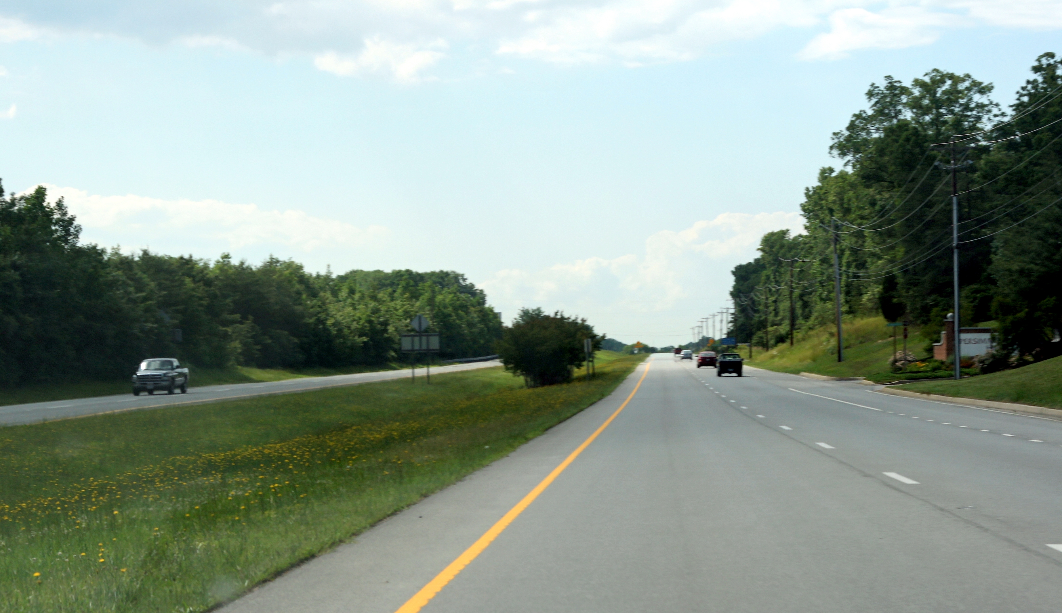
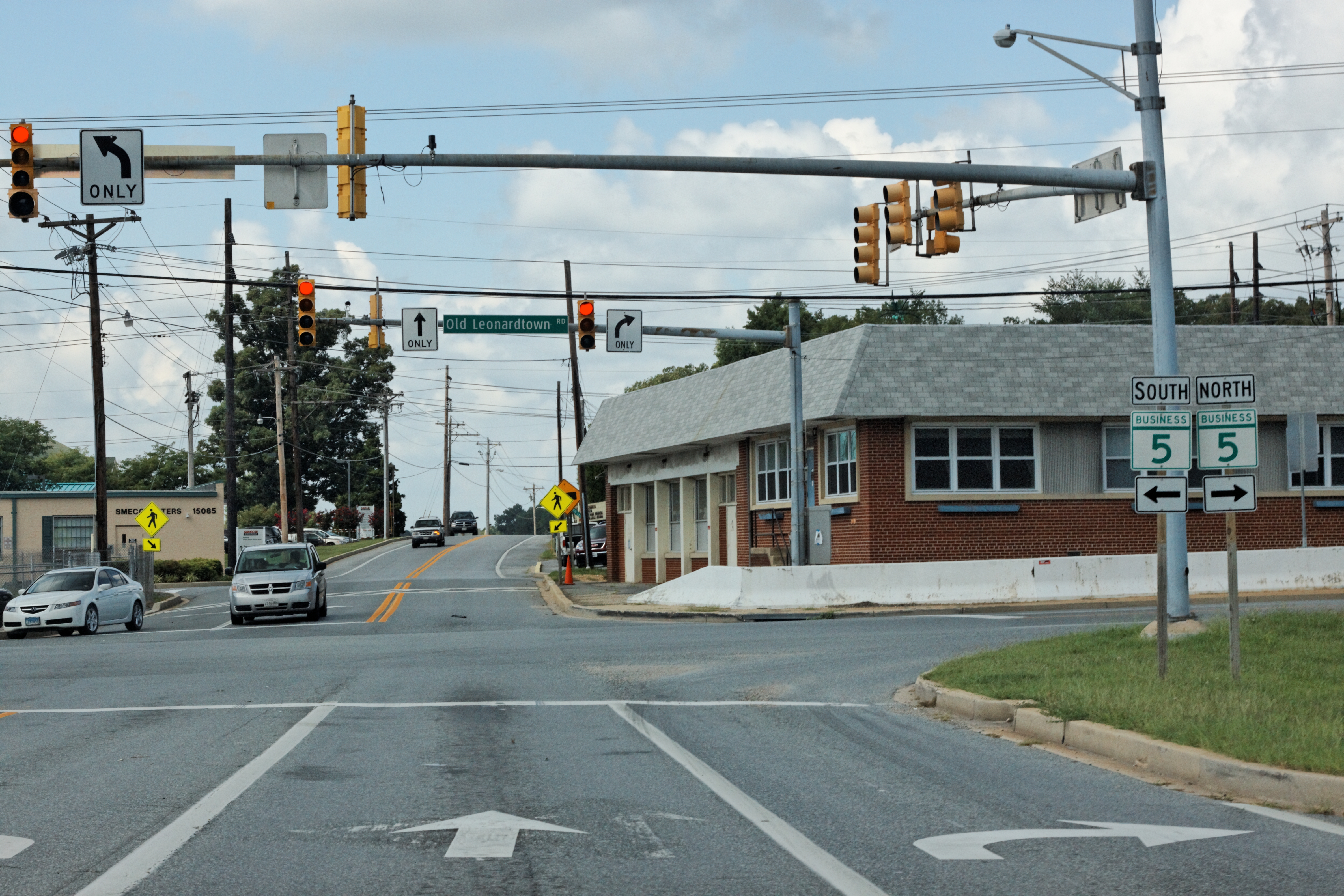
MD 5 crosses into Charles County, where it continues north on Leonardtown Road through areas of rural residences, with the speed limit dropping to 50 mph (80 km/h). The route reaches Hughesville, where MD 5 bypasses the community to the east on a limited-access highway and Maryland Route 5 Business (MD 625) continues to the north through Hughesville on Old Leonardtown Road.[2][4] The bypass heads through wooded areas before coming to a dumbbell interchange with Maryland Route 231 (Prince Frederick Road) that features roundabouts where the ramps meet MD 231.[4] Past MD 231, the bypass continues through woodland before intersecting MD 5 Business again.[2][4] From here, MD 5 heads northwest through a mix of woods and farms with some residences and businesses.[4] The route turns to the west and passes through Bryantown, where it intersects Olivers Shop Road/Bryantown Road intersection.[2][4] The road turns to the northwest past Bryantown and heads through wooded areas, passing through Zekiah Swamp.[4] MD 5 comes to an intersection with Maryland Route 488 (La Plata Road) and turns north again, heading through a mix of woods, farms, and residences. The speed limit decreases to 45 mph (72 km/h) as the route heads through wooded residential neighborhoods before increasing to 55 mph (89 km/h) again as MD 5 heads back into farmland. The route reaches the eastern edge of the planned community of St. Charles, where it comes to an intersection where St. Charles Parkway heads south into St. Charles, MD 5 Business heads to the west on Leonardtown Road, and MD 5 turns north onto Mattawoman Beantown Road.[2][4]
MD 5 follows Mattawoman Beantown Road, a four-lane divided highway with a speed limit of 45 mph (72 km/h) that bypasses the center of Waldorf to the east. The route intersects Poplar Hill Road, which leads to the house of Dr. Samuel A. Mudd.[2][4] Mattawoman Beantown Road carries MD 5 north through farm fields before heading into woodland. It continues into suburban residential areas of Waldorf, passing by the entrance to the Pinefield neighborhood, which used to be intertwined with several Nike Missile installations.[4] The route crosses over CSX’s Popes Creek Subdivision before coming to an intersection with U.S. Route 301 (Crain Highway). Here, MD 5 forms a concurrency with US 301 and continues north as a six-lane divided highway.[2][4]
In Charles County, the daily traffic counts on MD 5 range from a high of 84,990 vehicles at the south end of the US 301 concurrency in Waldorf to a low of 33,810 vehicles at the intersection with MD 5 Business in Waldorf in 2007.[2]
Prince George's County
The Crain Highway crosses the Mattawoman Creek into Prince George's County, where it heads north as a 55 mph (89 km/h) road through wooded areas with some businesses along the road. US 301 splits from MD 5 at an interchange near Brandywine with MD 5 continuing to the north on four-lane divided Branch Avenue.[3][4] A short distance past US 301, the route intersects Maryland Route 373 (Accokeek Road).[3][4] It continues north through woodland with some businesses and adjacent residential areas before passing by the Southern Maryland Hospital Center at the Surratts Road intersection.[4] Past Surratts Road, the route heads through suburban residential areas of Clinton as a six-lane road before turning into a freeway that comes to a single-point urban interchange (SPUI) with Maryland Route 223 (Woodyard Road). The route heads northwest through commercial areas, with interchanges located at Malcolm Road (MD 5M)/Schultz Road and Coventry Way (MD 5L), the latter being a single-point urban interchange.[3][4] The route has a southbound exit to Old Branch Avenue and a northbound entrance from Old Alexandria Ferry Road before it turns north and heads through wooded surroundings, forming the western boundary of Andrews Air Force Base.[4] MD 5 comes to another SPUI with Maryland Route 337 (Allentown Road) in Camp Springs. A short distance later, the road interchanges with Manchester Drive (MD 5R)/Linda Lane (MD 5Q) before heading north as a 50 mph (80 km/h) freeway to an interchange with Interstate 95/Interstate 495 (Capital Beltway).[3][4]
Past the Capital Beltway, MD 5 becomes a surface road again, intersecting Maryland Route 535 (Auth Road), which provides access to northbound MD 5 from southbound I-95/I-495 as well as to the Branch Avenue station on Washington Metro’s Green Line. The route continues northwest into commercial areas, intersecting Maryland Route 967C (Simpson Road)/Auth Way and Maryland Route 967A (Old Branch Avenue). The route narrows to four lanes and turns west, coming to an interchange with Maryland Route 414 (St. Barnabas Road) in Marlow Heights. MD 5 turns to the northwest past this interchange as a 35 mph (56 km/h) road, passing by the Marlow Heights Shopping Center and continuing to Hillcrest Heights, where the route intersects Maryland Route 458 (Silver Hill Road) adjacent to the Iverson Mall.[3][4] The route passes more businesses and heads toward Suitland, where it intersects MD 414 (Bonita Street) again. The speed limit drops to 30 mph (48 km/h) and the road continues to an intersection with Maryland Route 637 (Naylor Road). North of Naylor Road, the route passes under the Green Line of the Washington Metro, interchanges with the Suitland Parkway, and narrows to a 2-lane undivided road in quick succession.[3][4] MD 5 passes through wooded areas before coming to an intersection with Southern Avenue at the Washington, D.C. border where the route ends and Branch Avenue continues into the District of Columbia toward Pennsylvania Avenue.[4]
In Prince George's County, the daily traffic counts on MD 5 range from a high of 110,920 vehicles at the interchange with Coventry Way in Clinton to a low of 31,770 vehicles at the interchange with the Suitland Parkway near the Washington, D.C. border in 2007.[3]
History
 Shields for MD 5 Business along westbound MD 231 in Hughesville. MD 5 Business (designated MD 625 in MDSHA internal documents) was created in 2006 when MD 5 was moved to the Hughesville Bypass.
MD 5 was designated by 1927 to run from north of Point Lookout State Park to the Washington, D.C. border in Suitland.[5] By 1940, the route was extended south into Point Lookout State Park and it was routed to the District of Columbia border on Naylor Road while MD 637 followed Branch Avenue to the D.C. border. District of Columbia Route 5 continued into Washington, D.C. on Naylor Road, Good Hope Road, and 11th Street to District of Columbia Route 4 (Pennsylvania Avenue).[6] MD 5 was directed to follow Branch Avenue to the D.C. border and DC 5 was modified to follow Branch Avenue from the Maryland border to DC 4 (Pennsylvania Avenue), which it followed west to the White House, by 1946.[7][8] By 1960, DC 5 no longer existed while MD 5 was widened into a divided highway from the proposed Capital Beltway to just south of the Suitland Parkway.[9] Further widening of the route to a divided highway occurred by 1975 between US 301 and the Capital Beltway, along the US 301 concurrency, and along Leonardtown Road between MD 235 and US 301 with the exception of the portion through Hughesville.[10] MD 5 was routed to bypass Leonardtown by 1996, with the former route becoming MD 5 Business.[11] Another rerouting of MD 5 in Waldorf by 1999 moved the route from Leonardtown Road and US 301 to Mattawoman Beantown Road, where it replaced Maryland Route 205.[11][12] With this modification, Leonardtown Road between Mattawoman Beantown Road and US 301 became MD 5 Business.[12] Also by 1999, three interchanges were constructed in Prince George's County at MD 223, Coventry Lane, and MD 337.[13] In 2001, an interchange was constructed with Manchester Drive and Linda Lane in Camp Springs.[14]
In February 2007, a $56 million limited-access bypass around Hughesville was completed, redirecting MD 5 to the east of the community. The bypass was built due to the heavy amount of congestion at the old intersection of MD 5 and MD 231 in Hughesville's central business district.[15] Groundbreaking for construction of the bypass took place on November 5, 2004, with $10 million in federal funds given to the project.[16] The old portion of MD 5 that went through Hughesville received the official MD 625 designation in 2006, even though it is signed as MD 5 Business.[17] The bypass was formally opened on August 8, 2007.[15]
Future
There are plans to improve MD 5 in Prince George's County due to traffic congestion along the route. An interchange is planned to be built with MD 373 and Brandywine Road in Brandywine that would widen the route to six lanes in the vicinity of the proposed interchange.[18] A notice to begin construction of Phase 1, which will widen MD 5 to 6 lanes in the vicinity of the future interchange was issued in November 2009 with completion in Spring 2011. Phase 2, which will build the interchange itself, is in design with a Preliminary Investigation Meeting planned for Summer 2010.[19] In addition, the route is planned to be upgraded to a full freeway between US 301 and the Capital Beltway, with new interchanges at Burch Hill Road/Earnshaw Drive and Surratts Road. This project is currently in the planning stages with many alternatives including upgrading only portions to freeway, adding reversible lanes or high-occupancy vehicle lanes, and various interchange designs.[20]
Junction list
County Location Mile
[1][2][3]Intersection Notes Saint Mary's Point Lookout 0.00 Point Lookout Road south Southern terminus Ridge 5.01 MD 235 north (Three Notch Road)Saint Mary's City 10.92
11.16 MD 584
Loop to west of MD 5 Park Hall 13.33  MD 489 east (Park Hall Road)
Great Mills 17.20  MD 246 east (Great Mills Road)
17.46  MD 471 north (Indian Bridge Road)
Callaway 18.65  MD 249 south (Piney Point Road)
Leonardtown 24.71  MD 244 east (Medleys Neck Road)
25.53 MD 4 north (St. Andrews Church Road)25.97 
 MD 5 Bus. north (Fenwick Street)
26.70 
 MD 5 Bus. south (Washington Street) / MD 245 north (Hollywood Road)
28.09  MD 243 south (Newtowne Neck Road)
28.83  MD 234 west (Budds Creek Road)
Loveville 32.61  MD 247 north (Loveville Road)
Morganza 33.67  MD 242 south (Colton Point Road)
Helen 35.14  MD 238 west (Chaptico Road)
Oraville 38.32 MD 235 south (Three Notch Road)Charlotte Hall 42.55  MD 236 south (Thompsons Corner Road)
42.76 MD 6 (New Market Turner Road)Charles Hughesville 46.36
MD 5 Bus. north (Old Leonardtown Road)47.08 MD 231 (Prince Frederick Road) – Prince Frederick, HughesvilleInterchange 47.92
MD 5 Bus. south (Old Leonardtown Road)52.17  MD 488 west (La Plata Road)
St. Charles 55.89
MD 5 Bus. north (Lenoardtown Road) / St. Charles Parkway southWaldorf 59.10 US 301 south (Crain Highway)South end of US 301 overlap Prince George's Brandywine 61.75 US 301 north (Crain Highway) – BaltimoreNorthbound exit, southbound entrance; north end of US 301 overlap 62.26 MD 373 (Accokeek Road)South end of freeway section Clinton 67.05  MD 223 (Woodyard Road) – Clinton, Mellwood
67.64 Malcolm Road (MD 5M) Northbound exit and entrance Schultz Road Southbound exit and entrance 68.13 Coventry Way (MD 5L) – Clinton, Andrews AFB 68.59 Old Branch Avenue/Kirby Road Southbound exit Camp Springs 69.88 MD 337 north (Allentown Road) – Camp Springs, Andrews AFB70.39 To Manchester Drive (MD 5R) Northbound exit and entrance Linda Lane (MD 5Q) to Old Branch Avenue Southbound exit and entrance 71.15 I-95 / I-495 (Capital Beltway) – Baltimore, College Park, Richmond, AlexandriaNorth end of freeway section Marlow Heights 72.67 MD 414 (St. Barnabas Road)Interchange Hillcrest Heights 73.23  MD 458 (Silver Hill Road) – Suitland
Suitland 73.48 MD 414 west (Bonita Street)73.95  MD 637 west (Naylor Road)
74.27 Suitland Parkway 74.34 Branch Avenue Northern terminus, District of Columbia line Bannered routes
Leonardtown business route
Maryland Route 5 Business
Location: Leonardtown Length: 0.96 mi[1] (1.54 km) Maryland Route 5 Business is a 0.96-mile (1.54 km) business route of MD 5 that loops through the central part of Leonardtown. The route heads west from MD 5 on Fenwick Street, a two-lane undivided road with a 40 mph (64 km/h) speed limit and a traffic count of 7,271 vehicles in 2007. It heads through wooded areas before the speed limit drops to 25 mph (40 km/h)as the road heads into the downtown area of Leonardtown.[1][21] Upon reaching the town center, MD 5 Business turns north onto Washington Street, which follows a one-way pair with two lanes in each direction. The road turns into a four-lane undivided road and continues through residential and commercial areas before intersecting MD 5 again.[21] Past here, the road becomes MD 245 (Hollywood Road).[1]
Hughesville business route
Maryland Route 5 Business
Location: Hughesville Length: 1.36 mi[2] (2.19 km) Existed: 2006–present Maryland Route 5 Business (officially Maryland Route 625 in MDSHA internal documents) is a 1.36-mile (2.19 km) business route that was designated in 2006 along the former alignment of MD 5 in Hughesville after that route was moved to the Hughesville Bypass.[17] The route heads north from MD 5 south of Hughesville on Old Lenoardtown Road, a two-lane undivided road with a 40 mph (64 km/h) speed limit and a traffic count of 3,458 vehicles in 2007. It passes a mix of residences and farm fields before becoming a four-lane undivided road and passing businesses in the center of Hughesville, where the route crosses MD 231 (Prince Frederick Road). Past this intersection, the route passes more businesses before narrowing to two lanes and ending at MD 5 north of Hughesville.[2][22]
Waldorf business route
Maryland Route 5 BusinessLocation: Waldorf Length: 1.80 mi[2] (2.90 km) Maryland Route 5 Business is a 1.80-mile (2.90 km) business route that runs along Leonardtown Road between MD 5 in St. Charles and US 301 in Waldorf. The route heads west from MD 5 (Mattawoman Beantown Road) and St. Charles Parkway as a four-lane divided highway with a speed limit of 45 mph (72 km/h) and a traffic count of 29,430 vehicles in 2007. It passes by Thomas Stone High School before the speed limit drops to 35 mph (56 km/h) as the route heads into commercial areas.[2][23] The median ends and MD 5 Business gains a center left-turn lane. It crosses CSX’s Popes Creek Subdivision before coming to an intersection with Maryland Route 925 (Old Washington Road).A short distance later, MD 5 Business becomes a divided highway again and ends at US 301 (Crain Highway), where the road continues west as Maryland Route 228 (Berry Road).[2]
References
- ^ a b c d e f g h i j k l m n o p q r s t u v "Highway Location Reference: St. Mary's County" (PDF). Maryland State Highway Administration. 2009. http://sha.maryland.gov/Location/2009_SAINTMARYS.pdf. Retrieved 2010-10-21.
- ^ a b c d e f g h i j k l m n "Highway Location Reference: Charles County" (PDF). Maryland State Highway Administration. 2009. http://sha.maryland.gov/Location/2009_CHARLES.pdf. Retrieved 2010-10-21.
- ^ a b c d e f g h i "Highway Location Reference: Prince George's County" (PDF). Maryland State Highway Administration. 2009. http://sha.maryland.gov/Location/2009_PRINCEGEORGES.pdf. Retrieved 2010-10-21.
- ^ a b c d e f g h i j k l m n o p q r s t u v w x y z aa ab ac ad ae af ag ah ai Google, Inc. Google Maps – overview of Maryland Route 5 (Map). Cartography by Google, Inc. http://maps.google.com/maps?f=d&source=s_d&saddr=MD+5+%40+38.062,+-76.33&daddr=38.241955,-76.560287+to:MD-5%2FPoint+Lookout+Rd+to:Branch+Avenue+and+Southern+Avenue+suitland,+md&geocode=FbDHRAId8Etz-w%3B%3BFT70SAIdnARu-w%3B&hl=en&mra=dpe&mrcr=0&mrsp=1&sz=11&via=1,2&sll=38.236023,-76.49025&sspn=0.238387,0.439453&ie=UTF8&ll=38.505191,-76.679077&spn=0.950005,1.757812&t=h&z=9. Retrieved 2009-05-27.
- ^ Maryland State Highway Administration (1927). Map of Maryland (Map). http://www.mdhighwaycentennial.com/images/template/gallery/maps/1927SIDE1.jpg. Retrieved 2009-03-03.
- ^ Maryland State Highway Administration (1940). Map of Maryland (Map). http://www.mdhighwaycentennial.com/images/template/gallery/maps/1940SIDE1.jpg. Retrieved 2009-03-03.
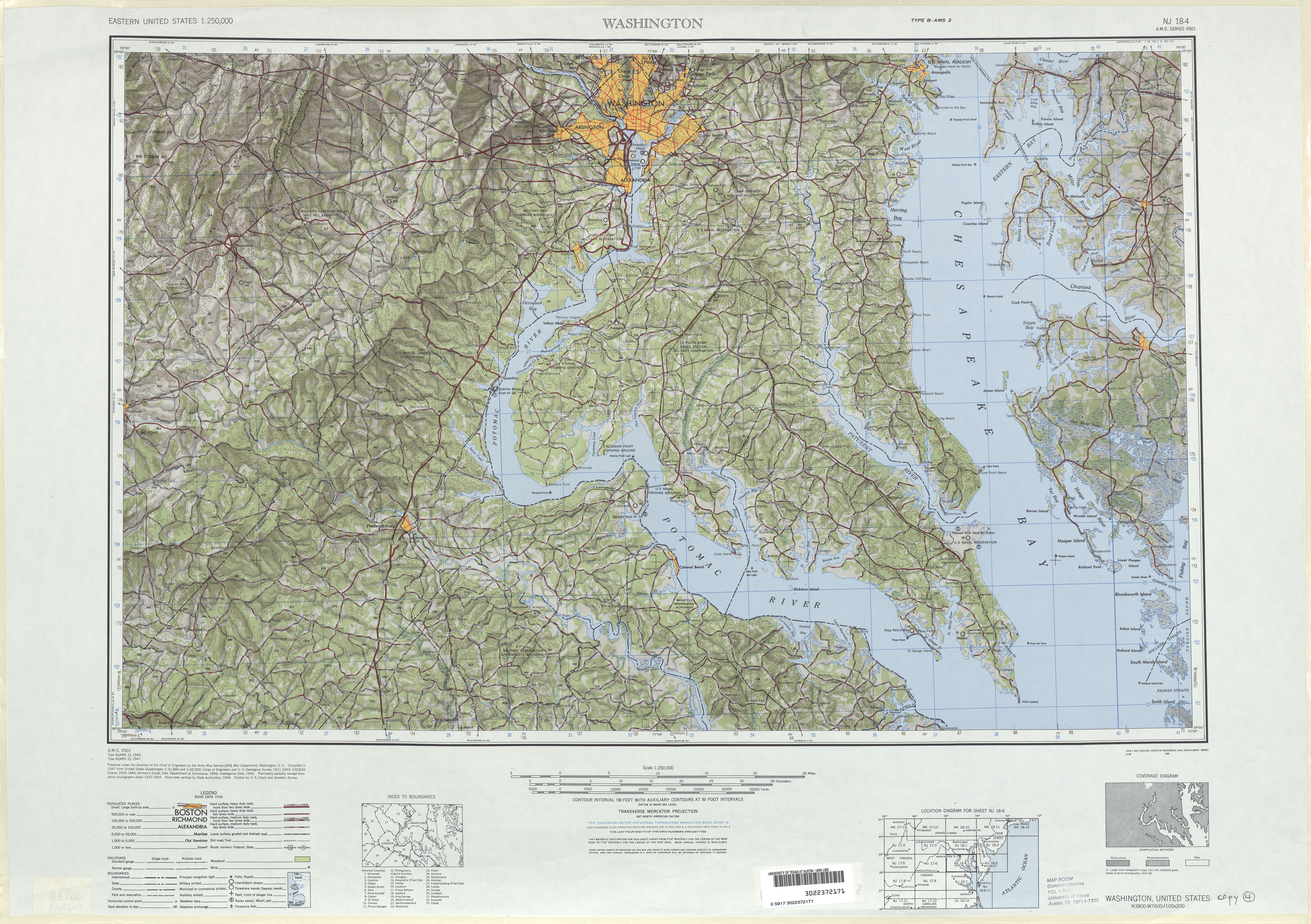
- ^ United States Geological Survey (1946). Washington, D.C. 1:250,000 quadrangle (Map). http://www.lib.utexas.edu/maps/topo/250k/txu-pclmaps-topo-us-washington_dc-1946.jpg. Retrieved 2009-04-03.
- ^ Firestone (1946). Map of Washington, D.C. (Map). Cartography by Rand McNally.
- ^ Maryland State Highway Administration (1960). Map of Maryland (Map). http://www.mdhighwaycentennial.com/images/template/gallery/maps/1960SIDE1.jpg. Retrieved 2009-03-03.
- ^ Exxon (1975). Delaware, Maryland, Virginia, West Virginia (Map). Cartography by General Drafting.
- ^ a b Rand McNally (1996). United States-Canada-Mexico Road Atlas (Map).
- ^ a b "Highway Location Reference: Charles County" (PDF). Maryland State Highway Administration. 1999. http://sha.maryland.gov/Location/1999_CHARLES.pdf. Retrieved 2010-10-21.
- ^ "Highway Location Reference: Prince George's County" (PDF). Maryland State Highway Administration. 1999. http://sha.maryland.gov/Location/1999_PRINCEGEORGES.pdf. Retrieved 2010-10-21.
- ^ "Highway Location Reference: Prince George's County" (PDF). Maryland State Highway Administration. 2001. http://sha.maryland.gov/Location/2001_PRINCEGEORGES.pdf. Retrieved 2010-10-21.
- ^ a b "Lt. Governor Brown and Congressman Hoyer celebrate completion of transportation improvements in Southern Maryland". Maryland Department of Transportation. August 8, 2007. http://www.marylandtransportation.com/News/2007/August%202007/Hughesville%20bypass.htm. Retrieved 2009-05-29.
- ^ "Hoyer Breaks Ground for Hughesville Bypass". Congressman Steny Hoyer. November 5, 2004. Archived from the original on April 1, 2006. http://web.archive.org/web/20060401175145/http://hoyer.house.gov/newsroom/index.asp?ID=119&DocumentType=Press+Release. Retrieved 2009-05-29.
- ^ a b "Highway Location Reference: Charles County" (PDF). Maryland State Highway Administration. 2006. http://sha.maryland.gov/Location/2006_CHARLES.pdf. Retrieved 2010-10-21.
- ^ "MD 0005 Branch Avenue at Brandywine Road (MD 373/MD 381) – Project Information". Maryland State Highway Administration. http://apps.roads.maryland.gov/WebProjectLifeCycle/ProjectInformation.asp?projectno=PG1752116. Retrieved 2010-07-30.
- ^ "MD 0005 Branch Avenue at Brandywine Road (MD 373/MD 381) – Project Schedule". Maryland State Highway Administration. http://apps.roads.maryland.gov/WebProjectLifeCycle/ProjectSchedule.asp?projectno=PG1752116. Retrieved 2010-07-30.
- ^ "MD 0005 US 301 at TB to north of I-95 – Project Information". Maryland State Highway Administration. http://apps.roads.maryland.gov/WebProjectLifeCycle/ProjectInformation.asp?projectno=PG3911616. Retrieved 2009-05-29.
- ^ a b Google, Inc. Google Maps – overview of Maryland Route 5 Business in Leonardtown (Map). Cartography by Google, Inc. http://maps.google.com/maps?f=d&source=s_d&saddr=Point+Lookout+Road+and+Cedar+Lane+Court+leonardtown,+md&daddr=38.290981,-76.633673+to:Point+Lookout+Road+and+hollywood+road+leonardtown,+md&geocode=&hl=en&mra=dpe&mrcr=0&mrsp=1&sz=15&via=1&sll=38.293255,-76.63004&sspn=0.014887,0.027466&ie=UTF8&t=h&z=15. Retrieved 2009-05-29.
- ^ Google, Inc. Google Maps – overview of Maryland Route 5 Business in Hughesville (Map). Cartography by Google, Inc. http://maps.google.com/maps?f=d&source=s_d&saddr=38.525,+-76.7797&daddr=38.5421,+-76.7895&geocode=FUjYSwIdTG9s-w%3B&hl=en&mra=ls&sll=38.540899,-76.792674&sspn=0.007553,0.013797&ie=UTF8&t=h&z=14. Retrieved 2009-08-19.
- ^ Google, Inc. Google Maps – overview of Maryland Route 5 Business in Waldorf (Map). Cartography by Google, Inc. http://maps.google.com/maps?f=d&source=s_d&saddr=MD-5+Bus+%26+St+Charles+Pkwy+%26+St+Charles+Pkwy,+Waldorf,+Charles,+Maryland&daddr=US-301+%26+Leonardtown+Rd+%26+MD-5+Bus,+Waldorf,+Charles,+Maryland&geocode=FQ42TQId1OFq-w%3BFThkTQIdZXBq-ynnxCW7KaG3iTELSmpME8eNlQ&hl=en&mra=pe&mrcr=0&sll=38.620251,-76.895687&sspn=0.02964,0.054932&ie=UTF8&ll=38.620492,-76.896057&spn=0.02964,0.054932&t=h&z=14. Retrieved 2009-05-29.
External links
- Maryland 5 on mdroads.com
- Maryland @ AARoads - Maryland 5
- Maryland Scenic Byways
- Satellite view of old Nike Missile Silos
Roads in Prince George's County, Maryland Maryland State Highways 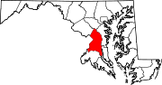
U.S. Routes Interstate Highways Roads by name Roads in Charles County, Maryland State highways 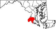
U.S. Highways Roads in St. Mary's County, Maryland State highways 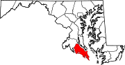 Categories:
- State highways in Maryland
- Roads in Prince George's County, Maryland
- Roads in Charles County, Maryland
- Roads in St. Mary's County, Maryland


Wikimedia Foundation. 2010.