- Maryland Route 458
-
Maryland Route 458
Silver Hill Road Route information Maintained by MDSHA Length: 3.12 mi[1] (5.02 km) Major junctions South end:  MD 5 in Hillcrest Heights
 MD 414 in Silver Hill
Suitland Parkway in Suitland
 MD 218 in Suitland
 MD 4 in District Heights
North end: Walker Mill Road in District Heights Highway system Maryland highway system
Interstate • US • State • Minor • Former • Turnpikes←  MD 457
MD 459  →
→Maryland Route 458 (MD 458) is a state highway in the U.S. state of Maryland. Known as Silver Hill Road, the route runs 3.12 mi (5.02 km) from Maryland Route 5 in Hillcrest Heights north to Walker Mill Road in District Heights.
Contents
Route description
Maryland Route 458 begins at an intersection with Maryland Route 5 (Branch Avenue) in Hillcrest Heights. Iverson Street heads the opposite direction from the same intersection and passes under the Iverson Mall 500 ft (150 m) to the west. MD 458 heads east as a four-lane divided highway with a speed limit of 35 mph (56 km/h) through dense suburban commercial and residential areas. The route then encounters Maryland Route 414, which heads south as St. Barnabas Road and north as Old Silver Hill Road. The road expands to six lanes east of the MD 414 intersection. After passing through Silver Hill, MD 458 meets Suitland Parkway at a partial cloverleaf interchange.
Immediately after crossing Suitland Parkway, the route turns northeast and passes the Suitland station of the Washington Metro on the north. Navy Day Drive provides additional access to the park and ride facilities at the transit station. Suitland Federal Center, which contains the headquarters of the United States Census Bureau, fronts the road to the north between Metro and Maryland Route 218 (Suitland Road). After MD 218, MD 458 turns east again, passes Suitland High School, then intersects Maryland Route 4 (Pennsylvania Avenue).
Immediately after crossing MD 4, Old Silver Hill Road, which is unsigned Maryland Route 972A, splits to the east as MD 458 turns northeast.[1] After passing a few shopping centers, the route intersects Marlboro Pike, which is the old alignment of MD 4. After the Marlboro Pike intersection, MD 458 briefly enters the town limits of District Heights before meeting its northern terminus at Walker Mill Road. Walker Mill Road east heads straight as the continuing movement while the westbound direction requires a left turn at the intersection. The 0.36 mi (0.58 km) stretch of Walker Mill Road immediately around the northern terminus of MD 458 is unsigned Maryland Route 458A.[1]
History
Maryland Route 458 was paved from MD 5 northeast to MD 4 by 1933.[2] At that time, MD 5 followed the alignment of what is now MD 414 in Silver Hill, while MD 4 was Marlboro Pike and MD 458 followed what is now Old Silver Hill Road (MD 972A). The 1939 Maryland state highway map shows MD 458 assigned to the aforementioned course.[3] When MD 5 was realigned to its present course in Hillcrest Heights in 1950, MD 458 was extended west to MD 5 along what is now Old Silver Hill Road.[4] When MD 4 was realigned to its present course in 1960, MD 458 was placed on its new, divided alignment in District Heights.[5] By 1970, MD 458 was extended to its current southern terminus opposite Iverson Street and was a multi-lane divided highway for its entire length.[6] The route was extended to Walker Mill Road between 1980 and 1999.[7][8]
Junction list
The entire route is in Prince George's County.
Location Mile[1] Destinations Notes Hillcrest Heights 0.00 MD 5 (Branch Avenue) – Waldorf, Washington
Iverson Street - Hillcrest Heights
Southern terminus Silver Hill 0.25 MD 414 (St. Barnabas Road/Old Silver Hill Road) – Marlow Heights, Silver HillSuitland 0.83 Suitland Parkway - Washington, Andrews AFB 1.41 MD 218 (Suitland Road) – Suitland, MorningsideDistrict Heights 2.28 MD 4 (Pennsylvania Avenue) – Upper Marlboro, Washington2.40 Old Silver Hill Road Unsigned MD 972A 2.71 Marlboro Pike Old alignment of MD 4 3.12 Walker Mill Road west Northern terminus Walker Mill Road east continues straight
References
- ^ a b c d Maryland State Highway Administration (2008). "Highway Location Reference: Prince George's County" (PDF). http://apps.roads.maryland.gov/KeepingCurrent/performTrafficStudies/dataAndStats/hwyLocationRef/2008_hlr_all/co16.pdf. Retrieved 2010-01-20.
- ^ Maryland State Highway Administration (1933). "Map of Maryland" (PDF). http://commons.wikimedia.org/wiki/File:Maryland_State_Highway_Map_-_1933.pdf. Retrieved 2010-01-20.
- ^ Maryland State Highway Administration (1939). "Map of Maryland" (PDF). http://commons.wikimedia.org/wiki/File:Maryland_State_Highway_Map_-_1939.pdf. Retrieved 2010-01-20.
- ^ Maryland State Highway Administration (1950). "Map of Maryland" (PDF). http://commons.wikimedia.org/wiki/File:Maryland_State_Highway_Map_-_1950.pdf. Retrieved 2010-01-20.
- ^ Maryland State Highway Administration (1960). "Map of Maryland" (PDF). http://commons.wikimedia.org/wiki/File:Maryland_State_Highway_Map_-_1960.pdf. Retrieved 2010-01-20.
- ^ Maryland State Highway Administration (1970). "Map of Maryland" (PDF). http://commons.wikimedia.org/wiki/File:Maryland_State_Highway_Map_-_1970.pdf. Retrieved 2010-01-20.
- ^ Maryland State Highway Administration (1980). "Map of Maryland" (PDF). http://commons.wikimedia.org/wiki/File:Maryland_State_Highway_Map_-_1980.pdf. Retrieved 2010-01-20.
- ^ Maryland State Highway Administration (1999). "Highway Location Reference: Prince George's County" (PDF). http://apps.roads.maryland.gov/KeepingCurrent/performTrafficStudies/dataAndStats/hwyLocationRef/Allint_99_hlr/co16.pdf. Retrieved 2010-01-20.
External links
Roads in Prince George's County, Maryland Maryland State Highways 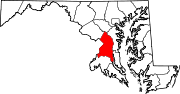
U.S. Routes Interstate Highways Roads by name Categories:- State highways in Maryland
- Roads in Prince George's County, Maryland


Wikimedia Foundation. 2010.