- Maryland Route 337
-
Maryland Route 337
Allentown Road 
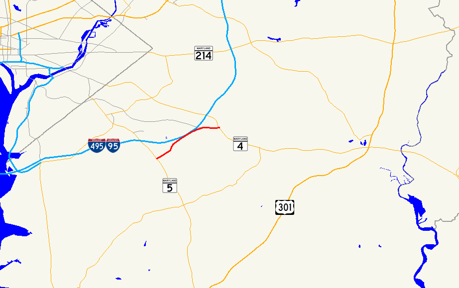
Route information Maintained by MDSHA Length: 3.41 mi[1] (5.49 km) Major junctions South end:  MD 5 in Camp Springs
 I-95 / I-495 in Morningside
North end:  MD 4 near Forestville
Highway system Maryland highway system
Interstate • US • State • Minor • Former • Turnpikes←  MD 336
MD 338  →
→Maryland Route 337, Allentown Road, is a short road in Prince George's county, Maryland. It begins at its intersection with Maryland Route 5 and ends at MD Route 4, going east through the communities of Camp Springs and Forestville. The main entrance to Andrews Air Force Base is on Allentown Road.
Contents
Route description
Maryland Route 337 begins along Allentown Road at an single-point urban interchange with MD 5 (Branch Avenue). It travels east from Camp Springs along a four-lane road, featuring a shared left-turn lane in the center. The route then enters Morningside, where it serves a retail area. As the route begins to approach the Capital Beltway, the development eases away and the route begins to feature a grassy median.
After the route intersects Forestville Road, which provides some access to the Capital Beltway, the route begins to circle around the northeastern edge of Andrews Air Force Base, paralleling its Perimeter Road on the east side. Along this path, maintenance switches over to the government. The road's four lanes narrow to two, and the westbound lane also ends; the road becomes an eastbound only ramp leading into eastbound Suitland Parkway. Traffic travelling west along Suitland Parkway can use Forestville Road, which also intersects the road, and is marked on some maps as MD 337. Government control of the road continues onto the four-lane divided Suitland Parkway until it meets a trumpet interchange leading directly into the base. Here, maintenance returns to the state for the remainder of its journey, which is only a short stretch to MD 4 (Pennsylvania Avenue).
Junction list
The entire route is in Prince George's County.
Location Mile
[1]Intersection Notes Camp Springs 0.00 MD 5 (Branch Avenue) to I-95 / I-495 – Waldorf, WashingtonInterchange, southern terminus Morningside 1.46-1.61 I-95 / I-495 south (Capital Beltway) – Richmond, VA, Alexandria, VAI-95/495 exit 9 2.20 I-95 / I-495 north (Capital Beltway) – Baltimore, College ParkForestville 2.65 Suitland Parkway west South end of Suitland Parkway overlap 3.34 Andrews Air Force Base north gate Interchange, north end of Suitland Parkway overlap 3.41 MD 4 (Pennsylvania Avenue)Northern terminus References
External links
Roads in Prince George's County, Maryland Maryland State Highways 
U.S. Routes Interstate Highways Roads by name Categories:- State highways in Maryland
- Roads in Prince George's County, Maryland


Wikimedia Foundation. 2010.