- Maryland Route 500
-
Maryland Route 500
Queens Chapel Road Route information Maintained by MDSHA Length: 2.22 mi[1] (3.57 km) Major junctions West end: Michigan Avenue in Washington, D.C.  MD 208 in Hyattsville
East end:  MD 410 in Hyattsville
Highway system Maryland highway system
Interstate • US • State • Minor • Former • Turnpikes←  MD 499
MD 501  →
→Maryland Route 500 (MD 500) is a state highway in the U.S. state of Maryland. Known as Queens Chapel Road, the state highway runs 2.22 mi (3.57 km) from Michigan Avenue at the Washington, D.C. border in Chillum east to MD 410 in Hyattsville. MD 500 is a commuter route between the District of Columbia and Hyattsville. The state highway also provides access to the West Hyattsville and Prince George's Plaza stations of the Washington Metro. MD 500 was constructed in two segments: MD 210 from D.C. to Ager Road in West Hyattsville in the 1920s, and MD 500 from Hamilton Street in West Hyattsville to U.S. Route 1 (US 1) in University Park in the early 1930s. By the mid 1940s, MD 500 took over the length of MD 210. The state highway was straightened out through West Hyattsville and made a divided highway to the D.C. border in the 1950s. The Hamilton Street to MD 410 segment was made a divided highway in the 1970s. MD 500's eastern terminus was rolled back to MD 410 in 1988 to allow Metro to be constructed underneath Queens Chapel Road through the city of University Park; the citizens of University Park made the closure permanent in 1993, shortly after the subway was completed through the town.
Contents
Route description
MD 500 begins at Eastern Avenue in Chillum. The highway continues into the District of Columbia as Michigan Avenue.[2] MD 500 heads northeast as a four-lane divided highway with a speed limit of 35 mph (56 km/h).[1] The state highway turns north and forms the western boundary of Mount Rainier as the highway intersects MD 501 (Chillum Road). Chillum Road also heads into Mount Rainier as a county highway.[1] MD 500 crosses Northwest Branch and enters the city of Hyattsville.[1] The state highway turns to the northeast where Ager Road, which leads to the West Hyattsville Metro Station, splits to the north. There is no direct access between Ager Road south and MD 500 east. The missing connection is provided at the intersection with MD 208 (Hamilton Street) and county-maintained Hamilton Street. MD 500 continues northeast through a residential area of Hyattsville through the intersection with Queensbury Road and Belcrest Road. Belcrest Road provides access to the Prince George's Plaza Metro Station. Shortly thereafter, the state highway reaches its northern terminus at MD 410 (East–West Highway). County-maintained Adelphi Road continues north on the other side of the intersection.[2]
History
Queens Chapel Road between the District of Columbia and Ager Road in Hyattsville was paved by 1927.[3] The section between Hamilton Street and US 1 in University Park was completed by 1933.[4] At the time, the first section was marked as MD 210 while the second segment was designated MD 500. North of the crossing of Northwest Branch, MD 210 turned north on Ager Road to meet MD 209, which followed Hamilton Street a short distance east to MD 500.[5] By 1946, MD 500 replaced MD 210 on the western section of Queens Chapel Road and MD 209 had been assumed by MD 410.[6] MD 500 was made a divided highway between the District and West Hyattsville and was placed on a new, straight alignment through West Hyattsville, bypassing Ager Road and Hamilton Street, in 1950.[7] The divided highway was extended east through Hamilton Street in 1956 and to the intersection with MD 410 in the 1970s.[8][9] MD 500 was expanded to six lanes between D.C. and MD 410 in the late 1980s, but was restriped for four lanes over that stretch in 2005.[10][11][2] The state highway between MD 410 and US 1 was temporarily closed to through traffic in 1988 due to construction of the Green Line of the Washington Metro. This closure through University Park became permanent after a town referendum in 1993.[12] The western end of Queens Chapel Road in the town is a cul-de-sac, while the eastern end is exit only from the town street to US 1.[13]
Junction list
The entire route is in Prince George's County.
Location Mile
[1]Destinations Notes Chillum 0.00 Michigan Avenue west – Washington, D.C. Western terminus Eastern Avenue 0.74 MD 501 west (Chillum Road) / Chillum Road east – Mount RainierHyattsville 0.93 Ager Road – Chillum Old alignment of MD 500; no access from Ager Road east to MD 500 east 1.16 MD 208 south (Hamilton Street) / Hamilton Street west – BrentwoodOld alignment of MD 500 2.22 MD 410 (East–West Highway) – Takoma Park, Riverdale ParkEastern terminus Adelphi Road – University Park, University of Maryland, College Park References
- ^ a b c d e "Highway Location Reference: Prince George's County" (PDF). Maryland State Highway Administration. 2008. http://apps.roads.maryland.gov/KeepingCurrent/performTrafficStudies/dataAndStats/hwyLocationRef/2008_hlr_all/co16.pdf. Retrieved 2010-03-22.
- ^ a b c Google, Inc. Google Maps – Maryland Route 500 (Map). Cartography by Google, Inc. http://maps.google.com/maps?f=d&source=s_d&saddr=Michigan+Ave+NE&daddr=Queens+Chapel+Rd&hl=en&geocode=FRZGUgId9mlp-w%3BFRyUUgIdeNxp-w&mra=ls&sll=38.96982,-76.94365&sspn=0.007657,0.01929&ie=UTF8&t=h&z=14. Retrieved 2010-03-24.
- ^ Maryland State Roads Commission (JPG). Map of Maryland (Map) (1927 ed.). http://www.mdhighwaycentennial.com/images/template/gallery/maps/1927SIDE1.jpg. Retrieved 2010-03-24.
- ^ Maryland State Roads Commission (PDF). Map of Maryland (Map) (1933 ed.). http://commons.wikimedia.org/wiki/File:Maryland_State_Highway_Map_-_1933.pdf. Retrieved 2010-03-24.
- ^ Maryland State Roads Commission (PDF). Map of Maryland (Map) (1939 ed.). http://commons.wikimedia.org/wiki/File:Maryland_State_Highway_Map_-_1939.pdf. Retrieved 2010-03-24.
- ^ Maryland State Roads Commission (PDF). Map of Maryland (Map) (1946 ed.). http://commons.wikimedia.org/wiki/File:Maryland_State_Highway_Map_-_1946.pdf. Retrieved 2010-03-24.
- ^ Maryland State Roads Commission (PDF). Map of Maryland (Map) (1950 ed.). http://commons.wikimedia.org/wiki/File:Maryland_State_Highway_Map_-_1950.pdf. Retrieved 2010-03-24.
- ^ Maryland State Roads Commission (PDF). Map of Maryland (Map) (1956 ed.). http://commons.wikimedia.org/wiki/File:Maryland_State_Highway_Map_-_1956.pdf. Retrieved 2010-03-24.
- ^ Maryland State Highway Administration (PDF). Map of Maryland (Map) (1980 ed.). http://commons.wikimedia.org/wiki/File:Maryland_State_Highway_Map_-_1980.pdf. Retrieved 2010-03-24.
- ^ Svirsky, Alexander. "National Bridge Inventory Database". http://nationalbridges.com/. Retrieved 2010-03-24.
- ^ "Highway Location Reference: Prince George's County" (PDF). Maryland State Highway Administration. 2005. http://apps.roads.maryland.gov/KeepingCurrent/performTrafficStudies/dataAndStats/hwyLocationRef/2005_hlr_all/co16.pdf. Retrieved 2010-03-24.
- ^ "Queens Chapel Road to Remain Closed". The Washington Post (Washington, D.C.: The Washington Post Company). 1993-02-04. http://www.highbeam.com/doc/1P2-931029.html. Retrieved 2010-03-24.
- ^ Google, Inc. Google Maps – Queens Chapel Road in University Park (Map). Cartography by Google, Inc. http://maps.google.com/maps?f=d&source=s_d&saddr=Queens+Chapel+Rd&daddr=Queens+Chapel+Rd&hl=en&geocode=FTSVUgId-N5p-w%3BFVKuUgIdLAVq-w&mra=ls&sll=38.966854,-76.947282&sspn=0.001914,0.004823&ie=UTF8&t=h&z=16. Retrieved 2010-03-24.
External links
Roads in Prince George's County, Maryland Maryland State Highways 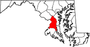
U.S. Routes Interstate Highways Roads by name Categories:- State highways in Maryland
- Roads in Prince George's County, Maryland


Wikimedia Foundation. 2010.