- Chillum, Maryland
-
Chillum, Maryland — CDP — Location of Chillum, Maryland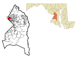
Coordinates: 38°58′6″N 76°58′45″W / 38.96833°N 76.97917°WCoordinates: 38°58′6″N 76°58′45″W / 38.96833°N 76.97917°W Country United States State Maryland County Prince George's Area - Total 4.0 sq mi (10.5 km2) - Land 4.0 sq mi (10.4 km2) - Water 0.0 sq mi (0.1 km2) Elevation 148 ft (45 m) Population (2000) - Total 34,252 - Density 8,527.2/sq mi (3,292.4/km2) Time zone Eastern (EST) (UTC-5) - Summer (DST) EDT (UTC-4) ZIP code 20782 Area code(s) 301 FIPS code 24-16875 GNIS feature ID 0597239 Chillum is an unincorporated area and census-designated place (CDP) in Prince George's County, Maryland, United States. The population was 34,252 at the 2000 census. The Chillum CDP includes the communities of Avondale, Carole Highlands, Green Meadows, and Lewisdale.[1]
Contents
Geography
Chillum is located at 38°58′6″N 76°58′45″W / 38.96833°N 76.97917°W (38.968210, -76.979046)[2].
According to the United States Census Bureau, the CDP has a total area of 4.0 square miles (10 km2), of which, 4.0 square miles (10 km2) of it is land and 0.04 square miles (0.10 km2) of it (0.50%) is water.
History
Chillum takes its name from "Chillum Castle Manor," the 4,443-acre (17.98 km2) land patent established in 1763, by William Dudley Digges.[3] It included lands in present day District of Columbia and in Prince George's County, and was composed of previously established land patents such as Henrietta Maria, Widows Purchase, and Yarrow Farm and Yarrow Swamp.[4] Chillum Castle Manor was named after Chilham Castle, the old home of Sir Dudley Digges an ancestor of William Dudley Digges, in Kent County, England.[5]
The manor house for the Henrietta Maria parcel was named Green Hill. It was home to William Dudley Digges, and was the place where Pierre L'Enfant, designer of nearby Washington, D.C., died in destitution in 1825.[5] He remained buried at the Green Hill property until being reinterred at Arlington National Cemetery in 1909.[6] The Green Hill plantation was subsequently purchased by George Washington Riggs, who built the present Green Hill historic home in 1868.[6]
Since this area was not serviced by public transportation, such as a streetcar, Chillum remained rural in character into the 1930s. Beginning in the mid 1930s, the area of Chillum that is close to the District of Columbia border was subdivided into lots. Developers promoted the area’s convenient access into the city as well as its water, gas, and electricity supply. The first platted developments in the late 1930s included Chillum Gardens and Oakdale Terrace. The developers of these communities sold the lots but left the construction of houses to the lot owners. Consequently, the communities were slow to develop. In contrast, the developer-built Green Meadows and Brookdale Manor were platted in the early 1940s and completed by 1942. Other developer-built communities begun in the 1940s include Chillumgate (1946) and Michigan Hills Park (1940s). Several subdivisions were constructed along Riggs Road, Sargent Road, and Sligo Creek Park in the 1950s, including Sargent Knolls (1950), Bel Air Estates (1955), Parkland (1955), Carrington (1957), and Miller Estates (mid-1950s-early 1960s). The street pattern of these communities are typical of their period. They have a grid pattern of streets broken by a few curvilinear roadways, and cul-de-sac. In addition to single-family residences, two apartment communities were constructed in 1949. The Chillum Heights Apartments and Ager Terrace Apartments consist of three story brick structures containing a combined total of 1,147 units. Larger-scale apartment complexes and mid-rise structures were constructed in the 1960s.[7][8]
Commercial activity in the Chillum area is concentrated in shopping centers located at the intersections of the principal roadways. Two of the shopping centers, Riggs Plaza Shopping Center (1960s) and the Riggs-Sargent Shopping Center (1970s), contain supermarkets, drug stores and other retail outlets. Other establishments such as gas stations and restaurants are scattered throughout the community.[7]
Historic sites
The following is a list of historic sites in Chillum identified by the Maryland-National Capital Park and Planning Commission:[9]
Site name Image Location M-NCPPC Inventory Number Comment 1 Green Hill 2009 Van Buren Street 65-008 Located in Lewisdale / West Hyattsville. 1 Green Hill Overseer’s House 6606 22nd Place 65-013 Located in Lewisdale / West Hyattsville. Demographics
Historical populations Census Pop. %± 1970 35,656 — 1980 32,775 −8.1% 1990 31,309 −4.5% 2000 34,252 9.4% source:[10] As of the census[11] of 2000, there were 34,252 people, 12,080 households, and 7,900 families residing in the CDP. The population density was 8,527.2 people per square mile (3,289.7/km²). There were 12,524 housing units at an average density of 3,117.9 per square mile (1,202.9/km²). The racial makeup of the CDP was 14.34% White, 62.68% African American, 0.47% Native American, 2.88% Asian, 0.08% Pacific Islander, 14.49% from other races, and 5.05% from two or more races. Hispanic or Latino of any race were 23.67% of the population.
There were 12,080 households out of which 33.6% had children under the age of 18 living with them, 36.6% were married couples living together, 21.1% had a female householder with no husband present, and 34.6% were non-families. 26.8% of all households were made up of individuals and 7.7% had someone living alone who was 65 years of age or older. The average household size was 2.80 and the average family size was 3.40.
In the CDP the population was spread out with 25.8% under the age of 18, 11.5% from 18 to 24, 34.0% from 25 to 44, 19.4% from 45 to 64, and 9.3% who were 65 years of age or older. The median age was 32 years. For every 100 females there were 92.4 males. For every 100 females age 18 and over, there were 88.3 males.
The median income for a household in the CDP was $41,307, and the median income for a family was $46,329. Males had a median income of $29,546 versus $28,069 for females. The per capita income for the CDP was $17,915. About 8.5% of families and 10.2% of the population were below the poverty line, including 11.5% of those under age 18 and 8.8% of those age 65 or over.
References
- ^ "Prince George's County, MD: Census Incorporated Places & Census Designated Places". Prince George's County Map. Maryland Department of Planning. 2009-01-29. http://www.mdp.state.md.us/MSDC/census/cen2000/maps/PLC00/prinplc.pdf.
- ^ "US Gazetteer files: 2010, 2000, and 1990". United States Census Bureau. 2011-02-12. http://www.census.gov/geo/www/gazetteer/gazette.html. Retrieved 2011-04-23.
- ^ "Maryland Indexes(Patents, Manor Index), 1634-1804, Series S1436". Maryland State Archives Guide to Government Records. http://guide.mdsa.net/series.cfm?action=viewSeries&ID=S1436. Retrieved 2008-10-29.
- ^ "Prince George's County Circuit Court Land Surveys and Condominium Plats". Maryland State Archives Guide to Government Records. http://plato.mdarchives.state.md.us/msa/stagser/s1500/s1529/cfm/dsp_advancesearch.cfm?county=pg. Retrieved 2008-10-29.
- ^ a b "HONORS TO L'ENFANT," The Washington Post, Oct 1, 1904, pg. 15.
- ^ a b Maj. L'Enfant's Forgotten Grave," by T. Loftin Snell, The Washington Post, Jul 30, 1950, pg. B3.
- ^ a b "Community Summary Sheet, Prince George's County". Chillum, Maryland. Maryland State Highway Administration, 1999. 2008-05-10. http://www.sha.maryland.gov/oppen/pg_co.pdf.
- ^ The Neighborhoods of Prince George's County. Upper Marlboro: Community Renewal Program, 1974.
- ^ M-NCPPC Illustrated Inventory of Historic Sites: Prince George's County, Maryland (Prince George's County, Maryland), 2006
- ^ "CENSUS OF POPULATION AND HOUSING (1790-2000)". U.S. Census Bureau. http://www.census.gov/prod/www/abs/decennial/index.html. Retrieved 2010-07-17.
- ^ "American FactFinder". United States Census Bureau. http://factfinder.census.gov. Retrieved 2008-01-31.
External links
- Chillum-Adelphi Volunteer Fire Department website
- A scalable PDF map of Prince George's County, MD showing the boundaries of the Chillum Census Designated Place and other CDPs and Census Incorporated Places in the county -- from the Maryland Department of Planning web site
Categories:- Baltimore–Washington metropolitan area
- Populated places in Prince George's County, Maryland
- Unincorporated communities in Maryland
- Census-designated places in Maryland
- Populated places in Maryland with African American majority populations


Wikimedia Foundation. 2010.