- Maryland Route 344
-
Maryland Route 344
Chicamuxen Road Route information Maintained by MDSHA Length: 2.16 mi[1] (3.48 km) Major junctions South end:  MD 6 in Doncaster
North end:  MD 224 near Chicamuxen
Location Counties: Charles Highway system Maryland highway system
Interstate • US • State • Minor • Former • Turnpikes←  MD 343
MD 346  →
→Maryland Route 344 (MD 344) is a state highway in the U.S. state of Maryland. Known as Chicamuxen Road, the state highway runs 2.16 miles (3.48 km) from MD 6 in Doncaster north to MD 224 near Chicamuxen. A connector between MD 6 and MD 224 in western Charles County, MD 344 was originally the southernmost part of MD 224. When MD 224 was rerouted to the west in the mid 1950s, MD 344 was assigned to its present course.
Contents
Route description
MD 344 begins at an intersection with MD 6 (Port Tobacco Road) in the hamlet of Doncaster. County-maintained Gilroy Road is the south leg of the four-way intersection. The state highway heads northwest as a two-lane road through farmland and forest. MD 344 reaches its northern terminus at a T-intersection with MD 224 near Chicamuxen. Northbound MD 224 north heads straight as Chicamuxen Road while southbound MD 224 heads west from the intersection as Riverside Road.[1][2]
History
The highway to which MD 344 is now assigned was originally the southern end of MD 224, which extended north to the District of Columbia in Forest Heights.[3] The Doncaster–Chicamuxen portion of MD 224 was constructed in 1930.[4][5] When MD 224 was placed onto Riverside Road south to Riverside in 1957, MD 344 was assigned to the portion of Chicamuxen Road south of the MD 224–MD 344 intersection.[6]
Junction list
The entire route is in Charles County.
Location Mile
[1]Destinations Notes Doncaster 0.00 MD 6 (Port Tobacco Road) – La Plata, NanjemoySouthern terminus Chicamuxen 2.16 MD 224 (Chicamuxen Road/Riverside Road) – Riverside, MarburyNorthern terminus 1.000 mi = 1.609 km; 1.000 km = 0.621 mi References
- ^ a b c "Highway Location Reference: Charles County" (PDF). Maryland State Highway Administration. 2009. http://www.marylandroads.com/Location/2009_CHARLES.pdf. Retrieved 2011-01-12.
- ^ Google, Inc. Google Maps – Maryland Route 344 (Map). Cartography by Google, Inc. http://maps.google.com/maps?f=d&source=s_d&saddr=md-6+and+md-344+doncaster,+md&daddr=md-344+and+md-224+chicamuxen,+md&geocode=FepuSwId3ttl-ykrkfn1m_22iTFw3BedsdhIiw%3BFUrFSwIdK4Rl-yn7utw-yf22iTE5ZHk8LS1-ZA&hl=en&mra=ls&sll=38.503445,-77.207966&sspn=0.061661,0.154324&ie=UTF8&t=h&z=14. Retrieved 2010-03-22.
- ^ Maryland State Roads Commission. General Highway Map: State of Maryland (Map) (1939 ed.).
- ^ Report of the State Roads Commission of Maryland. 1927-1930. Baltimore: Maryland State Roads Commission. 1930-10-01. p. 207. http://www.archive.org/details/reportofstateroa1927mary. Retrieved 2011-01-12.
- ^ Maryland Geological Survey. Map of Maryland Showing State Road System: State Aid Roads and Improved County Road Connections (Map) (1930 ed.).
- ^ Maryland State Roads Commission. Maryland: Official Highway Map (Map) (1957 ed.).
External links
Roads in Charles County, Maryland State highways 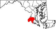
U.S. Highways Categories:- State highways in Maryland
- Roads in Charles County, Maryland


Wikimedia Foundation. 2010.