- Nanjemoy, Maryland
-
Nanjemoy — Unincorporated area — Location within the state of Maryland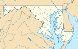
 Nanjemoy
Coordinates: 38°27′17″N 77°13′01″W / 38.45472°N 77.21694°WCoordinates: 38°27′17″N 77°13′01″W / 38.45472°N 77.21694°W Country United States State Maryland County Charles Time zone Eastern (EST) (UTC-5) - Summer (DST) EDT (UTC-4) ZIP codes FIPS code GNIS feature ID Nanjemoy is a settlement along Maryland Route 6 in southwestern Charles County, Maryland, United States, and the surrounding large rural area more or less bounded by Nanjemoy Creek to the east and north, and the Potomac River to the south and west. It and the creek draw their names from a Native American tribe. Nanjemoy is within the Washington, D.C., metropolitan area, being about 25 miles (40 km) south of the Capital Beltway (Interstates 95 and 495).
The village center includes a Post Office and a county-operated community center building that serves the area's population. Two children's camps and a sheriffs' training facility are also in the Nanjemoy area.
The area is served by Maryland Route 6 and other two-lane state highways; the nearest major roads are Maryland Route 210 to the north and U.S. Route 301 to the west. The Nanjemoy area is becoming increasingly popular with Washington-area commuters, particularly those working in nearby Indian Head or Fort Washington in Maryland or in Alexandria, Virginia. The Waldorf, Maryland, commercial area is nearby to the east, along U.S. 301. No rail lines presently serve the area.
Much of the Nanjemoy area is now forest or farmland. Tobacco was formerly commonly cultivated in the area, but is now rarely seen. Other settlements in the Nanjemoy area include Grayson, Maryland Point, and Riverside. Chickamuxen, Doncaster, and Ironsides are nearby to the north.
Contents
History
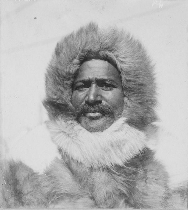
 Arctic explorer Matthew Henson, photographed in 1910
The Southern-sympathizing area saw occupation by a large force of the Union army during the early part of the American Civil War, with an encampment of about 12,000 soldiers near Chicamuxen,[1] a few miles (kilometers) north of the Nanjemoy area.
The sunken hulls of dozens of scrapped wooden World War I boats are still extant and visible at low tide at Mallows Bay, along the Potomac River in the Nanjemoy area, the location of what is regarded as the "largest shipwreck fleet in the Western Hemisphere"[2]
Famous people born in Nanjemoy include Raphael Semmes,[3][4] captain of the Confederate battleship "Alabama", and Matthew Henson,[5][6] who with Robert Peary explored the Arctic in 1909 and with Peary may have discovered the North Pole.
Wild areas
 Great blue herons at a nest
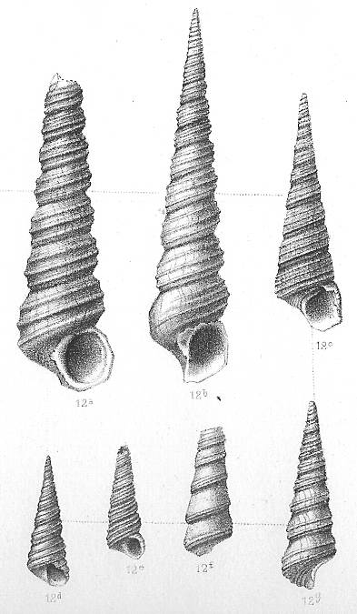
 Fossil specimens of a Turritella snail
The Nanjemoy area, on the Atlantic Coastal Plain, includes the largest great blue heron (Ardea herodias) rookery in the Eastern United States north of Florida, now a preserve owned and managed by The Nature Conservancy.[7][8]
The area also includes Purse State Park, well known for its fossil shark teeth, Turritella snails, and other fossils of Paleocene geological age,[9] and other protected wild areas along the Potomac River's freshwater tidal (estuarine) shore. Smallwood State Park, the Chicamuxen Wildlife Management Area, the Doncaster Demonstration Forest and Chapel Point State Park are also nearby.
The Nanjemoy Creek Environmental Education Center is located along Nanjemoy Creek. Operated by the Charles County Public School system, it offers trails, a pier, a boardwalk through a freshwater tidal marsh, a pavilion, a laboratory building, and several cabins for use by school groups.[10] An observatory there, operated by the Southern Maryland Astronomical Society, has a dome formerly used at a U.S. Naval Research Laboratory facility nearby.[11]
Recreation
Hunting and fishing have long been popular in the relatively undeveloped Nanjemoy area, and many miles of remote hiking trails are available. More recently, the area's scenic, little-traveled roads have become popular with cyclists.
Public boat landings are provided on the Potomac at Mallows Bay and on the estuarine portion of Nanjemoy Creek at Friendship Landing, the latter also popular for fishing.[12] Recreational boaters, mostly from the Woodbridge and Quantico areas on the Virginia side of the Potomac, frequently visit the extensive undeveloped river shore in the Purse State Park area. Kayaking is also increasing in popularity in the area, both on the Potomac and on the quiet tidewaters of Nanjemoy Creek.
References
- ^ "Chickamuxen United Methodist Church". Chickamuxen United Methodist Church. http://wikimapia.org/7636118/Chicamuxen-United-Methodist-Church. Retrieved 13 October 2011.
- ^ Shomette, Donald G. (Winter 2001). "The Ghost Fleet of Mallows Bay". The Maryland Natural Resource. http://www.dnr.state.md.us/naturalresource/winter2001/ghostship.html. Retrieved December 19, 2010.
- ^ "Raphael Semmes Connection". http://freepages.genealogy.rootsweb.com/~wittichen/raphsemmes.html. Retrieved 2006-11-12.
- ^ "Land Records: Deed Samuel Hanson to Raphael Semmes (1819): Charles County, MD". USGenWeb archives. http://ftp.rootsweb.com/pub/usgenweb/md/charles/land/hanson-semmes.txt. Retrieved 2006-11-12.[dead link]
- ^ "Chronology of Henson's life". http://www.matthewhenson.com/chronology.htm. Retrieved 2006-11-12.
- ^ "Matthew Henson". Maryland State Archives. http://www.mdarchives.state.md.us/msa/speccol/sc5600/sc5604/html/august.html. Retrieved 2006-11-12.
- ^ "Nanjemoy Creek Preserve: A primordial sanctuary for "love birds"". The Nature Conservancy. Archived from the original on 2006-11-11. http://web.archive.org/web/20061111050757/http://www.nature.org/wherewework/northamerica/states/maryland/preserves/art4812.html. Retrieved 2006-11-12.
- ^ "Maryland Greenways". Maryland Greenways Commission. http://www.dnr.state.md.us/greenways/counties/charles.html. Retrieved 2006-11-12.
- ^ "Potomac River". FossilGuy.com. http://www.fossilguy.com/sites/potomac/index.htm. Retrieved 13 October 2011.
- ^ "Nanjemoy Creek Environmental Education Center". Charles County Public Schools. http://www2.ccboe.com/nanjemoycreek/. Retrieved 13 October 2011.
- ^ "Nanjemoy Creek Observatory: Frequently asked questions". Southern Maryland Astronomical Society. http://www.smas.us/html/FAQ%20-%20NCO%20Category.htm. Retrieved 2006-11-12.
- ^ "Fishing". Nanjemoy.net. http://www.nanjemoy.net/recreation.htm. Retrieved 13 October 2011.
External links
Municipalities and communities of Charles County, Maryland Towns 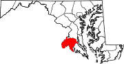
CDPs Other
communitiesBel Alton | Benedict | Bryantown | Cobb Island | Dentsville | Faulkner | Ironsides | Issue | Malcolm | Marbury | Masons | Morgantown | Mount Victoria | Nanjemoy | Newburg | Newport | Patuxent | Pisgah | Pomfret | Popes Creek | Pomonkey | Ripley | Rison | Riverside | Rock Point | Swan Point | Welcome | White Plains
Categories:- Populated places in Charles County, Maryland
- Astronomical observatories in Maryland
- Unincorporated communities in Maryland


Wikimedia Foundation. 2010.